The best walks and hikes around Castiglione
4.4
(856)
4,082
hikers
71
hikes
Hiking around Castiglione offers diverse landscapes, blending coastal beauty with a hilly hinterland. The region features golden dunes, pristine beaches, and extensive pine forests, transitioning inland to Mediterranean scrub and rolling hills. Notable natural features include the Tombolo Pine Forest, the Diaccia Botrona Nature Reserve with its wetlands, and viewpoints like Poggio Sentinella. Trails often incorporate historical elements, such as ancient Etruscan traces and watchtowers.
Best hiking trails around Castiglione
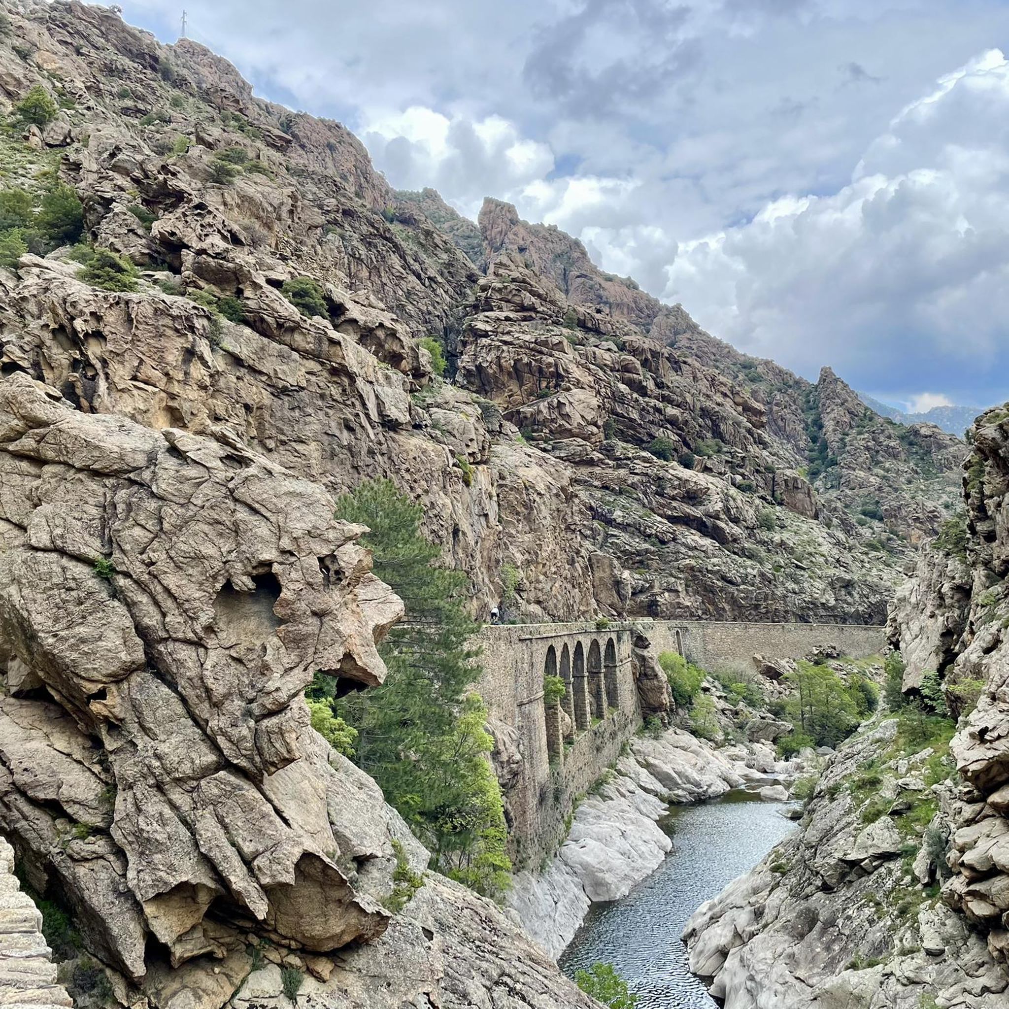
- The most popular hiking route is Genoese Bridge of Asco – View of the Corsican Mountains loop from Poggio, a 2.0 miles (3.2 km) trail that takes about 1 hour to complete. This moderate route offers views of the Corsican Mountains and crosses a historic bridge.
- Another top favourite among local hikers is Bathing area under the bridge – The old scala loop from Funtana Vignente, a moderate 3.1 miles (5.0 km) path. This trail leads past a bathing area and an old scala, providing varied scenery.
- Local hikers also love the Old bridge over the Ruda – Scala di Santa Regina loop from Corscia, a 4.1 miles (6.5 km) trail leading through riverine landscapes and an old scala, often completed in about 3 hours.
- Hiking around Castiglione is defined by coastal paths, pine forests, and a hilly hinterland. The network offers options for easy strolls, moderate treks, and more challenging routes.
- The routes in Castiglione are highly rated by the komoot community with an average score of 4.5 stars from over 800 reviews. More than 3,900 hikers have used komoot to explore Castiglione's varied terrain.
Last updated: June 28, 2026
4.8
(19)
57
hikers
Moderate hike. Great for any fitness level. Mostly accessible paths. Sure-footedness required.
4.8
(42)
153
hikers
Moderate hike. Good fitness required. Mostly accessible paths. Sure-footedness required.

Sign up for free
4.8
(36)
178
hikers
Moderate hike. Good fitness required. Mostly accessible paths. Sure-footedness required.
3.5
(2)
16
hikers
Moderate hike. Good fitness required. Mostly accessible paths. Sure-footedness required.
4.7
(7)
29
hikers
Moderate hike. Good fitness required. Mostly accessible paths. Sure-footedness required.
Get access to more routes and recommendations from other explorers.
Sign up for free
Already have an account?
Our route recommendations are based on thousands of hikes, rides, and runs completed by other people on komoot.
Start today with a free account
Your next adventure awaits.
Login or Signup
Tips from the Community

Access from the south side of the bridge.
0
0

Great hike with an amazing reward of bathing in the under bridge pools. We did it in the month of June and since during the first part of the hike you are walking without protection of trees and between really hot rocks, it was particularly hard but with sufficient water, sun protection and hat it will be a great and beautiful adventure. Enjoy!
0
0


The water is very cold but worth it
1
0

For the long-distance trail "Le sentier de la transhumance," hikers are recommended to divide the total distance of approximately 75 kilometers—and, coming from the coast, more than three and a half thousand meters of ascent and three thousand meters of descent—into five to ten daily stages, depending on their personal fitness and hiking enthusiasm. A related hiking collection, "In the Footsteps of the Corsican Shepherds," by Julien Harté, is available at the following link: https://www.komoot.de/collection/2020568/auf-den-spuren-der-korsischen-hirten-sentier-de-la-transhumance
3
1

The spectacular Scala di Santa Regina is the eastern entrance to the Niolo. Reddish granite rocks show beautiful tafoni weathering here. A centuries-old mule track leads hikers through the gorge. But swimming in clear rivers is also possible. Source: https://www.paradisu.de/regionen/noerdliches-inselinneres/niolo/
1
0
Frequently Asked Questions
How many hiking trails are available in Castiglione della Pescaia?
Castiglione della Pescaia offers a comprehensive network of over 50 hiking trails, covering more than 130 kilometers. These routes cater to various fitness levels, from easy strolls to more challenging treks, and are well-maintained and signposted for year-round use.
What kind of landscapes can I expect to see while hiking in Castiglione della Pescaia?
Hiking in Castiglione della Pescaia offers a diverse blend of coastal beauty and lush inland scenery. You'll find golden dunes and pristine beaches, shady pine forests like the Tombolo Pine Forest, and a rolling hilly hinterland with Mediterranean scrub. The region also features the significant wetlands of the Diaccia Botrona Nature Reserve.
Are there any easy or family-friendly hiking trails in Castiglione della Pescaia?
Yes, Castiglione della Pescaia has 12 easy hiking trails perfect for beginners or families. An example is the "Promenade of Castiglione della Pescaia," an easy 6.66 km hike mentioned in the region research. Many routes through the Tombolo Pine Forest are also suitable for relaxed walks.
What natural features or landmarks can I discover on hikes around Castiglione della Pescaia?
You can explore a variety of natural features and historical landmarks. Highlights include the Diaccia Botrona Nature Reserve, a vital wetland, and coastal gems like Cala Martina and Cala Violina. Inland, you might encounter ancient Etruscan and Roman archaeological traces, or historical structures such as the Casa Rossa Ximenes within the reserve, the imposing castle in Castiglione della Pescaia, or the Rocchette Fortress along the coast.
Are there any challenging hikes in Castiglione della Pescaia for experienced hikers?
Yes, for experienced hikers seeking a challenge, Castiglione della Pescaia offers 12 difficult trails. The region's hilly hinterland, with ascents to viewpoints like Poggio Meletone (578 meters above sea level), provides routes requiring good physical condition and sure-footedness. An example of a moderate route that can be extended for more challenge is the Scala di Santa Regina – Old bridge over the Ruda loop from Funtana Vignente, which covers nearly 12.6 km with significant elevation gain.
What is the best time of year to go hiking in Castiglione della Pescaia?
The trails in Castiglione della Pescaia are usable year-round. However, spring and autumn offer pleasant temperatures for hiking. In summer, the shaded paths through pine forests provide a cooler option, while coastal walks can be enjoyed during milder parts of the day.
Are there any circular hiking routes in Castiglione della Pescaia?
Yes, many routes in Castiglione della Pescaia are circular. For instance, the Genoese Bridge of Asco – View of the Corsican Mountains loop from Poggio is a moderate 3.2 km round trip. Another option is the Bathing area under the bridge – The old scala loop from Funtana Vignente, a 5.0 km moderate path.
Can I bring my dog on the hiking trails in Castiglione della Pescaia?
While specific regulations for dogs on trails can vary, generally, dogs are welcome on many hiking paths in the Castiglione della Pescaia area, especially in natural areas like pine forests. It's always advisable to keep dogs on a leash and clean up after them. For specific nature reserves like Diaccia Botrona, check local guidelines before visiting.
What do other hikers enjoy most about hiking in Castiglione della Pescaia?
The area is highly rated by the komoot community, with an average score of 4.5 stars from over 800 reviews. Hikers often praise the diverse landscapes, from stunning coastal views to tranquil pine forests and the unique wetlands, as well as the well-maintained and clearly signposted trails that make exploration enjoyable.
Are there any historical sites or cultural points of interest accessible via hiking trails?
Absolutely. Hiking routes often incorporate historical sites. You can find ancient Etruscan and Roman archaeological traces in areas like Vetulonia and Pian di Rocca. Trails also lead to the imposing castle in Castiglione della Pescaia itself, and the Rocchette Fortress is a notable landmark on coastal walks. The Casa Rossa Ximenes within the Diaccia Botrona Nature Reserve is another historical point of interest.
Where can I find more information about the hiking and cycling opportunities in Castiglione della Pescaia?
For more detailed information on hiking and cycling in the region, including maps and specific routes, you can visit the official tourism website: visitcastiglionedellapescaia.it. This resource provides further insights into the extensive network of paths available.
Most popular attractions around Castiglione

Get inspired with the komoot mobile app


Explore more
Browse the best Hikes in other regions.
