The best walks and hikes around Petreto-Bicchisano
4.3
(496)
2,971
hikers
93
hikes
Hiking around Petreto-Bicchisano offers diverse landscapes, from mountainous terrain to river valleys. The region is characterized by prominent peaks like Monte San Petru, maquis-covered areas, and lush woodlands. Trails frequently provide panoramic views over the Gulf of Propriano and the south of Corsica, including the Bavella towers.
Best hiking trails around Petreto-Bicchisano
- The most popular hiking route is Monte San Petru Summit – Mont San Petru loop from Bicchisano, a 11.6 miles (18.6 km) trail that takes 6 hours…
Last updated: September 1, 2026
4.4
(18)
161
hikers
6.37km
01:57
210m
210m
Easy hike. Great for any fitness level. Easily-accessible paths. Suitable for all skill levels.
4.6
(20)
92
hikers
18.4km
06:44
1,010m
1,010m
Hard hike. Very good fitness required. Mostly accessible paths. Sure-footedness required.

Sign up for free
4.2
(19)
37
hikers
10.8km
03:42
540m
540m
Moderate hike. Good fitness required. Easily-accessible paths. Suitable for all skill levels.
5.0
(7)
46
hikers
18.2km
06:09
900m
900m
Hard hike. Very good fitness required. Easily-accessible paths. Suitable for all skill levels.
4.8
(8)
32
hikers
11.3km
04:28
430m
430m
Hard hike. Good fitness required. Sure-footedness, sturdy shoes and alpine experience required.
Get access to more routes and recommendations from other explorers.
Sign up for free
Already have an account?
Our route recommendations are based on thousands of hikes, rides, and runs completed by other people on komoot.
Start today with a free account
Your next adventure awaits.
Login or Signup
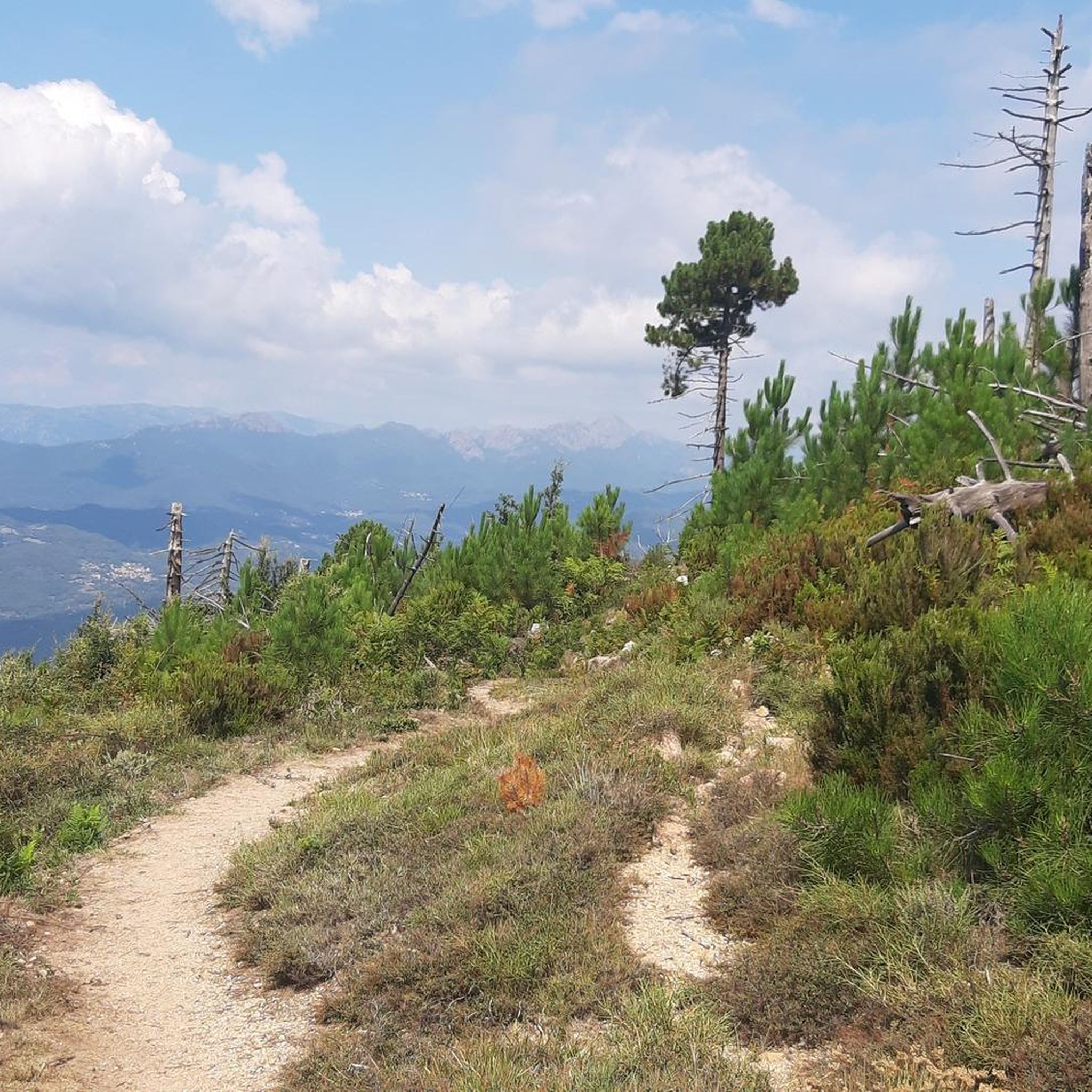
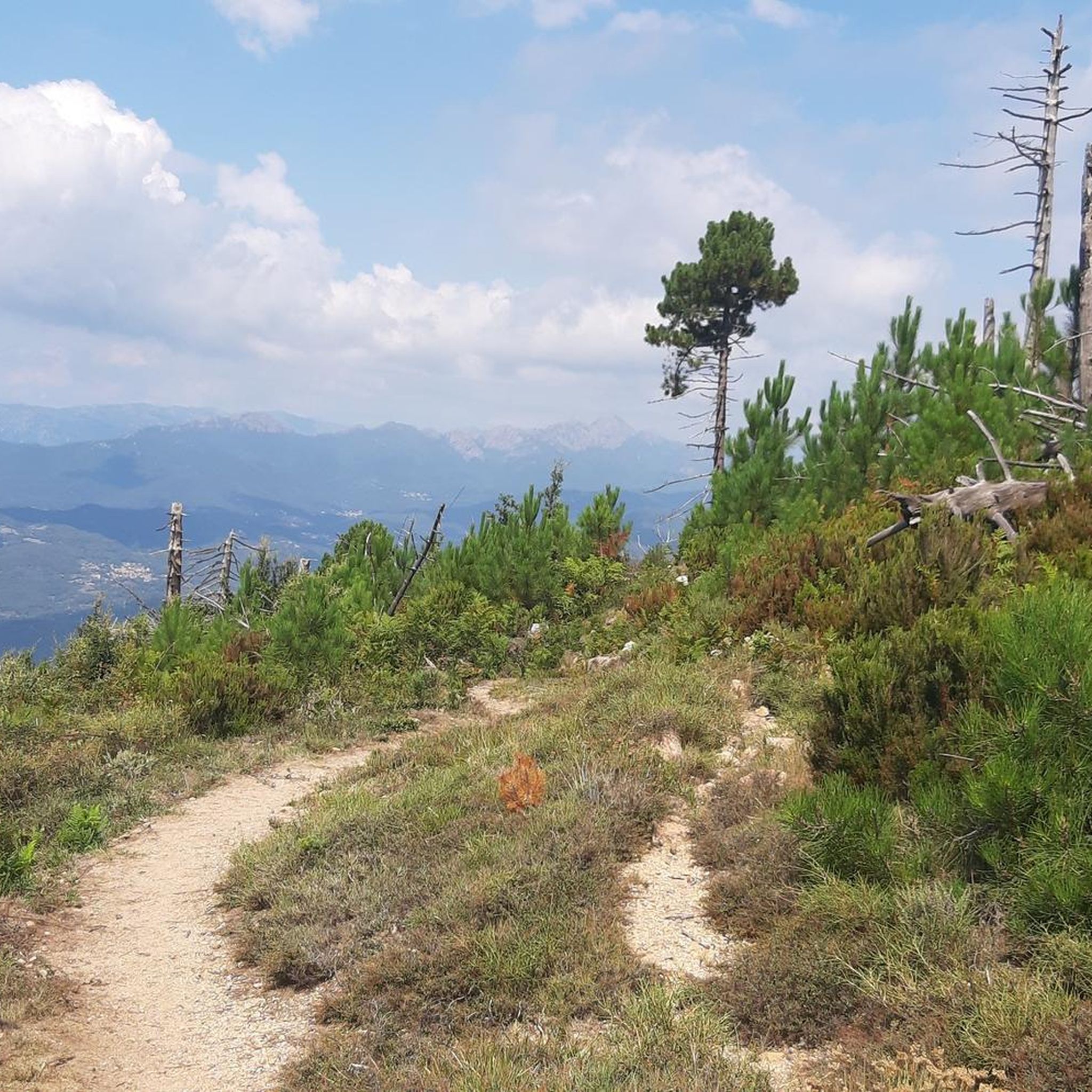
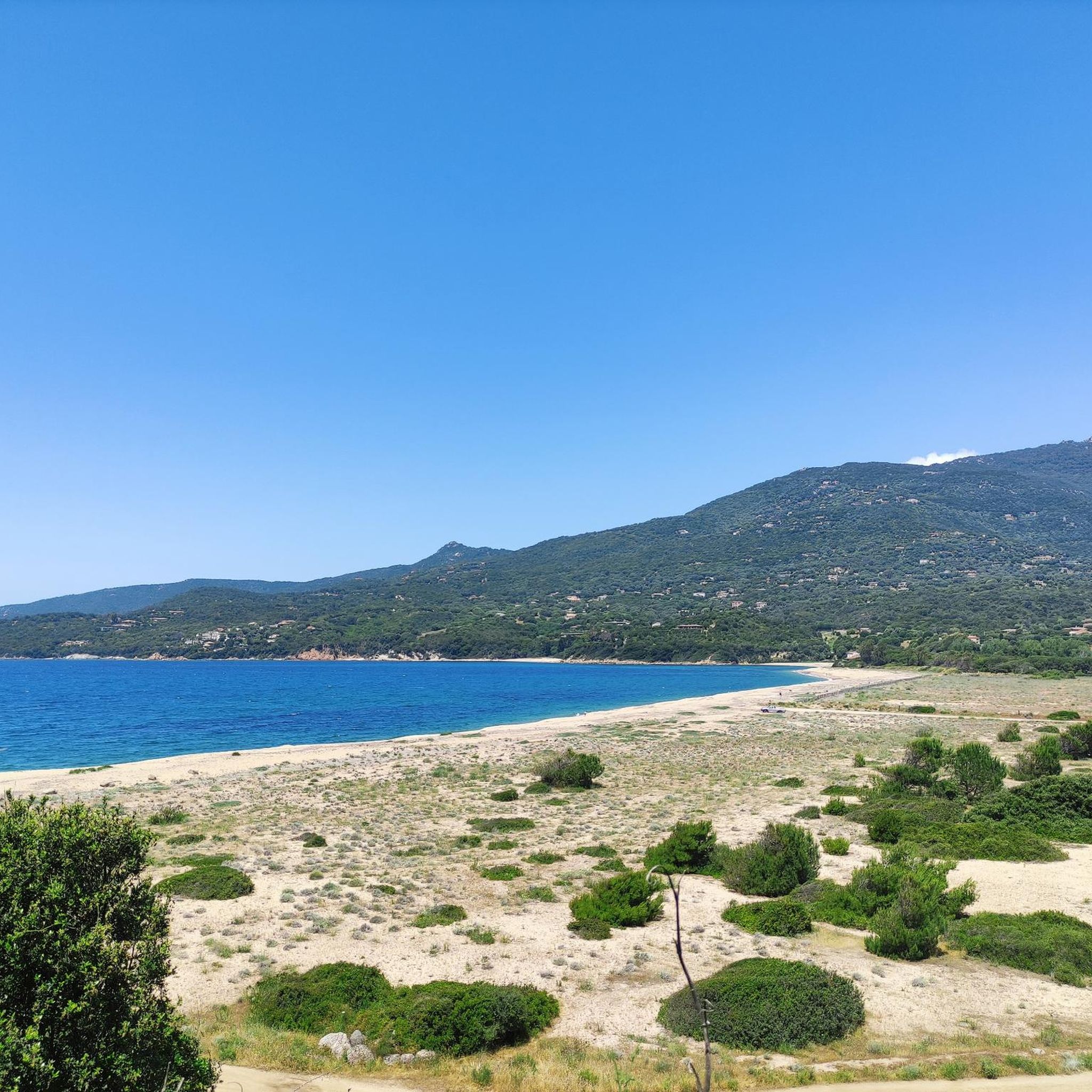
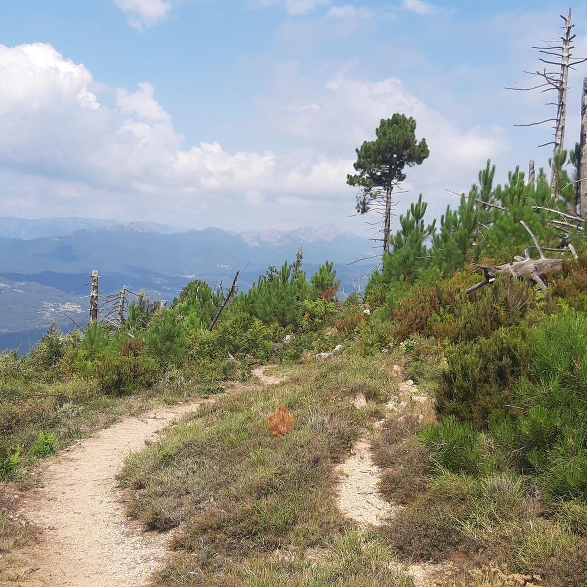
Tips from the Community

Beautiful views in a beautiful area.
0
0


two of the oldest houses on the island
0
0

From the summit it is initially blocky with - at least for me - some pushing sections. As it continues it becomes increasingly rideable and flowing towards the plateau. S2 - S3.
2
0


The path opens onto the bay of Propriano which is several meters below. In clear weather, it is also possible to distinguish the needles of Bavella.
1
0


These large olive trees are still harvested and the oil extracted from them is very famous.
0
0
Frequently Asked Questions
How many hiking trails are available around Petreto-Bicchisano?
There are over 80 hiking trails around Petreto-Bicchisano, offering a wide range of experiences from easy strolls to demanding mountain ascents. The region's diverse landscape includes mountainous terrain, maquis-covered areas, and lush river valleys.
What are the different difficulty levels for hiking trails in Petreto-Bicchisano?
The trails around Petreto-Bicchisano cater to various fitness levels. You'll find approximately 35 easy routes, 38 moderate routes, and 14 difficult routes. This variety ensures options for beginners, families, and experienced hikers seeking a challenge.
Are there any challenging hikes with significant elevation gain and panoramic views?
Yes, for experienced hikers, the Monte San Petru Summit – Mont San Petru loop from Bicchisano is a demanding option. This difficult 18.6 km (11.6 miles) trail offers a fabulous ridge experience with panoramic views across the Haut Taravo, Alta Rocca, Bavella, and potentially even Sardinia on clear days. Another challenging route is the Vera shelter-refuge – View of Olmeto loop from Vera, which features significant elevation gain.
Are there easy or family-friendly hiking options in the area?
Absolutely. An excellent easy option suitable for families and various fitness levels is the Cascade of Moca-Croce – Piscia di l'Onda Waterfall loop from Moca-Croce / Macà è Croci. This 6.4 km (4.0 miles) path leads to the beautiful Piscia di l'Onda Waterfall, offering an accessible and enjoyable outing.
Can I find trails with waterfalls or natural swimming spots?
Yes, the Abrà Valley, located between Petreto-Bicchisano and Moca-Croce, features a wild, crystal-clear river with small waterfalls and natural pools perfect for wild swimming during summer. The easy Cascade of Moca-Croce – Piscia di l'Onda Waterfall loop from Moca-Croce / Macà è Croci also leads to a notable waterfall.
Are there any circular hiking routes available?
Many trails in the region are designed as loops. For instance, the challenging Monte San Petru Summit – Mont San Petru loop from Bicchisano and the easy Cascade of Moca-Croce – Piscia di l'Onda Waterfall loop from Moca-Croce / Macà è Croci are both circular routes. The Vera shelter-refuge – View of Martini loop from Les Martini is another popular circular trail.
What kind of natural features and landscapes can I expect to see while hiking?
The region boasts diverse landscapes. You'll encounter dense woodlands, maquis-covered areas with broom, heather, and immortelle, and rocky peaks. Many trails offer 'viewing balconies' with grand vistas over the Gulf of Propriano, the Gulf of Valinco, and the Bavella towers. The Abrà Valley provides lush riverine scenery.
What do other hikers say about the trails in Petreto-Bicchisano?
The hiking routes in Petreto-Bicchisano are highly rated by the komoot community, with an average score of 4.4 stars from over 400 reviews. Hikers often praise the breathtaking panoramic views, the diverse terrain, and the opportunity to experience Corsica's wild natural beauty.
Are there any historical or cultural landmarks to explore near the trails?
While hiking, you can explore the charming village of Petreto-Bicchisano itself, with its traditional architecture and ancient fountains. Beyond hiking, the prehistoric site of Filitosa, known for its megaliths, is a significant nearby attraction. The ancient Abrà bridge in the Abrà Valley also offers a glimpse into the region's past.
What other attractions are there in the wider region around Petreto-Bicchisano?
Petreto-Bicchisano's central location makes it a great base for exploring. You can visit the coastal town of Propriano for its beaches and harbor, or venture to the scenic Col de Bavella for its dramatic mountain scenery. The Gradello Pass is also nearby.
Is public transport available to reach trailheads in Petreto-Bicchisano?
Information on specific public transport routes directly to all trailheads is limited. It is generally recommended to have a car for greater flexibility when exploring the diverse hiking opportunities around Petreto-Bicchisano, as many trailheads might be in more remote locations.
What is the best time of year to go hiking in Petreto-Bicchisano?
The best time for hiking in Petreto-Bicchisano is typically spring (April to June) and autumn (September to October) when the weather is milder and more pleasant. Summer can be very hot, especially for challenging mountain treks, though river walks and wild swimming spots offer relief. Winter hiking is possible but requires appropriate gear for potentially colder and wetter conditions at higher altitudes.
Most popular attractions around Petreto-Bicchisano

Get inspired with the komoot mobile app


Explore more
Browse the best Hikes in other regions.
