The best road cycling routes around Aldingen
4.5
(860)
8,267
riders
20
rides
Road cycling routes around Aldingen are situated in a region characterized by the Swabian Jura and the Danube Valley. This area features a varied terrain of mountains, plateaus, and valleys, providing diverse challenges for road cyclists. The landscape includes rolling hills, forests, and open areas, offering a scenic backdrop for rides. Its geographical position provides access to numerous cycling paths with varying degrees of difficulty.
Best road cycling routes around Aldingen
- The most popular road cycling route is Schömberg Reservoir…
Last updated: July 1, 2026
4.7
(9)
49
riders
50.8km
02:24
510m
510m
Moderate road ride. Good fitness required. Some segments of this route may be unpaved and difficult to ride.
4.4
(5)
25
riders
59.3km
02:45
570m
570m
Moderate road ride. Good fitness required. Some segments of this route may be unpaved and difficult to ride.

Sign up for free
5.0
(2)
31
riders
33.0km
01:32
220m
220m
Easy road ride. Great for any fitness level. Mostly well-paved surfaces and easy to ride.
3.3
(8)
27
riders
47.9km
02:16
450m
450m
Moderate road ride. Good fitness required. Some segments of this route may be unpaved and difficult to ride.
4.3
(3)
15
riders
28.5km
01:16
270m
270m
Easy road ride. Great for any fitness level. Mostly well-paved surfaces and easy to ride.
Get access to more routes and recommendations from other explorers.
Sign up for free
Already have an account?
Our route recommendations are based on thousands of hikes, rides, and runs completed by other people on komoot.
Start today with a free account
Your next adventure awaits.
Login or Signup



Tips from the Community

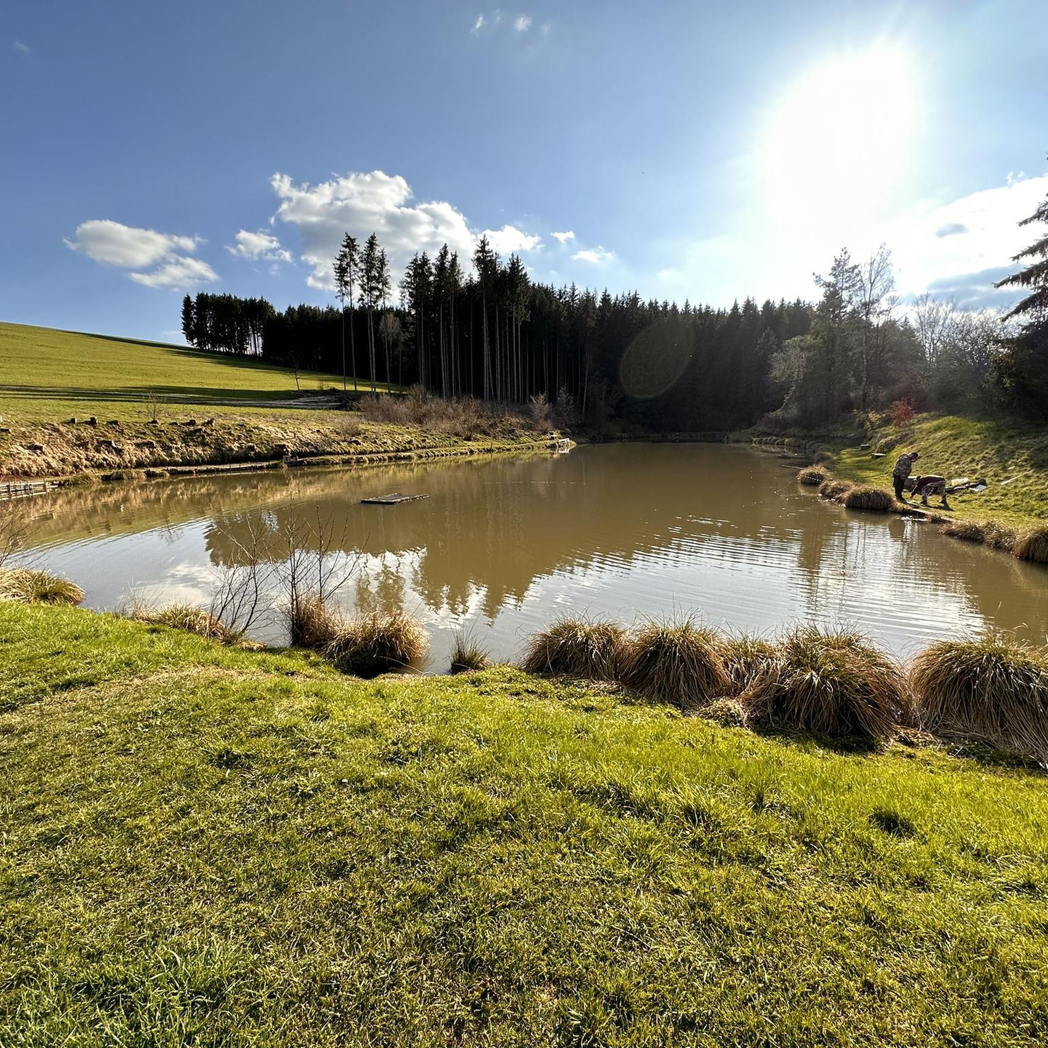
The Schlichemtalsperre (also known as Schömberger Stausee, mostly just called Stausee locally) east of Schömberg in Baden-Württemberg dams the Schlichem, a tributary of the Neckar coming from the Swabian Jura. The 90.6 ha Schömberger Stausee mit Palmbühl landscape protection area surrounds the Schlichemtalsperre. The approximately 1.35 km long and initially narrow reservoir, widening to about 175 m towards the end, with an area of 10.4 ha at 643.8 m above sea level (NHN), begins at the hamlet of Untere Säge and extends to the old town center of Schömberg. It has a catchment area of about 33.5 km², to which the Schlichem, over 11 km long at its inflow, contributes almost 90%. The watercourses Hölzlegraben from the forest to the right of the lake and Scheubühlgraben and Räßentälebach from the left, up to 1.2 km long, flow into it from the sides. A fish ladder leads from the Vorsee pre-reservoir near Untere Säge to the reservoir. There is also the only bridge over the lake that can be walked and driven on. The Schlichem Viaduct can only be used by the railway. The Schlichemtalsperre was built between 1940 and 1944. The Portlandzementwerk Rudolf Rohrbach KG (today Holcim (Süddeutschland) GmbH), based in neighboring Dotternhausen, which was the client for the dam, initially used it for cooling water supply and power generation. An outdoor swimming pool built in 1935 was flooded. After World War II, the facility was taken over by the state of Württemberg-Hohenzollern in 1948. The reservoir was renovated from 1975 to 1983. The barrier structure is an earth dam, and the hydropower plant within it has an output of 60 kW. There is a pre-reservoir, the Vorsee, which was built from 1975 to 1977. Source: https://de.wikipedia.org/wiki/Schlichemtalsperre
1
0

All common sizes 👍
0
0

There are several places to stop along the way
1
0
Narrenbrunnen ⛲ - Hauptstraße corner Untere Kirchstraße - Schömberg-Schörzingen - Zollernalbkreis
3
0

If the weather is good, definitely go up there. Depending on the position of the sun, you can see really far in one direction or the other. The direct view of the Neckar Valley (towards the A81/Neckarburg) is also great.
0
0
At Palmbühl on the Schömberg reservoir there is a free e-bike charging station with 3 sockets, marked but somewhat hidden.
3
0

Flat and wide dirt road.
0
0

The TK Elevator Test Tower in Rottweil is a 246-meter-high elevator test tower for express and high-speed elevators. With 232 meters, it offers Germany's highest visitor platform and is the world's second-tallest test tower for elevator systems.
6
0
Frequently Asked Questions
What kind of terrain can I expect when road cycling around Aldingen?
Road cycling routes around Aldingen are characterized by the diverse landscape of the Swabian Jura and the Danube Valley. You'll encounter a varied terrain of mountains, plateaus, and valleys, along with rolling hills, forests, and open areas, providing a scenic backdrop for your rides.
How many road cycling routes are available in the Aldingen area?
There are over 15 dedicated road cycling routes around Aldingen, offering a range of options for different skill levels and preferences.
Are there road cycling routes suitable for beginners in Aldingen?
Yes, Aldingen offers several beginner-friendly road cycling routes. For example, the Ice Cream Parlor loop from Aldingen is an easy 21.2 km ride with minimal elevation gain, perfect for those new to road cycling or looking for a relaxed tour. Another easy option is the View of Hohenkarpfen – Ice Cream Parlor loop from Aldingen, which covers 28.7 km.
What are some challenging road cycling routes around Aldingen?
For those seeking a challenge, the region provides routes with significant ascents. While specific 'difficult' routes are available, many moderate routes offer substantial climbs. The Schömberg Reservoir – Schlichem Dam loop from Aldingen, for instance, is a moderate 60 km route with nearly 600 meters of elevation gain, traversing rolling hills and offering rewarding views.
Can I find loop routes for road cycling in Aldingen?
Absolutely. Many of the road cycling routes around Aldingen are designed as loops, allowing you to start and end your ride in the same location. Popular examples include the Schömberg Reservoir – Viaduct Near Rottweil loop from Aldingen and the Kapellenkirche Rottweil – Viaduct Near Rottweil loop from Aldingen.
What kind of attractions can I see along the road cycling routes in Aldingen?
The routes often pass by historical sites and natural viewpoints. You can explore various castles and ruins, such as the Oberhohenberg Observation Platform (site of Hohenberg Castle) or the Rothenstein Castle Ruins. The region also features interesting caves like the Bettelmännskeller Cave.
What do other road cyclists enjoy most about cycling in Aldingen?
The komoot community highly rates road cycling in Aldingen, with an average score of 4.5 stars from over 800 reviews. Cyclists frequently praise the varied terrain, the scenic backdrop of rolling hills and forests, and the diverse challenges offered by the Swabian Jura and Danube Valley.
Is Aldingen a good destination for family road cycling trips?
While the region offers diverse terrain, families might prefer the easier, flatter sections, especially those along the Danube or Neckar Cycle Paths which are well-suited for more relaxed rides. Some of the shorter, easy loop routes around Aldingen could also be suitable for families with older children.
What is the best time of year for road biking in Aldingen?
The best time for road biking in Aldingen is generally from spring through autumn (April to October). During these months, the weather is typically mild, and the natural landscapes are at their most vibrant, offering ideal conditions for exploring the region's diverse routes.
Are there options for parking when starting a road cycling route in Aldingen?
Yes, Aldingen and the surrounding towns typically offer various parking facilities, often near town centers or trailheads, making it convenient to start your road cycling adventure. It's advisable to check local parking options for your specific starting point.
Can I reach road cycling routes in Aldingen using public transport?
Aldingen is located in a region with public transport options. Visitors staying in the Swabian Alb may even receive an AlbCard, which offers free use of public transport, making it easier to access different starting points for your cycling routes or to combine cycling with other regional explorations.
Most popular attractions around Aldingen

Get inspired with the komoot mobile app


Explore more
Browse the best Road cycling routes in other regions.
