The best MTB trails around Le Bouillon
4.9
(14)
306
riders
41
rides
Mountain biking around Le Bouillon offers a diverse network of trails within the Belgian Ardennes, characterized by its rugged terrain and the meandering Semois River. The region features dense forested hills and valleys, providing a natural environment for mountain bike trails. This landscape includes significant elevation changes, with routes designed for various skill levels. The area's geographical features contribute to a challenging and varied riding experience.
Best mountain bike trails around Le Bouillon
- The most popular mountain bike trail is Madame's Cross – Carrefour du Chêne au Verdier loop from Écouves, a 16.1 miles (26.0 km) trail that takes 2 hours 31 minutes to complete. This difficult route navigates through the forested hills of the Ardennes.
- Another top favourite among local mountain bikers is Sherman tank – Rendezvous crossroads loop from Écouves, a difficult 32.0 miles (51.6 km) path. This extensive route offers a challenging ride through the region's varied terrain.
- Local mountain bikers also love the Carrefour du Chêne au Verdier – Vignage Rocks loop from Carrefour du Chêne au Verdier, a 9.8 miles (15.8 km) trail leading through dense forested hills, often completed in about 1 hour 32 minutes.
- Mountain biking around Le Bouillon is defined by the Semois River Valley, dense forested hills, and rugged Ardennes terrain. The network offers options for different ability levels, from beginner-friendly routes to more challenging trails.
- The routes in Le Bouillon are highly rated by the komoot community with an average score of 4.7 stars from over 20 reviews. More than 370 mountain bikers have used komoot to explore Le Bouillon's varied terrain.
Last updated: July 2, 2026
4.7
(3)
55
riders
26.0km
02:31
570m
570m
Hard mountain bike ride. Good fitness required. Advanced riding skills necessary. Some portions of the route may require you to push your bike.
45
riders
51.6km
04:55
920m
920m
Hard mountain bike ride. Very good fitness required. Advanced riding skills necessary. Some portions of the route may require you to push your bike.

Sign up for free
4.5
(2)
29
riders
Hard mountain bike ride. Good fitness required. Advanced riding skills necessary. Some portions of the route may require you to push your bike.
19
riders
37.3km
03:34
740m
740m
Hard mountain bike ride. Good fitness required. Advanced riding skills necessary. Some portions of the route may require you to push your bike.
5.0
(1)
13
riders
13.9km
01:18
240m
240m
Hard mountain bike ride. Great for any fitness level. Advanced riding skills necessary. Some portions of the route may require you to push your bike.
Get access to more routes and recommendations from other explorers.
Sign up for free
Already have an account?
Our route recommendations are based on thousands of hikes, rides, and runs completed by other people on komoot.
Start today with a free account
Your next adventure awaits.
Login or Signup


Tips from the Community

Perhaps the small botanical problem only exists in the German translation that the komoot system displays via Google, but: The highlight name refers to an "oak," but the text then refers to a "mammoth tree." But aside from this minor linguistic confusion, a beautiful carving can be found at this point in the forest.
0
0
Perhaps the small botanical problem only exists in the German translation that the komoot system displays via Google, but: The highlight name refers to an "oak," but the text then refers to a "mammoth tree." But aside from this minor linguistic confusion, a beautiful carving can be found at this point in the forest.
0
0
At this central location in the forest—where six streets converge to form an open space—the brightly lit small sacred monument rises above a slab and a small stone base. The simply crafted wooden cross (without a body) bearing the name "La Croix Madame" is painted white, forming a radiant centerpiece in the middle of the forest.
0
0

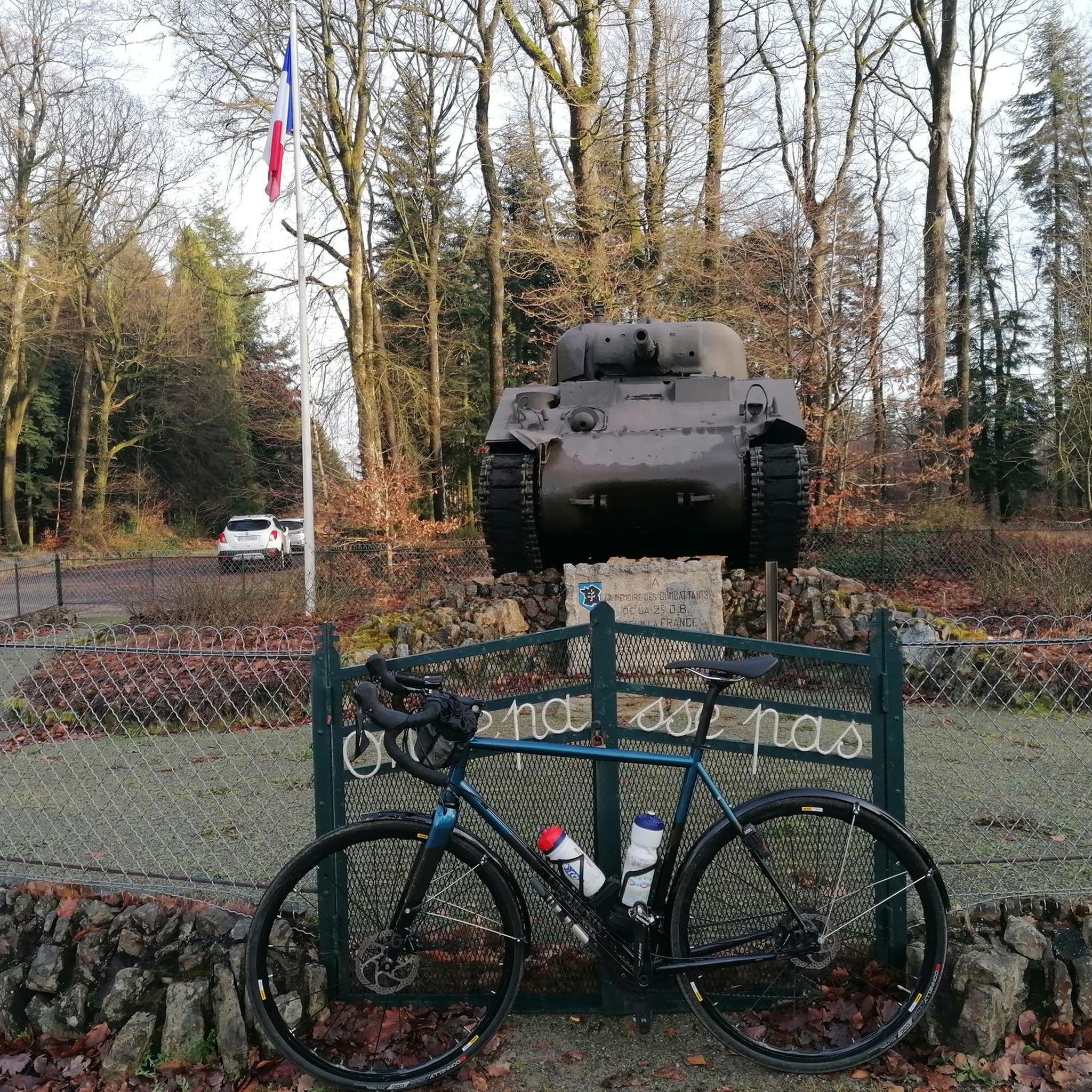
2 perforations visible on the 12th photo of the Sherman M4A2 "Valois"
0
0

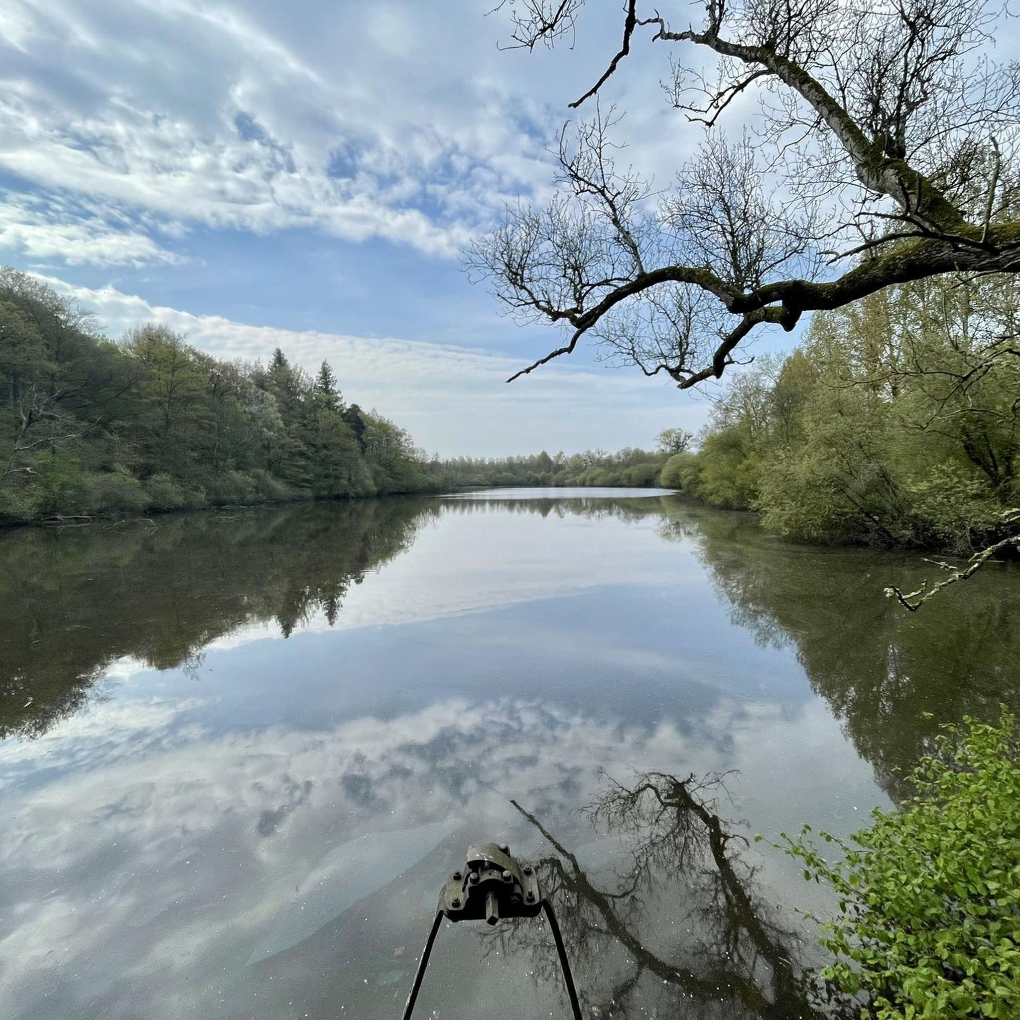
Several nice descents start from here towards l'Etang de Radon
0
0

The Écouves national forest is located in the Normandy-Maine Regional Natural Park. It is home to abundant game, sessile oaks, beeches and Scots pines, over 15,000 hectares. Its highest point is the Écouves signal, which rises to an altitude of 413 meters. It is the highest peak in Normandy.
1
0

If you are looking for a unique destination in Normandy, you should stop to see the Sherman tank in La Ferrière-Béchet. This is an American tank from World War II that was abandoned in the Ecouves forest after being hit by a German shell in August 1944. The tank is today covered in moss and vegetation, creating a striking contrast with its metal structure.
2
0
“Each of these crosses can tell its own story and what motivated people to erect“ their ”cross at this point. (...) These crossroads were erected as visible signs and attract the eyes of many people. The cross is a symbol of life. It stands as a sign of our Christian hope and wants to direct our gaze to Jesus Christ, who overcame death (...). The cross is part of our life, just as it was part of the life of Jesus. So I wish that many people ... visit the crossroads, whether as places of silence and breathing before God, whether as places of congregation meeting, prayer and praise of God. " (Text source: Dean Rainald M. Ollig in: "Crosses of the way ... Small sacred monuments as a sign of popular piety")
2
0
Frequently Asked Questions
How many mountain bike trails are available in Le Bouillon?
Le Bouillon offers a wide selection of mountain bike trails, with over 45 routes available for exploration. These trails cater to various skill levels, from easy to difficult.
What is the general difficulty level of mountain bike trails in Le Bouillon?
The mountain bike trails around Le Bouillon are predominantly challenging, with 36 out of 47 routes rated as difficult. There are also 6 easy and 5 moderate trails, providing options for different experience levels.
Are there any family-friendly mountain bike trails in Le Bouillon?
Yes, while many trails are challenging, Le Bouillon does offer 6 easy mountain bike routes suitable for families or those looking for a less strenuous ride. These routes often feature progressive elements, making them accessible for various skill levels.
What kind of terrain can I expect on mountain bike trails in Le Bouillon?
You can expect a diverse and rugged terrain in Le Bouillon, characteristic of the Belgian Ardennes. Trails wind through dense forested hills and valleys, often featuring significant elevation changes, natural obstacles like off-camber roots, and purpose-built singletrack sections. The region's dramatic landscapes and the meandering Semois River also contribute to varied riding experiences.
Are there any circular mountain bike routes in Le Bouillon?
Yes, many of the mountain bike routes in Le Bouillon are designed as loops. For example, the difficult Madame's Cross – Carrefour du Chêne au Verdier loop from Écouves is a 26.0 km circular trail, and the Carrefour du Chêne au Verdier – Vignage Rocks loop from Carrefour du Chêne au Verdier offers a 15.8 km loop through dense forested hills.
What are some notable landmarks or points of interest along the mountain bike trails?
Several interesting landmarks can be found along the trails. You might encounter historical sites like the Sherman tank, or natural features such as Madame's Cross and Carrefour du Chêne au Verdier. The region is also known for its stunning viewpoints, like the 'Tombeau du Géant' (Giant's Tomb) near Botassart, offering panoramic views of the Semois River valley.
What do other mountain bikers enjoy most about mountain biking in Le Bouillon?
The mountain biking experience in Le Bouillon is highly rated by the komoot community, with an average score of 4.7 stars from over 20 reviews. Riders often praise the diverse network of trails, the challenging terrain, and the beautiful natural environment of the Belgian Ardennes, including the dense forests and the scenic Semois River valley.
Are e-bikes allowed on the mountain bike trails in Le Bouillon?
Yes, e-bikes are generally permitted on many of the mountain bike trails in the Bouillon region. This allows more riders to enjoy the significant elevation changes and varied terrain, including the challenging climbs and descents.
What is the longest mountain bike trail in Le Bouillon?
One of the longest and most challenging routes is the Sherman tank – Rendezvous crossroads loop from Écouves. This difficult path extends for 51.6 km (32.0 miles) and typically takes around 4 hours and 54 minutes to complete, offering an extensive ride through the region's varied terrain.
What is the best time of year for mountain biking in Le Bouillon?
The Belgian Ardennes, including Bouillon, offers a great outdoor experience for much of the year. While specific seasonal recommendations depend on personal preference for weather and trail conditions, spring and autumn often provide pleasant temperatures and vibrant scenery. Winter riding is possible, but trails may be wet or muddy, and some features could be more challenging.
Are there any specific trail grading systems used in Le Bouillon?
Yes, the mountain biking infrastructure in the Bouillon region, particularly for purpose-built singletrack trails, often utilizes the UK/Euro style trail grading system. This system helps riders understand the difficulty and technical demands of each trail, ranging from beginner-friendly to advanced red and black trails.
Where can I find more information about the Bouillon region?
For additional information about the Bouillon region and its surroundings, you can visit the official tourism website for Wallonia: visitwallonia.com.
Most popular attractions around Le Bouillon

Get inspired with the komoot mobile app


Explore more
Browse the best MTB trails in other regions.
