The best walks and hikes around Castineta
4.2
(463)
2,101
hikers
44
hikes
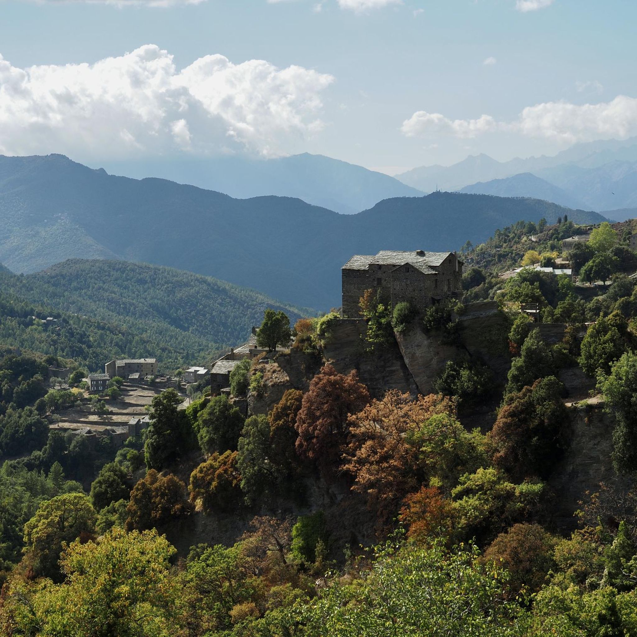
Hiking trails around Castineta traverse a landscape defined by mountainous terrain, dense chestnut forests, and notable waterfalls. The region's elevation changes provide varied hiking experiences, from gentle paths through woodlands to more challenging ascents. Many hikes near Castineta offer views of the surrounding Corsican peaks, including Monte San Petrone.
Best hiking trails around Castineta
- The most popular hiking route is Church – Struccia Waterfall loop from Piedicroce, a 4.6 miles (7.4 km) trail that takes 2 hours 13 minutes…
Last updated: July 2, 2026
4.7
(133)
660
hikers
10.8km
03:38
510m
510m
Moderate hike. Good fitness required. Mostly accessible paths. Sure-footedness required.
5
hikers
7.19km
03:01
500m
500m
Moderate hike. Good fitness required. Mostly accessible paths. Sure-footedness required.

Sign up for free
5.0
(2)
13
hikers
Moderate hike. Good fitness required. Easily-accessible paths. Suitable for all skill levels.
5.0
(1)
9
hikers
2.32km
00:43
90m
90m
Easy hike. Great for any fitness level. Easily-accessible paths. Suitable for all skill levels.
3.7
(3)
5
hikers
6.43km
02:03
210m
210m
Moderate hike. Good fitness required. Mostly accessible paths. Sure-footedness required.
Get access to more routes and recommendations from other explorers.
Sign up for free
Already have an account?
Our route recommendations are based on thousands of hikes, rides, and runs completed by other people on komoot.
Start today with a free account
Your next adventure awaits.
Login or Signup


Tips from the Community

A slightly flatter part of the route to Monte San Petrone. Pleasant to walk.
0
0

Great climb in the shade Dream panorama at the summit over the island of beauty
1
0

The hike to the summit in pictures https://youtu.be/WeNIHwlX3ao
1
1

A wonderful and well-marked circular hike to the summit of San Petrone. At 1767m, Monte San Petrone is the highest peak in the Castagniccia region. Castagniccia stands for the Corsican name 'chestnut grove' and covers the hilly area between Bastia and Aleria in the east of Corsica. The last ascent is again intense and well attended, I hardly met any people on my circular hike. But apparently there is still a not so intense way to the summit that comes from the north and brings some visitors with it.
2
0
A wonderful and well-marked circular hike to the summit of San Petrone. At 1767m, Monte San Petrone is the highest peak in the Castagniccia region. Castagniccia stands for the Corsican name 'chestnut grove' and covers the hilly area between Bastia and Aleria in the east of Corsica. The last ascent is again intense and well attended, I hardly met any people on my circular hike. But apparently there is still a not so intense way to the summit that comes from the north and brings some visitors with it.
0
0

Great place to linger, the four-legged friends are all very approachable and curious. Great!!
0
0

The parking lot is really very small, a maximum of 2 to 3 cars fit in addition to the broken white one that has apparently been there for a long time in the parking lot.
0
0
Frequently Asked Questions
How many hiking trails are available around Castineta?
There are over 40 hiking trails around Castineta, offering a variety of experiences for different skill levels. The komoot community has recorded 43 routes in the area.
What kind of terrain can I expect on hikes near Castineta?
Hikes around Castineta traverse mountainous terrain, dense chestnut forests, and feature picturesque waterfalls. You can expect varied elevation changes, from gentle paths through woodlands to more challenging ascents, often providing views of the surrounding Corsican peaks.
Are there any easy, family-friendly hikes in Castineta?
Yes, Castineta offers several easy routes suitable for families. For example, the Struccia Waterfall – Piedicroce loop from Piedicroce is an easy 3.7-mile (5.9 km) path that allows you to experience the area's natural beauty, including the Struccia Waterfall, without significant difficulty. Overall, 13 easy routes are available.
Can I find hikes with waterfalls in Castineta?
Absolutely. The Struccia Waterfall is a prominent natural feature in the area. Several routes incorporate it, such as the Church – Struccia Waterfall loop from Piedicroce, which is a moderate 4.6-mile (7.4 km) trail, or the easier Struccia Waterfall – Piedicroce loop from Piedicroce.
What are the difficulty levels of hiking trails in Castineta?
The trails around Castineta cater to various fitness levels. You'll find 13 easy routes, 24 moderate routes, and 6 difficult routes, ensuring options for casual walkers and experienced hikers alike.
Are there any circular walks available in Castineta?
Many of the popular hikes in Castineta are circular, allowing you to start and end at the same point. Examples include the Church – Struccia Waterfall loop from Piedicroce and the Struccia Waterfall – Church loop from Piedicroce, both offering diverse scenery.
What do other hikers enjoy most about hiking in Castineta?
The area is highly rated by the komoot community, with an average score of 4.4 stars from over 400 reviews. Hikers often praise the varied terrain, the beauty of the chestnut forests, and the scenic waterfalls, as well as the views of Corsican peaks like Monte San Petrone.
Are there any historical sites or landmarks to see while hiking?
Yes, the region offers historical points of interest. The Orezza Monastery Ruins are a notable historical site that can be explored in the vicinity of some hiking routes, adding a cultural dimension to your outdoor adventure.
Can I find hikes with views of Monte San Petrone?
Yes, many trails in the Castineta area offer impressive views of Monte San Petrone, one of Corsica's significant peaks. The View of San Petrone loop from Lutina is a moderate 6.7-mile (10.8 km) route specifically designed to showcase these panoramic vistas.
What is the best time of year to go hiking in Castineta?
While specific seasonal data isn't provided, the mention of dense chestnut forests and mountainous terrain suggests that spring and autumn would offer pleasant temperatures and vibrant scenery. Summer can be warm, especially at lower elevations, while winter might bring colder conditions and potential snow at higher altitudes.
Are there any longer, more challenging hikes for experienced trekkers?
For experienced trekkers, Castineta offers more challenging options. The Through beautiful woods – Mount San Petrone loop from Piedicroce is a difficult 9.4-mile (15.1 km) trail with over 1000 meters of elevation gain, providing a strenuous and rewarding experience through the region's beautiful woodlands.
Most popular attractions around Castineta

Get inspired with the komoot mobile app


Explore more
Browse the best Hikes in other regions.
