The best walks and hikes around Val-Buëch-Méouge
4.7
(515)
3,321
hikers
39
hikes
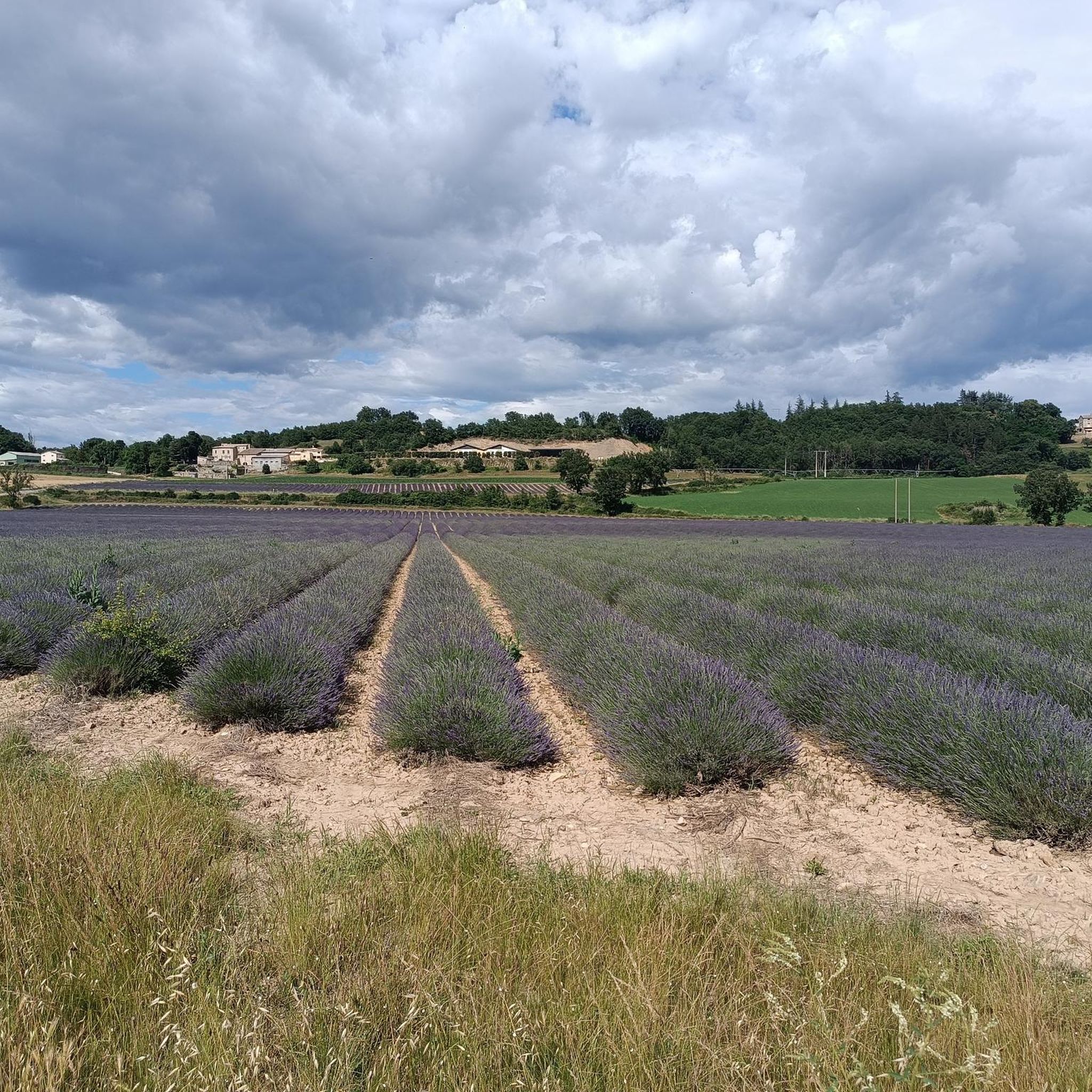
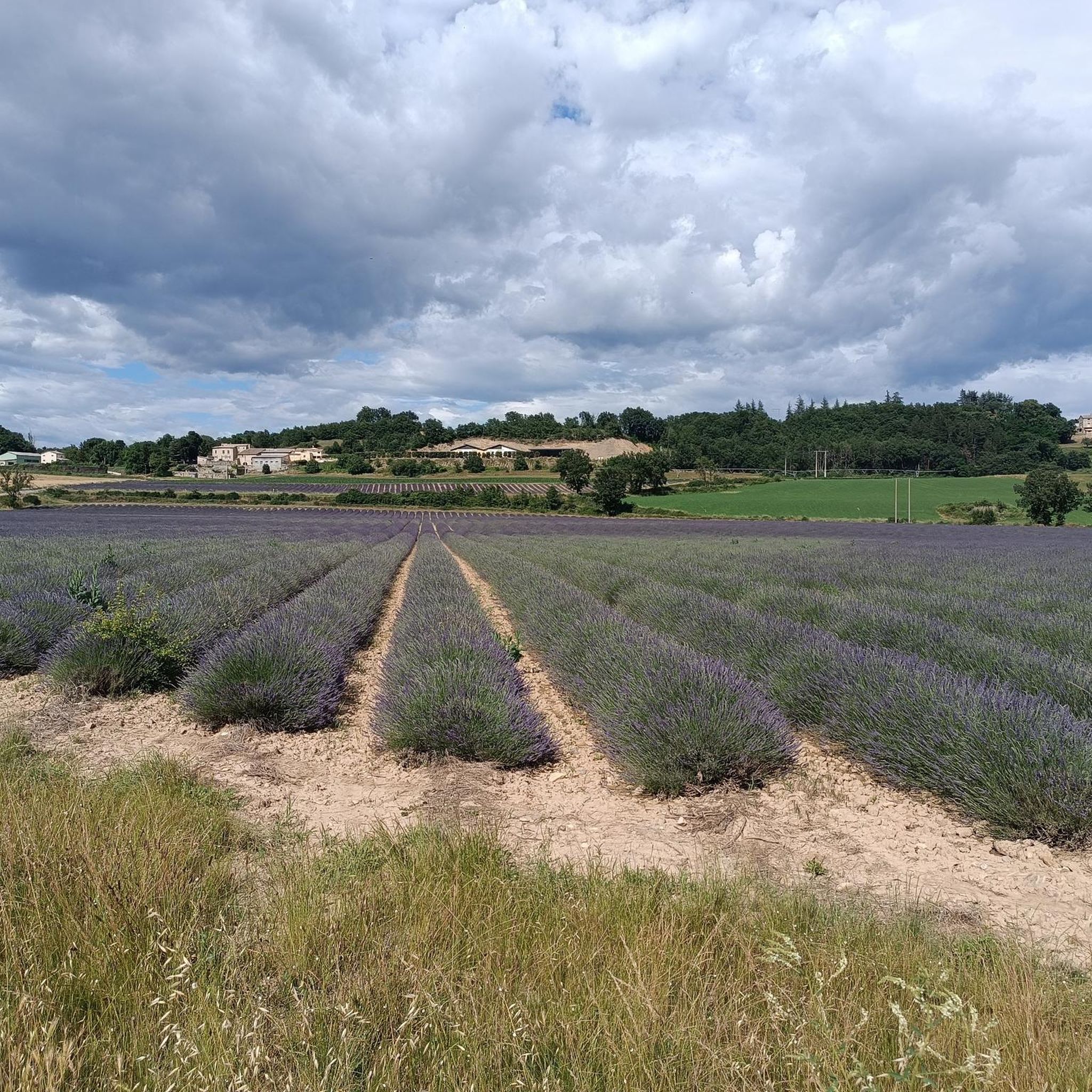
Hiking around Val-Buëch-Méouge offers diverse terrain within the Baronnies Provençales Regional Natural Park. The region is characterized by the dramatic limestone cliffs and turquoise waters of the Gorges de la Méouge, a designated biological reserve. Pine forests and verdant valleys define much of the landscape, with some areas featuring orchards and lavender fields. The elevation changes range from gentle riverside paths to more challenging ascents, providing varied hiking experiences.
Best hiking trails around Val-Buëch-Méouge
- The most popular hiking route is The Gorges de la Méouge loop - Parc naturel régional des Baronnies provençales, a 2.3 miles (3.8 km) trail that takes 1 hour 18 minutes to complete. This easy route explores the natural features of the Méouge Gorge, including its clear waters and rock formations.
- Another top favourite among local hikers is Picnic area – Méouge Gorge loop from Châteauneuf-de-Chabre, a moderate 4.9 miles (7.8 km) path. This route offers views of the gorge and surrounding landscapes, often passing by designated picnic spots.
- Local hikers also love the Méouge Gorge – Picnic area loop from Val-Buëch-Méouge, a 11.5 miles (18.5 km) trail leading through varied terrain with significant elevation gain, often completed in about 5 hours 47 minutes.
- Hiking around Val-Buëch-Méouge is defined by dramatic gorges, limestone cliffs, and natural pools. The network offers options for different ability levels, from easy riverside walks to more challenging routes with notable elevation changes.
- The routes in Val-Buëch-Méouge are highly rated by the komoot community with an average score of 4.6 stars from over 400 reviews. More than 2,600 hikers have used komoot to explore Val-Buëch-Méouge's varied terrain.
Last updated: June 30, 2026
4.9
(16)
82
hikers
Easy hike. Great for any fitness level. Easily-accessible paths. Suitable for all skill levels.
4.7
(60)
226
hikers
10.5km
03:19
360m
360m
Moderate hike. Good fitness required. Mostly accessible paths. Sure-footedness required.

Sign up for free
4.7
(22)
178
hikers
4.56km
01:22
90m
90m
Moderate hike. Great for any fitness level. Mostly accessible paths. Sure-footedness required.
4.6
(51)
371
hikers
18.5km
05:47
650m
650m
Hard hike. Very good fitness required. Mostly accessible paths. Sure-footedness required.
4.5
(15)
92
hikers
2.84km
00:54
70m
70m
Moderate hike. Great for any fitness level. Mostly accessible paths. Sure-footedness required.
Get access to more routes and recommendations from other explorers.
Sign up for free
Already have an account?
Our route recommendations are based on thousands of hikes, rides, and runs completed by other people on komoot.
Start today with a free account
Your next adventure awaits.
Login or Signup

Tips from the Community

Area well covered by the shade of the plants.
8
0
In this spot in summer, you always find many people bathing in the stream.
6
0
From here you can take different paths for hiking.
7
0
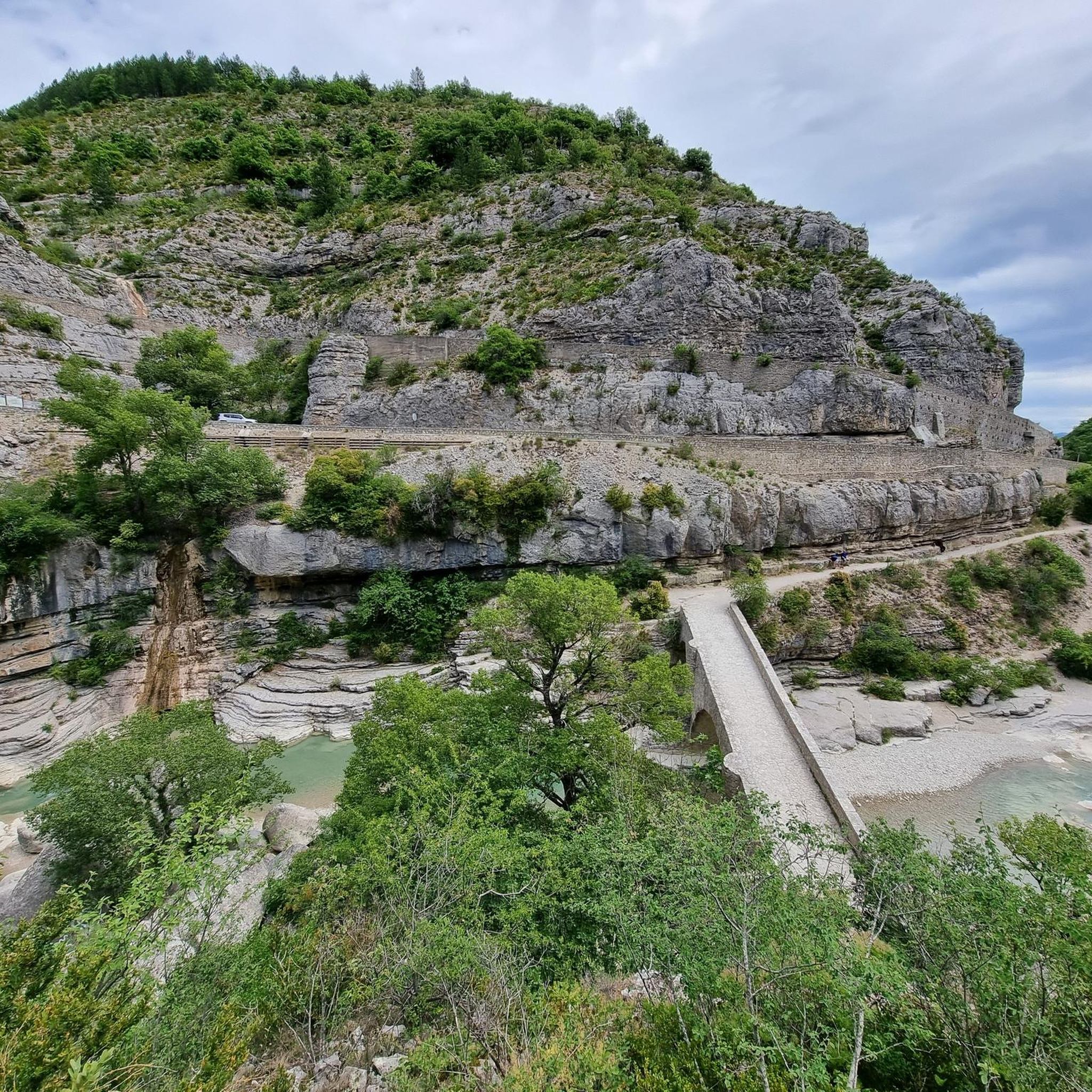
The medieval bridge of Châteauneuf-de-Chabre (France) is a very well-preserved historic bridge located on the Méouge river, in the Hautes-Alpes department.
8
0
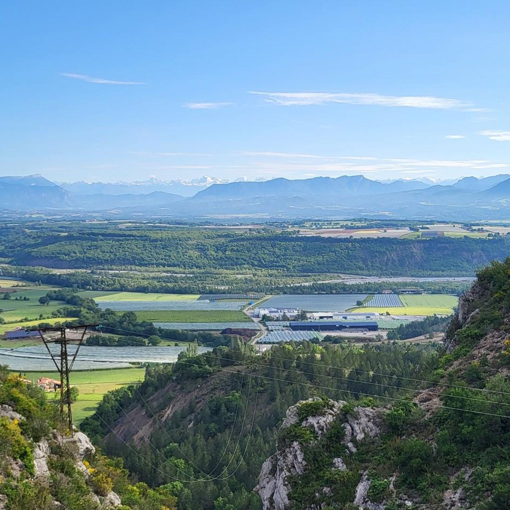
The Méouge valley (French: *Vallée de la Méouge*, sometimes also called *Val Buëch-Méouge*) is a small natural valley in the southeast of France, located between the Drôme Provençale and the Hautes-Alpes, in the Baronnies Provençales region.
8
0
Beautiful spot for a cool dip
10
0
The Gorges de la Méouge are a spectacular natural canyon located between the departments of Hautes-Alpes and Drôme, in the southeast of France. They are renowned for their turquoise waters, limestone cliffs, and numerous natural pools where you can swim in the summer.
6
0
Frequently Asked Questions
How many hiking trails are available in Val-Buëch-Méouge?
Val-Buëch-Méouge offers a diverse network of over 25 hiking trails, catering to various skill levels. You'll find everything from easy riverside paths to more challenging routes with significant elevation changes.
What kind of terrain can I expect on hikes in Val-Buëch-Méouge?
The terrain in Val-Buëch-Méouge is quite varied. You'll encounter dramatic limestone cliffs, especially around the Gorges de la Méouge, alongside verdant pine forests and open valleys. Some areas feature orchards and lavender fields. Paths range from gentle, accessible routes to more strenuous ascents and descents, offering a true 'rollercoaster' experience on longer circuits.
Are there any family-friendly hiking options in the region?
Yes, Val-Buëch-Méouge has several easy trails suitable for families. For instance, The Gorges de la Méouge loop is an easy 3.8 km route that explores the natural features of the gorge, perfect for a shorter outing. Many trails also feature natural pools and smooth rock beaches, ideal for cooling off with children.
Can I bring my dog on the trails in Val-Buëch-Méouge?
While the region is part of a Regional Natural Park, which generally welcomes dogs, it's always recommended to keep your dog on a leash to protect local wildlife and ensure a pleasant experience for all hikers. Specific rules may apply in certain protected areas within the Gorges de la Méouge.
What are the best times of year to go hiking in Val-Buëch-Méouge?
The spring and autumn months are ideal for hiking in Val-Buëch-Méouge, offering pleasant temperatures and vibrant landscapes. Summer is also popular, especially for enjoying the natural pools and swimming spots in the Méouge Gorge after a hike. Winters can be cold, but some trails may still be accessible for those prepared for cooler conditions.
Are there any circular hiking routes in Val-Buëch-Méouge?
Yes, the region is known for its excellent circular routes. A notable example is the challenging 'Tour des Gorges de la Méouge' circuit, which provides spectacular 'balcony' views. Another option is the Picnic area – Méouge Gorge loop from Châteauneuf-de-Chabre, a moderate 7.8 km path that offers scenic views and passes by designated picnic spots.
What natural features or landmarks can I see along the hiking trails?
The most prominent natural feature is the stunning Gorges de la Méouge, with its dramatic limestone cliffs, crystal-clear turquoise waters, and natural pools. You can also discover the historic Pont Roman, a medieval bridge that often serves as a starting point for hikes. For panoramic views, consider trails leading towards Pic Saint-Cyr or viewpoints like View of Sisteron and the Rocher de la Baume.
Are there opportunities for wild swimming or cooling off during hikes?
Absolutely! The Gorges de la Méouge are famous for their numerous natural pools, cascades, and smooth rock beaches. Many hikers enjoy a refreshing dip in the Méouge's waters, especially after completing a longer route. Look for highlights like Swimming spots and waterfalls in the Méouge Gorge for specific locations.
What do other hikers enjoy most about hiking in Val-Buëch-Méouge?
The area is highly rated by the komoot community, with an average score of 4.6 stars from over 400 reviews. Hikers frequently praise the dramatic beauty of the Gorges de la Méouge, the refreshing swimming spots, and the diverse trails that cater to all abilities. The well-maintained paths and stunning panoramic views are also often highlighted.
Are there any challenging hikes for experienced trekkers?
Yes, for experienced trekkers, there are more challenging routes. The Méouge Gorge – Picnic area loop from Val-Buëch-Méouge is an 18.5 km trail with significant elevation gain, often taking nearly 6 hours to complete. These routes offer continuous ascents and descents with spectacular 'balcony' views over the gorges.
Where can I find parking for trailheads in Val-Buëch-Méouge?
Many popular trailheads, especially those near the Gorges de la Méouge and villages like Châteauneuf-de-Chabre or Antonaves, offer designated parking areas. The Pont Roman, a common starting point for gorge hikes, also typically has parking nearby. It's advisable to check specific route details for parking information.
Are there any villages or points of interest to explore near the trails?
Yes, the region is dotted with charming historic villages. Antonaves, for example, is known for its beautiful stone houses and fountains, and serves as a gateway to several hiking trails. These villages often provide a glimpse into the local culture and history, making for pleasant stops during or after your hike.
Most popular routes around Val-Buëch-Méouge
Most popular attractions around Val-Buëch-Méouge

Get inspired with the komoot mobile app


Explore more
Browse the best Hikes in other regions.
