The best walks and hikes around Söderköpings kommun
4.6
(173)
758
hikers
39
hikes
Hiking around Söderköpings kommun offers diverse natural landscapes, blending urban charm with serene environments. The region features prominent natural landmarks like Ramunderberget, towering 70 meters above the town, and the historic Göta Canal with its car-free towpaths. To the east, the Sankt Anna Archipelago provides a coastal landscape with numerous islands and skerries, characterized by oak forests and rugged terrain. Extensive trail networks, including sections of the Östgötaleden, connect various nature reserves with older coniferous forests.
Best hiking trails around Söderköpings kommun
- The most popular hiking route is Borgbergsleden – Ramunderbergets Naturreservat, a 5.5 miles (8.8 km) moderate trail that takes 2 hours 25 minutes to complete. This route ascends Ramunderberget, offering panoramic views and leading through a coniferous forest.
- Another top favourite among local hikers is Stegeborg rundslinga, a moderate 7.8 miles (12.6 km) path. This trail explores the area around Stegeborg, featuring varied landscapes and cultural points of interest.
- Local hikers also love the Tyrislöt Harbour – Turistlöt Camping loop from Högholmen, a 2.8 miles (4.6 km) trail leading through the Sankt Anna Archipelago, often completed in about 1 hour 10 minutes.
- Hiking around Söderköpings kommun is defined by prominent hills, historic canal paths, and diverse archipelago terrain. The network offers options for various ability levels, from easy strolls to more challenging routes.
- The routes in Söderköpings kommun are highly rated by the komoot community with an average score of 4.6 stars from over 140 reviews. More than 600 hikers have used komoot to explore Söderköpings kommun's varied terrain.
Last updated: October 20, 2026
4.8
(34)
129
hikers
8.79km
02:25
140m
140m
Moderate hike. Good fitness required. Easily-accessible paths. Suitable for all skill levels.
4.4
(19)
76
hikers
12.6km
03:17
100m
100m
Moderate hike. Good fitness required. Easily-accessible paths. Suitable for all skill levels.

3.34km
00:51
10m
10m
Easy hike. Great for any fitness level. Easily-accessible paths. Suitable for all skill levels.
4.3
(20)
97
hikers
4.58km
01:11
20m
20m
Easy hike. Great for any fitness level. Easily-accessible paths. Suitable for all skill levels.
4.6
(11)
37
hikers
3.35km
00:52
10m
10m
Easy hike. Great for any fitness level. Easily-accessible paths. Suitable for all skill levels.
Get access to more routes and recommendations from other explorers.
Already have an account?
Our route recommendations are based on thousands of hikes, rides, and runs completed by other people on komoot.
Start today with a free account
Your next adventure awaits.

Other adventures around Söderköpings kommun

Tips from the Community

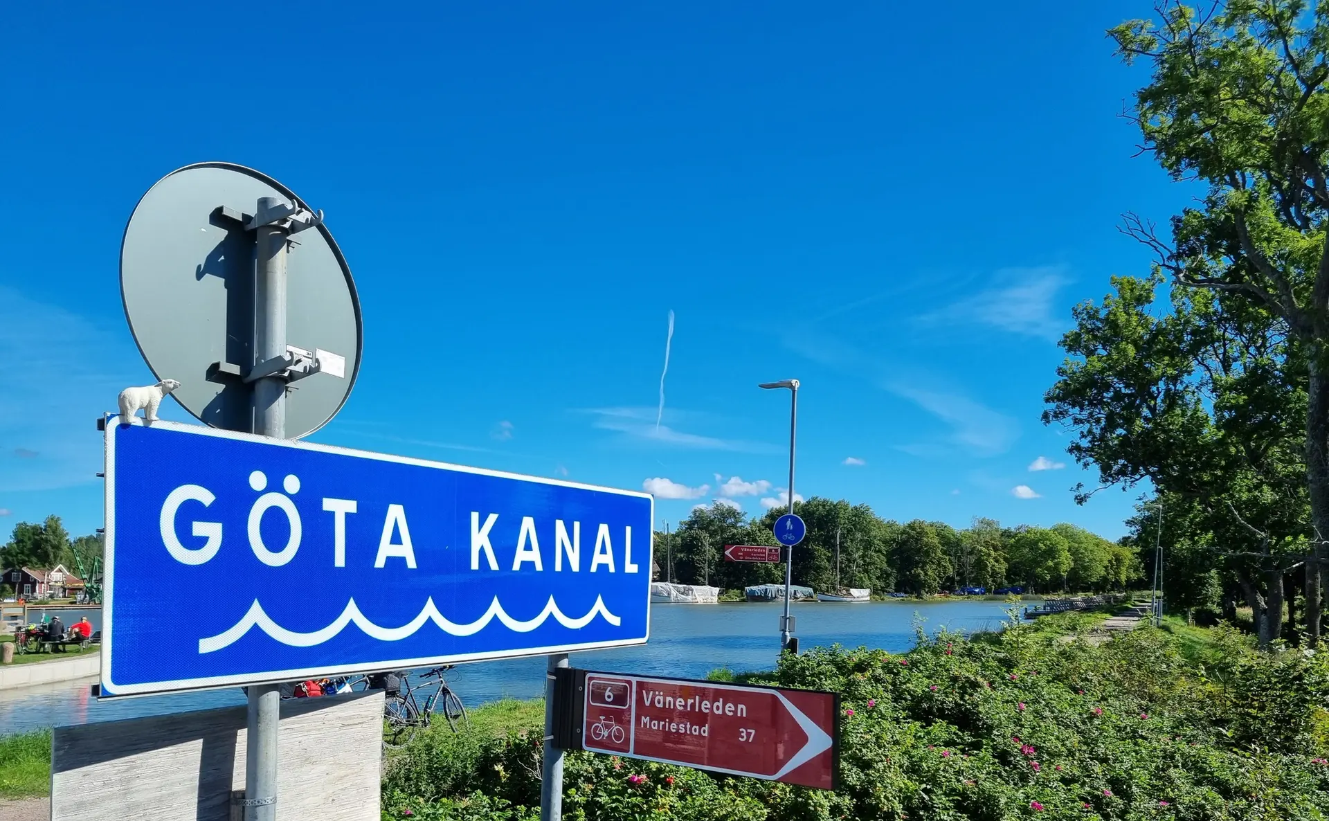
You can enjoy the canal’s banks along the greenway that runs alongside it and admire the cliffs of the Ramunderbergets Nature Reserve.
0
0
The Söderköping runestone is a historical monument from the Viking Age located directly in front of St. Lawrence Church. Next to it, you’ll find a plaque that tells its story.
0
0

Model of St. Kilian's Church with an information panel. The church no longer exists.
1
0
Rune stone from the pre-Viking age https://de.m.wikipedia.org/wiki/S%C3%B6derk%C3%B6pingssten
0
0

The Södlerköping Lock spans over the Göta canal and was built in 1847. However, the lock you see today is not the original one that dates back to 1832. It is a neat place to take a stroll and some scenic pictures.
3
0

Beautiful footpath and cycle path along the canal
0
0

At this point you will find a camp site with a fire pit and the climb to the “summit” around the corner (93 meters).
0
1
Between the fields you walk on wooden planks across fields and ditches.
0
0
Frequently Asked Questions
What types of landscapes can I expect to see while hiking in Söderköpings kommun?
Söderköpings kommun offers a diverse range of landscapes. You can explore prominent natural landmarks like Ramunderberget, which features coniferous forests and panoramic views. The historic Göta Canal provides scenic, car-free towpaths, while the Sankt Anna Archipelago to the east offers stunning coastal scenery with oak landscapes, rugged terrain, and numerous islands.
Are there any easy hiking trails suitable for beginners or families?
Yes, Söderköpings kommun has many easy trails. For example, the Tyrislöt Harbour – Turistlöt Camping loop from Högholmen is an easy 4.6 km route in the Sankt Anna Archipelago. Another gentle option is the Harstena Bakery – Harstena School Museum loop from Harstena, which is about 3.2 km. The region offers 31 easy tours in total, making it great for all skill levels.
What are some notable natural features or viewpoints I can discover on a hike?
Ramunderberget is a prominent natural landmark, offering rewarding panoramic views of Söderköping and its surroundings after ascending its 318 steps or following its paths. The Sankt Anna Archipelago also provides stunning coastal vistas with clear waters and rocky cliffs. You can also find the Motala Ström waterfalls in Norrköping nearby.
Can I find any historical or cultural landmarks along the hiking routes?
Absolutely. The Ramunderberget area includes cultural remains from prehistoric times and the Borgbergsleden trail leads to an ancient hillfort. Along the Göta Canal, you can experience historic locks like Mem Lock and the Lock Keeper Sculpture. The Himmelstalund Petroglyphs are also a significant historical site in the vicinity.
Are there any circular hiking routes available?
Yes, many trails in Söderköpings kommun are designed as loops. The Stegeborg rundslinga is a popular moderate 12.6 km circular path. In the archipelago, you can enjoy the Tyrislöt Harbour – Turistlöt Camping loop from Högholmen or the Harstena Bakery – Harstena School Museum loop from Harstena.
What is the best time of year to go hiking in Söderköpings kommun?
The region is enjoyable for hiking across multiple seasons. Spring and autumn offer pleasant temperatures and beautiful foliage, especially in the coniferous forests of Ramunderberget or the oak landscapes of Sankt Anna. Summer is ideal for exploring the archipelago and enjoying the clear waters. Even in winter, some illuminated tracks on Ramunderberget are available for activity.
What do other hikers say about the trails in Söderköpings kommun?
The hiking routes in Söderköpings kommun are highly regarded by the komoot community, with an average score of 4.6 stars from over 140 reviews. Hikers often praise the diverse terrain, from the challenging ascents of Ramunderberget to the serene paths along the Göta Canal and the unique beauty of the Sankt Anna Archipelago.
Are there opportunities for birdwatching or observing wildlife?
Yes, the diverse ecosystems in Söderköpings kommun provide excellent opportunities for wildlife observation. Ramunderberget Nature Reserve is home to various flora and fauna, including bird species like the black woodpecker. The Sankt Anna Archipelago is known for its rich bird life, and other nature reserves in the municipality protect habitats for species such as the Western Capercaillie.
Can I find trails that are part of a larger network?
Yes, the extensive Östgötaleden long-distance trail passes through Söderköpings kommun, connecting various natural areas and reserves. This allows for longer hikes and exploration of different parts of the region.
Are there any trails that offer a mix of nature and urban exploration?
Söderköping seamlessly blends urban charm with natural environments. You can start your hike near the town center and quickly access trails like those on Ramunderberget, which is just above the town. The Göta Canal towpaths also offer a unique blend of natural scenery and views of historic canal infrastructure, often passing through or near charming villages.
How many hiking routes are available in Söderköpings kommun?
There are 39 hiking routes available in Söderköpings kommun. These include a variety of options, with 31 easy trails and 8 moderate trails, ensuring there's something for every fitness level.
Are there any specific trails that lead to a hillfort?
Yes, the Borgbergsleden – Ramunderbergets Naturreservat trail, which is about 8.8 km long, includes some steep sections and leads to an ancient hillfort on Ramunderberget.
Most popular routes around Söderköpings kommun
Most popular attractions around Söderköpings kommun

Get inspired with the komoot mobile app


Explore more
Browse the best Hikes in other regions.
