The best walks and hikes around Västervik
4.6
(784)
2,776
hikers
117
hikes
Hiking around Västervik offers a diverse landscape characterized by its extensive archipelago, dense forests, and coastal paths. The region features over 5,000 islands, providing varied scenery from larger inhabited islands to secluded skerries. Inland areas include deep forests and open fields, with rocky outcrops offering panoramic views. This blend of environments makes Västervik a notable destination for outdoor enthusiasts.
Best hiking trails around Västervik
- The most popular hiking route is Gränsö Trail, a 9.2 miles (14.7 km) trail that…
Last updated: October 8, 2026
4.8
(160)
557
hikers
14.7km
03:47
60m
60m
Moderate hike. Good fitness required. Easily-accessible paths. Suitable for all skill levels.
4.9
(7)
43
hikers
3.09km
00:55
60m
60m
Moderate hike. Great for any fitness level. Mostly accessible paths. Sure-footedness required.

4.9
(26)
70
hikers
12.6km
03:29
120m
120m
Hard hike. Good fitness required. Sure-footedness, sturdy shoes and alpine experience required.
4.3
(7)
35
hikers
8.77km
02:19
80m
80m
Moderate hike. Good fitness required. Easily-accessible paths. Suitable for all skill levels.
4.0
(11)
31
hikers
9.74km
02:39
140m
140m
Moderate hike. Good fitness required. Easily-accessible paths. Suitable for all skill levels.
Get access to more routes and recommendations from other explorers.
Already have an account?
Our route recommendations are based on thousands of hikes, rides, and runs completed by other people on komoot.
Start today with a free account
Your next adventure awaits.

Tips from the Community

Everything spotless.. that's how it should be
6
0
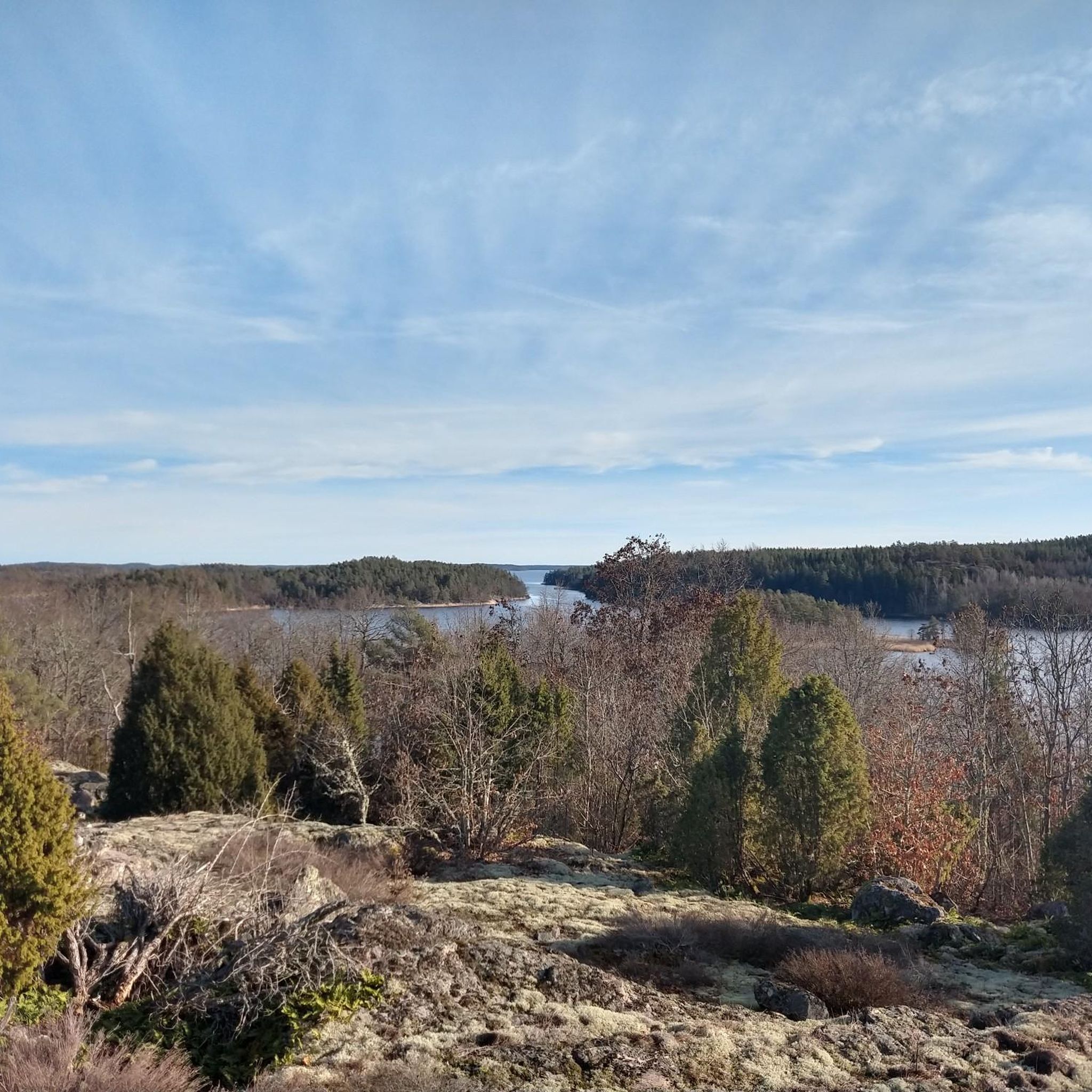
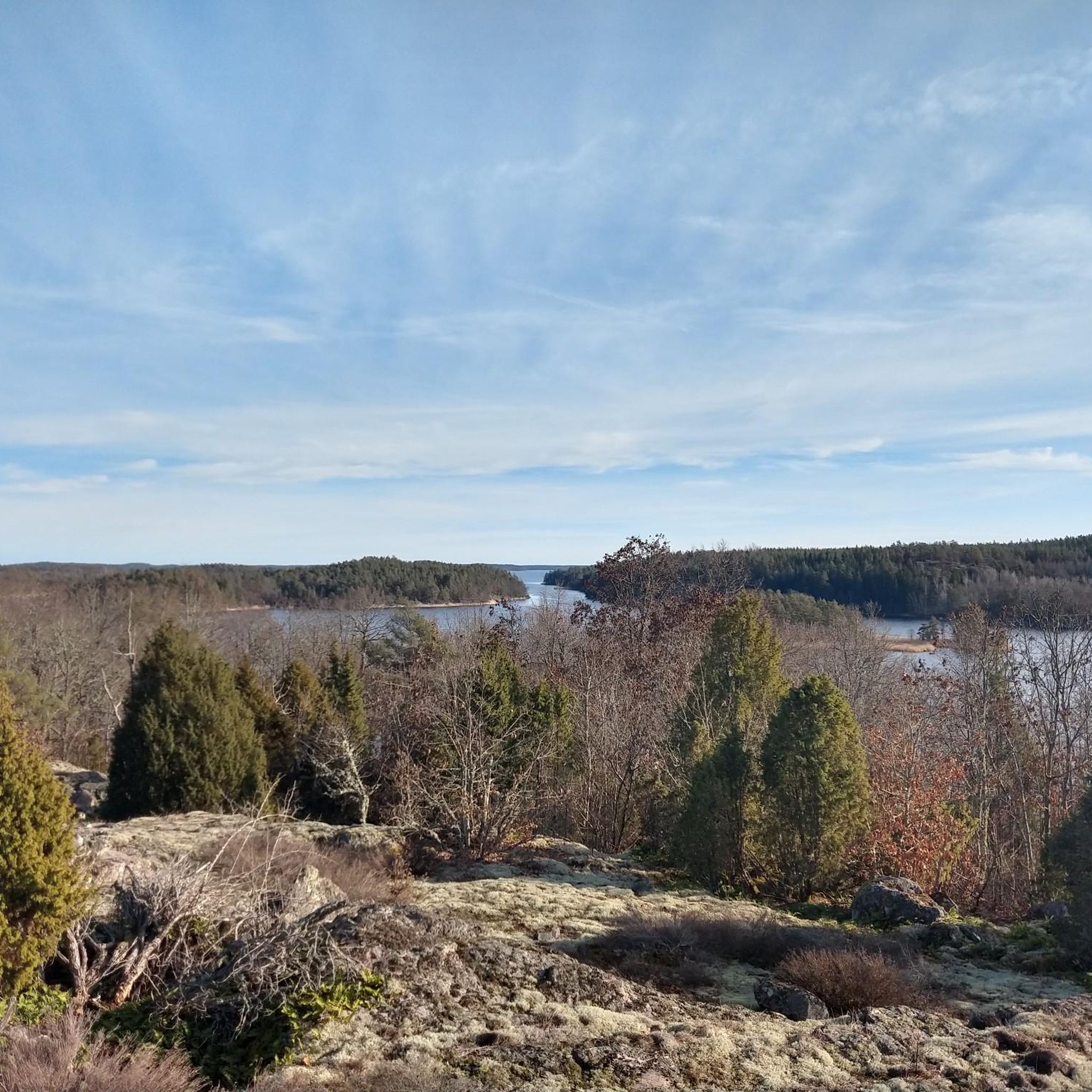
Fine view of the archipelago
7
0

From this vantage point, you’ll find large stone slabs on the ground where you can easily sit down and take the time to admire the vast view of the coniferous forests. A beautiful vista opens up before you, so take a moment to breathe it all in.
0
0
From this beautiful rock outcrop, you'll find an open gazebo where you can enjoy the view of Gamleby while staying out of the elements.
0
0
This trail is part of the Trollskogen Sculpture Park, created by Jerzy Przybyl based on local legends about trolls, elves, nymphs, and dragons. Along this section, you can admire some of these sculptures.
1
0

From the path, the view opens up to the Segersgärde nature reserve with its characteristic quartzite hills Furuberget and Örnberget. The mosaic of old coniferous forest, flowering meadows, and rocky hills is typical of the Tjust coast and can be taken in at a glance from here.
0
0
Up here, a wide panorama opens up over the skerries outside Västervik, with views of the bird-rich holms and, in good visibility, all the way to the church towers of Lofta and Gamleby.
1
0

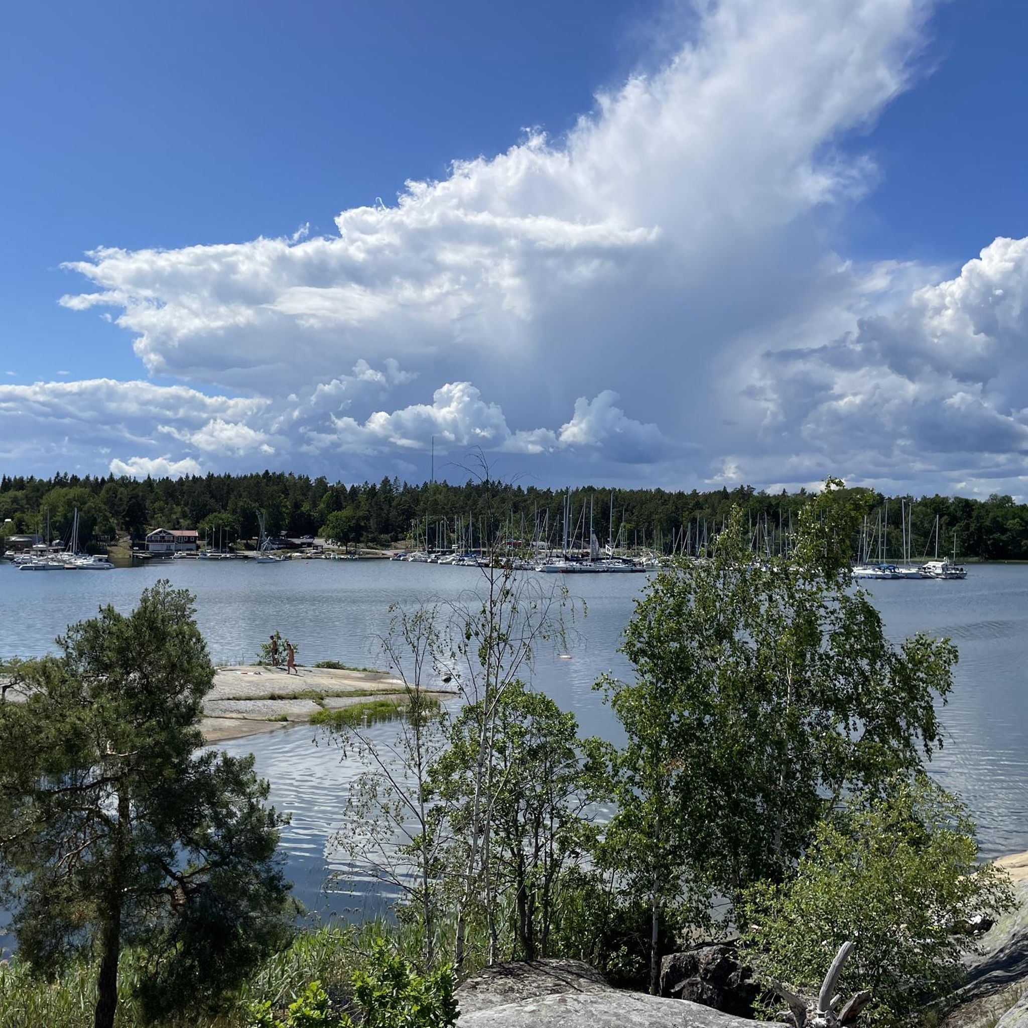
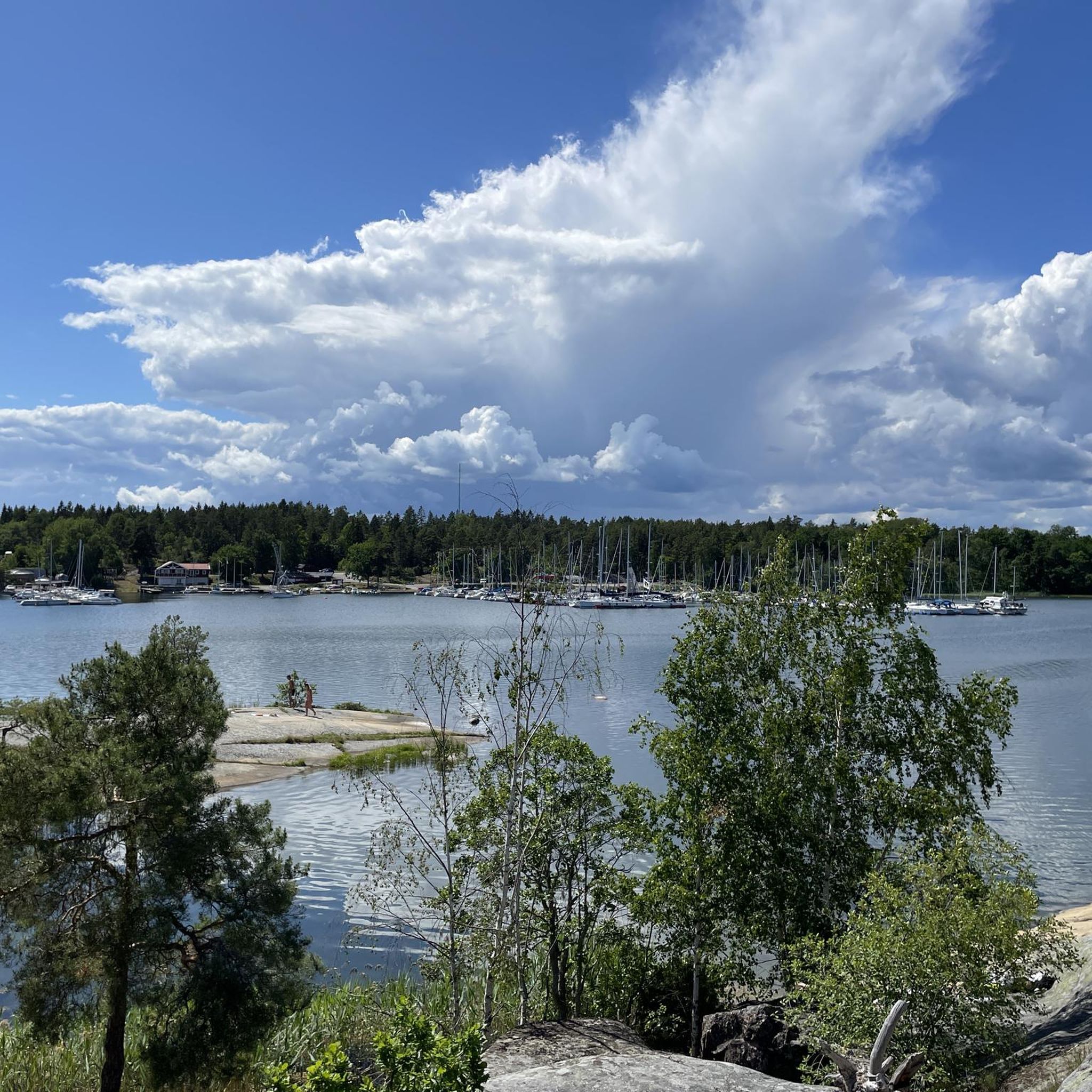
Not only this rock, but the entire stretch of coast here is worth a visit. Here, you can walk to your heart's content over the rock formations right on the shore and enjoy the view.
0
0
Frequently Asked Questions
How many hiking trails are available around Västervik?
Västervik offers a wide variety of hiking opportunities, with over 120 routes documented on komoot. These range from easy strolls to more challenging long-distance trails, ensuring options for all fitness levels.
What types of landscapes can I expect to see while hiking in Västervik?
Hiking in Västervik provides a diverse experience, blending extensive archipelagos with over 5,000 islands, rugged coastlines offering stunning sea views, and deep inland forests. You'll also encounter rocky outcrops and areas with elevation, such as Borgberget, providing panoramic vistas.
Are there any easy hiking trails suitable for families or beginners?
Yes, Västervik has many easy trails. For example, the Södra Rågöslingan is an easy 3.2 km route that can be completed in under an hour, perfect for a relaxed outing. Overall, there are over 75 easy routes to choose from.
Can I find circular hiking routes in Västervik?
Many trails in Västervik are designed as circular routes, allowing you to start and end at the same point. The Gladhammar Trail - Green Route is a moderate 14 km loop that offers a great circular experience through varied terrain.
What are some natural attractions or landmarks to look out for on the trails?
Västervik's trails often lead to interesting natural features. You might encounter unique rock formations, ancient oak trees like the Ancient Oak Tree, or even bathing rocks. The region's granite cliffs are also notable, attracting climbers from around the world.
Are there any shelters or huts available along the hiking paths?
Yes, Västervik is known for its unique ArkNat wind shelters, designed by architecture students, which are scattered throughout the municipality. You can find places like the Wooden Shelter and Fire Spot or the Lakeside Shelter and Picnic Area, offering convenient spots for rest and shelter.
What do other hikers say about the trails in Västervik?
The hiking routes in Västervik are highly regarded by the komoot community, boasting an average rating of 4.6 stars from over 600 reviews. Hikers frequently praise the diverse scenery, from coastal paths to deep forests, and the well-maintained trails.
Is it possible to hike on the islands of the Västervik archipelago?
Absolutely. The Västervik archipelago offers fantastic hiking opportunities on many of its islands. Notable islands like Hasselö and Sladö have trails that connect them via a wooden bridge, allowing for exploration of their varied landscapes. Östra Skälö also features diverse terrain and trails.
Are there any long-distance hiking options in the Västervik area?
Yes, the Tjustleden trail is a significant long-distance option, stretching approximately 200 kilometers through the Västervik municipality. It's divided into several stages, allowing hikers to experience a wide range of landscapes from deep forests to open fields, and connects to other regional trails.
What is the best time of year to go hiking in Västervik?
The best time to hike in Västervik is generally during the spring, summer, and early autumn months (May to September). During this period, the weather is milder, the archipelago is vibrant, and the forests are lush. Late autumn can also offer beautiful colors, though some services might be reduced.
Are there opportunities for wild swimming near hiking trails?
Given Västervik's extensive coastline and archipelago, many hiking trails run alongside the sea or lakes, offering opportunities for wild swimming. The Gränsö Bathing Rocks are one such highlight where you can combine a hike with a refreshing dip.
Can I find information about Västervik's outdoor activities beyond hiking?
Yes, Västervik is a hub for various outdoor activities. Beyond hiking, you can enjoy kayaking in the archipelago, cycling (including mountain biking tracks at Karstorp), fishing, and diving. For more general information about outdoor experiences in the region, you can visit visitsmaland.se.
Most popular routes around Västervik
Most popular attractions around Västervik

Get inspired with the komoot mobile app


Explore more
Browse the best Hikes in other regions.
