The best walks and hikes around Neerijnen
4.5
(309)
1,557
hikers
71
hikes
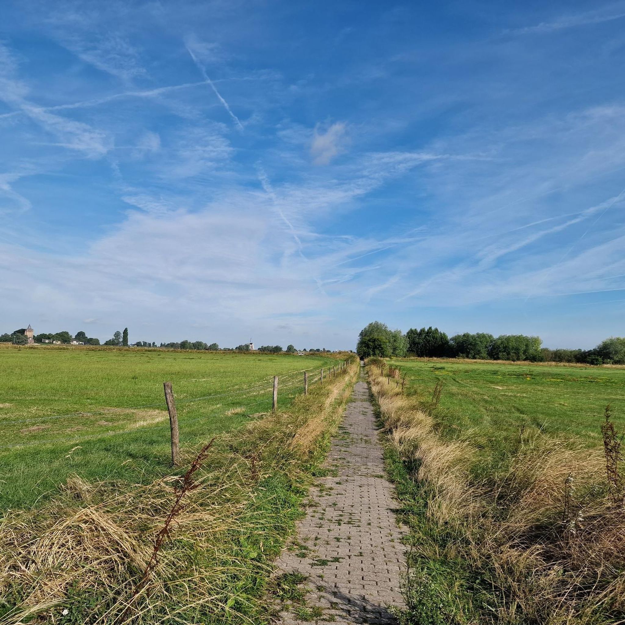
Hiking around Neerijnen, located in the province of Gelderland, offers diverse landscapes shaped by the Linge river and its floodplains. The region features woodlands, agricultural areas, and manicured parkland around historical castles. Elevation changes are generally gentle, characteristic of the Dutch riverine landscape.
Best hiking trails around Neerijnen
- The most popular hiking route is Wine hiking through the land of Maas and Waal - 20x tasting in Gelderland, a 12.9 miles (20.8 km) trail that takes 5 hours 15…
Last updated: July 1, 2026
4.5
(6)
14
hikers
Hard hike. Very good fitness required. Mostly accessible paths. Sure-footedness required.
4.7
(80)
310
hikers
Moderate hike. Good fitness required. Easily-accessible paths. Suitable for all skill levels.

Sign up for free
4.6
(21)
105
hikers
Easy hike. Great for any fitness level. Easily-accessible paths. Suitable for all skill levels.
4.6
(18)
84
hikers
8.62km
02:10
10m
10m
Moderate hike. Good fitness required. Easily-accessible paths. Suitable for all skill levels.
4.7
(22)
81
hikers
9.67km
02:26
10m
10m
Moderate hike. Good fitness required. Easily-accessible paths. Suitable for all skill levels.
Get access to more routes and recommendations from other explorers.
Sign up for free
Already have an account?
Our route recommendations are based on thousands of hikes, rides, and runs completed by other people on komoot.
Start today with a free account
Your next adventure awaits.
Login or Signup




Tips from the Community

On July 30, 1943, an American crew was flying their B-17F bomber back to England. They had carried out a raid on the Messerschmidt aircraft factories in Kassel, Germany. The B-17, renamed "Man-O-War" by the crew, had completed the mission without incident, but was fired upon by German anti-aircraft fire on the return flight. The aircraft crashed near Opijnen, killing eight of the ten crew members. The American B-17 bomber, belonging to the 323 Squadron of the 91st Bombardment Group, was returning to its base in England on July 30, 1943. Only two crew members survived the flight. The bombardier had fallen through the thatched roof of a farmhouse on a damaged parachute; he died from his injuries. The pilot and co-pilot landed safely by parachute but were captured by German troops. On August 1, 1943, the fallen Americans were buried in the cemetery of the Reformed Church in Opijnen. Despite the fact that only the mayor received permission from the occupying forces to attend the funeral, the villagers turned out to attend. They listened to the speech and laid flowers on the graves to show their respect for the fallen Americans. Gravediggers were assisted, and a large sea of flowers formed. The mayor sent a letter to his American counterpart from the pilot's hometown; a copy of this letter was sent to all the relatives of the eight fallen crew members. During a memorial service in 1947, the people of Opijnen received a triptych. They were also thanked with a memorial. Almost all American soldiers who died in the Netherlands are buried in Margraten; Opijnen is one of the exceptions.
1
0

Architecturally very striking church that doesn't quite fit in with the rest of the town, but is very attractive.
2
0
The castle itself is not open to the public. It's hard to find a good view when the trees are in leaf. It's barely visible from the gate, and even from the dike, it's only partially visible.
2
0

The dike was repaired from Gornichem to Vatik and was impassable.
0
1

Heesselt is a village in the municipality of West Betuwe in the Dutch province of Gelderland and is located on the Waalbandijk.
0
0

Visit the Anne Frank tree in Neerijnen and park easily at the Stroomhuis, where you can also go for a cup of coffee or a cultural activity. A beautiful combination of nature and culture!
0
0
The Anne Frank tree in Neerijnen is a special and symbolic monument that commemorates Anne Frank and the tragedy of the Holocaust. It is a cutting of the original horse chestnut that stood at the Secret Annex in Amsterdam, where Anne Frank and her family were in hiding during the Second World War. ### Background of the original tree The original Anne Frank tree was a white horse chestnut (Aesculus hippocastanum) and stood in the garden behind the Secret Annex. Anne mentioned this tree several times in her diary, in which she described how she could see it from the small window of the hiding place. For her, the tree was a symbol of hope and freedom in a time of great fear and uncertainty. Unfortunately, the original tree fell in 2010 due to poor condition due to disease and storm damage. ### The Anne Frank tree in Neerijnen The cutting in Neerijnen is one of the trees that were grown from the seeds of the original chestnut before it fell. Planting this tree is a way to honor Anne Frank's legacy and message of hope and tolerance. Neerijnen was chosen because of the serene and natural character of the area, which offers a place of reflection. ### Meaning of the tree The tree in Neerijnen, like other Anne Frank trees planted worldwide, symbolizes the fight against injustice, anti-Semitism and discrimination. It is a living monument that reminds visitors to reflect on the past and work towards a peaceful future.
0
0
Beautiful area for walking
0
0
Frequently Asked Questions
What types of landscapes can I expect to see while hiking in Neerijnen?
Neerijnen offers a diverse range of landscapes, primarily shaped by the Linge river. You'll find picturesque floodplains (uiterwaarden), tranquil woodlands, and fertile agricultural areas, especially fruit orchards. Many routes also lead through manicured parkland surrounding historical castles, blending natural beauty with cultural heritage.
Are there hiking trails suitable for families with children or those needing accessible paths?
Yes, Neerijnen has options for various abilities. Geldersch Landschap en Kasteelen provides three marked routes (Red: 2.4 km, Green: 1.6 km, Yellow: 1.6 km) that are specifically designed to be accessible for wheelchairs, walkers, and strollers, indicating gentle terrain suitable for families.
Can I bring my dog on the hiking trails in Neerijnen?
Many trails in Neerijnen are dog-friendly. For example, the popular 9-kilometer 'Trage Tocht Neerijnen' route, which explores the estates and passes Kasteel Waardenburg, welcomes dogs on a leash. Always check specific trail regulations, but generally, dogs are permitted on leash.
What historical landmarks or attractions can I see along the hiking routes?
Hiking in Neerijnen often combines natural beauty with historical sights. You can explore the grounds of Kasteel Neerijnen, a block-shaped castle surrounded by a moat, or enjoy views of Kasteel Waardenburg, an imposing fortress with a rich history. Other nearby attractions include Loevenstein Castle and Fort Asperen.
Are there any circular hiking routes in Neerijnen?
Yes, Neerijnen features several excellent circular routes. A popular choice is the Waardenburg Castle – Waardenburg Corn Mill loop from Uiterwaarden Waal, which is 8.1 km long and offers views of Waardenburg Castle and the floodplains. Another option is the Waardenburg Castle – Waardenburg Boundary Marker loop from Uiterwaarden Waal, an easier 5.8 km path.
What is the best time of year to go hiking in Neerijnen?
Neerijnen is enjoyable for hiking throughout much of the year. Spring and summer offer lush greenery and blooming fruit orchards, while autumn brings beautiful fall colors. Be aware that access to riverine floodplains might be restricted during periods of high water, typically in late autumn or winter.
Where can I find parking or public transport access for hiking trails in Neerijnen?
Many routes start from convenient locations. Het Stroomhuis is a well-known starting point for several hiking routes and offers amenities like catering, bicycle charging, and electric car charging. Specific parking details often vary by trailhead, so checking the individual route descriptions on komoot is recommended.
What do other hikers enjoy most about the trails in Neerijnen?
The hiking trails in Neerijnen are highly rated by the komoot community, with an average score of 4.5 stars from over 250 reviews. Hikers frequently praise the tranquil countryside, the picturesque riverine landscapes, and the charming blend of natural beauty with historical castles and villages.
Are there any easy hiking trails for beginners in Neerijnen?
Absolutely. Out of the 72 hiking routes available, 52 are classified as easy. An example is the Waardenburg Castle – Waardenburg Boundary Marker loop from Uiterwaarden Waal, an easy 5.8 km trail that takes about 1 hour 45 minutes to complete, perfect for a relaxed walk.
Are there any challenging or longer hikes in the Neerijnen area?
While Neerijnen is known for its gentle terrain, there are options for more strenuous hikes. The Wine hiking through the land of Maas and Waal - 20x tasting in Gelderland is a difficult 20.8 km route that takes approximately 5 hours 15 minutes, exploring the riverine landscape between the Maas and Waal rivers.
What kind of natural features can I expect to encounter on the trails?
Neerijnen's trails showcase a variety of natural features. You'll walk through lush forests, along the banks of the Linge river, and across its unique floodplains (uiterwaarden). These areas are rich in diverse ecosystems, offering glimpses of local flora and fauna, especially in the spring and summer months.
Are there places to eat or drink near the hiking trails in Neerijnen?
Yes, you can find amenities near some trailheads. Het Stroomhuis, a common starting point for hikes, offers catering facilities. Additionally, the charming villages within the Neerijnen region often have local cafes or restaurants where you can refresh after your hike.
Most popular routes around Neerijnen
Most popular attractions around Neerijnen

Get inspired with the komoot mobile app


Explore more
Browse the best Hikes in other regions.
