The best running trails around Wathlingen
4.5
(258)
1,674
runners
44
runs
Jogging routes around Wathlingen offer a varied landscape for runners, characterized by expansive green meadows, diverse forests, and rolling hills. The region provides a mix of environments, from field paths to more developed trails, suitable for different preferences. A distinctive feature is the Wathlinger Kaliberg, a former salt mining residue mound undergoing renaturation, which adds a unique backdrop to some running routes. This natural setting ensures a pleasant outdoor experience for those exploring the area on foot.
Best jogging routes…
Last updated: June 26, 2026
12
runners
9.24km
00:58
20m
20m
Moderate run. Good fitness required. Mostly paved surfaces. Suitable for all skill levels.
10
runners
14.5km
01:30
20m
20m
Moderate run. Good fitness required. Mostly paved surfaces. Suitable for all skill levels.

Sign up for free
4
runners
Moderate run. Good fitness required. Mostly paved surfaces. Suitable for all skill levels.
7
runners
11.9km
01:15
10m
10m
Moderate run. Good fitness required. Mostly paved surfaces. Suitable for all skill levels.
4
runners
10.5km
01:06
10m
10m
Moderate run. Good fitness required. Mostly paved surfaces. Suitable for all skill levels.
Get access to more routes and recommendations from other explorers.
Sign up for free
Already have an account?
Our route recommendations are based on thousands of hikes, rides, and runs completed by other people on komoot.
Start today with a free account
Your next adventure awaits.
Login or Signup
Tips from the Community

I drove past for decades on my commute. On the bike, a longer look was possible, even if even more closeness is not possible.
0
0
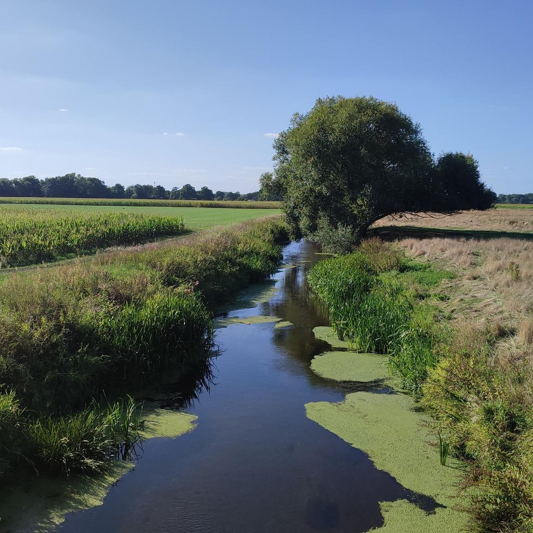
Even though this body of water is probably something artificially created (see 'Alte Thöse'), nature has reclaimed a lot here, so a short stop to admire is worthwhile. To stay in the forest between Wathlingen and Hänigsen, there isn't much else you can do, as @Watho96 correctly mentioned in his highlight [www.komoot.com/de-de/highlight/4791781?ref=whd] about the supposedly most direct path past the spoil heap.
0
0
In any case, the better way than the L311, unless you have a racing bike under you. ...although the L311 isn't fun with it at the moment either...
0
0

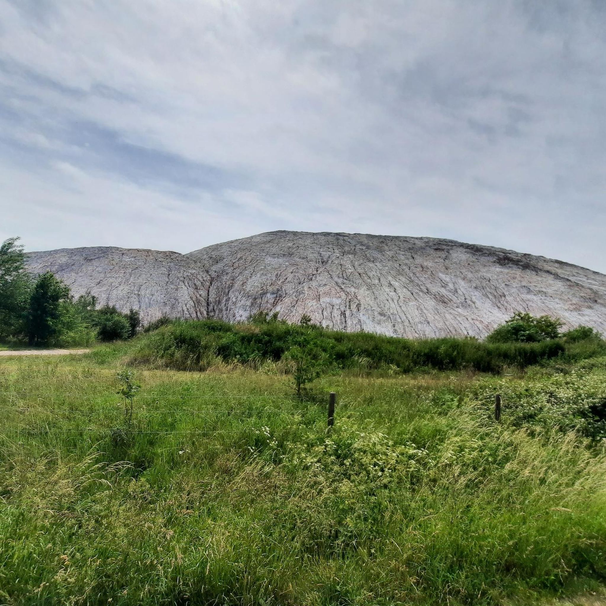
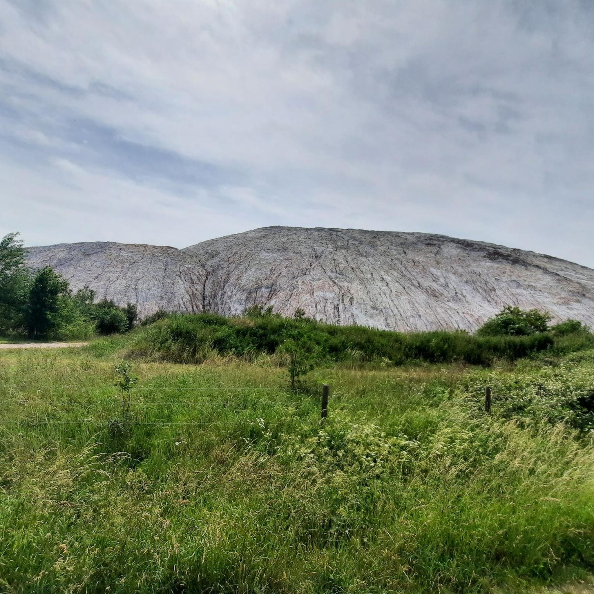
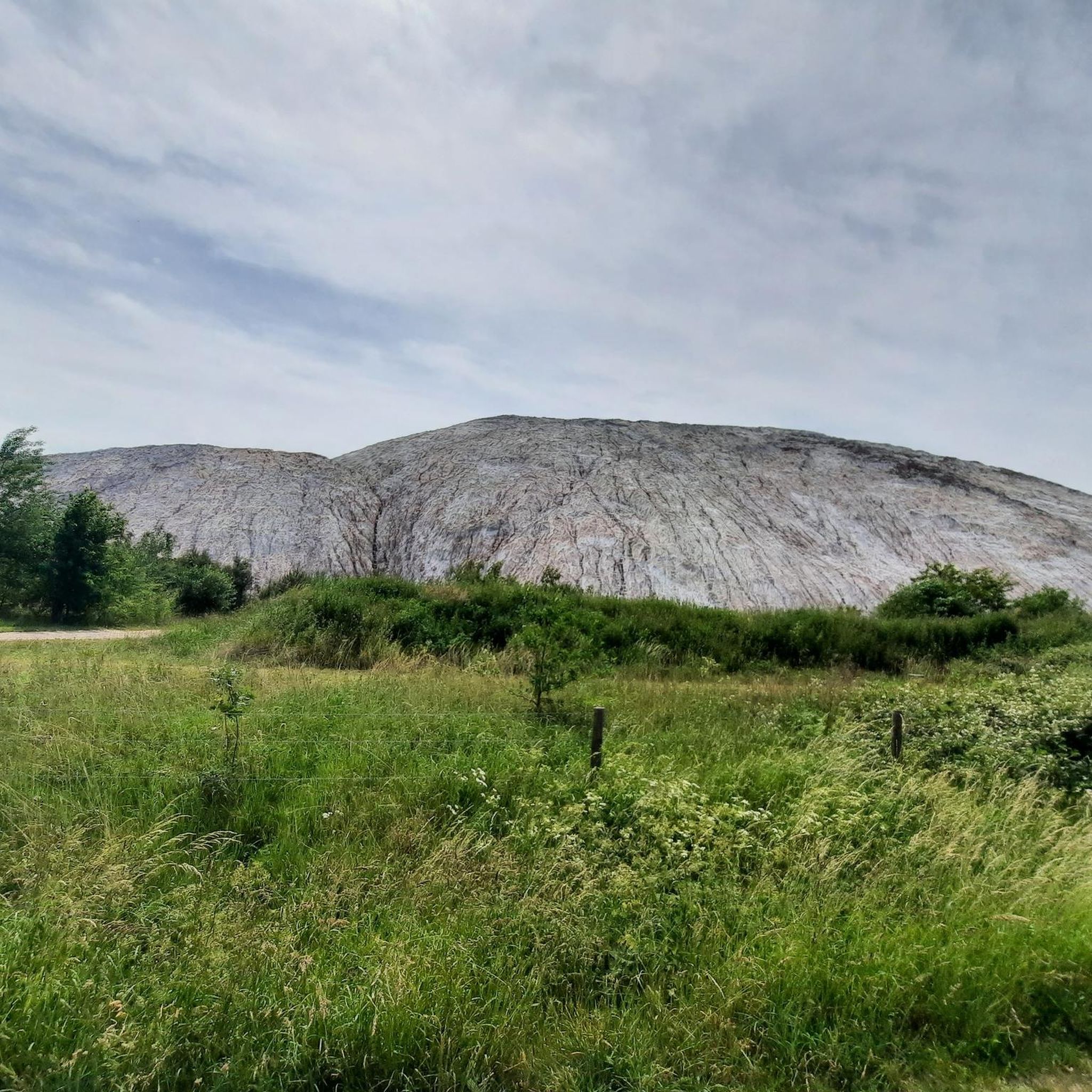
This high mountain of waste is always impressive.
0
0
Nice to cycle along here.
0
0

That's what grandma always said: If the mountain is dark, it will rain, if it is light, the sun will shine 🌞
2
0

From 1910 to 1997, potash and rock salt were mined in the Lower Saxony-Riedel mine. Most of the production residue from 87 years of mining could be returned to the underground cavities. The remaining material was dumped in Wathlingen. You can see the result from afar today. The dump consists of 94 percent rock salt. Now when it rains or snows, the precipitation dissolves salt from the heap. The salted rainwater is currently collected in the edge of the heap and used to flood the underground mine workings. However, this flooding cavity can only be used to a limited extent. That is the reason why K+S is covering and renaturating this waste dump - the new formation of saline water should be significantly reduced.
1
0
The Riedel potash plant is a former potash mine near Hänigsen. It was the world's deepest mine for potash salt. The Riedel shaft was sunk between 1905 and 1908 (770 m). Funding began in 1909. In 1907/08 a mine siding railway was built from Burgdorf via Sorgensen and Weferlingsen to Hänigsen. In 1928 it was temporarily closed. In the years 1937 to 1945 the mine was part of the army ammunition production facility and underground dump, the Hänigsen Army Ammunition Facility. On June 18, 1946, the explosion accident in Hänigsen occurred here. In 1949 the shaft tube received new installations and potash production was resumed. The mine remained in operation until 1997. The production of potash was stopped in 1996 and that of rock salt in 1997. The bottom is at a depth of 1525 meters. Plans for an underground toxic waste dump were scrapped. The 650 and 750 m level probably still contains old weapons waste (detonators, grenades, combat agent Excelsior (10-chloro-9,10-dihydroacridarsin, Blaukreuz) and its precursor merodanoic acid). The rainwater from the site and the heap seepage water (around 10,000 m³/year) is led into the Thöse. The flooding of the mine is scheduled to be completed in 2028. The BUND criticizes this measure. The miners' association, founded in 1908, still exists today.
1
0
Frequently Asked Questions
What kind of terrain can I expect on running routes in Wathlingen?
Wathlingen offers a diverse landscape for runners, featuring expansive green meadows, varied forests, and gentle rolling hills. You'll find a mix of surfaces, from natural field paths to more developed trails, providing a varied experience for your run.
Are there many running trails available in Wathlingen?
Yes, Wathlingen boasts a good selection of running trails. There are over 45 routes available, catering to various fitness levels, including 12 easy, 32 moderate, and 1 difficult route.
What do other runners say about the trails in Wathlingen?
The running routes in Wathlingen are highly regarded by the komoot community, holding an average rating of 4.5 stars from over 250 reviews. Many users praise the varied terrain and the pleasant outdoor experience.
Are there any unique landmarks or sights to see while jogging in Wathlingen?
Absolutely! A distinctive feature you might encounter is the Wathlinger Kaliberg, a former salt mining residue mound that is currently undergoing renaturation. This unique landmark provides a memorable backdrop for runs in the area. You can explore routes like the Kalimandscharo Wathlingen – Wathlingen Potash Hill loop from Wathlingen to experience it.
Are there any circular running routes around Wathlingen?
Yes, many of the running routes in Wathlingen are circular, offering convenient starting and ending points. Examples include the popular Brand Forest – Alte Thöse Pond loop from Wathlingen and the Gut Wathlingen loop from Wathlingen.
Are there any running routes that offer views of local industry or specific points of interest?
Yes, for those interested in local sights, the Brand Forest – View of Kaliwerk Riedel loop from Wathlingen is a great option. This route offers views of the Kaliwerk Riedel while traversing diverse natural scenery.
What are some natural attractions near the running trails in Wathlingen?
Beyond the trails themselves, you can find several natural attractions nearby. These include beautiful lakes such as the Spreewald Lakes, Uetze, the Lily Pond in Beerbusch Forest, and Irenensee. There are also various huts and shelters like the Dasselsbruch Village Meeting Shelter and Beerbusch Shelter, which can be points of interest during your outdoor activities.
Are there any longer running routes for more experienced runners?
Yes, if you're looking for a longer run, the Brand Forest – View of Kaliwerk Riedel loop from Wathlingen is a moderate 14.5 km (9.0 miles) path. Another good option is the Gut Wathlingen – Kalimandscharo Wathlingen loop from Wathlingen, which covers nearly 12 km (7.5 miles).
What is the general elevation profile like for running in Wathlingen?
The running routes in Wathlingen generally feature gentle elevation changes. The region is characterized by rolling hills, so you can expect some minor ascents and descents, but nothing overly strenuous, making it suitable for a wide range of runners.
What makes Wathlingen a good place for outdoor running?
Wathlingen is ideal for outdoor running due to its picturesque natural landscapes. The area offers varied terrain with colorful meadows, diverse forests, and hedges, providing both scenic beauty and different running surfaces. The emphasis on green spaces contributes to a pleasant and well-being-focused outdoor experience.
Can I find easy running routes in Wathlingen?
Yes, Wathlingen offers 12 easy running routes, perfect for beginners or those looking for a more relaxed jog. These trails typically feature gentler terrain and shorter distances, allowing for an enjoyable and accessible experience.
Most popular routes around Wathlingen
Most popular attractions around Wathlingen

Get inspired with the komoot mobile app


Explore more
Browse the best Running Trails & Routes in other regions.
