The best walks and hikes around Slievenaboley
4.7
(81)
1,138
hikers
40
hikes
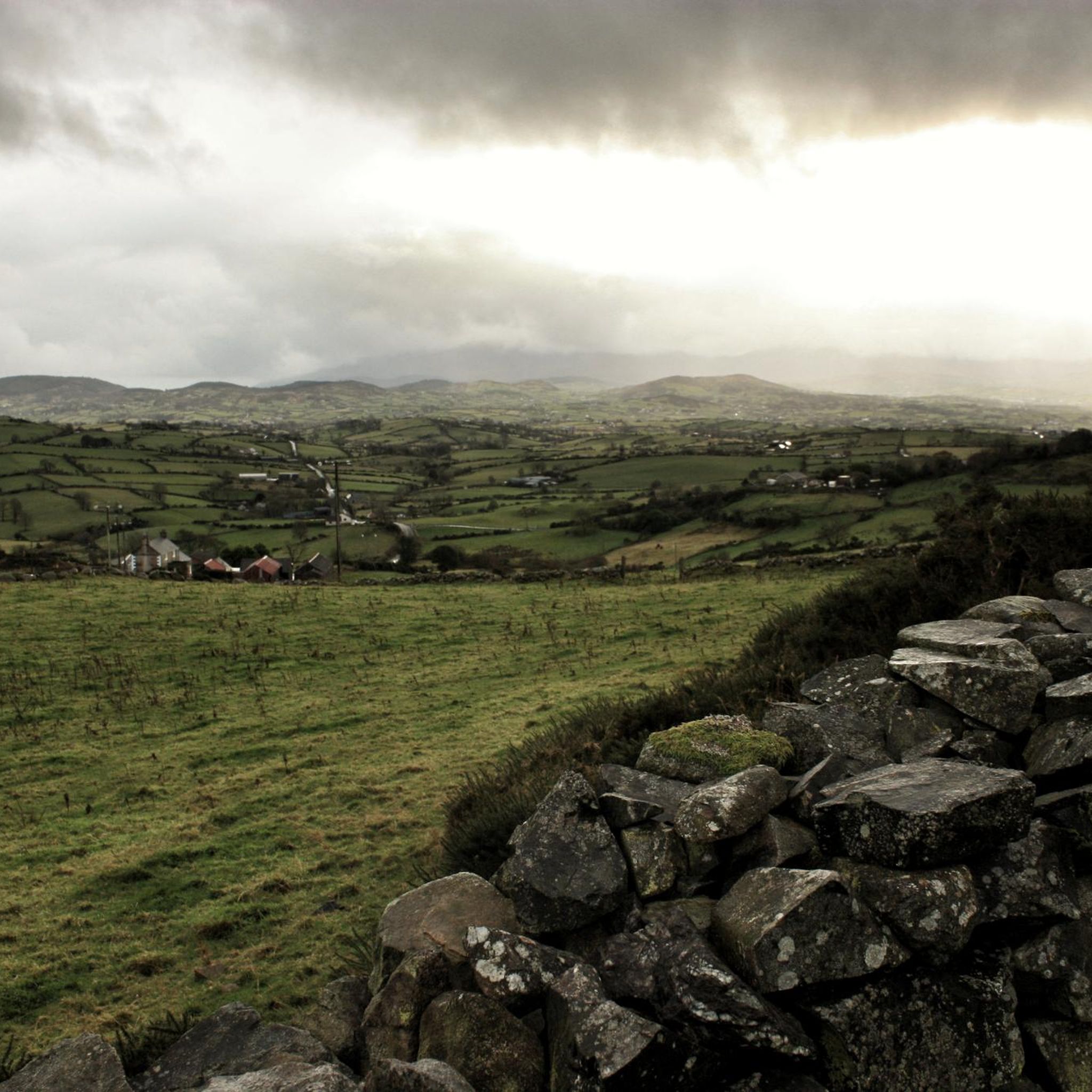
Hikes around Slievenaboley explore the Dromara Hills of County Down, an Area of Outstanding Natural Beauty. The region is characterized by rolling hills, open moorland, and farmland, offering a quieter alternative to the nearby Mourne Mountains. Routes often start from the Windy Gap car park and ascend Slievenaboley or the neighboring Slieve Croob, providing panoramic views from the summits.
Best hiking trails around Slievenaboley
- The most popular hiking route is the Slieve Croob Summit Path – Slieve Croob Summit loop from Dromara Hills, a 6.3 mile (10.1 km) trail that takes around 3 hours 7 minutes to complete. This moderate hike involves an ascent of 360 meters to the highest peak in the Dromara Hills.
- Another top favourite among local hiking enthusiasts is the Drumkeeragh Forest Park loop, a moderate 4.8 mile (7.7 km) path. The route leads through forested areas and takes approximately 2 hours 8 minutes.
- Local hiking enthusiasts also love the Slieve Croob — Mourne, a 2.8 mile (4.5 km) trail leading toward the Mourne Mountains, often completed in about 1 hour 22 minutes.
- Hiking around Slievenaboley is defined by open hillsides, farm tracks, and forest paths. The network of Slievenaboley walking trails offers options for different ability levels, from easy ascents to more moderate loops.
- The routes in Slievenaboley are highly rated by the komoot community with an average score of 4.7 stars from over 80 reviews. More than 1,100 hikers have used komoot to explore Slievenaboley's varied terrain.
Last updated: June 27, 2026
4.2
(9)
151
hikers
4.49km
01:23
160m
160m
Embark on the Slieve Croob Transmitter Road Walk, an easy hiking route that promises extensive panoramic views from its summit. This 2.8-mile (4.5 km) journey involves a gentle climb of 536 feet (163 metres), typically completed in about 1 hour and 22 minutes. As you hike, you'll traverse open moorland, where the landscape unfolds to reveal County Down, the majestic Mourne Mountains, and even the distant Belfast hills on a clear day. Keep an eye out for grazing sheep and various birdlife, including buzzards and kestrels, adding to the serene atmosphere of the trail. The experience is one of quiet ascent, leading to expansive vistas that reward your effort.
To begin your hike, head to the Dree Hill car park, which serves as the starting point for the Slieve Croob Transmitter Road Walk. While the route is generally accessible, you should be prepared for the exposed mountaintop, which can become very windy. During winter months, ice can make parts of the trail slippery, so suitable footwear is highly recommended. Consider bringing poles or crampons if you plan to visit in icy conditions to ensure a safer and more comfortable experience.
This walk is located within the Mourne Area of Outstanding Natural Beauty, highlighting its significant natural appeal. At the Dree Hill car park, you will also find a public art piece that marks the source of the River Lagan, adding a unique point of interest to your visit. The trail's clear path to the Slieve Croob Summit offers a direct way to experience the region's wide-ranging vistas and natural beauty.
4.0
(2)
13
hikers
10.1km
03:07
360m
360m
Moderate hike. Good fitness required. Easily-accessible paths. Suitable for all skill levels.

Sign up for free
4.0
(2)
12
hikers
10.7km
03:17
380m
380m
Moderate hike. Good fitness required. Easily-accessible paths. Suitable for all skill levels.
5
hikers
3.02km
00:49
40m
40m
Easy hike. Great for any fitness level. Easily-accessible paths. Suitable for all skill levels.
7
hikers
10.7km
03:14
360m
360m
Moderate hike. Good fitness required. Easily-accessible paths. Suitable for all skill levels.
Get access to more routes and recommendations from other explorers.
Sign up for free
Already have an account?
Our route recommendations are based on thousands of hikes, rides, and runs completed by other people on komoot.
Start today with a free account
Your next adventure awaits.
Login or Signup
Tips from the Community

Drumkeeragh is a beautiful coniferous woodland located in the southern region of Northern Ireland. The forest is in a mountaineous area, creating an elevated position to enjoy far-reaching views toward the Mourne Mountains, coastline & surrounding lush counyside.
1
0
A winding path will lead you past a number of telecommunication towers up to the summit of Slieve Croob. There's some great views on offer here across County Down to the wonderful Mourne mountain range.
1
0
Slieve Croob stands at 534m and is the highest peak of the Dromara Hills, situated just north of the Mourne Mountains. From the summit, you can enjoy expansive views across County Down and toward the Mourne mountain range, a designated Area of Natural Beauty.
2
0

Good views and the most obvious spot to stop at the top of Dree hill, on the edge of Mourne AONB.
0
0

what a great day spent up slieve croob weather was fabulous.. handy enuff on a nice path even saw a few cyclists 👍
0
1

Tough climb to the summit, try and go on a clear day to get the best veiws.
1
0
Frequently Asked Questions
Where is the best place to park for hikes around Slievenaboley?
The most common starting point is the Windy Gap car park on Slievenaboley Road. It's a popular spot known for its magnificent views of the Mourne Mountains to the south and the Belfast Hills to the north, even before you start your walk. Be aware that it can get busy, so arriving earlier is a good idea.
Are the hiking trails around Slievenaboley suitable for beginners?
Yes, many trails are well-suited for beginners. The region has no officially graded 'difficult' hikes, with most being easy or moderate. For a straightforward option, consider the Drumkeeragh Forest – Fallen Tree on Forest Path loop from County Down. It's a relatively short and gentle walk through the forest.
Can I bring my dog on the trails?
While dogs are welcome in many of the open areas, be aware that Slievenaboley's trails often cross active farmland with livestock, particularly sheep. You must keep your dog on a lead and under close control at all times in these sections. For a walk that is particularly popular with dog walkers, you might consider visiting The Fairy Glen in nearby Rostrevor.
What are the views like from the summit of Slievenaboley?
The summit rewards hikers with breathtaking panoramic views. On a clear day, the vista stretches across the rolling Dromara Hills and includes prominent peaks like Slieve Croob. You can also see the famous Mourne Mountains to the south, offering a stunning backdrop.
Are there any good circular walks in the area?
Yes, the area is excellent for loop walks. Many routes are designed as circular paths, allowing you to start and end at the same point, like the Windy Gap car park. A great example of a moderate circular route is the Slieve Croob Summit Path – Slieve Croob Summit loop from Dromara Hills, which takes you to the highest point in the Dromara Hills and back.
How many hiking trails are available around Slievenaboley?
You can explore over 40 hiking trails around Slievenaboley. The network offers a great variety, from easy ascents on farm tracks to moderate loops through forests and across open moorland, providing plenty of options for different fitness levels.
What do other hikers think of the trails in this region?
The Slievenaboley area is highly rated by the komoot community, with an average score of 4.7 out of 5 stars. Hikers often praise the region for being a more tranquil alternative to the busier Mourne Mountains, highlighting the stunning panoramic views and the peaceful, rolling countryside.
Is it possible to hike both Slievenaboley and Cratlieve in one walk?
Yes, combining the ascent of Slievenaboley with the neighboring hill of Cratlieve is a popular option for a longer, more challenging day of hiking. The route typically involves following the connecting ridges between the two summits, offering extended views across the landscape.
Are there any historical sites to see near the hiking trails?
The area is rich in history. A short drive from Slievenaboley, you can find the Legananny Dolmen, an impressive portal tomb from the Neolithic period. The name Slievenaboley itself means 'hill of the booley,' referring to the ancient practice of moving cattle to higher pastures in summer.
What kind of terrain should I expect on the trails?
Expect a mix of terrain. Routes often start on farm tracks before moving onto fainter paths across open, sometimes boggy, hillsides. You will likely need to cross a few fences and stiles, which is characteristic of the area's rustic trails. Sturdy, waterproof footwear is highly recommended.
Are there any forest walks available?
Yes, if you enjoy walking through woodlands, the Drumkeeragh Forest Park loop is an excellent choice. This moderate trail offers a pleasant walk through a forested landscape, providing a different experience from the open hillsides of Slievenaboley itself.
Are there any pubs or cafes nearby for after a hike?
The immediate vicinity of the trailheads is quite rural, so you won't find pubs right at the car park. However, the nearby towns of Dromara and Castlewellan have several options for food and drink. For a coffee and a snack within a park setting, the popular Silent Valley Mountain Park has a coffee shop.
Most popular attractions around Slievenaboley

Get inspired with the komoot mobile app


Explore more
Browse the best Hikes in other regions.
