The best cycling routes around Donaghaguy
4.4
(24)
755
riders
56
rides
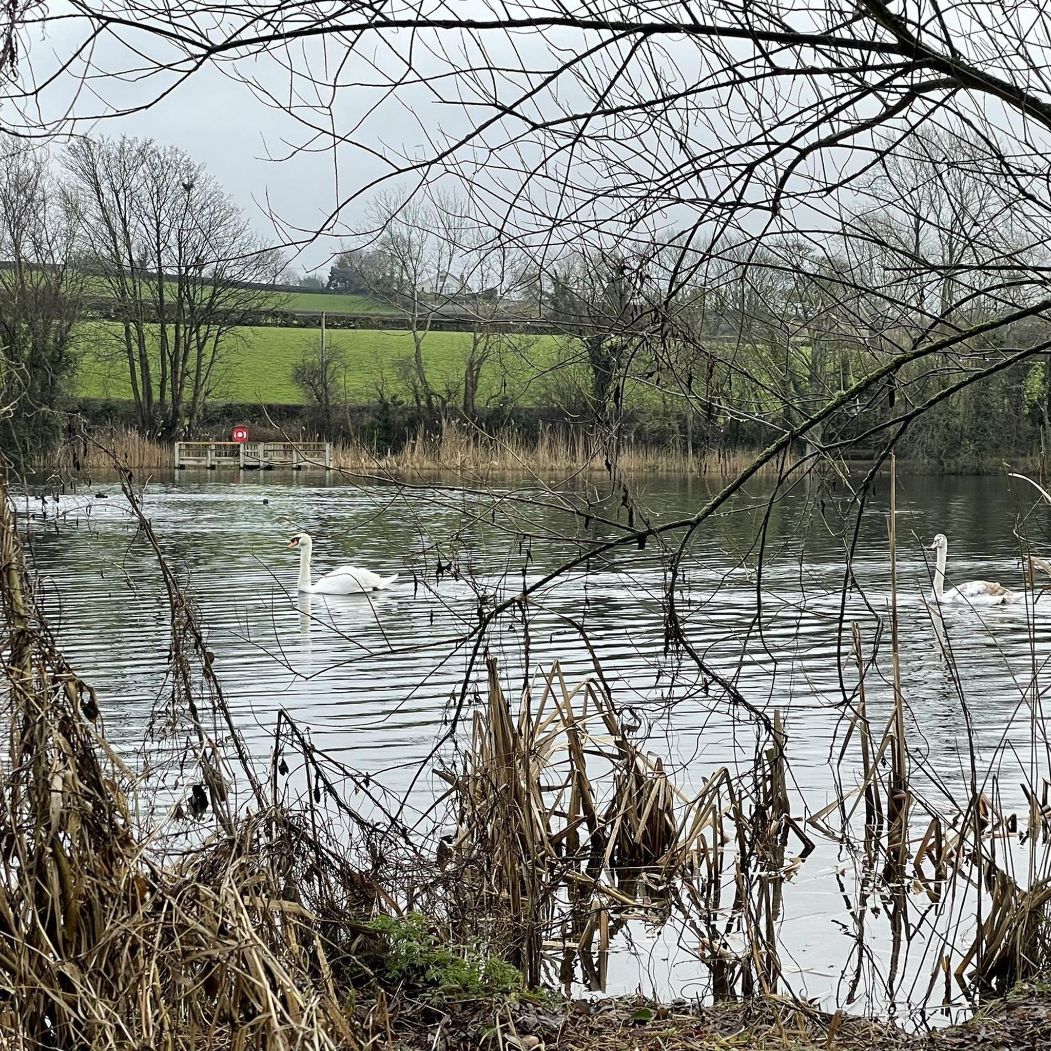
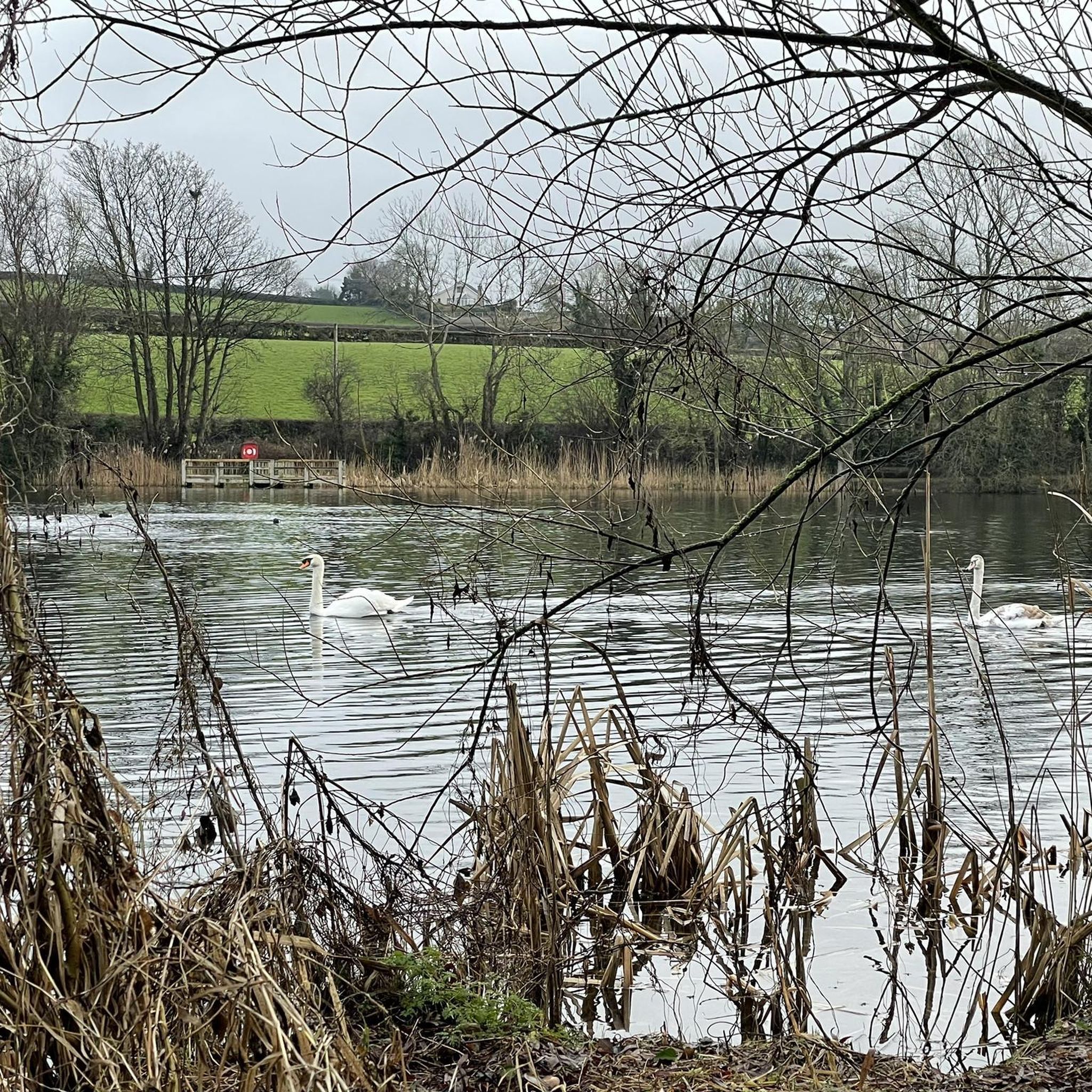
Touring cycling routes around Donaghaguy offer access to varied terrain, from tranquil reservoir paths to more challenging mountain-adjacent roads. The region is characterized by the Donaghaguy Reservoir, a spring-fed inland lake with a flat, tarmacked path, and serves as a gateway to routes with views of the Mourne Mountains. Cyclists can find well-paved surfaces suitable for various fitness levels, alongside unpaved segments that require good fitness. The area provides a mix of natural features and scenic routes for touring cyclists.
…Last updated: June 27, 2026
5.0
(1)
6
riders
28.1km
01:52
460m
460m
Hard bike ride. Very good fitness required. Mostly paved surfaces. Suitable for all skill levels.
1
riders
42.6km
02:45
470m
480m
Hard bike ride. Very good fitness required. Some segments of this route may be unpaved and difficult to ride.

Sign up for free
58
riders
56.9km
04:08
960m
960m
Hard bike ride. Very good fitness required. Mostly paved surfaces. Suitable for all skill levels.
5.0
(1)
43
riders
15.8km
01:30
350m
350m
Moderate bike ride. Good fitness required. Mostly paved surfaces. Suitable for all skill levels.
4.0
(2)
34
riders
38.0km
02:21
290m
290m
Moderate bike ride. Good fitness required. Mostly paved surfaces. Suitable for all skill levels.
Get access to more routes and recommendations from other explorers.
Sign up for free
Already have an account?
Our route recommendations are based on thousands of hikes, rides, and runs completed by other people on komoot.
Start today with a free account
Your next adventure awaits.
Login or Signup


Tips from the Community

This charming seaside town overlooks the Mourne Mountains, whose silhouette rises along the coast of Northern Ireland. Carlingford is very lively at weekends thanks to its many pubs and restaurants, which attract visitors from the north, and is famous for its oysters. The village has several historical sights, such as the small King John's Castle, with its romantic silhouette overlooking the sea, and Taaffe's Castle, a former 16th-century merchant's house located a little further from the quay.
6
0
The Tholsel is undoubtedly one of the most unique structures in the heart of Carlingford. This medieval city gate, originally built in the 15th century, is the only remaining gate from the original town wall and served for centuries as the ceremonial and administrative entrance to the town.
6
1
Above the medieval street pattern, which dominates the silhouette of Carlingford, stands the imposing ruin of Carlingford Castle, also known as King John’s Castle. This castle was built around 1190 by the Norman knight Hugh de Lacy and was for centuries the strategic key to the entrance of Carlingford Lough.
5
1
Small, elevated Calvary hill on the edge of Omeath, with a short path leading up to a series of white crosses on an open grassy plateau. The spot offers a quiet moment above the village, with clear views towards Carlingford Lough and the surrounding hills.
6
0
Taaffe's Castle is a fortified merchant's house dating from the early 16th century, built by the wealthy Taaffe family, who later became the Earls of Carlingford. Situated near the old harbour, the building originally served as a trading post on the ground floor with residential floors above. The architecture displays typical defensive features such as machicolations, narrow loopholes, spiral staircases, and multi-level garderobes. [curiousireland.ie], [castles.nl], [carlingfor...centre.com] The main structure is a four-storey rectangular tower, later extended with a 16th-century northern extension. Its location and construction clearly demonstrate Carlingford's importance as a thriving trading town during that period. After the 17th century, it fell into disuse, and eventually fell into disuse. Today, it forms part of a pub complex and remains a striking example of medieval urban defensive architecture in Carlingford.
6
1

Added to the collection: komoot.com/de-de/collection/3600632/-naturdenkmaeler-besondere-baeume-und-weitere-schaetze-der-natur
0
0

Carlingford Castle, also known as King John’s Castle, is a striking 12th-century fortress overlooking the charming medieval town of Carlingford and its scenic harbour. Built by Hugh de Lacy to guard the strategic Lough, the castle has a commanding presence with its weathered stone walls and rugged silhouette against the water. Though partially in ruins, it still captures the atmosphere of Ireland’s Norman past, and its elevated position offers sweeping views of the surrounding mountains and coastline.
2
2

This forest of around five hectares consists of a mixture of scrubland, Douglas fir and spruce. The well-maintained paths lead you through dense forest and offer striking views of the surrounding countryside, including the villages of Attical and Slieemageogh. However, some sections are slippery in wet weather, so care must be taken. A particular highlight is the proximity to Banns Road, a historic path that takes you further into the Mourne Mountains.
1
0
Frequently Asked Questions
What kind of terrain can I expect on touring cycling routes around Donaghaguy?
The Donaghaguy area offers a diverse range of terrain for touring cyclists. You'll find tranquil, flat, and fully tarmacked paths around the Donaghaguy Reservoir, suitable for all abilities. Beyond the reservoir, routes extend into the surrounding region with well-paved surfaces and some more challenging unpaved segments, often featuring views of the Mourne Mountains.
Are there touring cycling routes suitable for beginners in Donaghaguy?
Yes, Donaghaguy offers options for beginners. While many routes are rated moderate to difficult, the area around the Donaghaguy Reservoir provides a flat, tarmacked path perfect for an easy ride. Overall, there are 4 easy touring cycling routes available in the region.
What are some notable landmarks or viewpoints to see while cycling in Donaghaguy?
Cyclists can enjoy views of the majestic Mourne Mountains and explore areas like Rostrevor Forest. Specific highlights include the Cloughmore Stone, the scenic Kilbroney Park, and the charming settlement of Carlingford. The Donaghaguy Reservoir itself is a tranquil spot to observe local wildlife.
Are there any circular touring cycling routes in the Donaghaguy area?
Yes, many touring cycling routes in the Donaghaguy area are loops. For example, the difficult Kilbroney Park loop from Warrenpoint takes you through scenic landscapes. Another option is the challenging Crocknafeola Wood – Kilbroney Park loop from Rostrevor, offering a longer ride through varied terrain.
What is the best time of year to go touring cycling in Donaghaguy?
Donaghaguy offers a serene environment for outdoor activities year-round. Spring and summer provide pleasant weather for enjoying the scenic routes and observing wildlife around the reservoir. Autumn brings beautiful foliage, while winter can offer crisp, quiet rides, though some unpaved segments might be more challenging.
How many touring cycling routes are available around Donaghaguy?
There are over 60 touring cycling routes around Donaghaguy, catering to various skill levels. This includes 4 easy routes, 25 moderate routes, and 34 difficult routes, ensuring options for every touring cyclist.
What do other touring cyclists say about the routes in Donaghaguy?
The touring cycling routes in Donaghaguy are highly regarded by the komoot community, holding an average rating of 4.2 stars from over 20 reviews. Over 800 touring cyclists have explored the area using komoot, often praising the diverse terrain and scenic views, particularly towards the Mourne Mountains.
Are there any moderate difficulty touring cycling routes in Donaghaguy?
Yes, there are 25 moderate touring cycling routes in the Donaghaguy area. An example is The Old Oak Tree – The Calvary of Omeath loop from Rostrevor, which covers approximately 68.6 km and offers a balanced challenge for intermediate cyclists.
Can I find shorter touring cycling routes in Donaghaguy?
Yes, there are shorter routes available. For a moderate ride, consider the Yellow Water Lower Bridge – Yellow Water Descent loop from Rostrevor, which is about 15.6 km long and can be completed in under 1.5 hours. The Donaghaguy Reservoir also offers a short, accessible loop.
What is the most popular touring cycling route in Donaghaguy?
The most popular touring cycling route is Route 7 - The Rostrevor Route. This difficult 28.1 km trail offers stunning views towards the Mourne Mountains and is a favorite among local cyclists.
Are there facilities like picnic areas or benches along the cycling routes?
The Donaghaguy Reservoir, a central feature of the area, provides benches and picnic areas, making it an ideal spot for relaxation during or after your ride. Other routes may have facilities in nearby towns like Warrenpoint or Rostrevor.
Most popular attractions around Donaghaguy

Get inspired with the komoot mobile app


Explore more
Browse the best Cycling routes in other regions.
