The best running trails around Schnaittenbach
4.4
(15)
256
runners
31
runs
Jogging routes around Schnaittenbach offer diverse terrain within Germany's Upper Palatinate region. The area is characterized by rolling hills and dense forests, providing varied paths for runners. The presence of the River Vils and the broader Upper Palatinate Forest contributes to a natural environment ideal for outdoor activities. This landscape allows for both gentle inclines and shaded paths, making it suitable for different running preferences.
Best jogging routes around Schnaittenbach
- The most popular jogging route is Ehenbachweg 1 loop from…
Last updated: October 9, 2026
4.3
(3)
49
runners
10.5km
01:05
60m
60m
Moderate run. Good fitness required. Mostly paved surfaces. Suitable for all skill levels.
4.5
(2)
17
runners
11.7km
01:14
90m
90m
Moderate run. Good fitness required. Mostly paved surfaces. Suitable for all skill levels.

1.0
(1)
17
runners
6.21km
00:39
60m
50m
Moderate run. Good fitness required. Mostly paved surfaces. Suitable for all skill levels.
4.5
(2)
13
runners
8.20km
00:52
100m
100m
Moderate run. Good fitness required. Mostly paved surfaces. Suitable for all skill levels.
11
runners
26.2km
03:06
680m
680m
Hard run. Very good fitness required. Mostly accessible paths. Some sure footedness required.
Get access to more routes and recommendations from other explorers.
Already have an account?
Our route recommendations are based on thousands of hikes, rides, and runs completed by other people on komoot.
Start today with a free account
Your next adventure awaits.
Tips from the Community

It's always wonderful to be here again
0
0
It's always wonderful to be here
0
0
Always wonderful to be here again
0
0

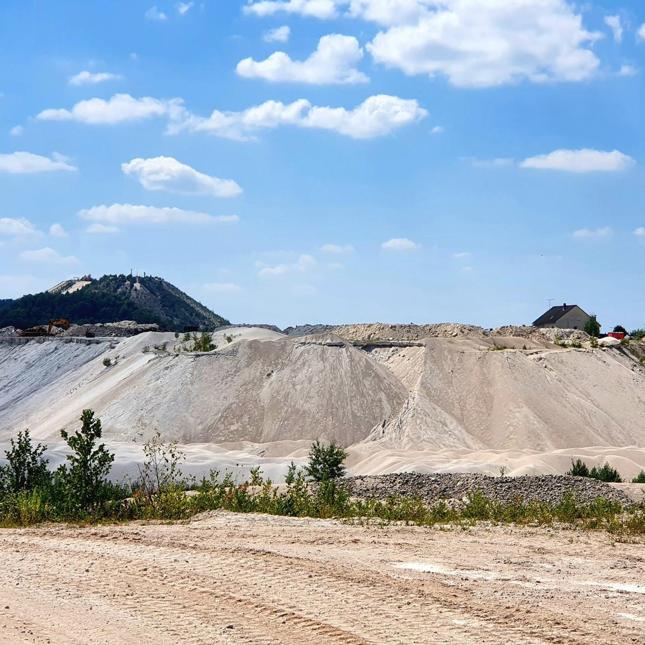
More information about the geotope: Kaolin pits near Hirschau and Schnaittenbach, Bavarian State Office for the Environment https://www.lfu.bayern.de/geologie/bayerns_schoenste_geotope/65/index.htm
0
0

Very successful fountain with a deer motif. The highlight of Hirschau.
1
0

with currently two small "poems"
1
0
The forest, prehistoric and early historical ore extraction and iron smelting in Eastern Bavaria The beginnings of iron smelting in Eastern Bavaria are proven by dating iron slags to the Late La Tène period (150 to 50 BC). The smelting of ores took place directly at the ore extraction sites, as numerous locations in the Regensburg – Kelheim – Parsberg area demonstrate.
2
0
Surface water measuring point At the measuring point of station 12, which was established in 1999, the discharge volumes of the Weitzendorfer Bach are measured on an hourly basis. These are discharges from a 2.7 square kilometer catchment area. In addition to the volume, the quality of the discharges is also measured. The data obtained are used by Amberger Kaolinwerke to determine key hydrological figures, which then provide information about groundwater recharge and flood events. The discharges could supply the planned lake landscape with water in the future. In streams with low discharges, the discharge can be determined relatively accurately with the help of defined overflow values, if no flow velocity occurs before the overflow. Only gravity must pull the water over the overflow weir.
2
0
Frequently Asked Questions
How many running routes are available around Schnaittenbach?
There are over 30 dedicated running routes around Schnaittenbach listed on komoot, offering a wide variety of options for all skill levels. The komoot community has explored these trails over 200 times.
What kind of terrain can I expect on running trails in Schnaittenbach?
The running trails in Schnaittenbach are characterized by rolling hills and dense forests, typical of Germany's Upper Palatinate region. You'll find a mix of gentle inclines and shaded paths, with some routes also following the tranquil River Vils. The broader Upper Palatinate Forest provides diverse terrain, from established paths to more natural forest floors.
Are there any easy or beginner-friendly running routes in the area?
Yes, Schnaittenbach offers several easy running routes suitable for beginners. Out of the 31 routes available, 4 are classified as easy, providing a gentle introduction to the region's beautiful landscapes. These routes are perfect for a relaxed run without significant elevation changes.
Can I find scenic running routes with viewpoints near Schnaittenbach?
Absolutely. Many routes offer scenic views, especially those traversing the rolling hills. For example, the View of Monte Kaolino loop from Schnaittenbach provides unique vistas of the distinctive Monte Kaolino. The area between Buchberg and Rotbühl, including the 'Teufelsgraben', also promises varied terrain and potentially rewarding views.
Are there any circular running routes in Schnaittenbach?
Yes, many of the running routes around Schnaittenbach are designed as loops, allowing you to start and finish at the same point. Popular options include the Ehenbachweg 1 loop from Holzhammer and the Running loop from Schnaittenbach, which takes you through local forests and fields.
Are the running trails around Schnaittenbach suitable for families?
While specific family-friendly routes are not explicitly highlighted, the presence of easy and moderate trails, combined with the region's natural beauty, makes many paths suitable for families. The tranquil environment along the River Vils or through shaded forests can be enjoyable for all ages. Always check the route's difficulty and length to ensure it matches your family's capabilities.
Can I bring my dog on the running trails in Schnaittenbach?
Generally, the natural environment of Schnaittenbach and the Upper Palatinate Forest is very welcoming to dogs. Most forest and river paths are suitable for running with your canine companion. However, it's always advisable to keep dogs on a leash, especially in nature reserves or near wildlife, and to respect local regulations.
What are some interesting natural features or landmarks I might see while running?
While running, you might encounter various natural and historical features. The Mantel bathing pond and Silbersee offer pleasant waterside views. The GeoPark Kaolinrevier Hirschau-Schnaittenbach features the 'Kaolin Mine Industrial Trail' with its 'Talking Granite Blocks', providing a unique, educational aspect to your run. You might also pass by historical sites like the Historic Cellars at Koppelberg or the Hammerschloss Röthenbach.
Is there parking available near the running routes in Schnaittenbach?
Yes, Schnaittenbach is generally well-equipped for visitors arriving by car. Many trailheads, especially for popular routes, offer designated parking areas. For routes starting directly from the town, you can usually find public parking within walking distance. It's recommended to check specific route details on komoot for precise parking information.
What do other runners say about the trails in Schnaittenbach?
The running routes in Schnaittenbach are highly rated by the komoot community, with an average score of 4.3 stars from 10 reviews. Runners often praise the tranquil environment, the variety of terrain through forests and along rivers, and the well-maintained paths that make for an enjoyable running experience.
What is the best time of year to go running in Schnaittenbach?
Schnaittenbach offers enjoyable running conditions throughout much of the year. Spring and autumn provide pleasant temperatures and beautiful scenery with blooming flora or vibrant fall colors. Summer runs are best enjoyed in the mornings or evenings to avoid the midday heat, taking advantage of the shaded forest paths. Even in winter, many trails remain accessible for a refreshing run, though conditions may vary.
Are there any longer, more challenging running routes for experienced runners?
Yes, for experienced runners seeking a greater challenge, Schnaittenbach offers several difficult routes. For instance, the Buchberg Summit – Buchberghütte loop from Schnaittenbach is a demanding 16.4-mile (26.4 km) trail with significant elevation gain, perfect for a longer, more intense workout. Overall, 4 of the 31 routes are classified as difficult.
Are there any running routes that pass by water features like rivers or lakes?
Yes, the region around Schnaittenbach is home to the River Vils, and several routes run alongside its banks, offering a serene running experience. Additionally, nearby attractions include the Mantel bathing pond and Silbersee, which could be incorporated into or found near your running adventures.
Most popular routes around Schnaittenbach
Most popular attractions around Schnaittenbach

Get inspired with the komoot mobile app


Explore more
Browse the best Running Trails & Routes in other regions.
