The best road cycling routes around Cattogs
4.8
(14)
1,524
riders
114
rides
Road cycling around Cattogs offers varied terrain across the rolling foothills of the Appalachian Mountains. The region features tranquil valleys and diverse landscapes suitable for different fitness levels. Cyclists can find routes with well-paved surfaces as well as segments with elevation changes. This area provides a mix of natural features for road cycling exploration.
Best road cycling routes around Cattogs
- The most popular road cycling route is Bike Path to Belfast – Peartree Hill Path loop from Comber, an…
Last updated: July 2, 2026
5.0
(1)
93
riders
46.9km
01:58
310m
310m
Moderate road ride. Good fitness required. Some segments of this route may be unpaved and difficult to ride.
31
riders
66.3km
02:41
340m
340m
Moderate road ride. Good fitness required. Some segments of this route may be unpaved and difficult to ride.

Sign up for free
24
riders
77.1km
03:08
440m
440m
Moderate road ride. Good fitness required. Some segments of this route may be unpaved and difficult to ride.
16
riders
21.8km
00:58
100m
100m
Easy road ride. Great for any fitness level. Mostly well-paved surfaces and easy to ride.
14
riders
11.4km
00:26
30m
30m
Easy road ride. Great for any fitness level. Mostly well-paved surfaces and easy to ride.
Get access to more routes and recommendations from other explorers.
Sign up for free
Already have an account?
Our route recommendations are based on thousands of hikes, rides, and runs completed by other people on komoot.
Start today with a free account
Your next adventure awaits.
Login or Signup
Popular around Cattogs
Tips from the Community

Nendrum Monastery was a Christian monastery founded in the 5th century. The monastery finished somewhere between 974 and 1178, but the church survived until the 15th century. You can visit the ruins if you're riding past.
0
0


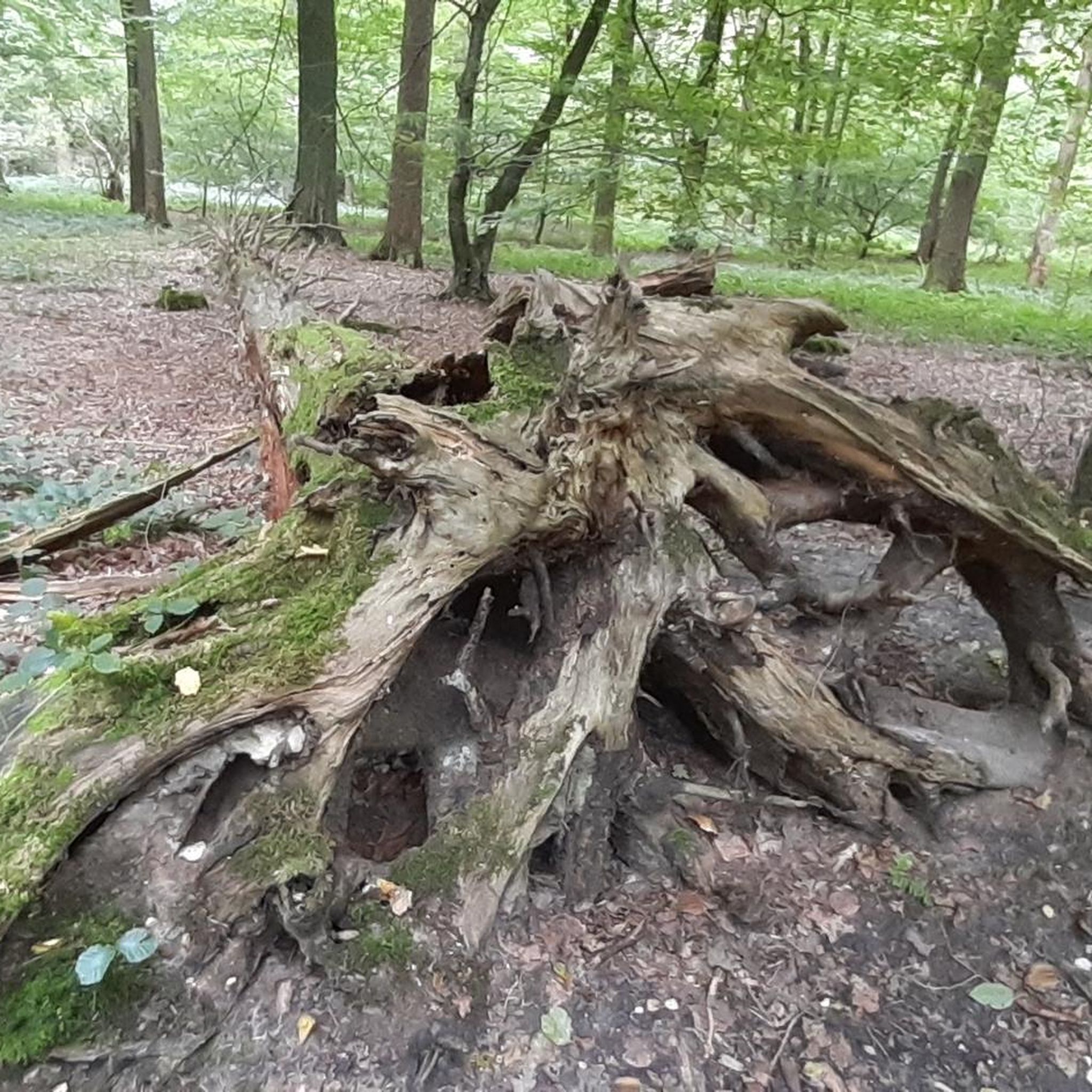
Visitors to Corrog Wood will be greeted by a curious wooden sculpture of a Dryad. The sculpture has been affectionately named the ‘Frump in the Stump’. A dryad is a tree nymph in Greek mythology. The Dryad keeps a watchful, protective eye on the new wood standing at the entrance. Continue past the Dryad on through the little kissing gate and a loop pathway will be waiting to lead you around the 14-acre wood, where a mix of approximately 12,000 native trees and 400 metres of hedging have been planted.
0
0
The Marina is a nature reserve of unparalleled beauty, it is a good starting point on which to explore the Lough.
0
0
Portaferry ( from Port an Pheire 'landing place of the ferry' ) is a small town in County down, at the southern end of the Ards Peninsula, near the Narrows at the entrance to Strangford Lough. It hosts its own small Marina, From where the The Ferry service operates daily at 30-minute intervals (7.45 am to 10.45 pm) between the villages of Portaferry and Strangford. The Lough being one of the world's most important marine sites with over 2,000 marine species. There are fine Georgian buildings in the town square, including a Market House, now used as a community centre. Portaferry Castle, a 16th-century townhouse ruin, sits atop a slope overlooking the Harbour.
0
0
This tower-house, said to have been built in 1570 by an English soldier, Captain Browne, is badly ruined but is still of considerable interest. Rectangular and fairly small in ground plan, it was entered by a door in the north-west wall which has a draw bar socket and a murder-hole. To the left of the door was a stair to the next floor. There are two ground floor rooms, the larger with a semi-circular vault built on plank centring and the smaller with a pointed vault built on paired wicker mats. The smaller room, once thought to be a secure boat bay, may be just a storeroom (compare nearby Sketrick). There were two storeys above, but the upper parts are ruined. Part of the bawn wall survives to the south-west, cut into the hill.
0
0
WWT Castle Espie is home to the largest collection of ducks, geese and swans in Ireland. Wide open spaces, and wetlands full of the sights and sounds of nature. Surprised by just how much there is to see and do including a Cafe / Gallery, plenty of walks, and places to just sit and take it all in.
0
0
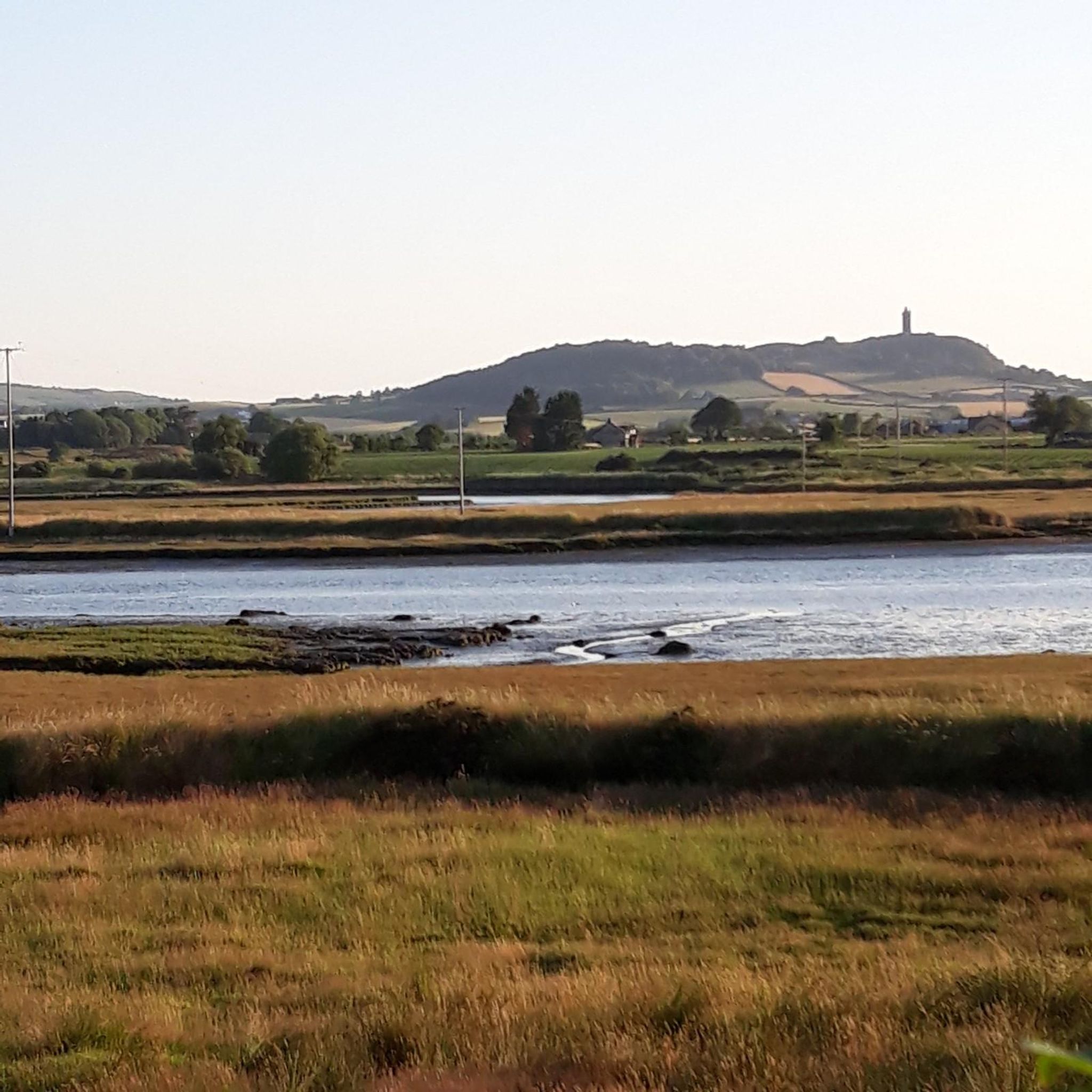
Always worth the ascent. If only for the view towards Sliev Croob and the Mournes. Beautiful patch work of swollen hills, cut by colourful fields, that meander all the way to the shore of Strangford Lough below. There are several interesting woodland gravel trails in the woods, connecting to Scrabo, and Ards. Twilight is magic up here. Smooth tarmac Decent down to Ards via Scrabo Road is a joy, with the tower on your left, and the sprawling Lough, and Newtownards to your right.
0
0
Frequently Asked Questions
How many road cycling routes are available in Cattogs?
There are over 120 road cycling routes documented in Cattogs on komoot, offering a wide range of options for cyclists of all abilities.
What kind of terrain can I expect when road cycling in Cattogs?
Cattogs features varied terrain across the rolling foothills of the Appalachian Mountains. You'll find tranquil valleys and diverse landscapes, with routes offering both well-paved surfaces and segments with elevation changes. The region is known as the 'Enchanted Mountains' of Western New York, providing picturesque views.
Are there easy road cycling routes suitable for beginners in Cattogs?
Yes, Cattogs offers a good selection of easy road cycling routes. For instance, the Bike Path to Belfast loop from Comber is a shorter, easy option. Another popular easy route is the Bike Path to Belfast – Peartree Hill Path loop from Comber, which is about 29 km long.
What are some moderate road cycling routes in Cattogs?
For those with good fitness, Cattogs has several moderate routes. The Picnic Café – Kilmood Church loop from Comber is a moderate 53.3 km trail. Another excellent moderate option is the Daft Eddy's Coffee Shop loop from Comber, spanning about 46.8 km.
Are there any challenging road cycling routes for experienced riders?
While the komoot data for Cattogs primarily lists easy and moderate routes, the region's description of 'rolling foothills of the Appalachian Mountains' and 'significant elevation gain' suggests that combining or extending existing routes could create more challenging rides. The region's natural features, like those found in Allegany State Park, offer varied terrain for advanced cyclists seeking a workout.
What kind of attractions can I see along road cycling routes in Cattogs?
Many routes in Cattogs pass by interesting landmarks and natural features. You might cycle past historical sites like Nendrum Monastery Ruins or Kilmood Church. The area also features scenic spots like Whiterock Harbour and the Comber Greenway, a dedicated cycle path.
Are there any circular road cycling routes in Cattogs?
Yes, many of the road cycling routes in Cattogs are designed as loops, allowing you to start and end at the same point. Examples include the Mahee Castle – Nendrum Monastery Ruins loop from Comber and the Picnic Café – Kilmood Church loop from Comber.
What do other road cyclists say about cycling in Cattogs?
The road cycling routes in Cattogs are highly rated by the komoot community, with an average score of 4.9 stars from over 17 reviews. Cyclists often praise the varied terrain, tranquil valleys, and well-paved surfaces that make for an enjoyable riding experience.
Is Cattaraugus County (Cattogs) a good destination for outdoor activities beyond cycling?
Absolutely. Cattaraugus County, known as the 'Enchanted Mountains,' offers a wide range of outdoor activities. Allegany State Park is a key highlight for fishing, kayaking, and hiking. You can also explore Rock City State Forest with its trails and roads, or visit attractions like the Bear Caves and Mount Seneca Trail.
Where can I find more information about tourism in Cattaraugus County?
For additional information on tourism and attractions in Cattaraugus County, you can visit the official county tourism website: cattco.gov/tourism.
Are there family-friendly road cycling options in Cattogs?
Yes, the region offers routes suitable for families, particularly those categorized as 'easy' with gentle gradients and well-paved surfaces. The Bike Path to Belfast loop from Comber is a shorter, easy route that could be a good option for a family outing.
Most popular routes around Cattogs
Most popular attractions around Cattogs

Get inspired with the komoot mobile app


Explore more
Browse the best Road cycling routes in other regions.
