The best cycling routes around Tollymore
4.5
(13)
595
riders
57
rides
Touring cycling around Tollymore offers routes through Northern Ireland's first state forest park, situated at the foothills of the Mourne Mountains. The landscape features diverse woodlands, including ancient arboreta and native species, alongside the Shimna River which flows through the park. Terrain varies from mostly paved surfaces to unpaved segments with significant elevation changes, catering to different cycling preferences. The park is part of the Mourne and Slieve Croob Area of Outstanding Natural Beauty.
Best touring cycling routes around Tollymore
…Last updated: July 2, 2026
5.0
(1)
4
riders
55.3km
03:43
710m
710m
Hard bike ride. Very good fitness required. Mostly paved surfaces. Suitable for all skill levels.
2
riders
62.2km
03:51
360m
360m
Moderate bike ride. Good fitness required. Mostly paved surfaces. Suitable for all skill levels.

Sign up for free
2
riders
32.5km
02:03
310m
310m
Moderate bike ride. Good fitness required. Mostly paved surfaces. Suitable for all skill levels.
4.4
(5)
61
riders
20.1km
02:13
610m
610m
Hard bike ride. Very good fitness required. Mostly paved surfaces. Suitable for all skill levels.
19
riders
62.6km
03:58
760m
760m
Hard bike ride. Very good fitness required. Mostly paved surfaces. Suitable for all skill levels.
Get access to more routes and recommendations from other explorers.
Sign up for free
Already have an account?
Our route recommendations are based on thousands of hikes, rides, and runs completed by other people on komoot.
Start today with a free account
Your next adventure awaits.
Login or Signup

Tips from the Community

Added to the collection: komoot.com/de-de/collection/3600632/-naturdenkmaeler-besondere-baeume-und-weitere-schaetze-der-natur
0
0

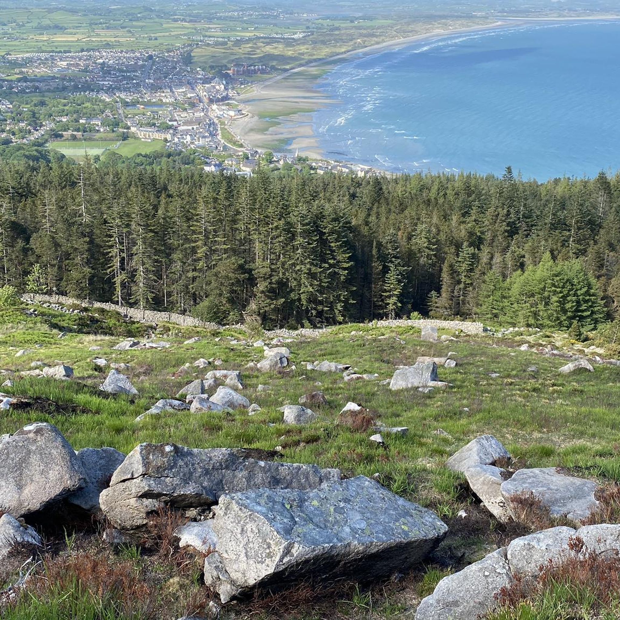
The vast coastline stretches out endlessly before you, and the panorama with the majestic Mourne Hills in the background creates a scene that is hard to put into words. The gentle waves touching the sand and the silence of the surroundings make you feel the vastness and freedom of this place.
1
0
This historic 12th century building is a typical example of an Anglo-Norman motte with a kidney-shaped bailey. The 7.6m high mound, which once housed a wooden tower, was later replaced by a stone tower house, the ruins of which can still be seen today. Access is via Clough's main road; there is a small car park, but it is not always well signposted. Access is usually permitted. The surrounding countryside, with views of the Mourne Mountains, offers a tranquil atmosphere that invites you to linger.
1
0
This picturesque spot is located between Dundrum Bay and Murlough Bay and offers impressive views of the surrounding countryside. The paths there lead through the Murlough National Nature Reserve, a 6,000-year-old dune system that is great for cycling. However, some sections can become slippery in wet weather, so care must be taken. A particular highlight is the Downshire Bridge, which connects the village of Dundrum with the nature reserve and provides a charming crossing over the bay.
1
0
This forest of around five hectares consists of a mixture of scrubland, Douglas fir and spruce. The well-maintained paths lead you through dense forest and offer striking views of the surrounding countryside, including the villages of Attical and Slieemageogh. However, some sections are slippery in wet weather, so care must be taken. A particular highlight is the proximity to Banns Road, a historic path that takes you further into the Mourne Mountains.
1
0
The gently ascending road winds through a wide, open landscape, surrounded by grassy hills and breathtaking silence. Only the wind and the quiet hum of the tires accompany you here as your gaze wanders into the distance. The climb may be challenging, but the view that opens up with every meter of altitude is worth the effort. Once at the top, you feel free and rewarded, as if you have conquered a piece of nature and then the reward comes with the descent.
0
0
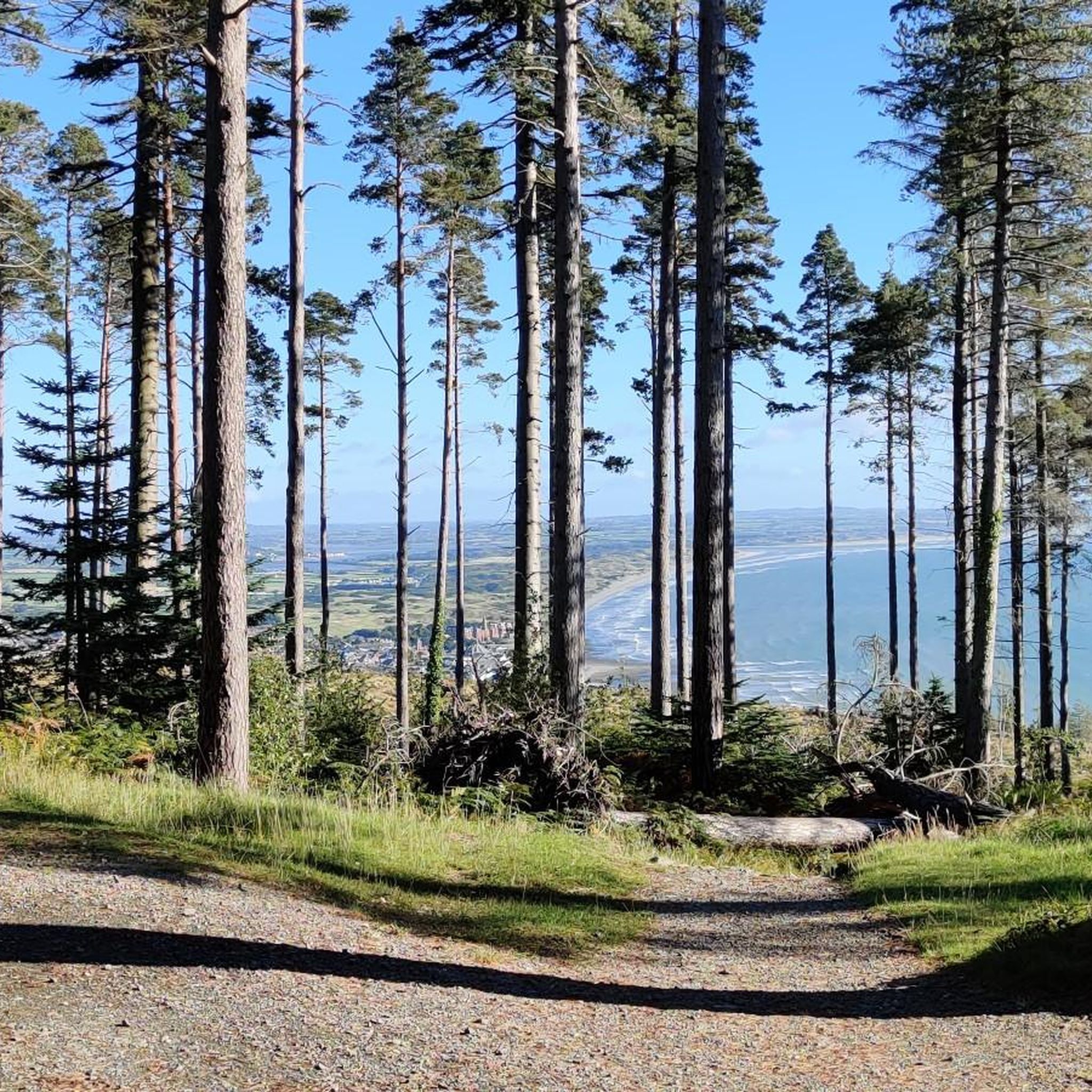
The route winds gently uphill, offering small clearings through which you can catch a glimpse of the valley and the sparkling water in the distance. The air here is wonderfully fresh and filled with the surrounding forests. During the climb you can feel the peace of the forest, accompanied only by the hum of the tires on the asphalt and the chirping of the birds. Once you reach the top, you are rewarded with a magnificent panorama.
0
0
It feels as if stories from times long past hang in the air here – the old tree has probably seen many seasons and radiates a certain calm and constancy.
1
0
Frequently Asked Questions
How many touring cycling routes are available in Tollymore?
Tollymore offers a wide selection of touring cycling routes, with over 60 options available. These routes cater to various skill levels, including 12 easy, 28 moderate, and 22 difficult paths.
What natural features can I expect to see along the cycling routes?
As you cycle through Tollymore, you'll experience the stunning natural beauty of Northern Ireland's first state forest park. Routes often follow the picturesque Shimna River, an Area of Special Scientific Interest, and wind through ancient arboreta and diverse woodlands featuring giant redwoods and Himalayan cedars. You'll also enjoy breathtaking views of the surrounding Mourne Mountains, part of the Mourne and Slieve Croob Area of Outstanding Natural Beauty.
Are there any historical or unique landmarks to explore while cycling?
Yes, Tollymore is rich in history and unique architecture. You can discover impressive Gothic-style gate arches, including the grand Barbican Gate, and intriguing follies like The Hermitage, a quirky stone structure built into the gorge above the Shimna River. The park also features the 18th-century Clanbrassil barn, the White Fort cashel, and The King's Grave megalithic cairn. Its mystical atmosphere even made it a filming location for 'Game of Thrones'.
Are there family-friendly touring cycling routes in Tollymore?
Yes, Tollymore offers several easy touring cycling routes suitable for families. These paths typically feature minimal elevation gain and mostly paved surfaces, making them enjoyable for all skill levels. Many routes are designed for up to two hours of cycling, perfect for a family outing.
Can I bring my dog on the touring cycling trails in Tollymore?
Tollymore Forest Park is generally dog-friendly, but it's important to keep dogs under control, especially given the presence of wild Fallow deer, red squirrels, and other wildlife. Always check specific trail regulations or park signage for any restrictions on cycling with dogs.
Is there parking available for touring cyclists at Tollymore Forest Park?
Yes, Tollymore Forest Park provides parking facilities for visitors. It's advisable to arrive early during peak seasons to secure a spot, especially if you plan a longer cycling tour.
How can I access Tollymore Forest Park by public transport?
Tollymore Forest Park is accessible by public transport, though options might be limited depending on your starting point. Buses often serve the nearby town of Newcastle, from which you may be able to connect to the park or cycle the short distance. It's recommended to check local bus schedules for the most up-to-date information.
What are the trail conditions like in Tollymore, especially after rain?
Tollymore's varied terrain includes both paved surfaces and unpaved segments. The park's trails are generally well-draining, meaning they tend to remain in good condition even after heavy rainfall, allowing for enjoyable cycling throughout the year.
Are there options for e-bike tours in Tollymore?
Yes, guided e-bike tours are available in Tollymore. These tours allow visitors to explore more of the park's diverse landscapes and attractions with less effort, making challenging routes more accessible.
What do other touring cyclists say about the routes in Tollymore?
The touring cycling routes in Tollymore are highly regarded by the komoot community, holding an average rating of 4.4 stars from over 12 reviews. Cyclists often praise the dense woodlands, the meandering Shimna River, and the stunning views of the Mourne Mountains, highlighting the variety of options for different ability levels.
Are there any circular touring cycling routes in Tollymore?
Yes, many of the touring cycling routes in and around Tollymore are circular, offering convenient starting and ending points. For example, the View of Tollymore Forest – Hare's Bridge loop from Newcastle is a challenging 20.8 km route that provides a great circular experience.
What viewpoints can I find along the touring cycling routes?
The routes around Tollymore offer numerous scenic viewpoints. You can find stunning vistas of the Mourne Mountains, including highlights like Slieve Bearnagh and the Summit of Slieve Donard. The park itself, particularly Tollymore Forest Park, offers beautiful perspectives of the landscape, and you might even catch views of the historic Mourne Wall.
Are there any advanced touring cycling routes for experienced riders?
Yes, Tollymore offers several challenging routes for experienced touring cyclists. These routes, such as the Slievenaman Climb – Trassey Road loop from Bryansford, often feature significant elevation gains and can include unpaved segments, requiring good to very good fitness. This particular route covers 62.1 km with substantial climbing.
Most popular routes around Tollymore
Most popular attractions around Tollymore

Get inspired with the komoot mobile app


Explore more
Browse the best Cycling routes in other regions.
