The best road cycling routes around Ballykinler Upper
4.3
(15)
768
riders
91
rides
Road cycling routes around Ballykinler Upper are set within County Down, Northern Ireland, offering a varied landscape for cyclists. The region features a blend of coastal scenery, undulating terrain, and the foothills of the Mourne Mountains. Cyclists can expect mostly paved surfaces with varying elevation gains, from moderate climbs to more challenging ascents. This area provides diverse cycling experiences, including routes near the Murlough National Nature Reserve and Tollymore Forest Park.
Best road cycling routes around Ballykinler Upper
- The most…
Last updated: July 11, 2026
4.5
(6)
96
riders
48.0km
02:28
710m
710m
Embark on a challenging road cycling adventure through the heart of the Mourne Mountains with the Spelga Reservoir loop. This moderate route covers 29.8 miles (48.0 km) and features a…
12
riders
98.4km
05:05
770m
770m
The Strangford & Castleward loop from Newcastle is a challenging road cycling experience, covering 61.1 miles (98.4 km) with a significant elevation gain of 2536 feet (773 metres). This difficult…

Sign up for free
54
riders
81.6km
03:48
1,010m
1,010m
Hard road ride. Very good fitness required. Mostly well-paved surfaces and easy to ride.
29
riders
51.2km
02:20
560m
560m
Moderate road ride. Good fitness required. Mostly well-paved surfaces and easy to ride.
33
riders
52.6km
02:17
400m
400m
Moderate road ride. Good fitness required. Mostly well-paved surfaces and easy to ride.
Get access to more routes and recommendations from other explorers.
Sign up for free
Already have an account?
Our route recommendations are based on thousands of hikes, rides, and runs completed by other people on komoot.
Start today with a free account
Your next adventure awaits.
Login or Signup



Tips from the Community

A great little cafe set in the bike shop, with great coffee and a nice variety of sweet goodies.
0
0

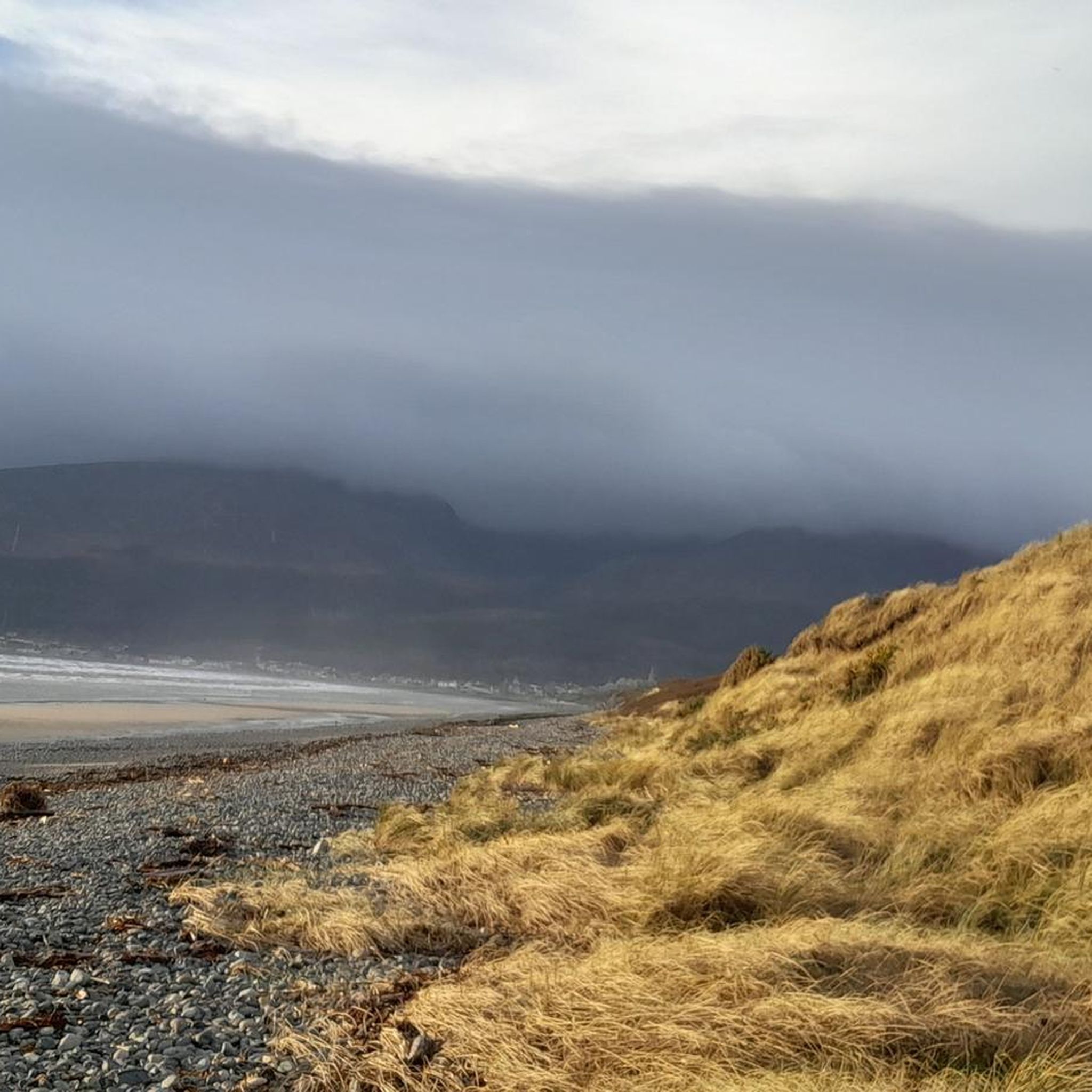
The vast coastline stretches out endlessly before you, and the panorama with the majestic Mourne Hills in the background creates a scene that is hard to put into words. The gentle waves touching the sand and the silence of the surroundings make you feel the vastness and freedom of this place.
1
0
This historic 12th century building is a typical example of an Anglo-Norman motte with a kidney-shaped bailey. The 7.6m high mound, which once housed a wooden tower, was later replaced by a stone tower house, the ruins of which can still be seen today. Access is via Clough's main road; there is a small car park, but it is not always well signposted. Access is usually permitted. The surrounding countryside, with views of the Mourne Mountains, offers a tranquil atmosphere that invites you to linger.
1
0
The small, historic port provides a charming setting with views of the Mourne Mountains and the sea. The promenade is well maintained and is great for a relaxing cruise along the coast. However, it can get quite busy in good weather and at weekends, which can slow down the journey. A highlight is the proximity to Murlough National Nature Reserve, which is just a few kilometers away and is ideal for further exploration. Note, however, that some sections of the promenade can be slippery when wet, so care must be taken.
1
0

National Trust (Castle Ward, 2023-12-24): https://www.nationaltrust.org.uk/visit/northern-ireland/castle-ward https://www.youtube.com/watch?v=tl_SVBg9R8U Wikipedia (Castle Ward, 2023-12-24): https://en.m.wikipedia.org/wiki/Castle_Ward https://de.m.wikipedia.org/wiki/Castle_Ward “… The most interesting aspect of Castle Ward is that of its dual architecture, representing the differing tastes of Lord Bangor and his wife, Lady Ann Bligh. While the entrance side of the building is done in a classical Palladian style with columns supporting a triangular pediment, the opposite side is Georgian Gothic with pointed windows, battlements and finials. …”
2
1

If you fancy a dip after all those hills, this is a very safe spot for swimming. The slipway at the side of the harbour wall is the preferred entry point. If you look back along the side of Slieve Donard, you will see some cottages known as “Widows Row”. These were built for the widows of fishermen who died at sea. They would be able to live out their days in one of the cottages looking out to sea.
1
0
The motte and bailey dates to c.1200 and is an excellent example of an Anglo-Norman earthwork castle. The taller mound, the motte, was built of earth to provide a look-out position and the central defence. Excavations at the top of the motte during the 1950s uncovered a wooden palisade which originally extended around the summit. When you climb the motte you realise what an important position the castle is in, over looking the routes east to Downpatrick, south to Dundrum and north to Belfast Lough. The views from the top of the motte west to Slieve Croob are particularly fine.
1
0

The perfect meeting spot to start any run in this area. From this point you can head either into Rostrevor village, out towards Killowen, into Kilbroney park or head north alongside the river.
1
0
Frequently Asked Questions
How many road cycling routes are available around Ballykinler Upper?
There are over 120 road cycling routes around Ballykinler Upper, offering a wide range of options for different skill levels and preferences. These routes explore the diverse landscapes of County Down, from coastal paths to the foothills of the Mourne Mountains.
What kind of terrain can I expect on road cycling routes in Ballykinler Upper?
Road cycling routes in Ballykinler Upper feature mostly paved surfaces with varying elevation gains. You can expect a blend of coastal scenery, undulating terrain, and challenging ascents as you approach the Mourne Mountains. The region offers diverse experiences, from moderate climbs to more strenuous endeavors.
Are there road cycling routes suitable for beginners or families in Ballykinler Upper?
Yes, Ballykinler Upper offers around 20 easy road cycling routes, making it possible to find options suitable for beginners or families looking for a less strenuous ride. These routes often feature gentler gradients and allow for a more relaxed pace to enjoy the scenery.
What natural features or landmarks can I see while cycling in the area?
While cycling around Ballykinler Upper, you can encounter several natural and historical landmarks. The majestic Mourne Mountains provide a dramatic backdrop, and you might cycle near the ecologically significant Murlough National Nature Reserve. Other points of interest include the Summit of Slieve Donard, the Mourne Wall, and the Murlough Nature Reserve Boardwalk.
Are there any historical sites along the road cycling routes?
Yes, the region has historical significance. Ballykinler itself was a primary training ground for the 36th Ulster Division during World War I, with practice trenches uncovered in the area. You can also find historical sites like Clough Castle Ruins, Dundrum Castle, and Inch Abbey nearby, which can be incorporated into your cycling excursions.
What do other road cyclists enjoy most about cycling in Ballykinler Upper?
The road cycling routes around Ballykinler Upper are highly rated by the komoot community, with an average score of 4.3 stars. Cyclists often praise the varied terrain, from challenging mountain ascents to scenic coastal stretches, and the opportunity to explore areas like the Mourne Mountains and the Murlough sand dune system.
Are there any circular road cycling routes in Ballykinler Upper?
Many of the road cycling routes in Ballykinler Upper are designed as loops, allowing you to start and finish at the same point. Examples include the challenging Spelga Reservoir loop from Newcastle – Mourne and the extensive Strangford & Castleward loop from Newcastle.
Can I find routes that pass through Tollymore Forest Park?
While Tollymore Forest Park is primarily known for its hiking trails and features like the Tollymore Forest Park Stone Arch Bridge, some cycling loops in the broader region may offer access or views of the park. It's a great spot to explore on foot as part of a multi-activity day.
Are there any cafes or pubs near the cycling routes for a break?
Yes, the surrounding towns and villages, particularly Newcastle, offer various options for cafes and pubs where cyclists can take a break. For instance, the Lackan Road – The Yard Café loop from Newcastle specifically highlights a café stop along its route.
What is the best time of year for road cycling in Ballykinler Upper?
The best time for road cycling in Ballykinler Upper is generally during the spring, summer, and early autumn months (April to October). During these periods, the weather is typically milder and drier, offering more pleasant conditions for exploring the coastal and mountain roads. Always check local weather forecasts before heading out.
Are there any particularly challenging road cycling routes in the area?
For experienced cyclists seeking a challenge, Ballykinler Upper and its surroundings offer several difficult routes. The Climb by Rostrevor Forest – Spelga Reservoir Hill Climb loop from Newcastle, for example, features significant elevation gain through Rostrevor Forest and past Spelga Reservoir, testing your climbing abilities.
Where can I find parking for road cycling routes in Ballykinler Upper?
Parking options for road cyclists are typically available in the nearby towns and villages, such as Newcastle, which serves as a common starting point for many routes. Specific parking details may vary by route, so it's advisable to check the route description on komoot for recommended starting points and parking facilities.
Most popular routes around Ballykinler Upper
Most popular attractions around Ballykinler Upper

Get inspired with the komoot mobile app


Explore more
Browse the best Road cycling routes in other regions.
