The best running trails around Hausen im Wiesental
4.5
(268)
3,558
runners
264
runs
Jogging routes Hausen im Wiesental offer diverse terrain within the picturesque Wiese Valley, situated in the southwestern Black Forest. The region features flatter riverside paths along the Wiese river, alongside rolling hills and mountain ridges to the east and west. This varied landscape provides options ranging from gentle valley runs to more challenging routes with rewarding inclines and views over the surrounding countryside. Proximity to the Black Forest further expands the network of trails through dense forests and open meadows.
…Last updated: July 1, 2026
5.0
(5)
68
runners
Hard run. Very good fitness required. Mostly paved surfaces. Suitable for all skill levels.
25
runners
11.9km
01:15
60m
60m
Moderate run. Good fitness required. Mostly paved surfaces. Suitable for all skill levels.

Sign up for free
5.0
(1)
10
runners
7.67km
00:54
210m
210m
Moderate run. Good fitness required. Mostly paved surfaces. Suitable for all skill levels.
3.3
(8)
45
runners
Moderate run. Good fitness required. Mostly paved surfaces. Suitable for all skill levels.
5.0
(1)
20
runners
6.40km
00:40
40m
40m
Moderate run. Good fitness required. Mostly paved surfaces. Suitable for all skill levels.
Get access to more routes and recommendations from other explorers.
Sign up for free
Already have an account?
Our route recommendations are based on thousands of hikes, rides, and runs completed by other people on komoot.
Start today with a free account
Your next adventure awaits.
Login or Signup
Tips from the Community


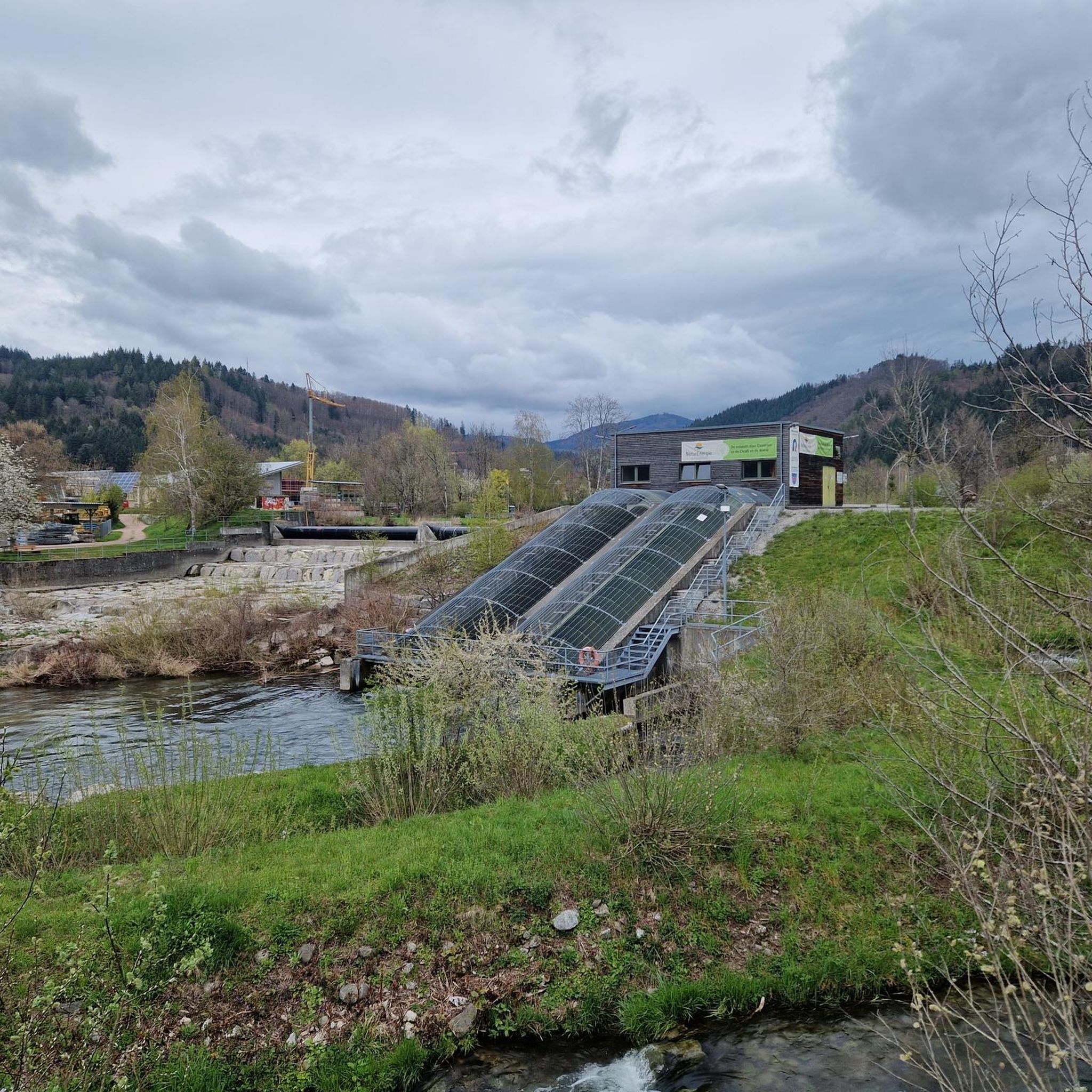
In 2024, after 112 years of operation, a spruce board wall was finally doweled in place, because like me, you are often too distracted by the view of the river on the bridge and end up standing on it. Maybe it's just a temporary solution until a suitable railing has been welded.
0
0

Perfect path also very beautiful through the meadows
0
0


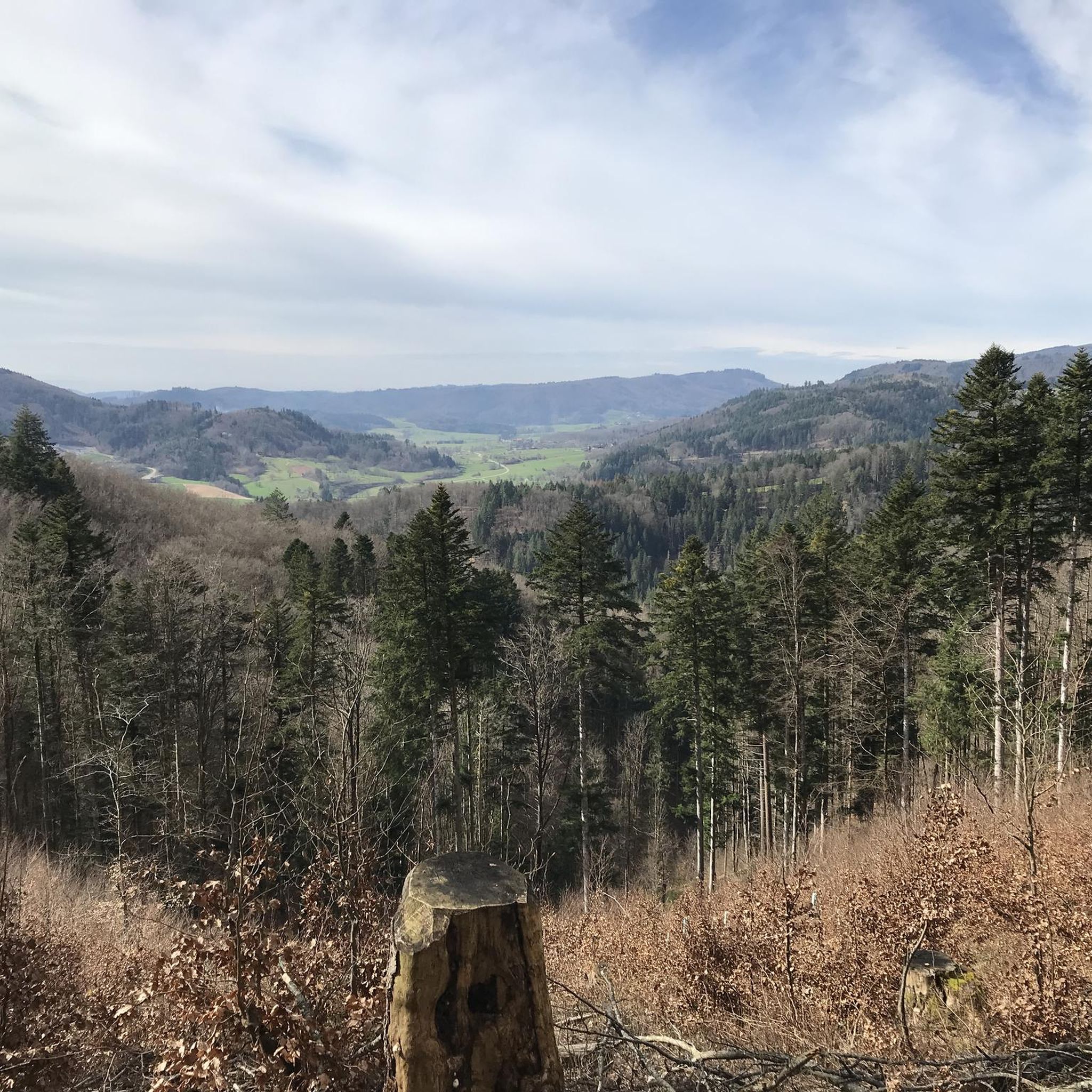
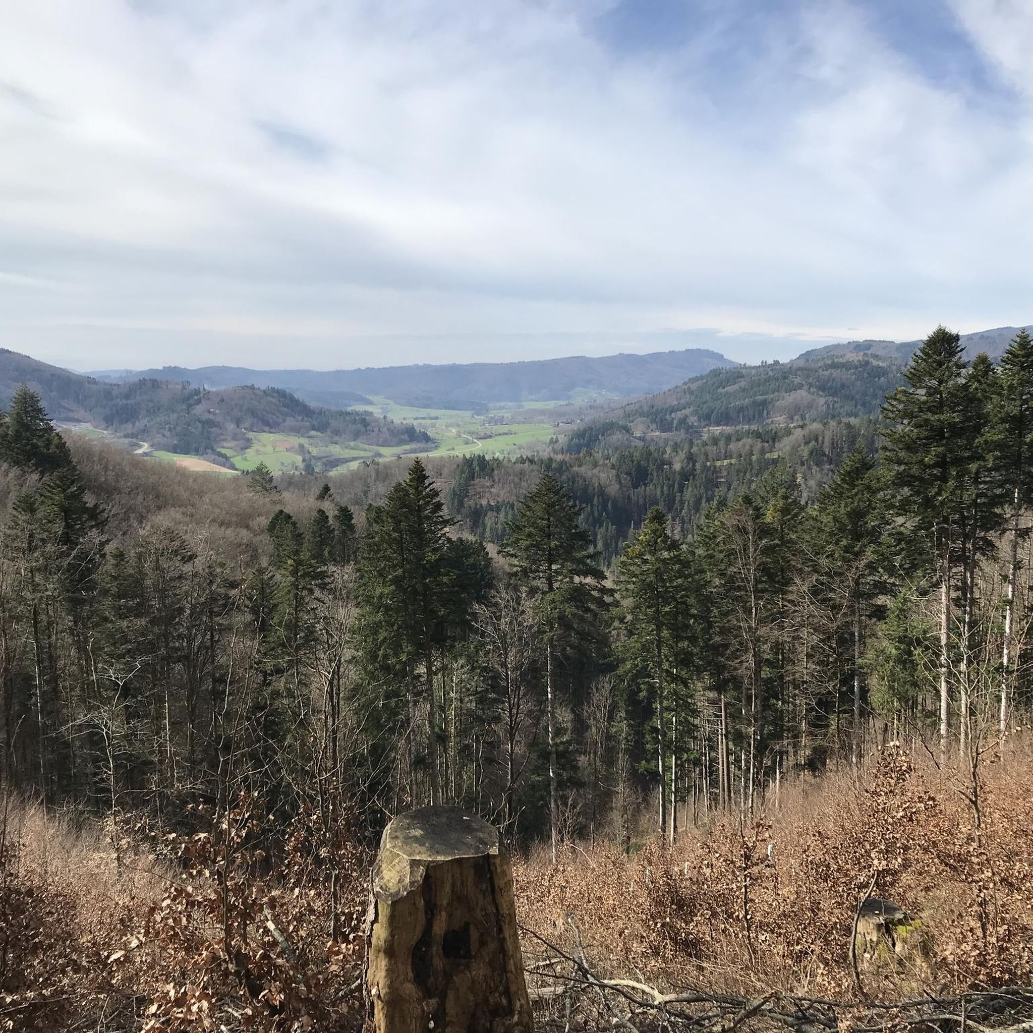
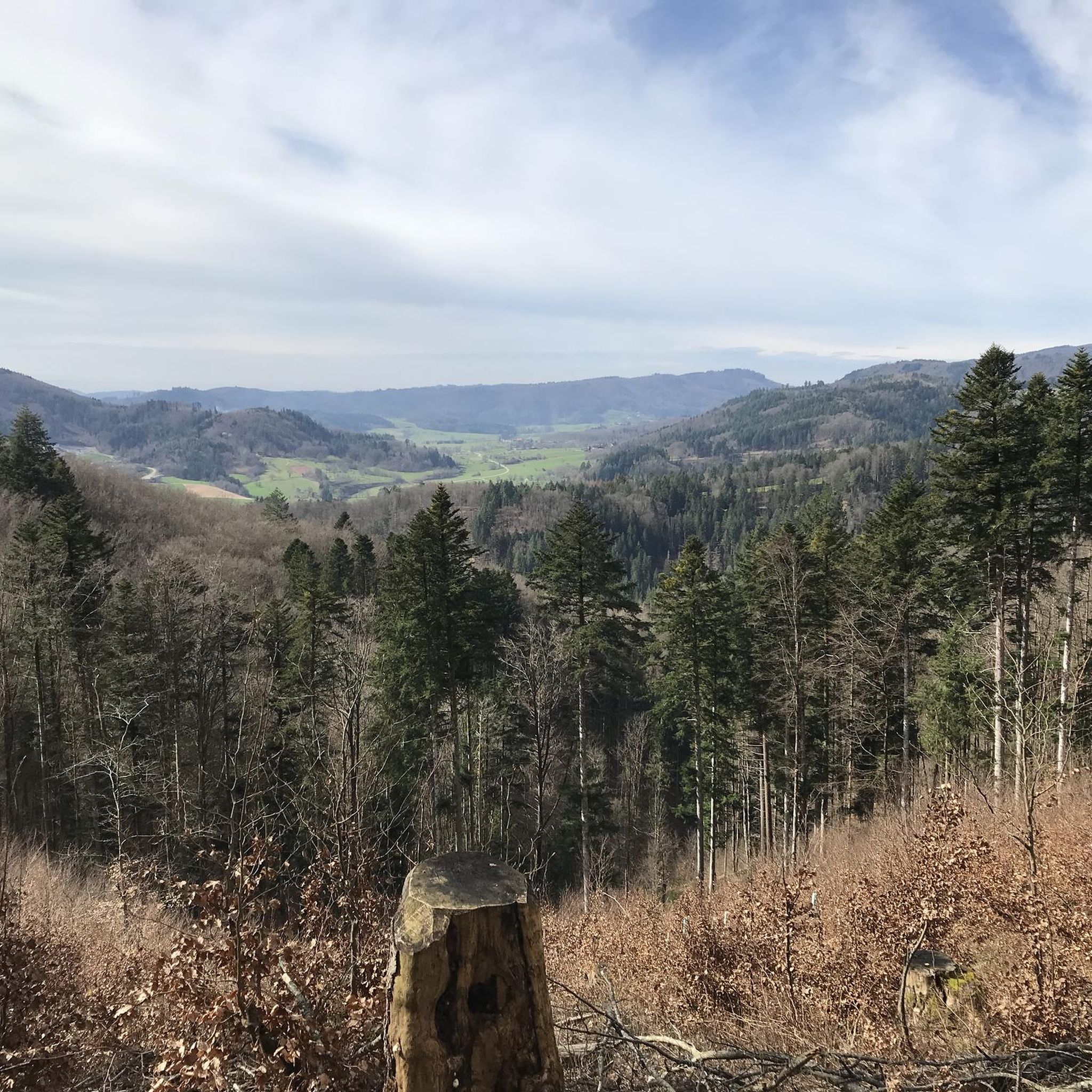
Nice view of Hausen and the Wiesental. From here you can drive up to the Hausener Köpfle with a height of 594 m
1
0


The bridge west of the center of Schopfheim crosses the meadow. The approximately 40-meter-long bridge was planned by engineer Friedländer from the Freiburg office Brenzinger & Cie. The execution took place in the years 1911 to 1912. It is 5.60 meters wide and about four meters high. The main girder is a double arch made of reinforced concrete, which is raised in the middle part as a parapet above the carriageway. The bow has a span of 34.80 meters and a height of 2.40 meters, which is unusual even for modern conditions. In order to avoid bending compulsion, joints made of concrete were used on the fighters. These have a spiral reinforcement, which was novel for the time. The roadway is supported by three-tier slabs with transverse ribs that rest between the main girders. On the right bank of the river, the bridge is widened on both sides for better traffic management. While the right-bank side is dominated by rocks and the bridge provides sufficient support, the foundations on the left bank had to be made 9.50 meters below the roadway profile, three meters lower than planned. For a secure foundation, the sole was sawtooth-shaped here. Source: Wikipedia
0
0
The bridge west of the center of Schopfheim crosses the meadow. The around 40 meter long bridge was designed by Friedländer, an engineer from the Freiburg office Brenzinger & Cie. The execution took place in the years 1911 to 1912. It is 5.60 meters wide and about four meters high. A two-joint arch made of reinforced concrete serves as the main girder, which is raised in the middle as a parapet above the carriageway. With a span of 34.80 meters, the arch is 2.40 meters high, which is also unusual for modern conditions. To avoid bending, concrete joints were used on the fighters. These have a spiral reinforcement that was new for the time. The carriageway is supported by three-ply slab beams with cross ribs that rest between the main girders. On the right bank in the direction of the river, the bridge is widened on both sides for better traffic management. While the right bank is dominated by rocks and the bridge provides sufficient support, the foundation on the left bank had to be made 9.50 meters below the lane profile and thus three meters lower than planned. The sole was sawtooth-shaped for a secure foundation. Source: Wikipedia
0
0
Frequently Asked Questions
How many running routes are available in Hausen im Wiesental?
Hausen im Wiesental offers a wide variety of running experiences, with over 260 routes available for jogging. These range from easy strolls along the river to more challenging trails through the hills and forests.
What do other runners say about the trails in Hausen im Wiesental?
The running routes in Hausen im Wiesental are highly regarded by the komoot community, boasting an average rating of 4.5 stars from over 250 reviews. Runners frequently praise the diverse terrain, from scenic valley paths to rewarding climbs with panoramic views, and the extensive network of trails through the Black Forest.
Are there running routes suitable for beginners in Hausen im Wiesental?
Yes, Hausen im Wiesental has options for all fitness levels. You'll find approximately 38 easy running routes, many of which follow the flatter, riverside paths along the Wiese river, perfect for a gentle jog or a leisurely run.
What kind of terrain can I expect on jogging routes around Hausen im Wiesental?
The region offers a diverse landscape for running. You can expect flatter, pleasant paths along the Wiese Valley, as well as rolling hills and mountain ridges to the east and west, such as the 'Grendel' and 'Knobel' areas. These elevated routes provide more challenging runs with rewarding inclines and panoramic views. The proximity to the Black Forest also means access to extensive trails through dense forests and open meadows.
Are there any long-distance running trails near Hausen im Wiesental?
Yes, for those looking for longer runs, Hausen im Wiesental provides several options. For example, the Ushölzliweg Bench – View of Hohe Möhr and Hausen loop from Hausen-Raitbach is a challenging 9.4-mile (15.2 km) route offering expansive views. Another great option is the Hausen Soccer Field – Wiese River loop from Hausen-Raitbach, a moderate 9.2-mile (14.7 km) path that follows the scenic Wiese River.
Can I find circular running trails in Hausen im Wiesental?
Absolutely. Many of the running routes in Hausen im Wiesental are designed as loops, allowing you to start and finish at the same point. A popular moderate circular route is the View of Hohe Möhr and Hausen – Ushölzliweg Bench loop from Hausen-Raitbach, which is 5.2 miles (8.3 km) long and offers varied terrain with views of Hohe Möhr.
Are there jogging routes with scenic viewpoints in Hausen im Wiesental?
Yes, the hilly terrain surrounding Hausen im Wiesental offers several routes with excellent viewpoints. The Ushölzliweg Bench – View of Hohe Möhr and Hausen loop from Hausen-Raitbach is known for its expansive views of Hohe Möhr and the valley. Additionally, the Schlossberg Viewing Platform provides breathtaking views over Hausen im Wiesental and the surrounding landscape, making it a rewarding destination for a run.
What interesting places can I explore along the running routes?
Beyond the natural beauty, you can discover several points of interest. Consider routes that pass by historical sites like the Hebelhaus, the home of poet Johann Peter Hebel. For those interested in history, the area also features various castle ruins such as Werrach Castle Ruins or Bärenfels Castle Ruins and Viewpoint. The Sausenburg Castle Park also offers beautiful paths for jogging amidst historical surroundings.
Are there any unique natural attractions near Hausen im Wiesental that I can incorporate into a run?
Yes, a notable natural attraction is the Eichener Lake, a unique natural monument known for its intermittent appearance. While not a direct jogging path, the surrounding area can provide interesting routes and a scenic point of interest during a longer run. You can even find the Eichener See Loop Trail nearby.
Are the running trails in Hausen im Wiesental dog-friendly?
Generally, the natural trails and paths in and around Hausen im Wiesental, especially those through forests and along the Wiese river, are suitable for running with dogs. However, it's always recommended to keep dogs on a leash, especially in nature reserves or near livestock, and to be mindful of local regulations regarding pets on trails.
Is there public transport access to the jogging routes in Hausen im Wiesental?
Hausen im Wiesental is well-connected within the Wiese Valley. Many routes are accessible directly from the town center or nearby villages, which are served by local bus lines. This makes it convenient to reach various starting points for your run without needing a car.
Where can I find parking for running trails in Hausen im Wiesental?
For most running routes, you can typically find public parking available in Hausen im Wiesental's town center or at designated trailheads on the outskirts of town. Look for parking areas near sports facilities or public parks, which often serve as convenient starting points for many trails.
Most popular routes around Hausen im Wiesental
Most popular attractions around Hausen im Wiesental

Get inspired with the komoot mobile app


Explore more
Browse the best Running Trails & Routes in other regions.
