The best road cycling routes around Lamb Holm
5.0
(4)
124
riders
5
rides
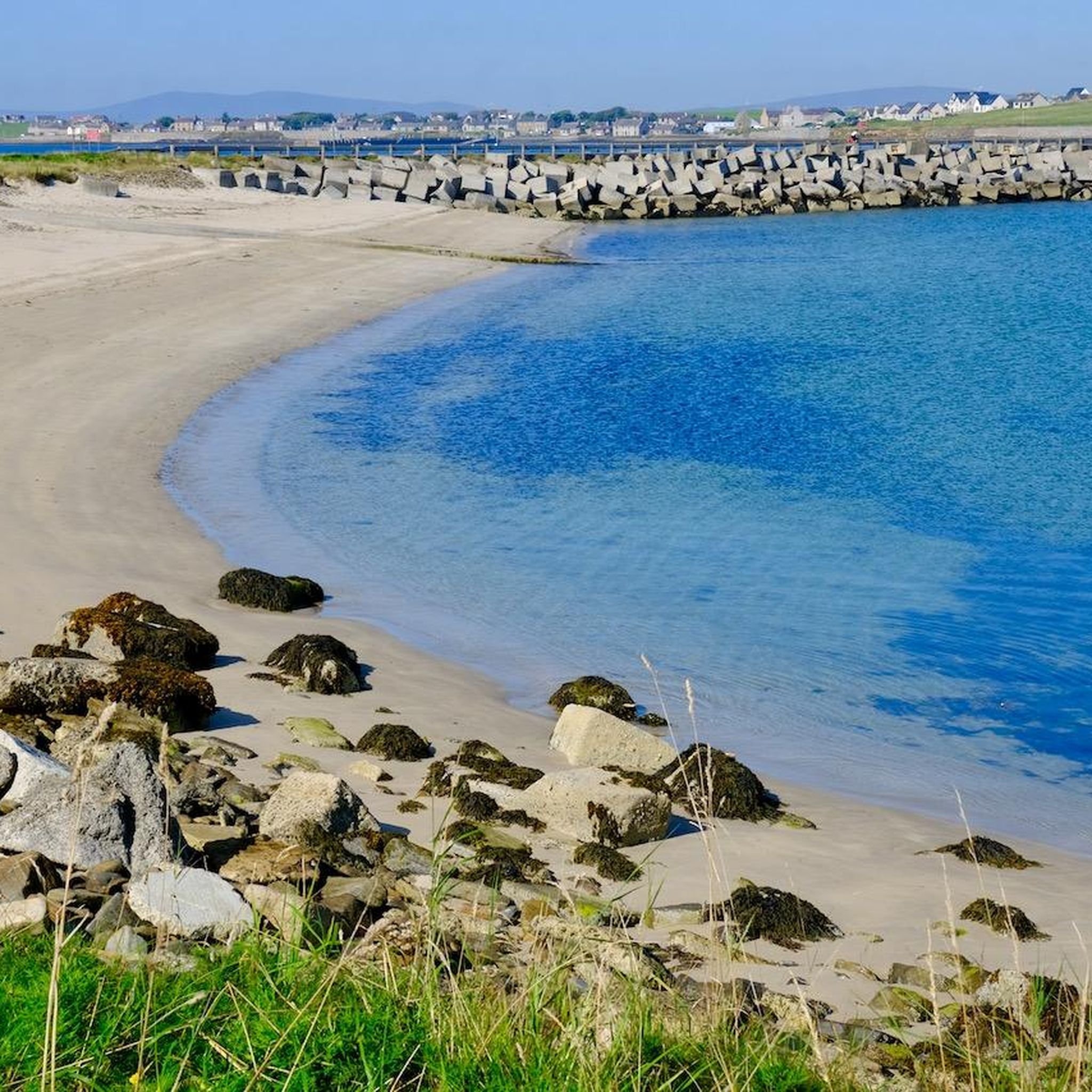
Road cycling around Lamb Holm is characterized by its unique historical landscape and accessible routes. The island is connected to other islands, including the Orkney Mainland, by the Churchill Barriers, which provide smooth, well-paved surfaces ideal for road cycling. These routes offer expansive views of Scapa Flow and the surrounding sea. The terrain is generally gentle, featuring quiet country roads suitable for various skill levels.
Best road cycling routes around Lamb Holm
- The most popular road cycling route is EuroVelo…
Last updated: July 12, 2026
5.0
(2)
58
riders
52.4km
02:17
480m
480m
Cycle a moderate 32.6 miles (52.4 km) section of the EuroVelo 12 in the Orkney Islands, passing Churchill Barriers and Kirkwall Harbour.
5.0
(1)
13
riders
84.9km
03:36
680m
680m
Cycle the North Sea Cycle Route: Orkney Mainland, a moderate 52.7-mile (84.9 km) route with 2238 feet (682 metres) of elevation gain.

Sign up for free
6
riders
31.0km
01:18
240m
240m
Easy road ride. Great for any fitness level. Mostly well-paved surfaces and easy to ride.
5.0
(1)
35
riders
Moderate road ride. Good fitness required. Mostly well-paved surfaces and easy to ride.
12
riders
25.9km
01:07
170m
170m
Easy road ride. Great for any fitness level. Mostly well-paved surfaces and easy to ride.
Our route recommendations are based on thousands of hikes, rides, and runs completed by other people on komoot.
Start today with a free account
Your next adventure awaits.
Login or Signup
Popular around Lamb Holm


Tips from the Community

Churchill had 4 dams built here and his own ships sunk so that the Germans would not get their hands on them
0
0

In the often storm-tossed seas of the Atlantic lies the Scapa Flow off the Orkney Islands, which belong to Scotland. A very special stretch of water measuring more than 300 square kilometers, a kind of natural harbor off the two main islands of the Orkneys. But what makes it so unique is underwater. A ship graveyard that is probably one of the most spectacular diving spots in Europe, if not the world. The story of its creation tells of a forgotten chapter of the First World War. According to the town's official website, the name Scapa Flow comes from the Norse word Skalpaflói, which means “The Bay of the Long Isthmus”. Accordingly, the place was first used by the British Admiralty around 1800 as a strategic natural harbor in the Napoleonic Wars. At a depth of up to 40 meters, merchant ships were allowed to anchor here before they set off for the Baltic North Sea ports. But Scapa Flow would not finally take its place in the history books until 1919. During the First World War, the British fleet moved its base to the difficult-to-access Scapa Flow. Old defenses on land were also put back into operation at this time. After Germany had to admit its defeat in the war in 1918, the ships of the German Navy with their crew on board were held there as prisoners of war. And so on June 21, 1919, one of the greatest ship accidents in world history occurred. The word “misfortune” is misleading, because it was actually an ordered tragedy. The commander of the German navy in the Scapa Flow, Admiral Ludwig von Reuter, believed at this point that the peace negotiations with the victorious powers had failed. In order to prevent “his” ships from finally falling into the hands of the enemy, he had them sunk without further ado on his orders. That day, 52 German warships found their watery grave in the waters of Scapa Flow. To date, this is the largest sinking ever recorded.
0
0

Here you can enjoy great views over the well-known Churchill Barriers. The barriers were built in 1945 and act as a causeway connecting the Orkney mainland with the isles of Lamb Holm, Glimps Holm, Burray and South Ronaldsay.
1
0
Burwick Pier is located on the southernmost tip of South Ronaldsay island. It's the Orkney landing point for passengers and cyclists on the John O'Groats Ferry. Ferries run daily, and you can find the times on the site... jogferry.co.uk/Ferry.aspx
1
0
Jump off the bike, take a rest, and enjoy wonderful views over to Scapa Beach, located just a mile or so from Kirkwall and Orkney's most popular beach.
1
0
St Margaret's Hope is the main town on the Orkney island of South Ronaldsay. The small town lies in a sheltered bay and features an attractive waterfront, a gift shop and museum, and a coffee shop, 'Robertson's Coffee House and Bar'. There is a ferry service that runs between St Margaret's Hope and Gills Bay on the mainland, you can find the times here https://www.orkney.com/listings/pentland-ferries
1
0
Kirkwall is the largest town on Scotland's beautiful northern archipelago of Orkney. In this bustling town, there are many wonderful places to discover, including cafés, restaurants, bars, museums, a cathedral, and many other historic landmarks.
1
0
Burwick Pier is located on the southernmost tip of South Ronaldsay island. It's the Orkney landing point for passengers and cyclists on the John O'Groats Ferry. Ferries run daily, and you can find the times on the site... https://www.jogferry.co.uk/Ferry.aspx
1
0
Frequently Asked Questions
How many road cycling routes are available around Lamb Holm?
There are 6 road cycling routes around Lamb Holm, offering a variety of experiences for different skill levels. You'll find 2 easy routes and 4 moderate routes, ensuring options for both beginners and more experienced cyclists.
What is the best time of year for road cycling in Lamb Holm?
The best time for road cycling in Lamb Holm is generally during the warmer, drier months, typically from spring through autumn. While the Orcadian breeze can be a factor, it can also aid cyclists. Winter conditions can be challenging due to wind and weather.
What are the typical terrain and difficulty levels for road cycling in Lamb Holm?
Road cycling around Lamb Holm is characterized by quiet country roads and generally gentle terrain. The routes often utilize the smooth, well-paved surfaces of the Churchill Barriers. While there are some varied elevations, particularly on routes extending to the Orkney Mainland, most routes are suitable for varying abilities, with options ranging from easy to moderate.
What do other cyclists say about road cycling in Lamb Holm?
The road cycling routes around Lamb Holm are highly rated by the komoot community, with an average score of 5.0 stars from over 5 reviews. Cyclists often praise the unique historical landscape, the expansive views of Scapa Flow, and the accessible, well-maintained roads of the Churchill Barriers.
Are there any historical landmarks or points of interest to see while cycling around Lamb Holm?
Yes, Lamb Holm is rich in history. A primary attraction is the highly ornamented Italian Chapel, built by Italian prisoners of war during WWII. Cyclists can also enjoy views of Scapa Flow, a historically significant natural harbor. Other points of interest include prehistoric settlement remains and a Bronze Age barrow mound on the island. You can also find the Scapa Beach and Royal Oak Memorial Garden nearby.
Are there any family-friendly road cycling routes around Lamb Holm?
Yes, the generally quiet country roads and gentle terrain around Lamb Holm make it suitable for family-friendly cycling. The smooth surfaces of the Churchill Barriers provide an excellent, safe environment for cyclists of varying ages. An easy route like St Mary's to South Ronaldsay via Churchill Barriers & Wheems Organic Farm is a good option.
Can I find circular road cycling routes in the area?
Yes, there are circular road cycling routes available. For example, the route View of the Churchill Barriers – The Churchill Barriers loop from Tankerness offers a moderate 60 km loop that allows you to experience the unique landscape and historical barriers.
Where can I find parking for road cycling near Lamb Holm?
Parking is generally available at various points along the Churchill Barriers and near attractions like the Italian Chapel. Many cyclists start their routes from areas like St. Mary's or Kirkwall, where dedicated parking facilities can be found, allowing easy access to the cycling network.
Are there any cafes or amenities along the road cycling routes?
While Lamb Holm itself is small, routes extending to nearby islands and the Orkney Mainland offer access to amenities. For instance, the route St Mary's to South Ronaldsay via Churchill Barriers & Wheems Organic Farm passes by Wheems Organic Farm, which may offer refreshments. Kirkwall, accessible via routes like EuroVelo 12 - North Sea Cycle Route, provides a wider range of cafes and services.
Are there any specific viewpoints along the road cycling routes?
Many routes offer panoramic views, especially along the Churchill Barriers, where you can see across Scapa Flow and the surrounding sea. The View from Wideford Hill – Kirkwall Town Centre loop from Kirkwall Airport route provides excellent vistas from Wideford Hill. The A961, part of the East Mainland of Orkney route, also offers fantastic views of Scapa Flow.
Do I need a permit to cycle in Orkney?
No, you do not generally need a permit to cycle on public roads and designated cycle paths in Orkney, including around Lamb Holm. Cyclists are expected to follow the Highway Code and respect local regulations.
What is the longest road cycling route near Lamb Holm?
The longest road cycling route featured near Lamb Holm is the North Sea Cycle Route: Orkney Mainland, which spans approximately 84.9 km (52.8 miles). This moderate route offers varied elevation across the Orkney Mainland on well-paved surfaces.
Most popular routes around Lamb Holm
Most popular attractions around Lamb Holm

Get inspired with the komoot mobile app


Explore more
Browse the best Road cycling routes in other regions.
