The best road cycling routes around Pinvin
4.7
(16)
520
riders
33
rides
Road cycling routes around Pinvin traverse a landscape characterized by rolling hills, river valleys, and agricultural land in Worcestershire, England. The area's network of roads, including the A44, A4104, and B4082, provides diverse journey options for cyclists. Terrain often includes varied elevation, offering both flatter sections and climbs suitable for road cycling. Pinvin's location allows for routes connecting to nearby towns like Pershore, Worcester, and Evesham.
Best road cycling routes around Pinvin
- The most popular road cycling route is Café…
Last updated: October 18, 2026
4.7
(6)
86
riders
41.4km
01:47
230m
230m
Easy road ride. Great for any fitness level. Mostly well-paved surfaces and easy to ride.
4.7
(3)
55
riders
55.7km
02:29
430m
430m
Moderate road ride. Good fitness required. Mostly well-paved surfaces and easy to ride.

4.0
(1)
36
riders
42.8km
01:56
230m
230m
Easy road ride. Great for any fitness level. Mostly well-paved surfaces and easy to ride.
5.0
(1)
51
riders
79.2km
03:49
560m
560m
Moderate road ride. Good fitness required. Mostly well-paved surfaces and easy to ride.
24
riders
44.1km
01:55
220m
220m
Easy road ride. Great for any fitness level. Mostly well-paved surfaces and easy to ride.
Get access to more routes and recommendations from other explorers.
Already have an account?
Our route recommendations are based on thousands of hikes, rides, and runs completed by other people on komoot.
Start today with a free account
Your next adventure awaits.
Tips from the Community

Sadly, doors locked, so internal investigations are impossible.
0
0


The Stock Green to Himbleton lane is a delight, lovely road and usually very quiet.
0
0
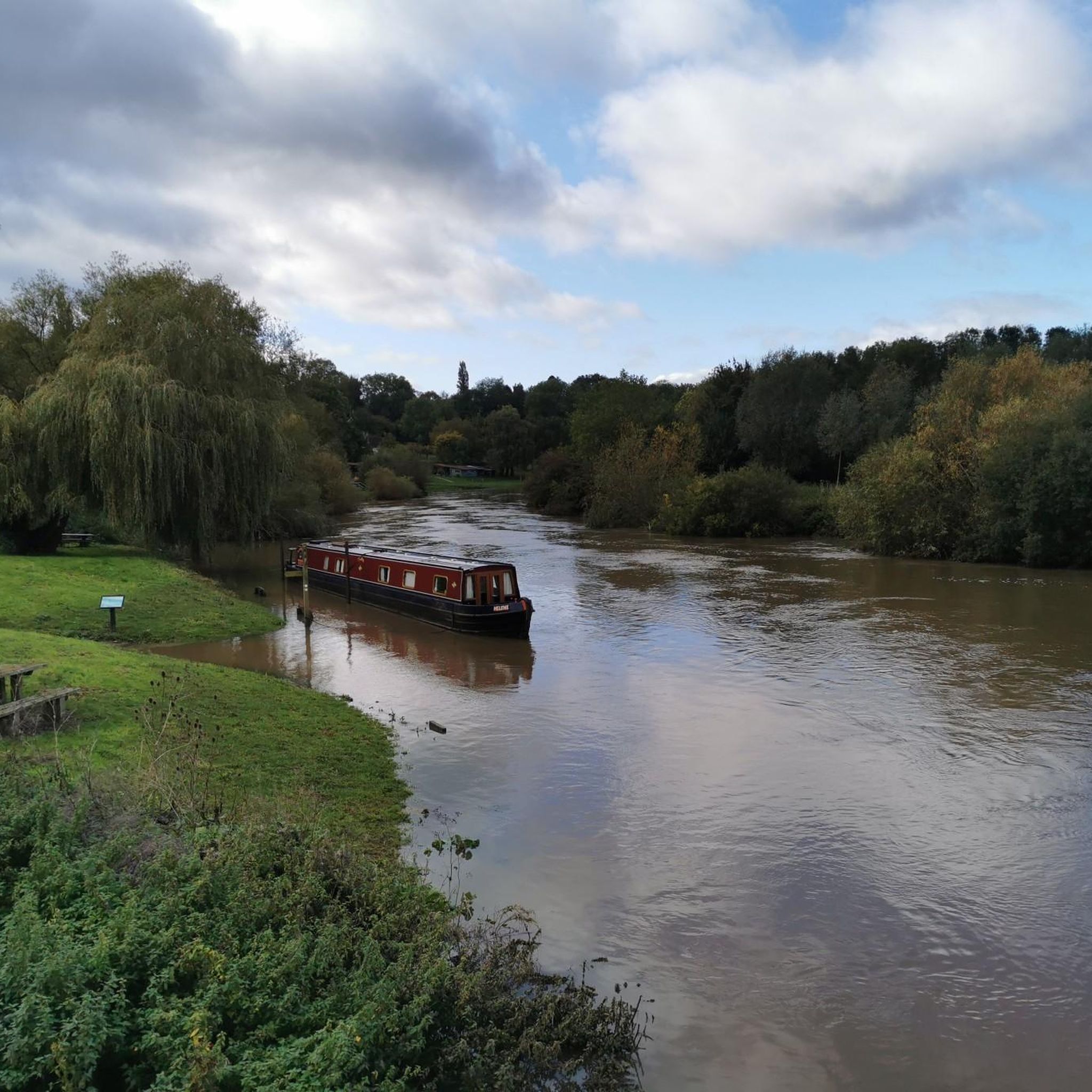
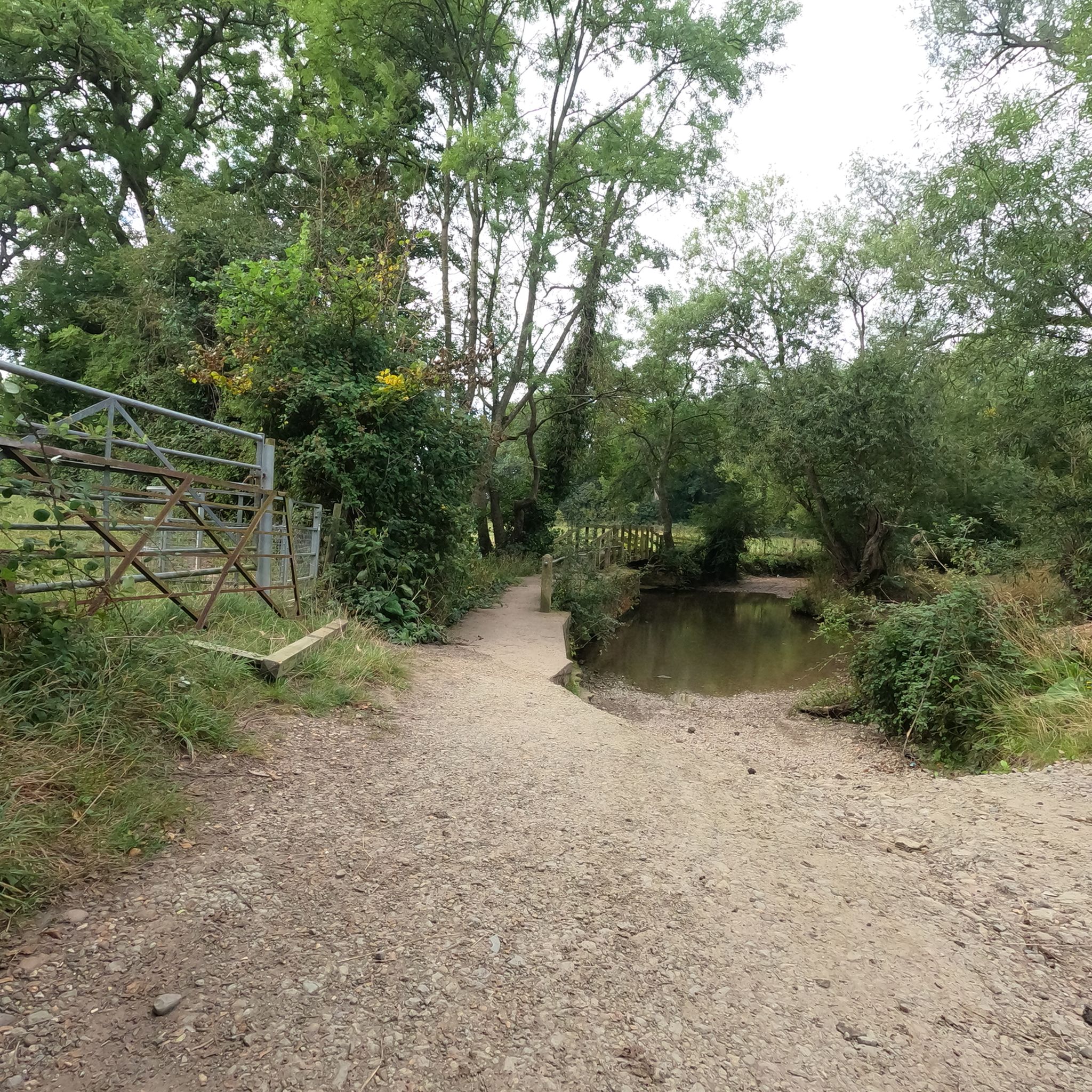
Shell Ford is both picturesque and notorious. It gets very deep during floods and countless motorists have drowned their cars here over the years. The old Packhorse bridge is the best way to get across on foot or with a bike as the ford itself gets very slippery.
0
0
Wonderful house and gardens, which were designed by Capability Brown. I love this place in the evening when the crowds have gone home.
0
0
Lovely old Sandstone bridge that is so narrow it is single track only and so is controlled by traffic lights. Note there is a small car park on the Eckington side that can get full very quickly, some folk have taken to parking on the road partially blocking it - it is illegal to park on the road here due to the double white lines.
0
0

Beautiful medieval bridge over river Avon. Incredibly well preserved given its age.
0
0
These two windblown trees stand in isolation with the view of Bredon Hill beyond.
0
0
Frequently Asked Questions
How many road cycling routes are available around Pinvin?
There are over 25 road cycling routes around Pinvin, offering a variety of options for different skill levels. You'll find 13 easy routes and 16 moderate routes to explore the Worcestershire countryside.
What kind of terrain can I expect when road cycling around Pinvin?
Road cycling around Pinvin features a diverse landscape of rolling hills, river valleys, and agricultural land. Routes often include varied elevation, providing both flatter sections and climbs. This allows for different ability levels, from gentle rides to more challenging routes with significant elevation gain.
Are there road cycling routes suitable for beginners in Pinvin?
Yes, Pinvin offers several easy road cycling routes perfect for beginners. For instance, the Café Near Croome Court – Croome Court loop from Pershore is an easy 24.6-mile (39.7 km) trail with gentle ascents through the Worcestershire countryside.
Are there challenging road cycling routes for experienced riders around Pinvin?
Experienced riders will find moderate routes that offer more challenge. The Pershore Abbey – Quiet Country Lane loop from Pershore is a moderate 47.7-mile (76.8 km) trail that leads through quiet country lanes and includes more significant elevation changes, typically completed in about 3 hours 40 minutes.
What natural features or landmarks can I see while cycling around Pinvin?
While cycling around Pinvin, you can encounter various natural and historical landmarks. Notable natural features include Grafton Wood Nature Reserve and Bredon Hill Summit, offering scenic views. Historical sites like Pershore Old Bridge and Croome Court are also within reach, providing interesting points of interest along your ride.
What do other road cyclists enjoy the most about road cycling in Pinvin?
The road cycling routes around Pinvin are highly rated by the komoot community, with an average score of 4.7 stars from over 12 reviews. Cyclists often praise the varied terrain, which includes both flat sections and climbs, and the scenic views of the Worcestershire countryside.
Are there any circular road cycling routes available near Pinvin?
Yes, many of the routes around Pinvin are designed as loops, allowing you to start and end in the same location. An example is the Croome Court – Pershore Abbey loop from Pershore, a moderate 34.5-mile (55.5 km) path offering varied terrain and scenic views.
Is public transport available to access road cycling routes in Pinvin?
Pinvin's location near larger towns like Pershore, Worcester, and Evesham suggests that public transport options, such as local bus services or train connections to these towns, could provide access points to the wider cycling network. However, specific public transport links directly to route starting points would require local inquiry.
What is the best time of year for road cycling around Pinvin?
Worcestershire's rolling hills and agricultural land are beautiful throughout the warmer months. Spring and autumn generally offer pleasant temperatures and vibrant scenery, while summer provides longer daylight hours. Always check local weather forecasts before heading out, especially for rain or strong winds.
Are there any routes that pass by historical buildings or significant sites?
Absolutely. The region is rich in history. For example, the Croome Court – Pershore Abbey loop from Pershore passes by significant sites like Croome Court and Pershore Abbey, offering a blend of cycling and historical exploration.
Can I find routes that connect Pinvin to nearby towns?
Pinvin's strategic location, with roads like the A44, A4104, and B4082, facilitates routes connecting to nearby towns such as Pershore, Worcester, and Evesham. These connections allow for diverse journeys and the opportunity to explore more of the Worcestershire region.
What are the typical distances for road cycling routes in the Pinvin area?
Routes in the Pinvin area vary significantly in length. You can find shorter rides, such as the St Bartholomew's Church – Throckmorton–Pinvin Route loop from Pershore at around 10.8 miles (17.4 km), up to longer excursions like the Pershore Abbey – Quiet Country Lane loop from Pershore, which is approximately 47.7 miles (76.8 km).
Most popular attractions around Pinvin

Get inspired with the komoot mobile app


Explore more
Browse the best Road cycling routes in other regions.
