Attractions and Places To See around Hillhampton - Top 20
Best attractions and places to see around Hillhampton include a variety of historical sites, natural reserves, and scenic trails. This region offers more than 20 unique spots for exploration, catering to those interested in both cultural heritage and outdoor activities. Visitors can discover historical bridges, expansive nature reserves, and former railway lines converted into accessible trails. The area provides diverse environments for discovery, from riverine settings to heathlands and forests.
Best attractions and places to see around Hillhampton
- The most…
Last updated: October 10, 2026
Bewdley Bridge
Highlight • Cafe
Tip by

Burlish Top Nature Reserve
Highlight • Natural
Tip by

Sign up now to discover places like this
Get recommendations on the best single tracks, peaks, & plenty of other exciting outdoor places.
Wyre Forest Line Rail Trail
Highlight • Trail
Tip by

Leapgate Old Railway Line
Highlight • Trail
Tip by
St Peter's Church, Martley
Highlight • Religious Site
Tip by
Sign up for free to discover even more attractions around Hillhampton.
Already have an account?
Start today with a free account
Your next adventure awaits.

Tips from the Community

Fine church with lovely grounds, made from the local sandstone.
0
0
One of the highlights of this part of the Geopark Way, rather better than walking through Stourport.
0
0

A large village church with 12th century Norman origins and work from several later periods. The tower is 15th century. The church was restored in 1909 by Sir Charles Nicholson. There is an excellent west window by Tom Denny, 1999. Parish church. Early C12, early C13 and circa 1315, restored 1875, 1884 and 1909. Last restoration by Sir Charles Nicholson. Ashlar, plain tile roof. Nave and chancel continuous, west tower, north vestry of 1875, south porch of 1184. Chancel: three bays, north wall early C13 with two lancets, north vestry; east window: restored Decorated of early C14, three trefoiled lights; south wall: eastern window Decorated with two trefoiled lights, other two larger each with two ogee trefoiled lights, formerly looked into Mortimer chapel (consecrated 1315, demolished), they flank a three-centred-headed priest's door; stepped right angle buttresses to corners. Nave: three bays, all windows restored: decorated each with two trefoiled lights in both walls. Restored early C12 south door with timber porch of 1884; blocked north door more complete and similar in design; doorway projects c150mm from wall face, with decorated semicircular head and consecration cross; wall has five bays defined by a series of early C12 pilasters, top four courses of naves walls are of alternate bands of red and white sandstone. West tower: C15 in three stages divided by moulded string, moulded plinth, embattled parapet with pinnacles of 1909 to diagonal corner buttresses. C15 Perpendicular west window with three cinquefoiled lights; first stage has single trefoiled lights, bell chamber has windows with two cinquefoiled lights under two-centred head. INTERIOR: chancel: double aumbry in north wall, piscina in south wall with priests head to label stop; nave: entrance to rood stairs and above rood left door, stairs were in an external projection, now lost; tower arch of two chamfered orders with moulded abaci at springing. Roofs: similar over nave and chancel, slightly lower pitch to chancel, collar-rafter roof with straight braces from rafter to collar and ashlar pieces, five tie beams in nave, two in chancel, probably early C14. A framed tympanum divides the nave from the chancel roof, probably C17. Fittings: wall paintings in nave of C15 including St Martin on horseback dividing his cloak for the beggar; in chancel wall paintings of late C13 and C15, including C15 canopy design on east wall, and a C15 Annunciation group on the south wall. A few late C15 Malvern tiles in chancel floor; early C20 screen, font, pulpit and organ. Late C15 recumbent effigy of alabaster against north wall of chancel, ridged coffin lid to south with traces of incised cross and pastoral staff. The two eastern windows in the south wall of the nave and central window in north wall are of circa 1915 by Walter E Tower. Source: britishlistedbuildings
0
0
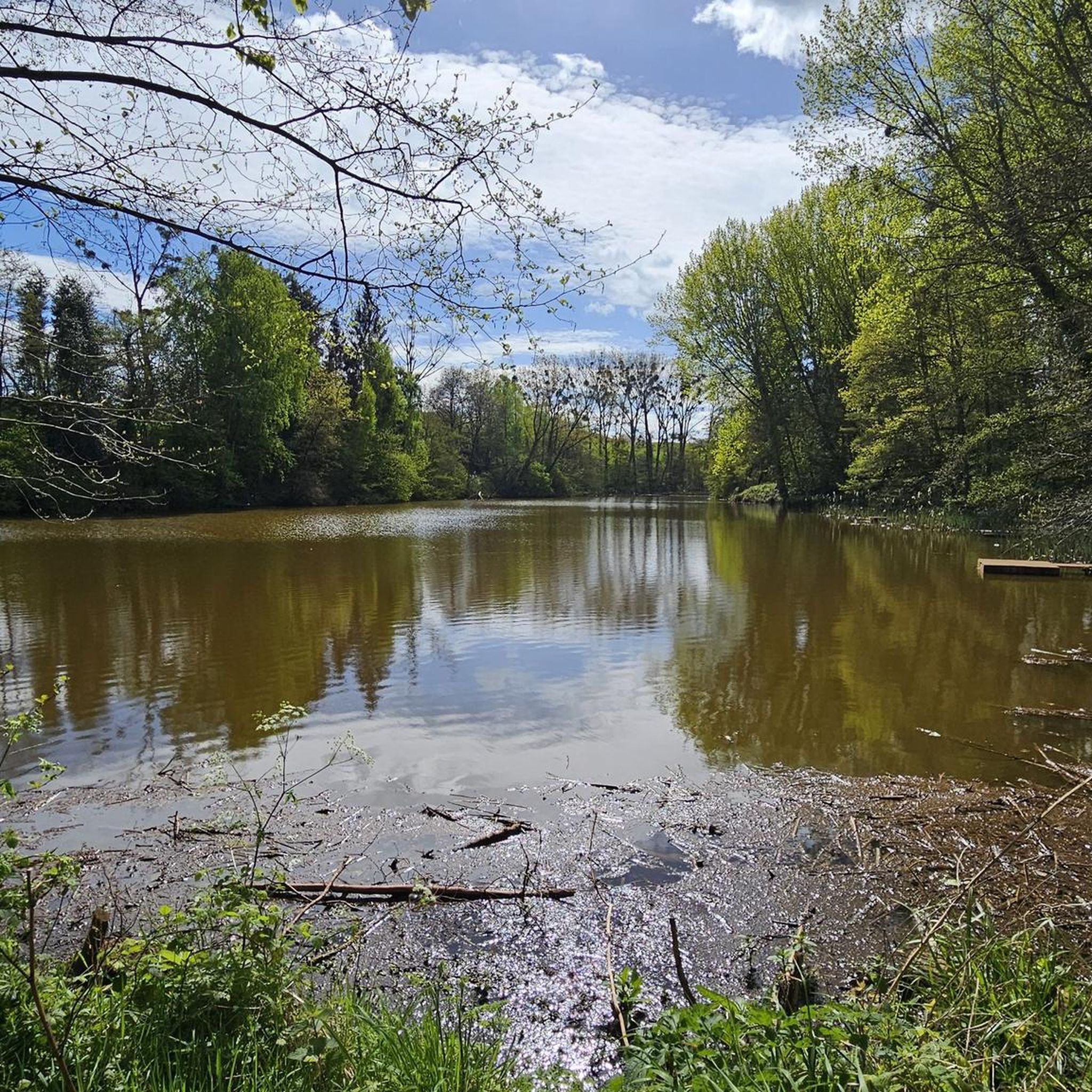
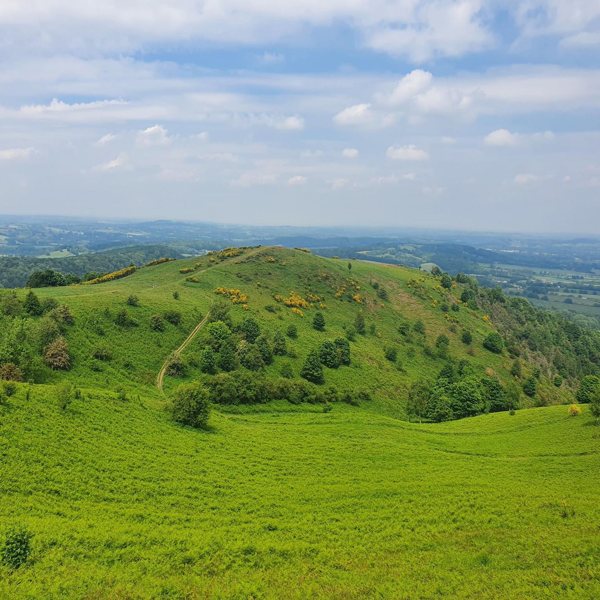
The nature reserve is approximately 35 hectares (86 acres) in size. The dominant habitat is heath and acid grassland, surrounded by oak and birch scrub. The acid grassland has been surveyed by many professional bodies, and Natural England rated it as the best quality acid grassland in the county. Wildlife on the site is typical for what you would expect on a heathland site, while reptiles are scarce due to the levels of disturbance from the public; however common lizard, grass snake and slow worm have been seen. There are many notable species of solitary bee and wasp which make use of the bare sandy soil, as do unusual heathland specialists, the green tiger beetle. The open areas are also utilised by a variety of ground feeding birds such as green woodpecker and as nesting sites for rarities like woodlark. There are a few small pools on site; one in particular supports a good breeding population of smooth newt, common frog, various dragonflies, damselflies and great diving beetle. Although traditionally a heath, this has given way in the main to gorse and broom scrub. There has been an increase in the density of rare grey hair grass after scrub clearance carried out in previous years. The area has an interesting history, with the site being used as a World War II American Army training and hospital camp. All that remains from those days are concrete paths, and some foundations from the original buildings. Much of this has been highlighted along a way marked ‘History’ trail. The website 'Burlish Camp' has more on the history of the site. In addition to the history trail, there are 3 other trails around the site, including 2 easy going routes, which take advantage of the sites historical concrete tracks, and a heathland circular, which also incorporates much of the Rifle Range SSSI. Source: Wyre Forest District Council
0
0
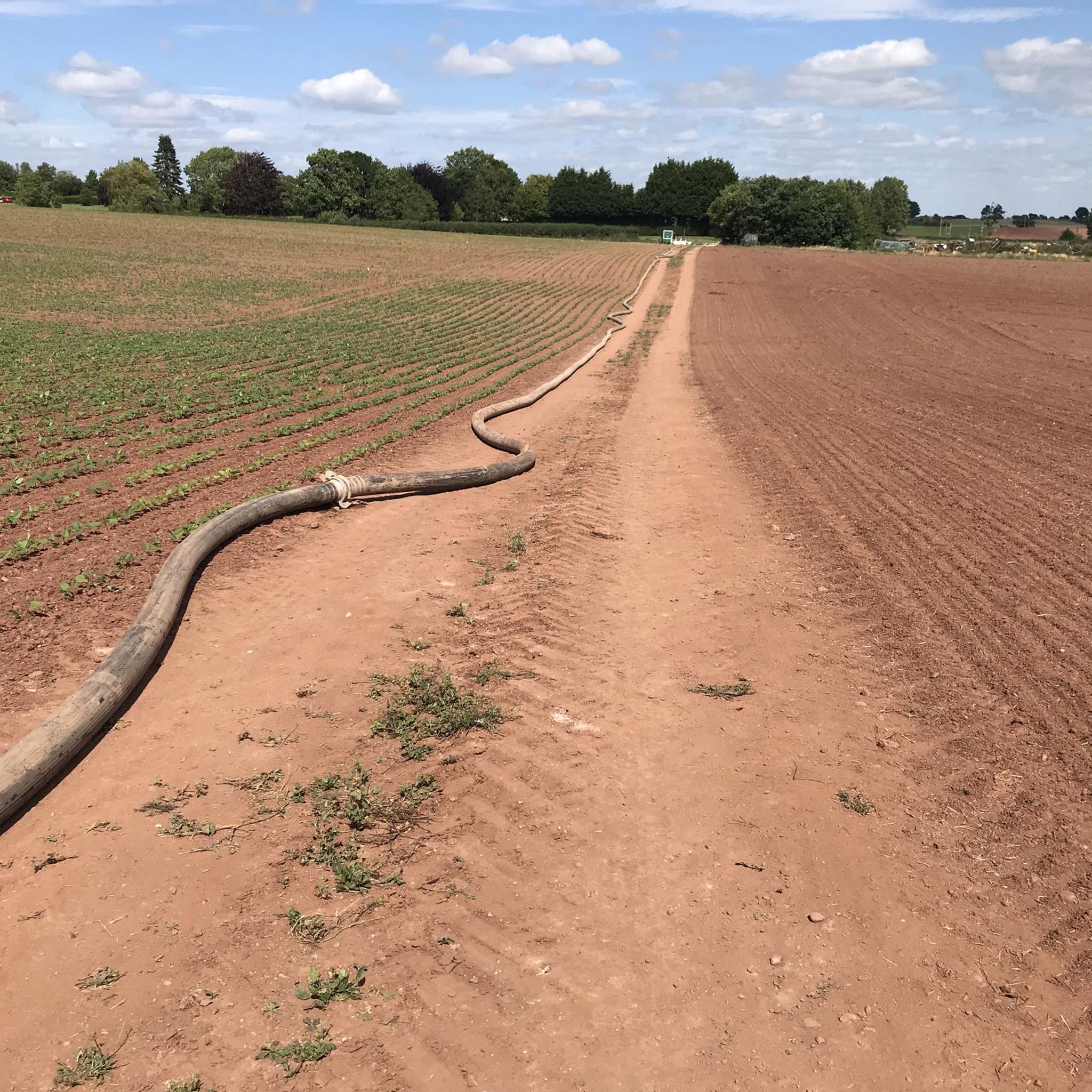
The ‘Old Railway Line’ cuts through the red sandstone bedrock. These sandstones are Triassic in age, belonging to the ‘Sherwood Sandstone Group’ of rocks. The Sherwood Sandstone Group, the older Permian-aged Bridgnorth Sandstone and the younger Triassic-aged Mercia Mudstone Group have one thing in common; they were deposited in a vast rift basin, called the Worcester Basin. The Worcester Basin was north-south orientated and formed during the Permian period. Its western edge, in the Geopark area, followed the line of a major fault-line, the East Malvern Fault. In the present day this fault line is most clearly marked by the Malvern, Suckley and Abberley Hills. The eastern edge of the Basin followed the line of another major fault-line, the Inkberrow Fault. Into this basin a great variety of different sedimentary rocks were deposited and formed. Some were windblown deposits, others were despotised by streams and rivers, evaporate deposits also formed in lakes and the other significant deposit was alluvial fans that formed along the edge of the basin. Each of the rocks represents the changing environments experienced in the basin through the passage of time. The rocks seen along the ‘Old Railway Line’ belong to the Wildmoor Sandstone Formation, part of the Sherwood Sandstone Group of rocks. They are around 220 million years ago and comprises soft, weakly cemented, pale red-brown, micaceous, sandstones. The well-rounded, evenly sized grains suggest reworking of windblown sands that were deposited the Worcester Basin during the Permian period. Source: geopark.org
0
0
Bewdley was once an important inland port, connecting Shrewsbury with the Midlands and the seaports of Gloucester and Bristol. Originally the quays were shorter and had slipways between them. In time, as more landing space was needed, the quayside walls were joined into one continuous length. The larger boats, known as Severn Trows, carried local goods such as rope and charcoal, metal goods from Birmingham and Staffordshire pottery to the south. They returned laden with woollen cloth, wine, spirits, tobacco, sugar, spices, citrus fruit and dried fish to be sold in market towns across the West Midlands and Welsh borders. This civic space was developed when the Environment Agency built the Town's new flood defences, and incorporates work by artist Elizabeth-Jane Grose. On the lower quayside you can find flowing words relating to the river and the vessels that worked on it. On the upper quayside have a look for the 'cargo-plates' recording forty of the common and less common exports and imports to the Port of Bewdley. Source: Environment Agency
0
0
Bewdley Bridge over the Severn was built in 1798 by Thomas Telford. It was erected to replace the 1483 medieval bridge that was swept away in the floods of 1795.
0
0
The ‘Wyre Forest Line’ formed a connection between the SVR at Bewdley and the Shrewsbury and Hereford Railway (S&HR) at Woofferton. The route encompassed two railways, the Tenbury Railway and the Tenbury & Bewdley Railway. Following the completion of the Tenbury & Bewdley Railway in 1864, the GWR took over the working of traffic over the Tenbury Railway section on behalf of the joint companies, with the LNWR also having running powers. As part of this process, the GWR telegraph system was extended to Woofferton; also the LNWR agreed to a turntable being installed at Tenbury to be paid for by the GWR. This turntable was moved from Bewdley and re-erected in the goods yard at Tenbury. (Some confusion has occurred in the past, as there was a small wagon turntable at Woofferton in its early days.) The completed line ran north from the GWR station at Bewdley on a single line track alongside the Severn Valley Line for a distance of about a mile before diverging to the west to cross the river Severn at Dowles Bridge (the viaduct referred to by Capt. Tyler), the remains of which are visible from trains on the SVR. The abutments where the line passed over what is now the B4194 remain in-situ. The line continued to Woofferton via Wyre Forest, Cleobury Mortimer, Neen Sollars, Newnham Bridge, Tenbury (later renamed Tenbury Wells) and Easton Court. The route acquired a number of names. A platform sign at Woofferton station referred to 'The Bewdley Branch', while passengers at Bewdley could take 'The Tenbury Branch'. Informally the route was often referred to as 'The Wyre Forest Line' or 'The Tenbury Line'. The Engineer's Line References were TBY for 'Tenbury & Bewdley' and WTW for 'Woofferton and Tenbury Wells', while the 1905 Ordnance Survey map describes it as the 'GW&L&NW Joint Railway - Woofferton & Tenbury' and the 'GWR - Tenbury & Bewdley Branch' One purpose of the Tenbury & Bewdley Railway was for freight traffic to gain access to the expanding markets of the West Midlands. However at the time of opening, this journey would require traveling to the SVR's southern terminus at Hartlebury, with a reversal to reach the West Midlands via Kidderminster. This was hampered by a lack of siding space at Hartlebury and resulted in frequent delays, leading to construction of the 'Kidderminster Loop Line' from Bewdley to Kidderminster. After the GWR built 'The Loop', the majority of services from Stourbridge and Kidderminster to Bewdley continued on the Wyre Forest Line. In January 1869, ownership of the Tenbury Railway was transferred jointly to the LNWR and GWR. It nominally remained an independent company until nationalisation in January 1948. The Tenbury & Bewdley Railway ceased to exist as a separate company when ownership was transferred to the GWR in February 1870. Both the GWR and the Tenbury Railway became part of British Railways' Western Region after nationalisation. In 1908 the Cleobury Mortimer and Ditton Priors Light Railway opened. This connected with the Tenbury & Bewdley Railway at Cleobury Mortimer and ran as a spur for 12½ miles to Ditton Priors.
0
0
Frequently Asked Questions
Are there family-friendly attractions around Hillhampton?
Yes, Hillhampton offers several family-friendly attractions. Bewdley Bridge is located in a pleasant riverside town with cafes. Burlish Top Nature Reserve features easy-going trails and historical remnants of a WWII camp, making it an interesting outdoor spot. The Wyre Forest Line Rail Trail is also suitable for families, offering a historical path for walking and cycling.
What natural features can I explore in Hillhampton?
You can explore diverse natural features in Hillhampton. Burlish Top Nature Reserve is an expansive 35-hectare site with lowland heath and forest, providing habitat for various wildlife. The Leapgate Old Railway Line cuts through Triassic-aged red sandstone bedrock, offering insights into the region's geological history. Additionally, the region features riverine settings and scenic trails.
What historical sites can I visit in Hillhampton?
Hillhampton is rich in historical sites. The Bewdley Bridge is a historical landmark by the river. Burlish Top Nature Reserve contains remnants of a World War II American army camp, with concrete paths and building foundations still visible. The Wyre Forest Line Rail Trail follows a former railway line, offering a glimpse into the region's railway past. You can also visit St Peter's Church, Martley, a large village church with 12th-century Norman origins and later additions.
Are there opportunities for hiking near Hillhampton's attractions?
Yes, there are several hiking opportunities near Hillhampton's attractions. You can find easy hikes around the area, such as the 'Wooden Footbridge in Woodland – Meadow by the River Severn loop' or the 'Stanley Wood – Meadow by the River Severn loop'. For more details and routes, refer to the Easy hikes around Hillhampton guide.
Can I go cycling near Hillhampton's attractions?
Absolutely. Hillhampton offers various cycling routes. For road cycling, consider routes like 'The Cob House Countryside Park – Ankerdine Hill Viewpoint loop' or 'Statue of a Man in Bewdley – Bewdley Riverside and Bridge loop'. For general cycling, options include 'View of Worcester Bridge – View of the Countryside loop'. Explore more routes in the Road Cycling Routes around Hillhampton and Cycling around Hillhampton guides.
What do visitors enjoy most about the attractions in Hillhampton?
Visitors appreciate the blend of history and nature. Many enjoy the pleasant riverside atmosphere and cafes around Bewdley Bridge. The historical and natural aspects of Burlish Top Nature Reserve, particularly its WWII remnants and diverse habitats, are also highly valued. The region's attractions have garnered over 170 upvotes and 47 photos from the komoot community, highlighting their appeal.
Are there places to eat or drink near the attractions?
Yes, particularly near Bewdley Bridge, you'll find a great little town with pubs, cafes, a cake shop, and a chippy, perfect for grabbing a tea, cake, or a meal by the river.
What is the best time of year to visit Hillhampton?
The best time to visit Hillhampton largely depends on your interests. For enjoying outdoor activities like hiking and cycling, spring and autumn offer pleasant weather. If you're interested in beach activities, the summer months, especially between May and September, are ideal for places like Buckroe Beach, which has lifeguards present. The region also hosts various festivals throughout the year, so checking a local event calendar might help you plan your visit.
Are there any trails suitable for wheelchairs or strollers in Hillhampton?
Yes, Burlish Top Nature Reserve offers easy-going routes that utilize the site's historical concrete tracks, making them suitable for wheelchairs and strollers. These trails provide an accessible way to experience the nature reserve and its historical elements.
Are there any dog-friendly walks in Hillhampton?
Many of Hillhampton's natural areas are suitable for dog walking. Burlish Top Nature Reserve and the Leapgate Old Railway Line, both featuring trails and open spaces, are generally good options for walks with dogs, though it's always advisable to check local regulations regarding leash requirements.
Are there any hidden gems or lesser-known spots worth visiting in Hillhampton?
Beyond the main highlights, the historical remnants of the WWII American army camp within Burlish Top Nature Reserve offer a unique, lesser-known historical insight. Similarly, the geological significance of the red sandstone bedrock along the Leapgate Old Railway Line provides an interesting, often overlooked, aspect of the region's natural history.
Most popular attractions around Hillhampton

Get inspired with the komoot mobile app


Explore more
Still not found the Highlight you’re looking for? See guides of the top attractions in other regions:
