Caistor St Edmund and Bixley
Caistor St Edmund and Bixley
The best road cycling routes around Caistor St Edmund and Bixley
4.6
(510)
11,836
riders
724
rides
Road cycling routes around Caistor St Edmund and Bixley traverse a gently undulating countryside, characterized by open fields, wooded areas, and the meandering River Tas. The terrain generally features manageable gradients, with routes often utilizing mostly paved surfaces. This area, located in South Norfolk, offers a blend of natural scenery and historical sites, making it suitable for varied road cycling experiences.
Best road cycling routes around Caistor St Edmund and Bixley
- The most popular road cycling route is Bishop Bridge…
Last updated: July 4, 2026
4.2
(10)
25
riders
53.6km
03:12
300m
300m
Moderate road ride. Good fitness required. Some segments of this route may be unpaved and difficult to ride.
5.0
(4)
25
riders
46.0km
02:00
200m
210m
Moderate road ride. Good fitness required. Mostly well-paved surfaces and easy to ride.

Sign up for free
3.0
(1)
8
riders
21.4km
00:54
130m
130m
Easy road ride. Great for any fitness level. Mostly well-paved surfaces and easy to ride.
18
riders
51.2km
02:12
220m
220m
Moderate road ride. Good fitness required. Mostly well-paved surfaces and easy to ride.
12
riders
26.9km
01:14
220m
220m
Easy road ride. Great for any fitness level. Mostly well-paved surfaces and easy to ride.
Get access to more routes and recommendations from other explorers.
Sign up for free
Already have an account?
Our route recommendations are based on thousands of hikes, rides, and runs completed by other people on komoot.
Start today with a free account
Your next adventure awaits.
Login or Signup

Tips from the Community

One of several art installations around the cathedral.
0
0


Note that the cafe is cash only though! Took a detour to get here, then couldn't buy anything :(
0
0


Cringleford Bridge was first built in stone in 1520, replacing a wooden bridge on the same site. Medieval sections survive in at least two arches, abutments and the central pier. It was widened in the late 18th century, restored in the 1970s. It crosses the River Yare south of Norwich and carries the Kett's County Long Distance Trail.
0
0

The Royal Arcade Norwich, beautiful Victorian architecture and Art Nouveau mix. Built and designed by George Skipper, opened in 1899. Eclectic mix of small shops and restaurants.
0
0
Frequently Asked Questions
What kind of terrain can I expect when road cycling around Caistor St Edmund and Bixley?
The region features a gently undulating countryside with open fields, wooded areas, and the meandering River Tas. While there are some gentle elevation changes, up to 230 meters on some routes, the terrain is generally manageable for road cyclists. Routes primarily utilize mostly paved surfaces and quiet country lanes, offering enjoyable rides through the serene Norfolk countryside.
How many road cycling routes are available in the Caistor St Edmund and Bixley area?
There are over 740 road cycling routes available around Caistor St Edmund and Bixley. This extensive network offers a wide range of options, from easy rides to more challenging routes, catering to various skill levels.
Are there routes suitable for beginners or those looking for an easy ride?
Yes, the area offers a good selection of routes for all abilities. Over 250 routes are classified as easy, making them perfect for beginners or those seeking a relaxed ride. The terrain generally features manageable gradients, ensuring an enjoyable experience without being overly strenuous.
What historical sites can I explore while road cycling in this region?
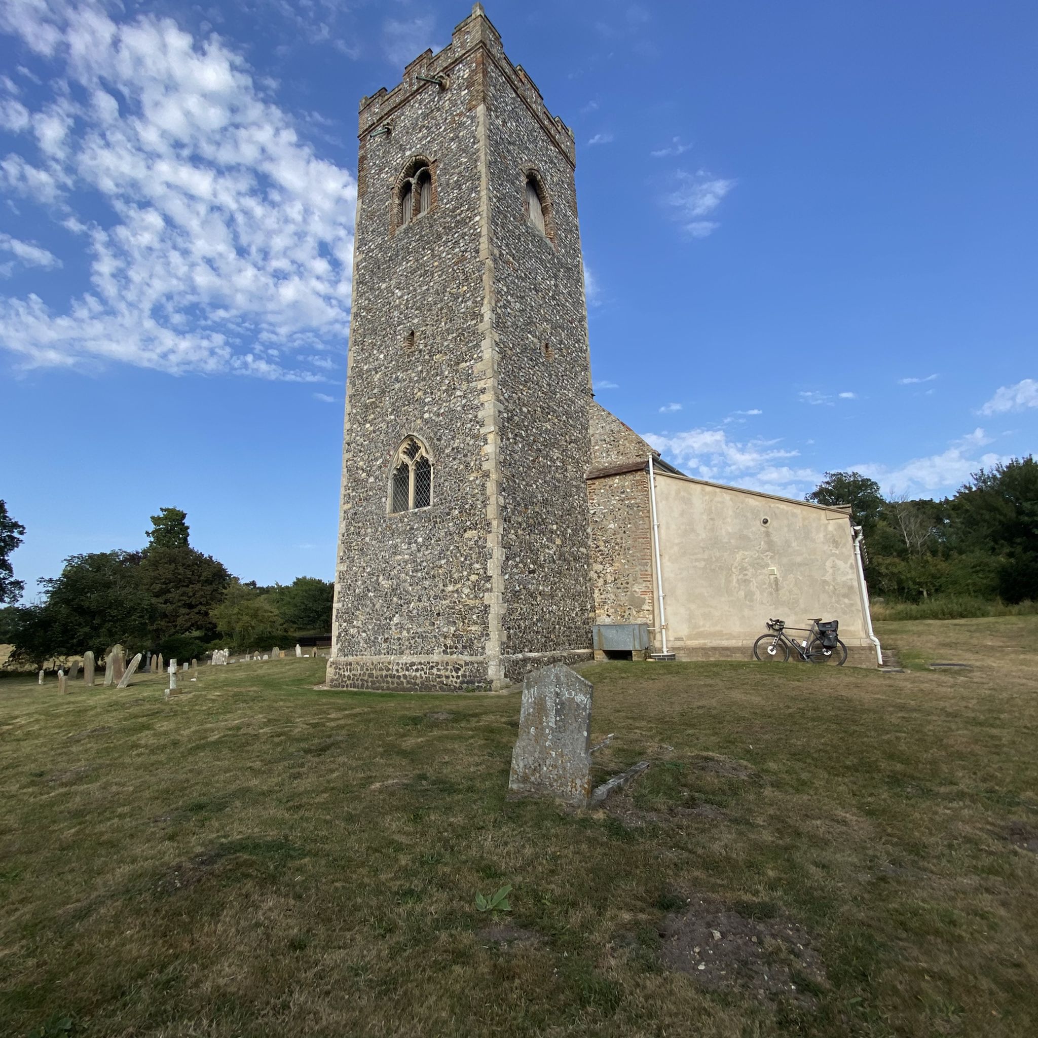
The area is rich in history. You can cycle past the remains of the Venta Icenorum Roman Town, once the capital of the Iceni tribe, which includes Roman walls, a forum, and a basilica. Other historical points of interest include St Edmund's Church in Caistor St Edmund and the historic St Wandregesilius Church in Bixley, which dates back to 1272.
Are there any scenic viewpoints or natural attractions along the cycling routes?
Absolutely. The routes often provide scenic views of the Tas Valley and the River Yare. You might encounter wildflower meadows, especially along paths integrated into longer cycling excursions. For specific natural beauty, consider routes that pass near Whitlingham Great Broad or the RSPB Rockland Marshes Nature Reserve, offering picturesque landscapes.
What do other road cyclists say about the routes in Caistor St Edmund and Bixley?
The road cycling routes in Caistor St Edmund and Bixley are highly rated by the komoot community, with an average score of 4.6 stars from nearly 400 reviews. Cyclists often praise the varied terrain, the blend of natural scenery and historical sites, and the network of mostly paved, quiet country lanes that make for engaging and enjoyable rides.
Can you recommend a popular moderate road cycling route?
A top favorite among local road cyclists is the Brooke Village Ponds – Rockland Staithe loop from Swardeston. This moderate 30.0-mile (48.3 km) path winds through open fields and wooded areas, providing pleasant cycling scenery and a good challenge.
Are there any longer road cycling routes for more experienced riders?
Yes, for those seeking a longer ride, the Venta Icenorum Roman Town – Saxlingham Nethergate Village loop from Norwich is a popular choice. This route covers 36.9 miles (59.4 km) and leads through historical attractions, offering a substantial ride for experienced cyclists.
Where can I find places to stop for refreshments like cafes or pubs along the routes?
While specific cafes and pubs directly on every route are not listed, the region's villages and towns, such as Brooke and Saxlingham Nethergate, often have local establishments. For example, Chestnuts Coffee Shop is a known highlight in the wider area, and many routes pass through or near villages where you can find local amenities.
What is the best time of year for road cycling in Caistor St Edmund and Bixley?
Norfolk generally offers pleasant cycling conditions for much of the year. Spring and summer provide warmer weather and blooming landscapes, while autumn brings beautiful foliage. The gentle terrain means that even in cooler months, many routes remain accessible, though checking local weather conditions is always advisable.
Are there any circular road cycling routes in the area?
Many of the routes in the Caistor St Edmund and Bixley area are designed as loops, offering convenient circular journeys. For instance, the Bishop Bridge – Drayton Lane Cycle Path loop from Stoke Holy Cross is a popular circular route, providing a comprehensive tour of the region's varied landscapes.
What are some notable landmarks or points of interest I might encounter on a ride?
Beyond the Roman Town, you might pass by St Peter's Church, Brooke, a historic religious building. The area also features High Ash Farm, a wildlife haven with wooded and rolling countryside, which can be integrated into longer excursions.
Most popular routes around Caistor St Edmund and Bixley
Most popular attractions around Caistor St Edmund and Bixley

Get inspired with the komoot mobile app


Explore more
Browse the best Road cycling routes in other regions.
