The best cycling routes around Wörnersberg
4.5
(1644)
8,144
riders
413
rides
Touring cycling around Wörnersberg is characterized by routes that navigate the valleys and hills of the northern Black Forest. The landscape features river valleys such as the Nagold and Waldach, alongside forested sections and open areas around reservoirs like the Nagoldtalsperre Erzgrube. Elevations vary, offering a mix of flat valley paths and more challenging climbs through the surrounding terrain.
Best touring cycling routes around Wörnersberg
- The most popular touring cycling route is Zinsbachtal Valley – Nagoldtalsperre Erzgrube loop from Wörnersberg…
Last updated: July 2, 2026
4.2
(24)
91
riders
54.2km
04:03
880m
880m
Hard bike ride. Very good fitness required. Mostly paved surfaces. Suitable for all skill levels.
4.4
(23)
104
riders
32.1km
02:09
420m
420m
Moderate bike ride. Good fitness required. Mostly paved surfaces. Suitable for all skill levels.

Sign up for free
5.0
(2)
21
riders
23.0km
01:45
310m
310m
Hard bike ride. Good fitness required. You may need to push your bike for some segments of this route.
4.5
(2)
19
riders
47.6km
03:17
650m
650m
Hard bike ride. Very good fitness required. Mostly paved surfaces. Suitable for all skill levels.
4.0
(2)
15
riders
21.1km
01:21
240m
240m
Moderate bike ride. Good fitness required. Mostly paved surfaces. Suitable for all skill levels.
Get access to more routes and recommendations from other explorers.
Sign up for free
Already have an account?
Our route recommendations are based on thousands of hikes, rides, and runs completed by other people on komoot.
Start today with a free account
Your next adventure awaits.
Login or Signup

Tips from the Community

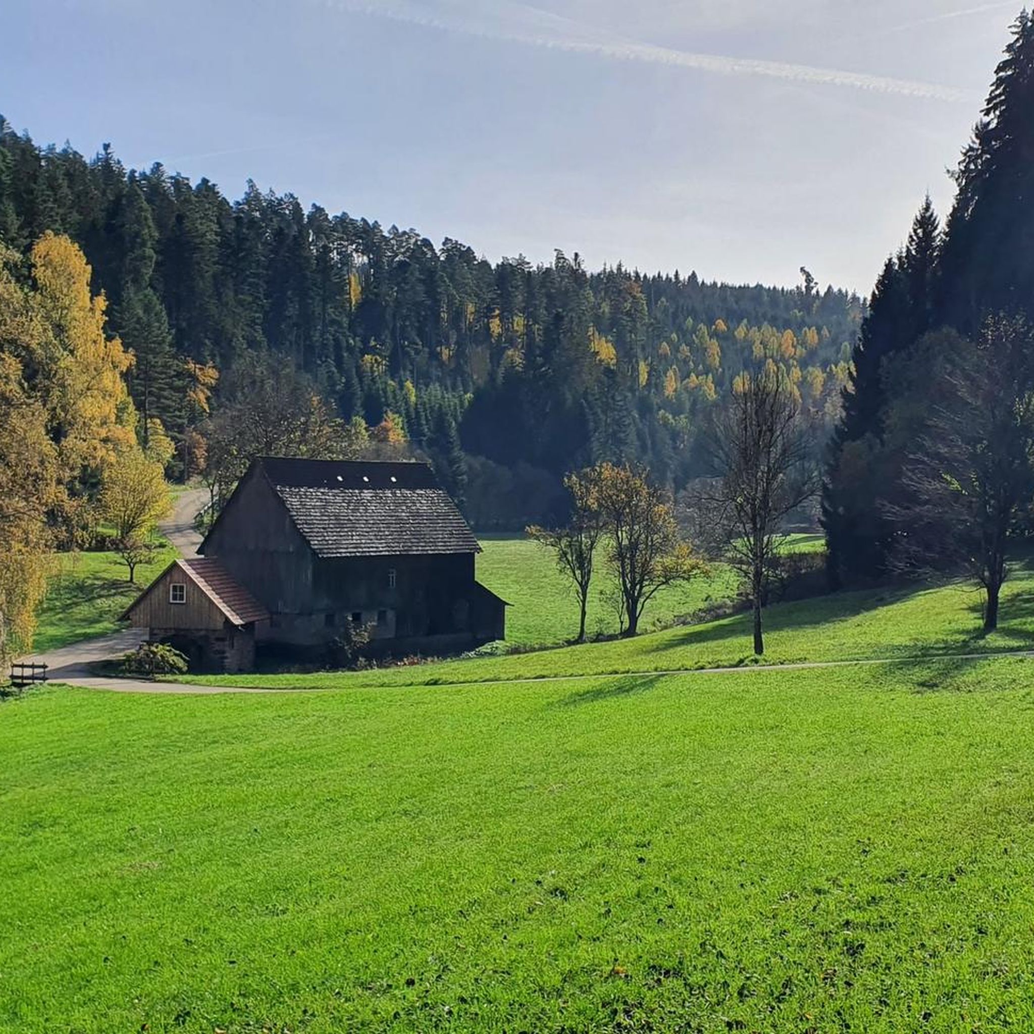
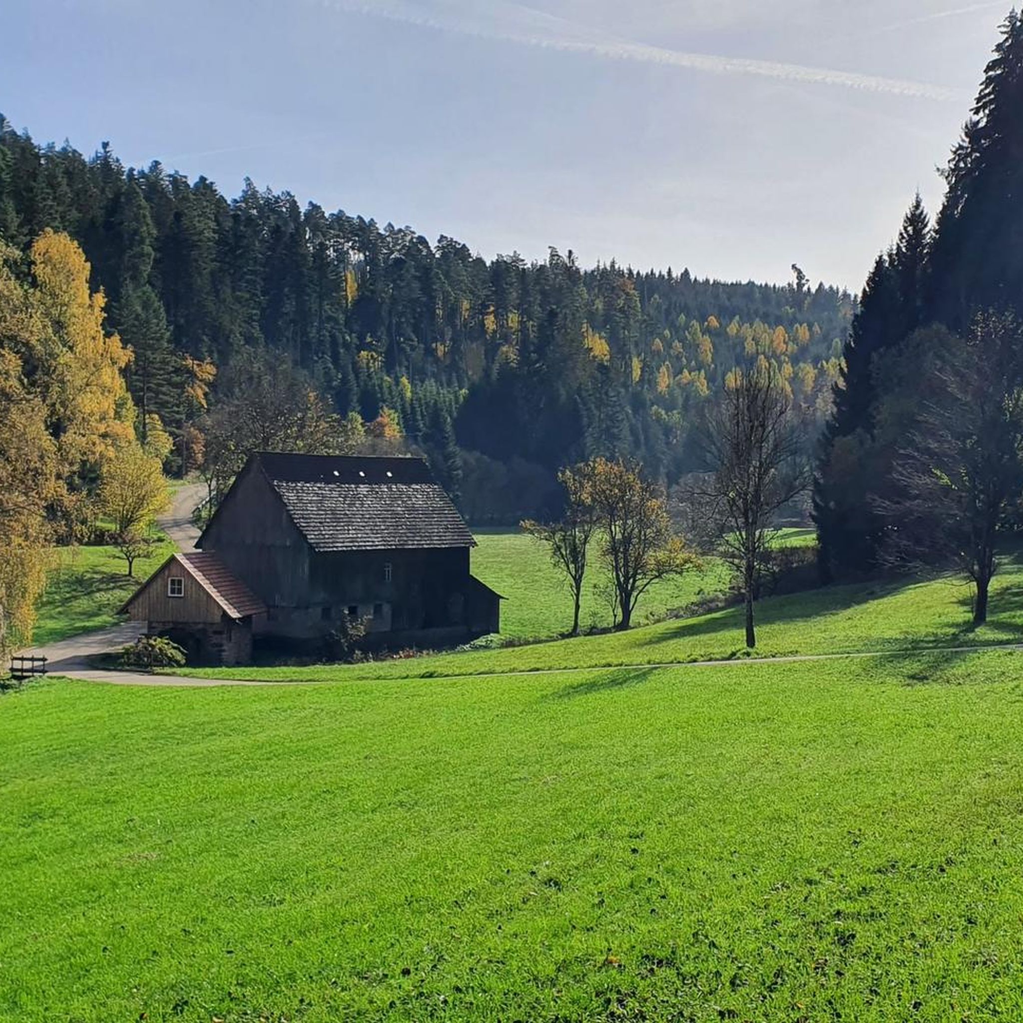
The Kohlsägmühle is already more than 400 years old. It was first mentioned in writing in 1614, located in the Zinsbachtal valley and named after the small stream Kohlbächlein. This date is mentioned in both the Altensteiger Forstlagerbuch and the Dorfbuch of Garrweiler, in whose district the mill stands. From the beginning, it was owned by several forest farmers. Today it belongs to more than 40 co-owners from Garrweiler, Spielberg and Überberg, Grömbach, Wörnersberg and Edelweiler - it is the only mill in the district with such an ownership structure.
2
0

The Augenblickrunde also leads past here. The striking viewpoints are recorded on the board. Unfortunately, the board has become dated in the meantime and should be refurbished. Some seating is available next to it. Behind it is a large memorial stone on which an eagle is enthroned. A plaque commemorates in honor of the named fallen of 1939-1945.
10
0

The Bösinger Wasserhäusle was a pumping station and was used to transport fresh spring water from a source in the Waldach valley via cast iron pipes to the village of Bösingen (a district of the municipality of Pfalzgrafenweiler), located 1.4 km away and 140 meters higher up. The pumps were driven by the water power of the Waldach. A water wheel with a diameter of six meters was used. The facility went into operation in 1894. In 1911, it was supplemented by an 8 hp gasoline engine, which could now also drive the pumps during low water levels in the Waldach. In 1948, it was connected to the power grid via a transformer station, after which a newly installed electric motor could serve as a backup drive. The Bösingen's own water supply was taken out of service in 1991 due to drinking water contamination. The entire facility, including the weir, the power channel, and the pumping station, has been protected as a cultural-historical monument since 2000. The pumping station can be visited all day on the Day of the Open Monument. Source: https://de.wikipedia.org/wiki/B%C3%B6singer_Wasserh%C3%A4usle
0
0
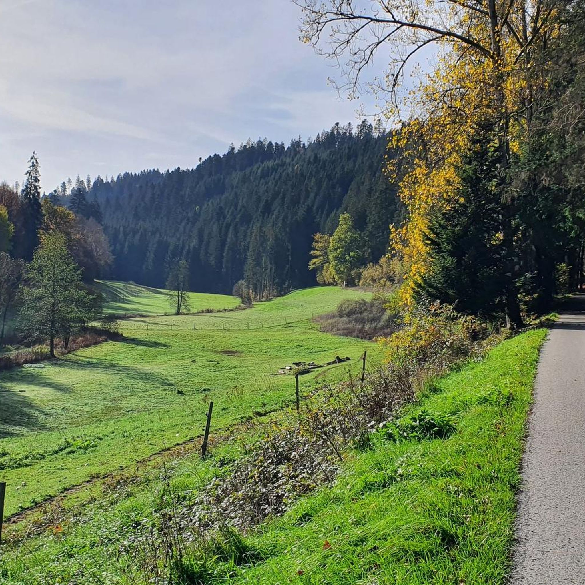
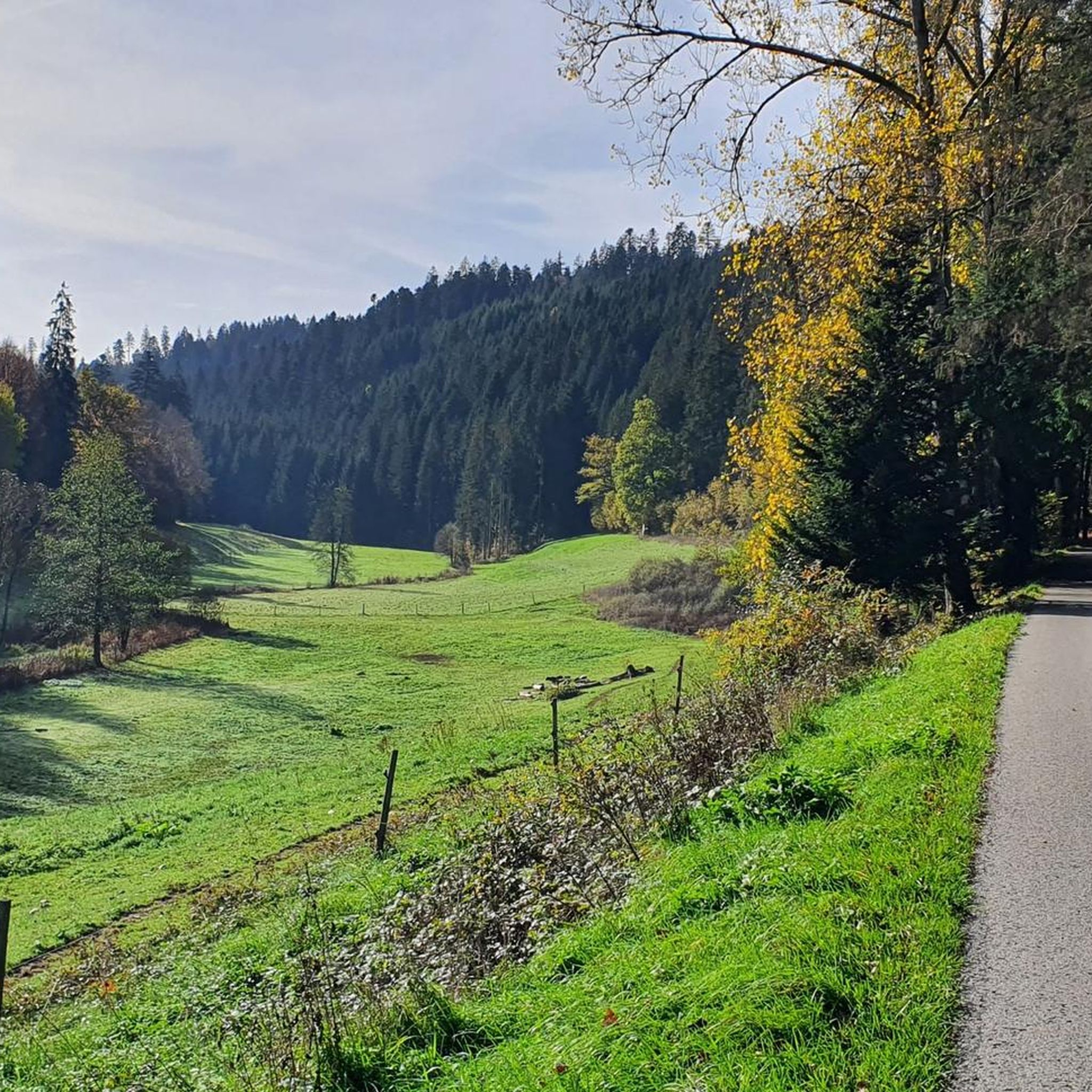
The Waldach is an almost 25 km long river in western Baden-Württemberg in the transition area between the Northern Black Forest and the Gäu, which flows into the river Nagold in the town of Nagold in the district of Calw from the right and south. The Waldach is a small river on the eastern edge of the Northern Black Forest towards the Upper Gäu, which drains a landscape triangle framed by the watercourses of the Upper Nagold to the north, the Upper Neckar to the southeast, and its tributary the Glatt, in a generally northeastern direction, with an approximate arc to the northwest, towards the Nagold. The Waldach originates in the municipality of Waldachtal, named after it, from some small streams. The Schneckenbächle, the official upper course[4], springs from the source furthest from the mouth, about 1.5 km south-southwest of the center of the village of Tumlingen, in the municipality, and at about 635 m above sea level, shortly before a strip of forest where the border with the neighboring municipality of Schopfloch to the southwest runs. The initially northeastern course in a flat, straight valley floor already turns to a north-northwesterly course before the village boundary; in and shortly after Tumlingen, the stream receives two larger left tributaries, the Weiherbach and the Heppersbach, which still originate beyond the border in Schopfloch territory. Here it also enters the Northern Black Forest, characterized by the colorful sandstone, from the natural region of the Upper Gäue, characterized by Muschelkalk in the underground. The Waldach then winds its way through the village of Lützenhardt, the hamlet of Vesperweiler, the village of Cresbach, and the hamlets of Ober- and Unterwaldach of the municipality, now on a northeastern course in a valley deepened by about 80 meters towards the wooded and interspersed with cleared patches marginal heights, above which, shortly before the last hamlet, the Rüdenberg castle ruin stands on a left confluence spur. Afterwards, it enters the municipal area of Pfalzgrafenweiler, whose central namesake settlement lies to the left on the height, and under forest slopes, after the Vörbach ruin, located on another left confluence spur, the narrowing valley floor also fills with forest, where no significant road runs anymore. For the next four and a half kilometers of its northeastern course, above which a viewing tower located to the left above the valley on the site of the Mantelberg ruin offers a view, the following Bösinger Mühle of Pfalzgrafenweiler is the only settlement in the valley, .... Source: https://de.wikipedia.org/wiki/Waldach
1
0

Beautiful view of the castle, which unfortunately cannot be visited.
2
0

Weir on the Waldach, 300-meter-long drive channel, iron, backward-acting water wheel with spur gear transmission, 6 meters in diameter (originally lined with wooden paddles), 3 meters of head in the drive channel, pump output: 3-5 HP depending on water inflow from the drive channel, double-acting plunger pump from Maschinenfabrik Esslingen from the year 1893 with a high-performance suction and delivery pump and pressure vessel. In 1991, the plant was shut down as a private water supply due to contaminated spring water. Depending on the water level of the Waldach, the pumping station managed to pump 160,000 liters of fresh spring water directly into the houses and into the water reservoir in Bösingen, 2.3 km away and 140 meters higher, in 8 to 14 hours. The spring yields 1-2 liters per second depending on the season.
0
0
The Waldach is a river just under 25 km long in western Baden-Württemberg in the transition area between the Northern Black Forest and Gäu. It flows into the town of Nagold in the district of Calw from the right and from the south into the Nagold. The confluence is located at the end of the Nagold knee opposite the Schlossberg with the ruin Hohennagold at less than 400 m above sea level. In total, the Waldach is 24.681 km long and has a catchment area of around 157 km². Its largest tributary is the Steinach, which alone contributes about 53.6 km² to the catchment area.
0
0
Frequently Asked Questions
How many touring cycling routes are available around Wörnersberg?
There are over 420 touring cycling routes in the Wörnersberg area, offering a wide variety of options for different skill levels and preferences.
What kind of terrain can I expect on touring cycling routes near Wörnersberg?
The routes around Wörnersberg navigate the diverse landscape of the northern Black Forest. You'll find paths through river valleys like the Nagold and Waldach, alongside forested sections, and open areas around reservoirs such as the Nagoldtalsperre Erzgrube. Elevations vary, providing both flat valley paths and more challenging climbs.
Are there easy touring cycling routes suitable for beginners in Wörnersberg?
Yes, Wörnersberg offers over 60 easy touring cycling routes. A good option for beginners is the Bridge over the Nagold River – Canal Pathway Near Altensteig loop from Altensteig, which is a shorter, less demanding ride.
Are there any long-distance touring cycling routes in the Wörnersberg area?
Yes, for those seeking longer rides, Wörnersberg has many options. Consider the Nagold Valley Cycle Path – Canal Pathway Near Altensteig loop from Grömbach, which covers over 62 kilometers and explores the Nagold Valley.
What are the best routes for experienced touring cyclists looking for a challenge?
Experienced cyclists can find over 140 difficult routes. A challenging option is the Zinsbachtal Valley – Nagoldtalsperre Erzgrube loop from Wörnersberg, which features significant elevation gain over its 54-kilometer distance.
Are there any circular touring cycling routes around Wörnersberg?
Many routes in the area are loops, allowing you to start and end in the same location. An example is the moderate Erzgrube Lake – Erzgrube Covered Bridge loop from Pfalzgrafenweiler, which circles Erzgrube Lake.
What natural attractions can I see along the touring cycling routes?
The region boasts several natural monuments. You can cycle past the Nagold Reservoir (Erzgrube), the Nagold Reservoir (Nagoldtalsperre), or the serene Waldsee Lützenhardt. The Wellnesswald Sensory Columns, Lützenhardt also offers a unique forest experience.
Are there any huts or shelters along the touring cycling routes for a break?
Yes, there are several huts and cabins in the vicinity that can serve as resting points. Notable ones include the Nördlinger Hut, Paradise Hut, and the Hermann Stottele Hut on Killberg.
What do other touring cyclists say about the routes in Wörnersberg?
The komoot community highly rates the touring cycling routes around Wörnersberg, with an average score of 4.5 stars from over 1000 reviews. Cyclists often praise the varied terrain, from peaceful river valleys to challenging forest climbs, and the well-maintained paths.
What is the best season for touring cycling in Wörnersberg?
The Black Forest region, including Wörnersberg, is generally best for cycling from late spring through early autumn (May to October) when the weather is mild and the trails are dry. During these months, the natural scenery is at its peak, and most facilities are open.
Are there any touring cycling routes that follow river valleys?
Absolutely. The region is defined by its river valleys. The Bösingen Water House – Waldach Cycle Path loop from Wörnersberg is a great example, following the Waldach river, offering a scenic ride through the valley.
Most popular routes around Wörnersberg
Most popular attractions around Wörnersberg

Get inspired with the komoot mobile app


Explore more
Browse the best Cycling routes in other regions.
