The best walks and hikes around Lower Kinnerton
4.3
(384)
5,708
hikers
210
hikes
Hiking around Lower Kinnerton offers access to a rural and agricultural landscape characterized by hedgerows and open fields. The area is situated on elevated land, historically overlooking the River Dee estuary, with land dropping towards the flatlands of Saltney and marshy fields near Pulford Brook. Numerous marl pits are present in the surrounding fields, indicating a historical natural feature. This setting provides a tranquil environment for walks, with views extending towards the Clwydian Range.
Best hiking trails around Lower Kinnerton
…Last updated: June 25, 2026
4.8
(5)
44
hikers
7.44km
02:01
100m
100m
Moderate hike. Good fitness required. Easily-accessible paths. Suitable for all skill levels.
5.0
(1)
45
hikers
Easy hike. Great for any fitness level. Easily-accessible paths. Suitable for all skill levels.

Sign up for free
5.0
(7)
34
hikers
10.4km
02:39
30m
30m
Moderate hike. Good fitness required. Easily-accessible paths. Suitable for all skill levels.
5.0
(1)
38
hikers
3.91km
01:04
60m
50m
Easy hike. Great for any fitness level. Easily-accessible paths. Suitable for all skill levels.
5.0
(1)
14
hikers
7.48km
02:02
100m
100m
Moderate hike. Good fitness required. Easily-accessible paths. Suitable for all skill levels.
Get access to more routes and recommendations from other explorers.
Sign up for free
Already have an account?
Our route recommendations are based on thousands of hikes, rides, and runs completed by other people on komoot.
Start today with a free account
Your next adventure awaits.
Login or Signup
Tips from the Community

good pathetic to ride or walk ! beware its closed on Race days 🐴
0
0

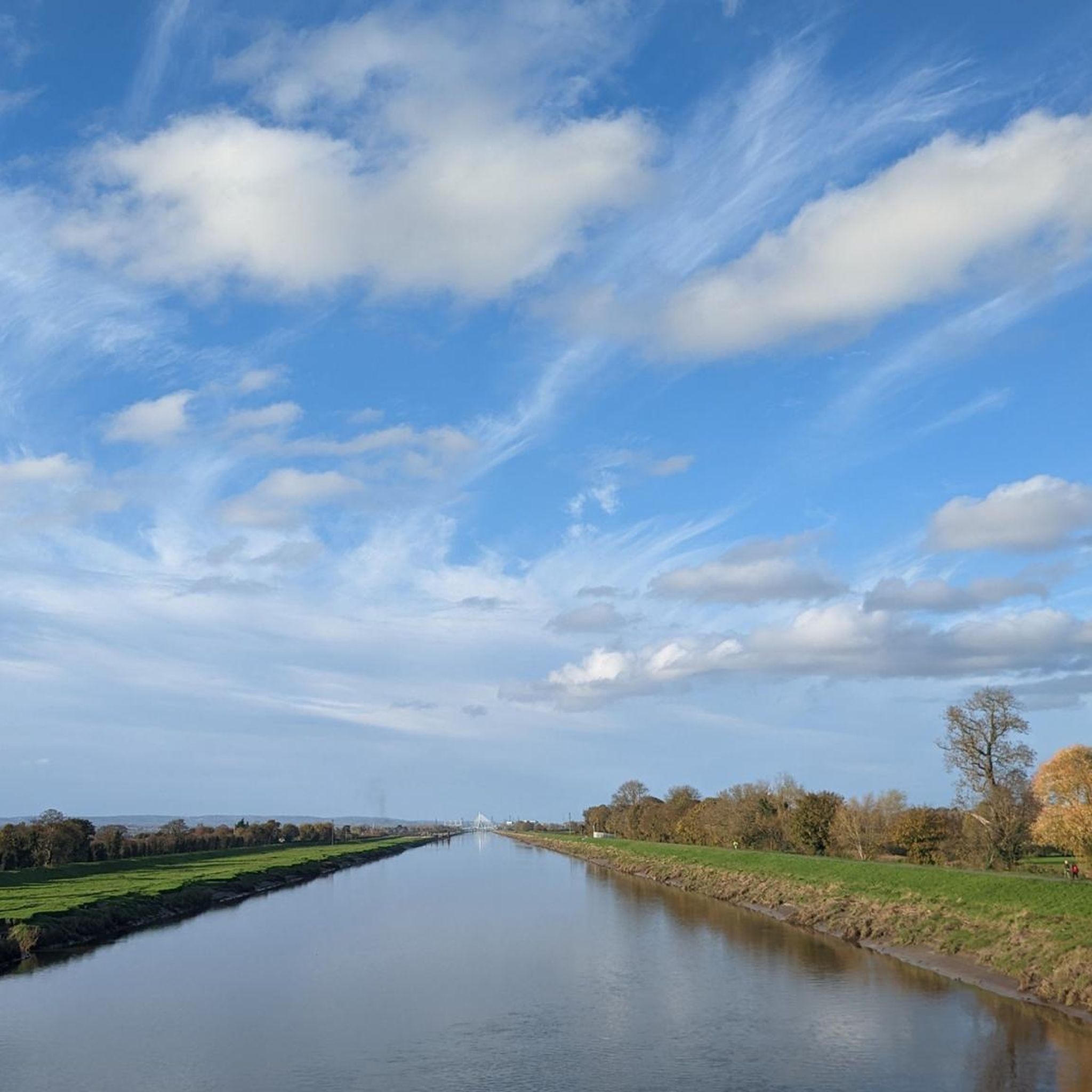
The view from the bridge gives a great perspective of the 'canalisation' of the River Dee - a straight 5 mile section of the river. In the distance you can just make out the Queensferry and Flintshire Bridges. "The Saltney Ferry Footbridge in Flintshire was built in 1968 to replace a ferry that crossed the River Dee. The ferry service had been operating since 1790 and was run by the Manifold family. Ferry service history The ferry service began in 1790 and was run by the Manifold family The ferry service was a 12-seat service that operated from 5 AM–9 PM The ferry carried babies, coffins, and was used for chain-making and sea-going industries The ferry service ended around 1966 Footbridge construction The footbridge is a four span reinforced concrete structure The bridge is approximately 100m long and 2.14m wide The bridge was built with a removable central section to allow boats with tall masts to navigate upstream The bridge is suitable for pedestrians and cyclists River Dee The River Dee has been designated a Site of Special Scientific Interest (SSSI) and a Special Area of Conservation (SAC)." Various sources; AI Summary https://www.bbc.co.uk/news/uk-wales-north-east-wales-30532480 https://www.jenningsbce.co.uk/saltney-ferry-foot-bridge/ https://sealandcommunitycouncil.co.uk/about/local-history/
1
0
The section of public footpath and cycling route is closed to the public during race meetings (see pic). Worth checking the racecourse website before setting out for a walk along this route. https://www.chester-races.com/
0
0

Good views onto the Chester Racecourse from NCN 568. The racecourse, known as Roodee, is the oldest racecourse still in operation.
0
0

A walk round the city walls is a worthwhile experience, giving not only good views of the centre of town, but also a number of other sights including the river, the castle and the racecourse
2
0

If busy with pedestrians best to walk across instead of ride
2
0
A lovely old race track. When I was there on my bike your are allowed to use the race track to walk your dog 🐕
4
0
Established in 1539, Chester is the oldest racecourse still in operation in the world. The racecourse has consistently been awarded the Gold Standard Award by the Racehorse Owners Association (ROA) since the award’s inception and was awarded the prestigious title of Large Racecourse of the Year, when the award was launched in 2015 and again in 2018 and 2019. There is a good cycle path around the racecourse, and when there are no races, you can walk around and take your dog on there.
7
0
Frequently Asked Questions
How many hiking trails are available around Lower Kinnerton?
There are over 200 hiking trails around Lower Kinnerton, offering a wide variety of options for different skill levels. The komoot community has explored these routes over 5000 times.
Are there easy hiking routes suitable for beginners or families?
Yes, Lower Kinnerton offers many easy hiking routes. Out of the over 200 trails, 136 are classified as easy. A good option for a gentle stroll is the Hawarden Park loop from Buckley, which is 2.5 miles (4.1 km) and takes about an hour to complete.
What kind of landscapes can I expect to see while hiking near Lower Kinnerton?
You'll experience a charming rural and agricultural landscape, characterized by hedgerows and open fields. The area is situated on elevated land, historically overlooking the River Dee estuary, with views extending towards the Clwydian Range. You might also spot historical marl pits in the surrounding fields.
Are there any circular hiking routes in the area?
Yes, many routes around Lower Kinnerton are circular. For example, the Hawarden Park – Footbridge Across the A55 loop from Hawarden Castle is a popular 4.4-mile (7.1 km) circular trail offering varied terrain within Hawarden Park.
What attractions or landmarks can I see along the trails?
While hiking, you can explore several interesting points. The historic city of Chester is nearby, offering walks along the city walls and views of the River Dee Riverside Trail. You can also find the Chester Greenway, a traffic-free path, and historic structures like the Eastgate Clock and Old Dee Bridge Weir.
Is Lower Kinnerton a good place for dog-friendly walks?
The rural and agricultural setting of Lower Kinnerton generally offers many opportunities for dog-friendly walks, particularly on public footpaths and bridleways. Always ensure dogs are kept under control, especially near livestock, and check local signage for any restrictions.
What do other hikers enjoy most about the trails in Lower Kinnerton?
The trails in Lower Kinnerton are highly rated by the komoot community, with an average score of 4.3 stars from over 300 reviews. Hikers often praise the tranquil rural environment, the varied terrain, and the accessibility of routes like those in Hawarden Park.
Are there any moderate hiking options for those looking for more of a challenge?
Yes, there are 74 moderate trails available. A good example is the Chester Castle – Watergate loop from Saltney, a 6.7-mile (10.8 km) trail that leads through historic Chester and along the River Dee, typically taking about 2 hours 44 minutes.
What is the best time of year to go hiking in Lower Kinnerton?
Lower Kinnerton offers pleasant hiking opportunities throughout the year. Spring and summer provide lush green landscapes, while autumn brings vibrant colors. Be aware that some sections, particularly on unpaved paths or railway embankments, can become muddy after rain, so appropriate footwear is recommended, especially in wetter seasons.
Is there public transport access to trailheads near Lower Kinnerton?
While Lower Kinnerton itself is a rural village, its proximity to Chester means that some trailheads, particularly those along the River Dee or the Millennium Greenway, might be accessible via public transport connections to Chester. For specific routes, it's advisable to check local bus services or plan transport to nearby towns like Chester or Hawarden.
Where can I find parking for hiking trails in Lower Kinnerton?
As Lower Kinnerton is a rural area, parking is generally available in designated village car parks or on-street where permitted. For trails starting in nearby areas like Hawarden Park or Chester, specific car parks are usually provided. Always check local signage for parking regulations.
Can I combine hiking with exploring historical sites?
Absolutely. The nearby city of Chester offers a unique opportunity to combine hiking with historical exploration. You can walk along the ancient Chester City Walls, which provide views of the city's historic center, Chester Castle, and the River Dee, after enjoying a rural hike around Lower Kinnerton.
Most popular attractions around Lower Kinnerton

Get inspired with the komoot mobile app


Explore more
Browse the best Hikes in other regions.
