The best cycling routes around Tottington
4.4
(46)
278
riders
54
rides
Touring cycling routes around Tottington are set within a rural landscape north of Bury, bordering the West Pennine Moors. This area features diverse terrain, including rugged moorland and hilly sections, alongside more gentle paths. Natural features like Redisher Woods and Two Brooks Valley provide scenic green spaces. The region also benefits from converted railway lines such as the Kirklees Trail, offering accessible and relatively flat cycling experiences.
Best touring cycling routes around Tottington
- The most popular touring cycling route is Kirklees Trail to Bury, an 8.0 miles (12.9 km) trail that takes about 1 hour 15 minutes to complete. This route follows a converted railway line, offering a largely flat and accessible path through farmland.
- Another top favourite among local touring cyclists is West Pennine Moors Loop from Tottington, a moderate 18.0 miles (29.0 km) path. This route explores the upland moorland and offers varied terrain with some challenging ascents.
- Local touring cyclists also love the Redisher Woods and Two Brooks Valley Path, a 6.5 miles (10.5 km) trail leading through woodlands and scenic valleys, often completed in about 1 hour.
- Touring cycling around Tottington is defined by its rural landscapes, proximity to the West Pennine Moors, and accessible converted railway lines. The network offers options for different ability levels, from easy, mostly paved routes to more challenging rides with significant elevation.
- The routes in Tottington are highly rated by the komoot community with an average score of 4.47 stars from over 40 reviews. More than 290 touring cyclists have used komoot to explore Tottington's varied terrain.
Last updated: October 18, 2026
4.7
(3)
9
riders
23.0km
01:21
110m
110m
Easy bike ride. Great for any fitness level. Mostly paved surfaces. Suitable for all skill levels.
4.0
(1)
3
riders
31.7km
01:50
110m
110m
Easy bike ride. Great for any fitness level. Mostly paved surfaces. Suitable for all skill levels.

6
riders
51.4km
03:35
240m
240m
Moderate bike ride. Good fitness required. Mostly paved surfaces. Suitable for all skill levels.
5.0
(1)
4
riders
38.6km
02:23
160m
160m
Moderate bike ride. Good fitness required. Mostly paved surfaces. Suitable for all skill levels.
3
riders
56.0km
03:20
210m
210m
Moderate bike ride. Good fitness required. Mostly paved surfaces. Suitable for all skill levels.
Get access to more routes and recommendations from other explorers.
Already have an account?
Our route recommendations are based on thousands of hikes, rides, and runs completed by other people on komoot.
Start today with a free account
Your next adventure awaits.
Other adventures around Tottington

Tips from the Community

Take time to go off the trail to the bird hides and vantage points around the water. The route is best in spring before the nettles take over the path in summer!
0
0


Great addition to the trail and godd markers for a break along it
0
0

Starting from the forestry commision car park, hed over the bridge and turn right. This will give you several options for forestry trails and if you head towards Lynford you can then pop on to the road for a short trip to Browns cafe.
0
0

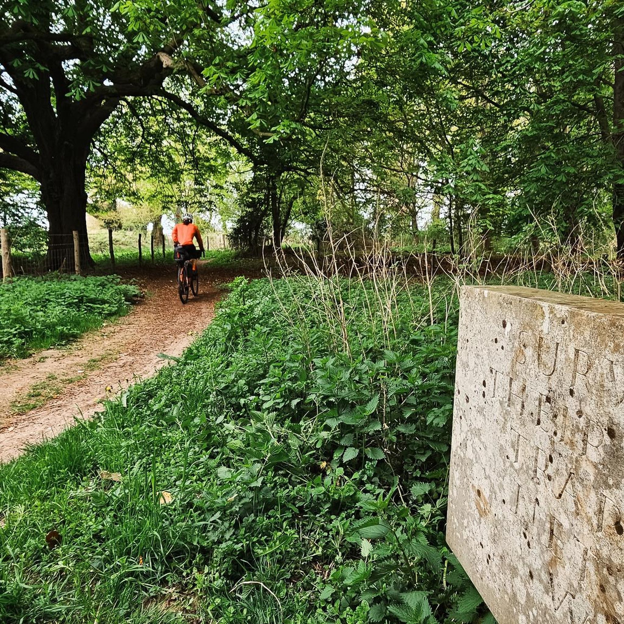
The inscription is a bit faded now, but reads: The footprint of our ancestors Familiar as our own faces Remote as fossils Written on clay And washed away Over & over Over and over For more info about the Songline see: https://www.luphen.org.uk/walks/peddars_way/norfolk_songline.htm
0
0

The Stanton Downham Bridge was built during the first world war as a rail bridge to transport timber and logging machines. It's been a road bridge since about 1922. The bridge crosses the Little Ouse River.
0
0
Frequently Asked Questions
How many touring cycling routes are available around Tottington?
There are over 60 touring cycling routes around Tottington, offering a wide range of options for different skill levels and preferences. The komoot community has explored these routes over 290 times.
What kind of terrain can I expect on touring cycling routes in Tottington?
Tottington's touring cycling routes feature diverse terrain. You'll find everything from rugged moorland and hilly sections, especially towards the West Pennine Moors, to more gentle, accessible paths like converted railway lines. The area north of Bury becomes increasingly rural, providing a quieter setting.
Are there any easy touring cycling routes suitable for beginners or families?
Yes, Tottington offers several easy touring cycling routes. The Kirklees Trail to Bury is a great option, following a converted railway line that is largely flat and accessible through farmland. Another easy route is Penny's Cafe – NCN Route 13 loop from Watton, which is just under 23 km with minimal elevation gain.
Where can I find more challenging touring cycling routes in the area?
For those seeking a challenge, the area's proximity to the West Pennine Moors provides more demanding routes. The West Pennine Moors Loop from Tottington is a moderate 29 km path that explores upland moorland with varied terrain and some challenging ascents. You can also find routes with significant elevation, such as the Thompson Water – Norfolk Songline Stone 2 loop from Hockham, which covers over 51 km with nearly 240m of elevation.
Are there any circular touring cycling routes around Tottington?
Many touring cycling routes in Tottington are designed as loops, allowing you to start and finish at the same point. For example, the Merton Air Raid Shelter – Thatched Cottage loop from Watton is a 31.7 km easy circular route. Another option is the Forest Picnic Spot – Merton Air Raid Shelter loop from Hockham, a moderate 56 km loop.
What natural attractions can I see along the touring cycling routes?
The routes often pass through scenic natural areas. You can explore woodlands and valleys on the Redisher Woods and Two Brooks Valley Path. The region also features several beautiful lakes and natural spots like Thompson Water, Pingo Pond on the Pingo Trail, and Thompson Common Pingos and Ponds.
Are there any historical landmarks or points of interest to visit while cycling?
Yes, beyond the natural beauty, you can encounter interesting landmarks. The Santon Downham Bridge – Little Ouse Bridge loop from Hockham passes by the Santon Downham Bridge. Other notable points of interest in the wider area include the Desert Rats Memorial and Norfolk Songline Stone 1.
What do other touring cyclists enjoy most about the routes in Tottington?
The touring cycling routes in Tottington are highly rated by the komoot community, with an average score of 4.47 stars from over 40 reviews. Cyclists often praise the varied terrain, from quiet rural paths to challenging moorland sections, and the accessibility of converted railway lines like the Kirklees Trail.
Is public transport available to access the cycling routes?
Tottington is located north of Bury, which has public transport links. While specific routes may require a short ride or walk from public transport stops, the Kirklees Trail, for instance, runs towards Bury town centre, making it relatively accessible for those using public transport to reach the area.
What is the best time of year for touring cycling in Tottington?
The rural landscape and moorland areas of Tottington are enjoyable throughout the warmer months, from spring to autumn, when the weather is generally milder and the natural scenery is at its best. During winter, some of the more exposed moorland routes might be challenging due to weather conditions.
Are there any cafes or places to stop for refreshments along the routes?
While specific cafes directly on every route are not detailed, the area around Tottington and nearby villages like Greenmount offer local amenities. Planning your route to pass through these villages can provide opportunities for refreshments and breaks.
Most popular attractions around Tottington

Get inspired with the komoot mobile app


Explore more
Browse the best Cycling routes in other regions.
