The best cycling routes around La Louvière
4.2
(267)
1,223
riders
66
rides
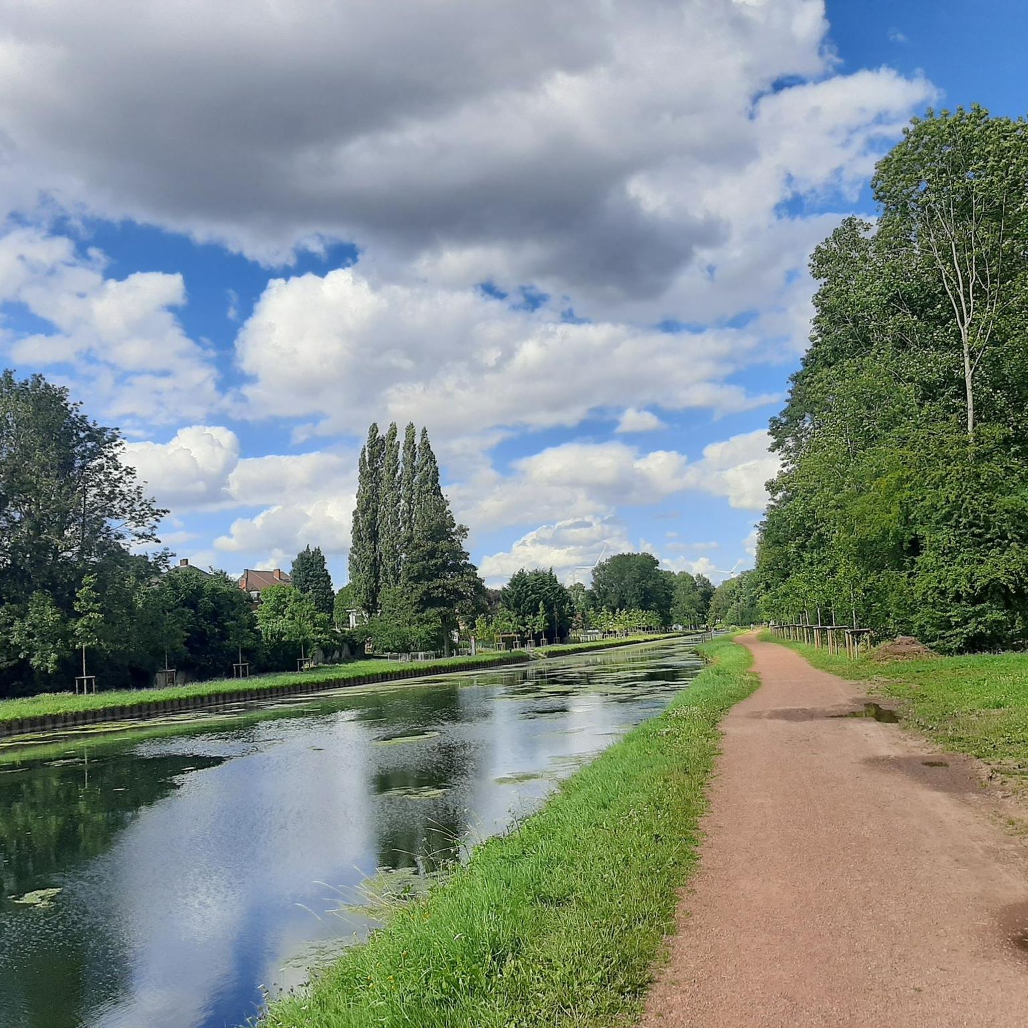
Touring cycling routes around La Louvière are primarily defined by the region's extensive canal networks and industrial heritage. The landscape features numerous scenic towpaths along waterways like the Canal du Centre and the Brussels-Charleroi Canal. Green spaces, including parks and transformed mining slag heaps (terrils), offer varied terrain and elevated perspectives. The area's relatively mild topography makes it accessible for a range of cycling abilities.
Best touring cycling routes around La Louvière
- The most popular touring cycling route is Strépy-Thieu…
Last updated: October 7, 2026
4.7
(93)
322
riders
Moderate bike ride. Good fitness required. Mostly paved surfaces. Suitable for all skill levels.
4.6
(56)
246
riders
Easy bike ride. Great for any fitness level. Mostly paved surfaces. Suitable for all skill levels.

4.6
(13)
76
riders
22.7km
01:26
120m
120m
Easy bike ride. Great for any fitness level. Mostly paved surfaces. Suitable for all skill levels.
3.5
(11)
37
riders
41.1km
02:32
360m
350m
Hard bike ride. Good fitness required. You may need to push your bike for some segments of this route.
4.3
(6)
38
riders
142km
08:44
680m
680m
Hard bike ride. Very good fitness required. Mostly paved surfaces. Suitable for all skill levels.
Get access to more routes and recommendations from other explorers.
Already have an account?
Our route recommendations are based on thousands of hikes, rides, and runs completed by other people on komoot.
Start today with a free account
Your next adventure awaits.

Other adventures around La Louvière

Tips from the Community


Caution. There was a lot of glass spread across the entire width of the cycle path. As the cycle path itself is also in a pretty bad condition, you have to be extremely careful. In built-up areas, it ends abruptly and you have to cross very busy roads.
0
0

The path is once again passable along its entire length from Ronquières to Ecaussinnes with a beautiful tarmac strip.
0
0

At the marina club, you can enjoy a drink and a small snack, spaghetti, croque monsieur, and more. There's a very pleasant terrace overlooking the canal and the passing boats. Order at the bar with Koen, the owner. Payment can be made in cash or by card.
0
0

The Ronquières inclined plane is a unique boat lift. Built in 1968, it allows barges to overcome a drop of nearly 70 meters thanks to a system of sliding trays. The structure can be observed from the cycle path along the canal.
0
0

Cycle paths along the canals in Belgium are usually nice to ride on, provided the surface is right.
1
0

Here we find ourselves at a modern technical structure of almost unimaginable dimensions. This enormous facility – like probably every project of this magnitude – has two aspects: Some may be in awe of the engineering that made it possible to plan and build this gigantic structure at the end of the 20th century. Others may be more concerned with the enormous intervention in nature that was necessary to realize the project and may doubt its usefulness. However, such a conflict of interest is by no means only a sign of the times, for the monumental – some might prefer the term monstrous – structure is the modern descendant of a series of significantly smaller ship lifts that were built in earlier times – and have now even been recognized as a UNESCO World Heritage Site as an industrial monument. Both the old facility and its modern successor are presented in a 15-minute feature (in German) in the series "Treasures of the World - Heritage of Humanity." If you are interested, see =>> https://www.ardmediathek.de/video/schaetze-der-welt/canal-du-centre-die-vier-schiffshebewerke-des-canal-du-centre-belgien-folge-375/3sat/Y3JpZDovL3N3ci5kZS82NjEwNTUy
0
0

The Ronquières inclined plane is an exceptional work of art
0
0
Frequently Asked Questions
How many touring cycling routes are available in La Louvière?
There are over 90 touring cycling routes around La Louvière, offering a diverse range of experiences. These include 33 easy routes, 48 moderate routes, and 9 more challenging options.
What is the best time of year for touring cycling in La Louvière?
La Louvière experiences a temperate oceanic climate. Spring and autumn are particularly appealing for touring cycling, offering mild weather ideal for exploring the canal networks and industrial heritage sites.
Are there any easy touring cycling routes suitable for beginners or families?
Yes, La Louvière offers 33 easy touring cycling routes. An excellent option for a relaxed ride is the Strépy‑Thieu Boat Lift loop from Besonrieux, which is 21.3 km long and provides close-up views of the modern boat lift. Another easy route is the Historic Lift No. 3 loop from La Louvière-Centre, covering 20.6 km through the historic Canal du Centre area.
What kind of landscapes can I expect to see while cycling in La Louvière?
The landscape is primarily defined by its intricate canal systems, featuring scenic towpaths along waterways like the Canal du Centre and the Brussels-Charleroi Canal. You'll also encounter green spaces, including parks like the Mayeur Garden, and transformed mining slag heaps (terrils) such as Pétria Spoil Tip No. 1, which offer unique elevated perspectives.
What historical or industrial attractions can I visit along the cycling routes?
La Louvière is rich in industrial heritage, including UNESCO World Heritage sites. You can cycle along the historic Canal du Centre to see the century-old hydraulic boat lifts, or visit the modern Strépy-Thieu Boat Lift, one of the tallest in the world. The region also features the Ronquières Inclined Plane and the Bois-du-Luc Mining Site, offering insights into the area's past.
Are there any circular touring cycling routes in La Louvière?
Yes, many routes in La Louvière are designed as loops, allowing you to start and end in the same location. Examples include the Strépy-Thieu boat lift loop from La Louvière-Centre (48.8 km) and the Strépy-Thieu Boat Lift loop from Besonrieux (21.3 km).
What do other touring cyclists enjoy most about cycling in La Louvière?
The area is highly rated by the komoot community, with an average score of 4.2 stars from over 300 reviews. Cyclists often praise the well-maintained towpaths along the canals, the unique blend of industrial heritage and natural beauty, and the accessibility of routes for various skill levels.
Are there any challenging touring cycling routes for experienced riders?
Yes, for experienced riders seeking more elevation gain, there are 9 difficult routes available. One such route is the Historic Lift No. 3 – Binche City Walls loop from Strépy-Bracquegnies, which covers 41.1 km with significant ascents.
Can I find viewpoints or scenic spots along the routes?
Absolutely. The transformed mining slag heaps, known as terrils, offer elevated perspectives. For instance, you can find a notable View from the Terril de l'Héribus. The canal towpaths themselves also provide picturesque views of the waterways and surrounding meadows.
Are there any castles or historical monuments to see near the cycling paths?
Yes, the region around La Louvière features several historic castles. You can explore sites like Écaussinnes-Lalaing Castle, Feluy Castle, or Château de Seneffe and Gardens, many of which are accessible via routes that incorporate the region's cultural treasures.
Are there any natural monuments or unique natural features to discover?
Beyond the canals, you can discover unique natural features. The Hyon Waterfall and Ponds offer a tranquil spot, and the region also has the intriguing The Neolithic Menhir, a prehistoric standing stone.
How can I access the cycling routes using public transport?
La Louvière-Centre is a central point with public transport connections, making it a convenient starting point for many routes. For example, the Strépy-Thieu boat lift loop from La Louvière-Centre begins directly from the city center, which is well-served by local transport.
Most popular routes around La Louvière
Most popular attractions around La Louvière

Get inspired with the komoot mobile app


Explore more
Browse the best Cycling routes in other regions.
