The best walks and hikes around Vaalermoor
4.6
(1343)
5,459
hikers
491
hikes
Hiking around Vaalermoor offers access to a distinctive moorland ecosystem, characterized by the expansive Vaaler Moor and Herrenmoor Fauna-Flora-Habitat area. The terrain includes typical raised bog areas, grasslands on moor soil, and birch forests, with parts lying 3.5 meters below sea level, making it one of Germany's deepest terrestrial points. Renaturation efforts are ongoing to preserve these unique hydrological conditions and the rich biodiversity. This low-lying landscape provides varied environments for exploration.
Best hiking trails around Vaalermoor
- The most popular…
Last updated: August 22, 2026
4.8
(31)
84
hikers
Moderate hike. Good fitness required. Easily-accessible paths. Suitable for all skill levels.
4.7
(15)
36
hikers
Moderate hike. Good fitness required. Easily-accessible paths. Suitable for all skill levels.

Sign up for free
5.0
(8)
20
hikers
Moderate hike. Good fitness required. Easily-accessible paths. Suitable for all skill levels.
4.7
(3)
7
hikers
Moderate hike. Good fitness required. Easily-accessible paths. Suitable for all skill levels.
5.0
(3)
11
hikers
5.87km
01:30
20m
20m
Easy hike. Great for any fitness level. Easily-accessible paths. Suitable for all skill levels.
Get access to more routes and recommendations from other explorers.
Sign up for free
Already have an account?
Our route recommendations are based on thousands of hikes, rides, and runs completed by other people on komoot.
Start today with a free account
Your next adventure awaits.
Login or Signup
Tips from the Community

The Old Harbor of Burg looks back on a long history. It was once an important transshipment point for shipping in Dithmarschen and shaped life in the town for many decades. Today, the calm lake is reminiscent of the time of sailors and boatmen and makes the past of the place still palpable.
1
0
The Herthateich pond is the ideal place to experience Burg's unusual topography (forest and hills in the heart of Dithmarschen). It combines nature (orchard), culture (open-air stage), and history (Bökelnburg Castle) in a very small area. The Herthateich is located in the center of the health resort of Burg. The area is characterized by a strong contrast to the otherwise rather flat marsh landscape of Dithmarschen. Because Burg lies on the geest (a ridge), the area around the pond is hilly and wooded, giving it an almost fairytale-like, sheltered atmosphere.
0
0
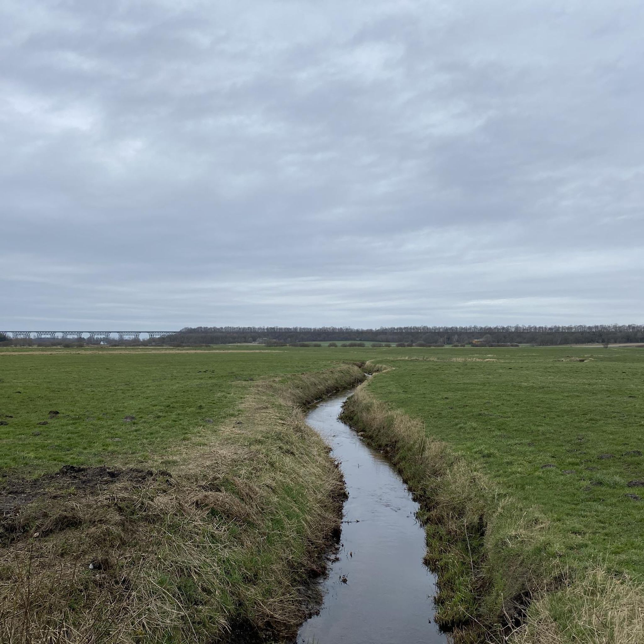
This massive viaduct was built in 1920 for the Marsh Railway and, with a length of 210 meters and a height of up to 26 meters, is one of the largest bridge structures in all of Schleswig-Holstein. The viaduct is still in regular use today by the railway line, which connects Kiel and Hamburg, among other cities.
0
0

There is now a new shelter near Nutteln
1
0

You should see this impressive piece of steel construction at least once and watch the many trains as they pass over the high bridge like on a toy train!
2
0


impressive building, a steel colossus
0
0
Frequently Asked Questions
What kind of hiking trails can I find in Vaalermoor?
Vaalermoor offers a diverse range of hiking trails, primarily through its unique moorland ecosystem. You'll encounter typical raised bog areas, grasslands on moor soil, birch forests, and reed beds. The landscape is generally low-lying, with some areas even below sea level, providing a distinct natural experience. There are over 490 routes available, catering to various difficulty levels.
Are there easy hiking options suitable for beginners or casual walkers?
Yes, Vaalermoor has plenty of easy hiking options. Over 310 of the available routes are classified as easy. For example, the Carpool bench loop from Vaale is an easy 5.9 km trail, and the View of Herrenmoor bei Kleve loop from Kleve is another accessible 6.4 km option.
What are some notable natural features or landmarks to see while hiking in Vaalermoor?
The region is rich in natural features. You can explore the expansive Vaaler Moor and Herrenmoor, which is a significant Fauna-Flora-Habitat area. A unique highlight is the Lowest Point in Germany, located within the moor, which is 3.5 meters below sea level. Other natural attractions include the Herrenmoor Nature Reserve near Kleve and several clay pit lakes like Muldsberg Clay Pit Lake and Edendorf Clay Pit.
Can I bring my dog on the hiking trails in Vaalermoor?
Generally, dogs are welcome on most hiking trails in Vaalermoor. However, as much of the area includes sensitive moorland ecosystems and nature reserves like the Vaaler Moor and Herrenmoor FFH area, it's crucial to keep dogs on a leash to protect local wildlife and flora. Always check local signage for specific restrictions, especially in designated conservation zones.
Are there any circular hiking routes available?
Yes, many of the trails in Vaalermoor are designed as circular routes, allowing you to start and end at the same point. For instance, the popular View of Herrenmoor bei Kleve – Beech Tree in the Pine Forest loop from Nutteln is a moderate 10.2 km circular path that showcases diverse natural features.
What is the best time of year to go hiking in Vaalermoor?
The best time to hike in Vaalermoor is typically during spring, summer, and early autumn. These seasons offer pleasant weather for exploring the moorland, and you'll have the best chance to observe the diverse flora and fauna, including moor lilies, sundew, and various bird species. Winter can also be an option for those who enjoy crisp, quiet walks, but some paths might be wet or muddy.
What kind of wildlife and plants might I see in Vaalermoor?
Vaalermoor's unique moorland environment supports a rich array of life. You might spot typical raised bog species such as moor lilies, sundew, cotton grass, and various sphagnum mosses. The area is also home to protected species like moor frogs, adders, and grass snakes. Birdwatchers can look out for meadow pipits, yellow wagtails, snipes, cranes, and even the rare short-eared owl.
Are there any challenging hikes for experienced trekkers?
While Vaalermoor is known for its low-lying and generally accessible terrain, there are some routes classified as difficult for those seeking more of a challenge. There are 19 difficult routes available, which might involve longer distances or more varied ground conditions within the moorland landscape. Always check the route details for elevation and terrain specifics.
What do other hikers say about the trails in Vaalermoor?
The hiking trails in Vaalermoor are highly regarded by the komoot community, with an average rating of 4.6 stars from over 1200 reviews. Hikers often praise the unique moorland scenery, the tranquility of the natural environment, and the well-maintained paths that allow for immersive nature observation.
Is public transport available to reach hiking trailheads in Vaalermoor?
Information regarding specific public transport connections directly to all trailheads is limited. It is advisable to check local bus schedules or regional transport options for connections to Vaalermoor and surrounding villages. Many visitors opt to arrive by car, and then utilize local parking facilities near trail starting points.
Are there family-friendly hiking routes in Vaalermoor?
Yes, Vaalermoor offers many routes suitable for families. The low elevation changes and generally easy terrain make it ideal for walks with children. You can choose from over 310 easy routes, many of which are shorter in length, allowing families to enjoy the unique moorland environment and observe nature at a comfortable pace.
Where can I park my car when visiting the hiking trails?
While specific parking locations for every trailhead are not detailed, parking is generally available in and around the villages surrounding the Vaaler Moor and Herrenmoor area, such as Vaale, Kleve, and Neuendorf-Sachsenbande. Look for designated parking areas or roadside parking where permitted, especially near popular starting points for trails.
Most popular attractions around Vaalermoor

Get inspired with the komoot mobile app


Explore more
Browse the best Hikes in other regions.
