The best road cycling routes around Urmein
4.7
(87)
3,368
riders
30
rides
Road cycling routes around Urmein traverse a landscape characterized by the mountainous terrain of the Grisons region in Switzerland. The area features significant elevation changes, with routes often following river valleys and ascending into higher alpine areas. Road cyclists can expect varied topography, including climbs and descents, with views of natural features like lakes and gorges. The region's geology provides a diverse backdrop for road cycling.
Best road cycling routes around Urmein
- The most popular road cycling route is Runda…
Last updated: July 7, 2026
5.0
(1)
23
riders
21.9km
01:36
730m
730m
Moderate road ride. Good fitness required. Mostly well-paved surfaces and easy to ride.
4.6
(17)
520
riders
50.2km
02:18
510m
510m
Moderate road ride. Good fitness required. Some segments of this route may be unpaved and difficult to ride.

Sign up for free
4.8
(5)
351
riders
93.4km
05:14
1,950m
1,950m
Hard road ride. Very good fitness required. Mostly well-paved surfaces and easy to ride.
4.3
(12)
307
riders
85.7km
05:13
2,280m
2,280m
Hard road ride. Very good fitness required. Mostly well-paved surfaces and easy to ride.
4.9
(8)
227
riders
84.5km
04:41
1,810m
1,810m
Hard road ride. Very good fitness required. Mostly well-paved surfaces and easy to ride.
Get access to more routes and recommendations from other explorers.
Sign up for free
Already have an account?
Our route recommendations are based on thousands of hikes, rides, and runs completed by other people on komoot.
Start today with a free account
Your next adventure awaits.
Login or Signup
Tips from the Community

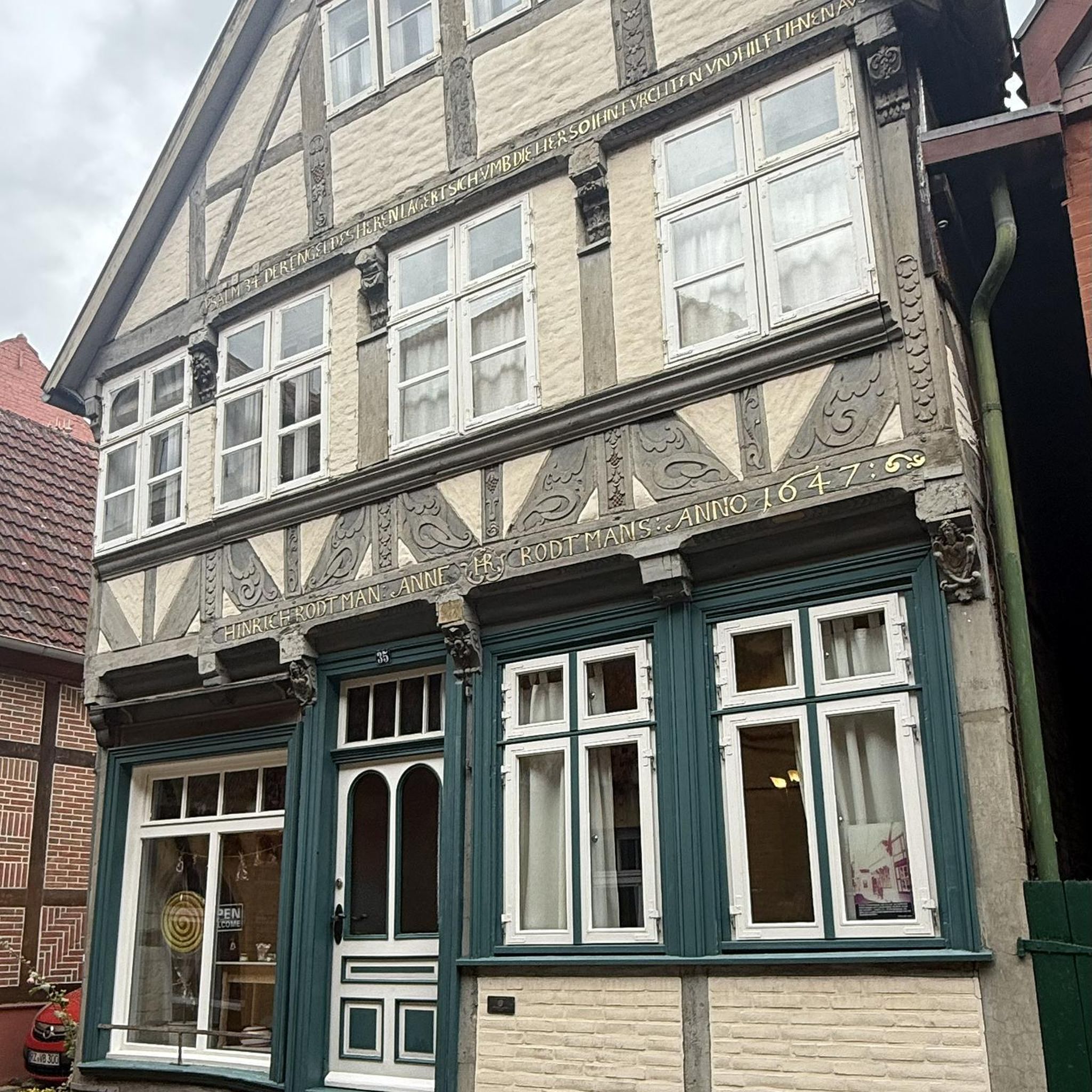
Saints Anne and Joachim are considered the parents of the Mother of God, whose birth this church celebrates. They are thus the grandparents of Jesus, but are not mentioned by name in the biblical writings of the New Testament. An exact date, in the historical or scientific sense, is not known for the various stages in the life of the Mother of God. However, the Feast of the Nativity of the Mother of God—one of Mary's numerous honorary titles—is celebrated on September 8th in many Christian denominations (Catholic, Anglican, Orthodox, and Armenian).
0
1

A place of power in a special class
0
0

Parish Church of the Nativity of Mary, Rhäzüns The present-day landscape of Rhäzüns is largely shaped by the Catholic parish church of Nossadunna, located in the center of the village. The church tower rises high above the rooftops and is a landmark visible from afar. Although consecrated in 1701, the Baroque sacred building did not become a parish church until 1777. The floor plan shows an octagonal central structure with two side niches and a polygonal choir loft extended to the north. The tower is inserted into the eastern choir shoulder, and the sacristy is located in the western one. The parish of Rhäzüns always celebrates the patronal feast of the parish church of the Nativity of Mary on the first Sunday in September. However, if September 8th falls on a Sunday, the Solemnity is celebrated on September 8th. Mass begins at 10:00 a.m. All churches are open daily from 8:00 a.m. to 7:00 p.m. (Automatic door closing) Text / Source: Catholic Parish of 7403 Rhäzüns https://www.kirchgemeinde-rhaezuens.ch/kirchen/
15
0

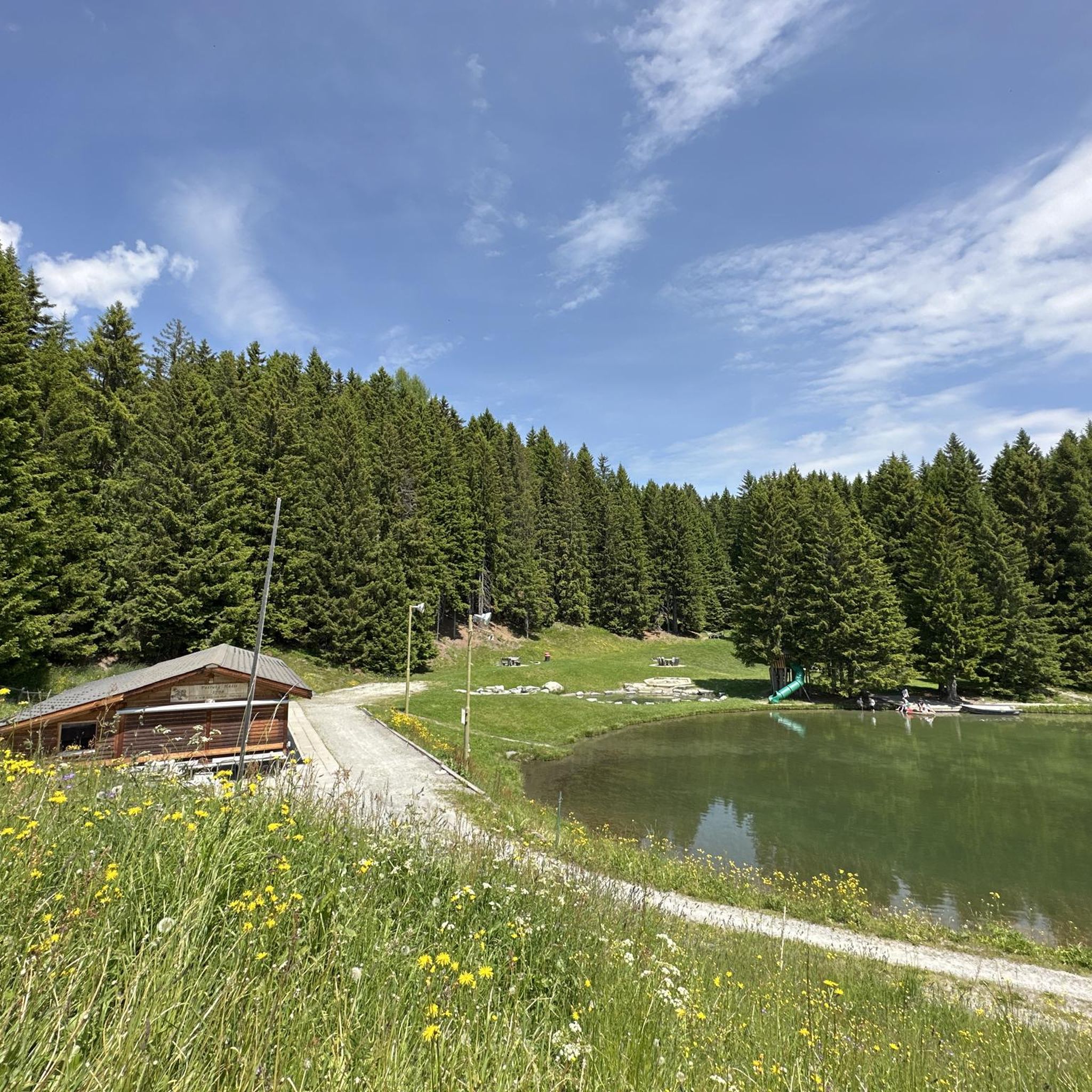
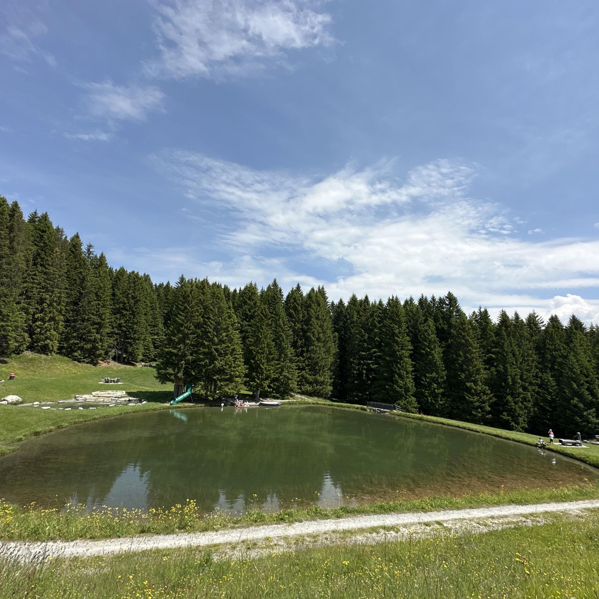
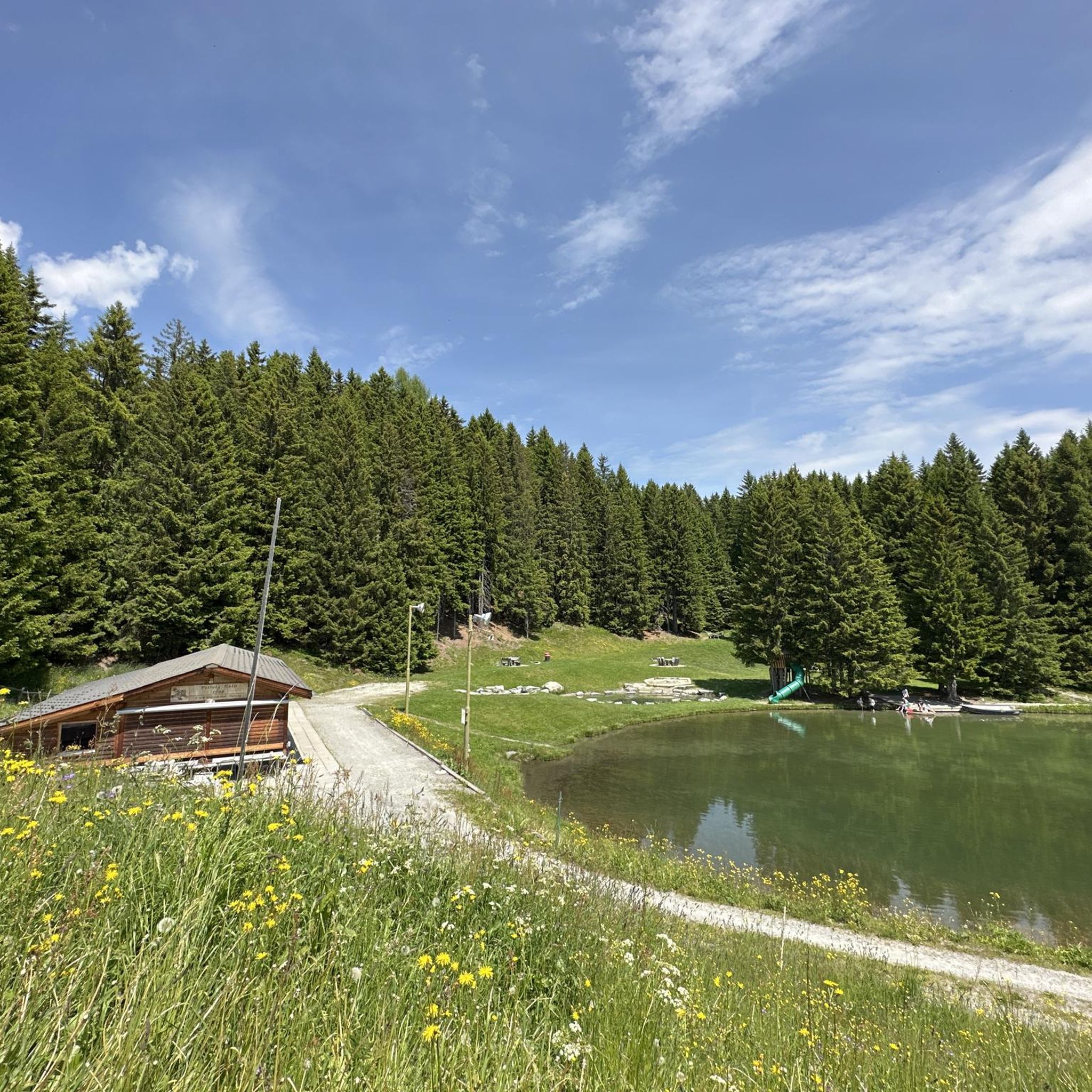
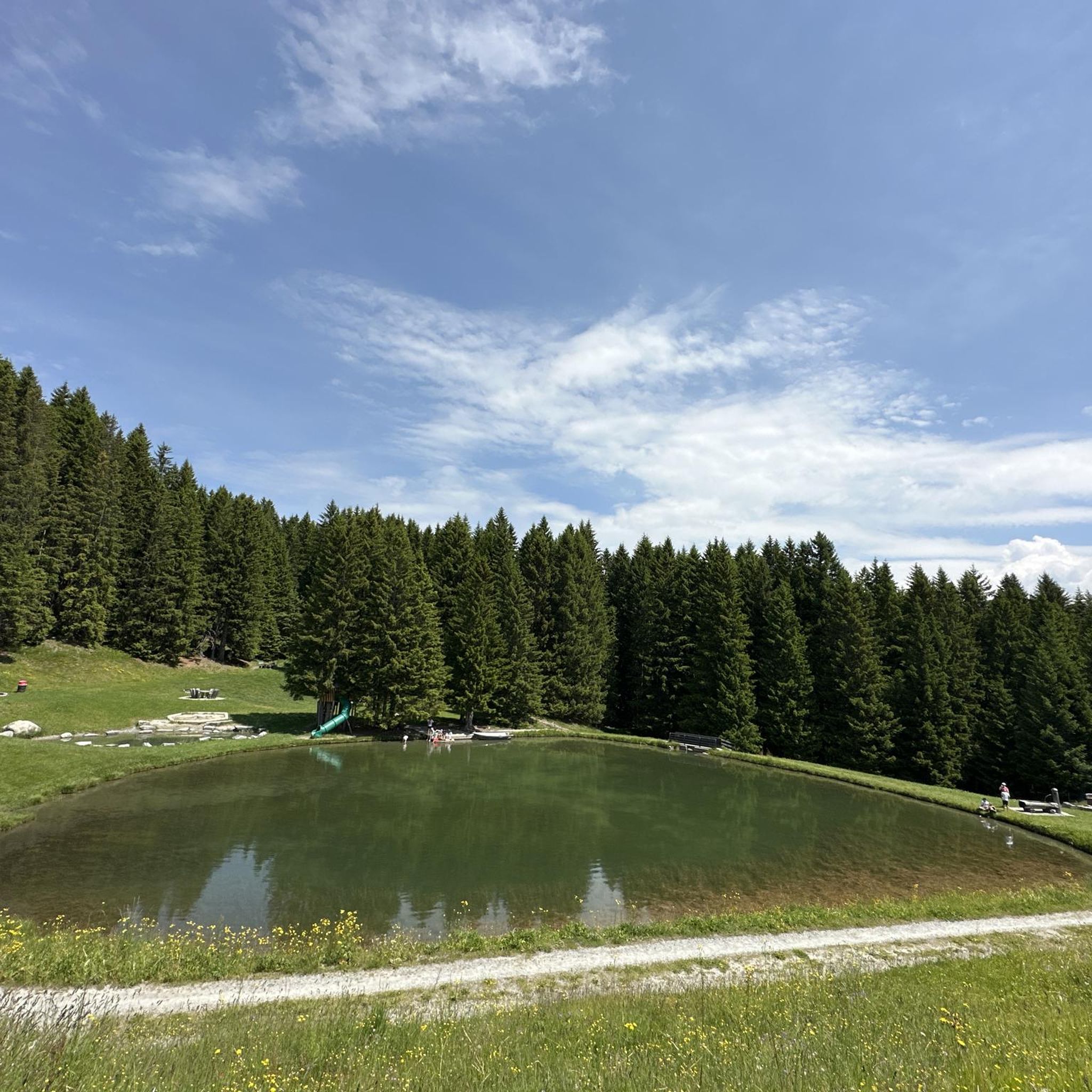
A reservoir in the Swiss canton of Graubünden, nestled in the impressive mountain landscape of the Viamala and Rheinwald regions. It stretches over a length of approximately two kilometers.
0
0
The ride through the famous Via Mala Gorge is a true highlight for road cyclists. The narrow, winding road winds spectacularly between steep rock faces, combining a challenging ride with impressive scenery. The asphalt is well-ridable, but you should expect tight bends, changing light, and heavy traffic—so it's best to ride in the early morning or late afternoon. A quick stop at the viewpoints is worthwhile to experience the magnificent views down into the gorge.
1
0
Ruinaulta Rhine Gorge The Ruinaulta, or Rhine Gorge, is a gorge of the Vorderrhein River, up to 400 meters deep and approximately 13 kilometers long, between Ilanz and the mouth of the Hinterrhein River near Reichenau in the canton of Graubünden in Switzerland. The Romansh name 'Ruinaulta' is composed of the two words ruina (scree slope, quarry) and aulta (high). The Ruinaulta was formed after the Flims Landslide almost 10,000 years ago. At that time, over 10 billion cubic meters of rock broke off between the Flimserstein and Piz Grisch, burying the Vorderrhein Valley between the present-day villages of Castrisch and Reichenau under a mass of debris several hundred meters thick. Because the Vorderrhein River could no longer drain away, a lake was dammed over a length of approximately 25 kilometers. Over time, the river cut deep into the landslide, and the resulting lake drained away completely. What remained was the Ruinaulta, with its steep limestone scree cliffs in impressive erosion formations. Text / Source: Wikipedia https://de.wikipedia.org/wiki/Ruinaulta
16
0
Schloss Reichenau At the confluence of the Hinterrhein and Vorderrhein, at the birthplace of the Alpine Rhine, lies the historic site of Reichenau. Reichenau already had great importance in the past: in the 14th century, as long-distance traffic over the Grisons Alpine passes increased significantly, two bridges and a customs house were built. Reichenau was considered a traffic hub, where all traffic could be controlled. In Reichenau, the routes of the north-south axis separate, along the Vorderrhein into the Oberland towards the Lukmanier and Oberalp passes, and along the Hinterrhein through the Domleschg via the Splügen and San Bernardino. Text / Source: Weinbau von Tscharner & Events Schloss Reichenau, Schloss Reichenau, Reichenauerstr. 59, 7015 Reichenau https://www.reichenau.ch/de/reichenau/geschichte-lage
15
0
At the confluence of the Hinterrhein and Vorderrhein, at the birthplace of the Alpine Rhine, lies Reichenau Castle. Built in the 17th century by the episcopal ministerial family Schauenstein, it looks back on a long history. The last king of France even lived here once.
15
0
Frequently Asked Questions
How many road cycling routes are available around Urmein?
There are over 30 road cycling routes around Urmein, offering a diverse range of options for different skill levels. These include 3 easy routes, 14 moderate routes, and 14 challenging routes.
What kind of terrain can I expect when road cycling near Urmein?
Road cycling around Urmein is characterized by the mountainous terrain of the Grisons region in Switzerland. You can expect significant elevation changes, with routes often following river valleys and ascending into higher alpine areas. This includes a mix of climbs and descents, offering views of natural features like lakes and gorges.
Are there any easy road cycling routes suitable for beginners around Urmein?
Yes, Urmein offers 3 easy road cycling routes. These routes are generally shorter with less demanding climbs, making them ideal for beginners or those looking for a more relaxed ride.
Which routes are recommended for experienced road cyclists seeking a challenge?
For experienced riders, Urmein features 14 difficult road cycling routes. A challenging option is the Sufnersee – Splügen loop from Donat, which covers 58 miles (93.4 km) and involves significant elevation gains through alpine valleys. Another demanding route is the Via Mala Gorge near Thusis – Juf Village loop from Cazis.
Are there any loop road cycling routes around Urmein?
Yes, many road cycling routes around Urmein are designed as loops. For example, the Roadbike loop from Thusis is a popular moderate 31.2-mile (50.2 km) option, providing a comprehensive tour through varied terrain. Another is the Runda Schams – Grisons' Road Cycling Menu, a scenic 13.6-mile (21.9 km) loop.
What are the best seasons for road cycling in Urmein?
Given the alpine nature of the Grisons region, the best seasons for road cycling in Urmein are typically late spring, summer, and early autumn. During these months, the weather is generally more stable, and higher mountain passes are usually clear of snow, offering optimal conditions for exploring the scenic routes.
What kind of scenic viewpoints or natural attractions can I expect along the routes?
Road cycling routes around Urmein offer stunning views of alpine valleys, lakes, and gorges. You might encounter beautiful lakes such as Canovasee or Patrutgsee in Oberurmein. The region's diverse geology provides a picturesque backdrop for your rides.
Are there any historical landmarks or castles to see while road cycling?
Yes, the Urmein area is rich in history. You can find several castles and ruins near the road cycling routes. Notable examples include the View of Hohen Rätien Castle Ruins, Rietberg Castle, and Sins Castle, offering glimpses into the region's past.
What do other road cyclists say about the routes in Urmein?
The road cycling routes in Urmein are highly regarded by the komoot community, with an average rating of 4.8 stars from over 80 reviews. Cyclists often praise the varied terrain, the stunning alpine scenery, and the well-maintained paths that cater to different ability levels.
Are there any routes that pass by the Sufnersee lake?
Yes, the Sufnersee – Splügen loop from Donat is a prominent route that leads through alpine valleys and past the scenic Sufnersee lake. Another option is the Sufnersee – Lake Montespluga loop from Donat, which also features the lake.
What should I consider bringing for a road cycling trip in Urmein?
Given the significant elevation changes and alpine conditions, it's advisable to bring layers of clothing, including a windproof or waterproof jacket. Essential items also include sufficient water, snacks, a repair kit, and navigation tools. Always check the weather forecast before heading out, especially for longer or higher-altitude routes.
Are there options for less crowded road cycling routes in Urmein?
While some popular routes can see more traffic, Urmein offers a wide network of 31 routes. Exploring some of the lesser-known moderate or difficult routes, particularly during off-peak hours or weekdays, can lead to a more tranquil cycling experience away from the crowds.
Most popular attractions around Urmein

Get inspired with the komoot mobile app


Explore more
Browse the best Road cycling routes in other regions.
