The best mountain hikes around Avigliana
4.3
(21)
235
hikers
11
hikes
Mountaineering routes around Avigliana are set within Italy's Piedmont region, offering diverse terrain for challenging ascents. The area is characterized by rugged mountain slopes, morainic hills, and the dramatic Val di Susa, providing a gateway to significant peaks. Glacial lakes and varied ecosystems contribute to a landscape ideal for both strenuous climbs and scenic exploration.
Best mountaineering routes around Avigliana
- The most popular mountaineering route is Cesana Tibetan Bridge loop from Sant'Ambrogio di Torino, a difficult 3.9 miles (6.2 km) trail that takes 4 hours 24 minutes to complete, offering views of the Susa Valley.
- Another top favourite among local mountaineers is Monte Musinè – Antico acquedotto loop from Caselette, a moderate 4.5 miles (7.3 km) path that ascends through varied mountain terrain.
- Local mountaineers also love the Mountaineering loop from Caprie, a difficult 2.4 miles (3.8 km) trail leading through mountain forests and rocky sections, often completed in about 2 hours 23 minutes.
- Mountaineering around Avigliana is defined by rugged mountain slopes, glacial lakes, and morainic hills. The network offers options for different ability levels, from moderate ascents to more challenging climbs.
- The routes in Avigliana are highly rated by the komoot community with an average score of 4.3 stars from over 10 reviews. More than 200 mountaineers have used komoot to explore Avigliana's varied terrain.
Last updated: October 8, 2026
4.8
(11)
114
hikers
6.31km
04:29
530m
530m
Hard mountaineering route. Good fitness required. Sure-footedness, sturdy shoes and alpine experience required.
23
hikers
7.18km
03:59
710m
710m
Moderate mountaineering route. Good fitness required. Mostly accessible paths. Sure-footedness required.

12
hikers
3.89km
02:25
460m
460m
Hard mountaineering route. Good fitness required. Sure-footedness, sturdy shoes and alpine experience required.
5.0
(1)
8
hikers
Hard mountaineering route. Good fitness required. Sure-footedness, sturdy shoes and alpine experience required.
5.0
(1)
3
hikers
3.14km
02:01
370m
370m
Hard mountaineering route. Good fitness required. Sure-footedness, sturdy shoes and alpine experience required.
Get access to more routes and recommendations from other explorers.
Already have an account?
Our route recommendations are based on thousands of hikes, rides, and runs completed by other people on komoot.
Start today with a free account
Your next adventure awaits.
Popular around Avigliana
Via Francigena in Valle di Susa – complete route and 'for all' section
Land of wines, culture, good food – UNESCO Grand Tour in Piedmont

Hiking around Avigliana

Road Cycling Routes around Avigliana

Cycling around Avigliana

MTB Trails around Avigliana

Running Trails around Avigliana

Gravel biking around Avigliana


Tips from the Community

Spectacular monument, an absolute must-visit
0
0

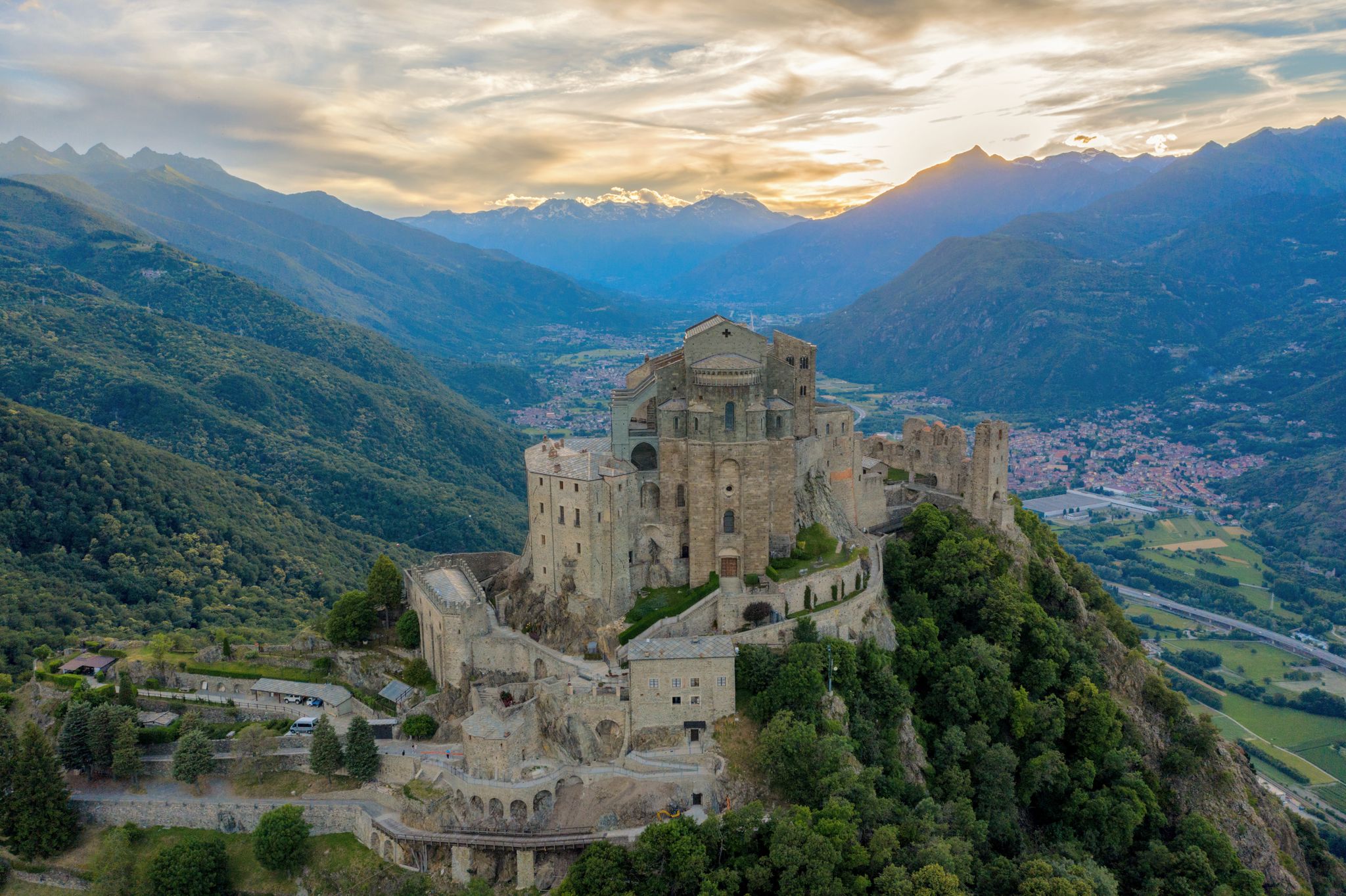
Sant'Ambrogio is an ancient village located at the entrance of the Val di Susa, along the Dora Riparia river, at the foot of the Sacra di San Michele. There is a legend about the foundation of the Sacra di San Michele, an abbey with a very characteristic shape, founded around 1000 by San Giovanni Vincenzo, former archbishop of Ravenna, perhaps replacing a Lombard temple dedicated to the Archangel Michael. You can read it near the Church, the starting point of the mule track that leads to it.
0
0

A grand 13th-century abbey, with walls as strong as the faith of its founders, evocative for its location and history, it's definitely worth a visit. A little trivia: Umberto Eco drew inspiration from this place for the setting of his masterpiece.
4
0

Departure for the firebreak trail right in front of the Kiosk
0
0

Very steep, steady climb. No equipment required; can be done in all seasons.
0
0

Climbing up to the Sacra di San Michele along the Stations of the Cross. Given the steepness, it's truly a Stations of the Cross.
0
0
Steep climb to the hamlet of San Pietro, which can become a real Stations of the Cross if you get too excited! Beautiful views of San Michele and wonderful woods.
0
0

The path up to San Michele gets steep very quickly!
0
0
Frequently Asked Questions
How many mountaineering routes are available around Avigliana?
There are over 15 distinct mountaineering routes around Avigliana, offering a variety of challenges across the rugged mountain slopes and morainic hills of the Val di Susa. These routes are highly rated by the komoot community, with an average score of 4.3 stars from over 16 reviews.
Are there any moderate mountaineering routes suitable for beginners near Avigliana?
Yes, while many routes are challenging, there are moderate options. For instance, the Monte Musinè – Antico acquedotto loop from Caselette is a moderate 7.3 km path that ascends through varied mountain terrain, offering a good introduction to the area's mountaineering.
Can I find circular mountaineering routes in the Avigliana area?
Absolutely. Many routes in the region are designed as loops, allowing you to start and end at the same point. An example is the Mountaineering loop from Caprie, a difficult 3.8 km trail through mountain forests and rocky sections.
What are some scenic viewpoints or landmarks I can encounter on mountaineering routes near Avigliana?
The region is rich in scenic spots. You might encounter the ruins of a 10th-century castle on Pezzulano mountain overlooking Avigliana's lakes, or the dramatic Sacra di San Michele abbey perched on Mount Pirchiriano. Specific routes can lead to stunning vistas like the Mount Cuneo (Moncuni) summit or the Summit cross of Monte Musinè, offering panoramic views of the Susa Valley and beyond.
Are there any routes that feature waterfalls around Avigliana?
Yes, the Val di Susa region has several beautiful waterfalls. While not directly on every mountaineering route, you can find highlights like the Goja del Pis Waterfall or the Tagliafuoco Waterfall in the broader area, which can be incorporated into or visited alongside your mountaineering adventures.
What is the typical duration for mountaineering routes in Avigliana?
The duration varies significantly based on the route's difficulty and length. For example, a challenging route like the Cesana Tibetan Bridge loop from Sant'Ambrogio di Torino, which is 6.2 km, typically takes around 4 hours and 24 minutes. Shorter, difficult routes like the Rocca Sella loop from Caprie (3.6 km) can be completed in about 2 hours and 20 minutes.
Are there any less crowded mountaineering options near Avigliana?
While popular routes can see more traffic, exploring some of the lesser-known trails or visiting during off-peak times can offer a more solitary experience. The broader Val di Susa offers vast areas of rugged mountain slopes and verdant meadows, providing ample opportunities to find quieter paths away from the main hubs.
What kind of terrain can I expect on mountaineering routes in Avigliana?
Mountaineering routes around Avigliana feature diverse terrain, ranging from mountain forests and rocky sections to open slopes and morainic hills. You'll encounter varied landscapes, including views of the glacial lakes and the dramatic Val di Susa, often with significant elevation changes.
Are there any routes that offer views of the Avigliana lakes?
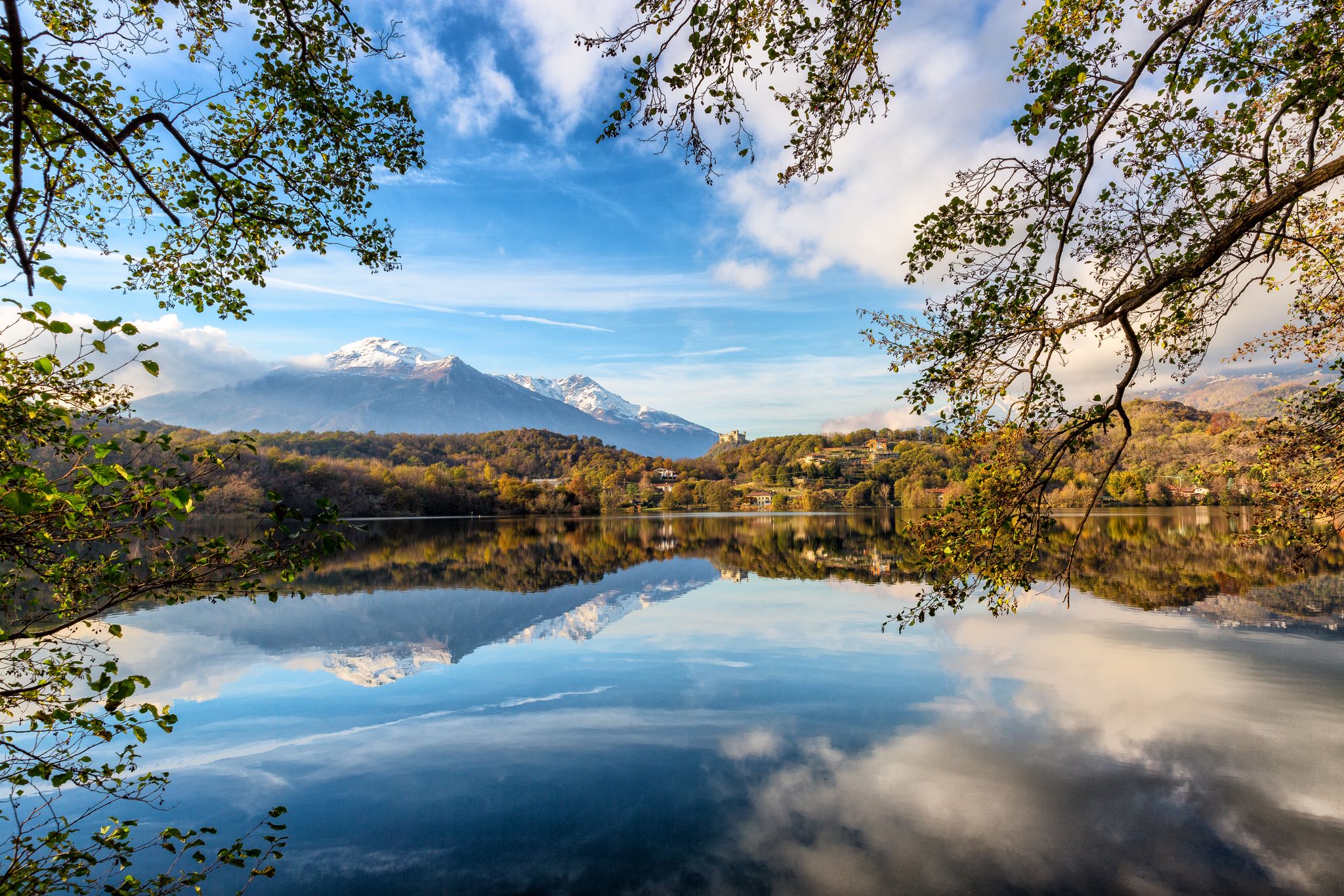
Many routes in the immediate vicinity of Avigliana provide stunning views of the Parco Naturale dei Laghi di Avigliana, including Lago Grande and Lago Piccolo. The ruins of the 10th-century castle on Pezzulano mountain, which overlooks the lakes, are a prime example of a viewpoint you might encounter or aim for.
What is the best time of year for mountaineering in Avigliana?
The best time for mountaineering typically spans from late spring through early autumn (May to October) when the weather is generally stable and trails are clear of snow. During winter, the Alta Val Susa transforms into a destination for ski mountaineering, offering a different kind of challenge.
Are there any other notable peaks or passes accessible from Avigliana?
Beyond the immediate vicinity, the Val di Susa provides access to significant peaks. For experienced mountaineers, Rocciamelone (3,538 meters) is a prominent peak. Closer to Avigliana, you might find routes leading towards areas like the Lys Pass, offering diverse high-altitude experiences.
Can I find routes with historical or religious landmarks?
Yes, the region is rich in history. The iconic Chapel of the Madonna of Rocca Sella is one such landmark you might encounter on a route like the Rocca Bianca loop from Caprie. The Sacra di San Michele, a medieval abbey, is also a significant historical and architectural marvel accessible via strenuous walks.
Most popular routes around Avigliana
Most popular attractions around Avigliana

Get inspired with the komoot mobile app


Explore more
Browse the best Mountain Hikes & Routes in other regions.
