The best walks and hikes around Santo Stefano In Aspromonte
4.4
(139)
551
hikers
28
hikes
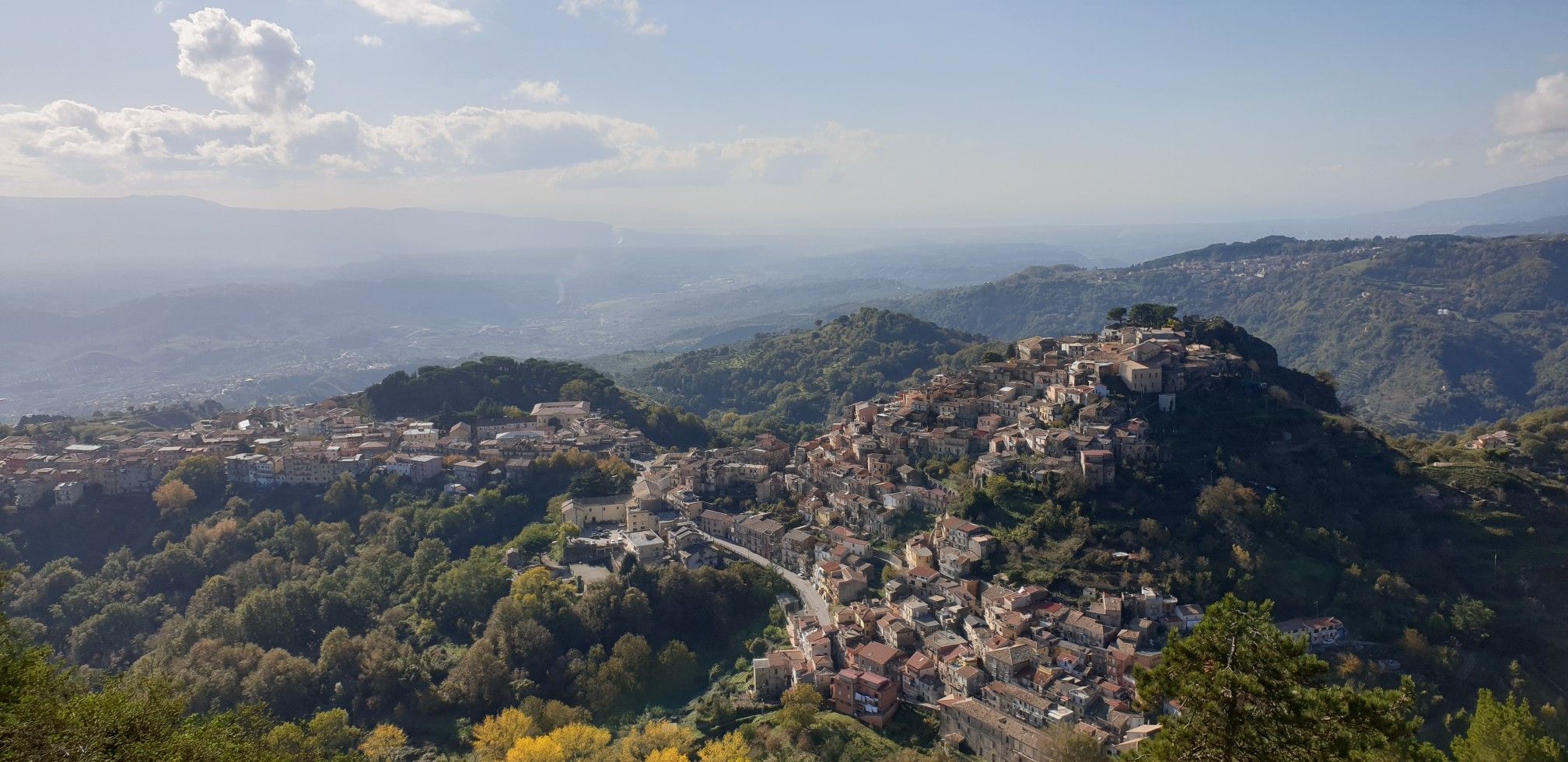
Hiking around Santo Stefano In Aspromonte offers access to the diverse landscapes of the Aspromonte National Park. The region is characterized by significant elevation changes, including Montalto, the highest peak in the massif, and features extensive forests of beech, silver fir, chestnut, and oak. Unique "fiumare" or ephemeral riverbeds carve through gorges, creating waterfalls and distinct geological formations. This area provides a range of trails through mountainous terrain and wooded valleys.
Best hiking trails around Santo Stefano In Aspromonte
- The most popular hiking route is Gambarie - ring tour - Aspromonte National Park, a 5.4 miles (8.7 km) trail that takes 3 hours 36 minutes to complete. This moderate route explores the surroundings of Gambarie, a key hub for park access.
- Another top favourite among local hikers is Monte Basilicò from Gambarie – loop in the Aspromonte National Park, a moderate 9.2 miles (14.9 km) path. This loop leads through some of the finest fir and beech forests in the park.
- Local hikers also love the Anello del Sentiero di Basilicò, a 3.2 miles (5.1 km) trail leading through forested areas, often completed in about 1 hour 28 minutes.
- Hiking around Santo Stefano In Aspromonte is defined by panoramic peaks, diverse forests, and unique riverbeds. The network offers options for various ability levels, from easy walks to more demanding climbs.
- The routes in Santo Stefano In Aspromonte are highly rated by the komoot community with an average score of 4.4 stars from over 100 reviews. More than 400 hikers have used komoot to explore Santo Stefano In Aspromonte's varied terrain.
Last updated: July 7, 2026
3.6
(30)
103
hikers
8.69km
03:36
480m
480m
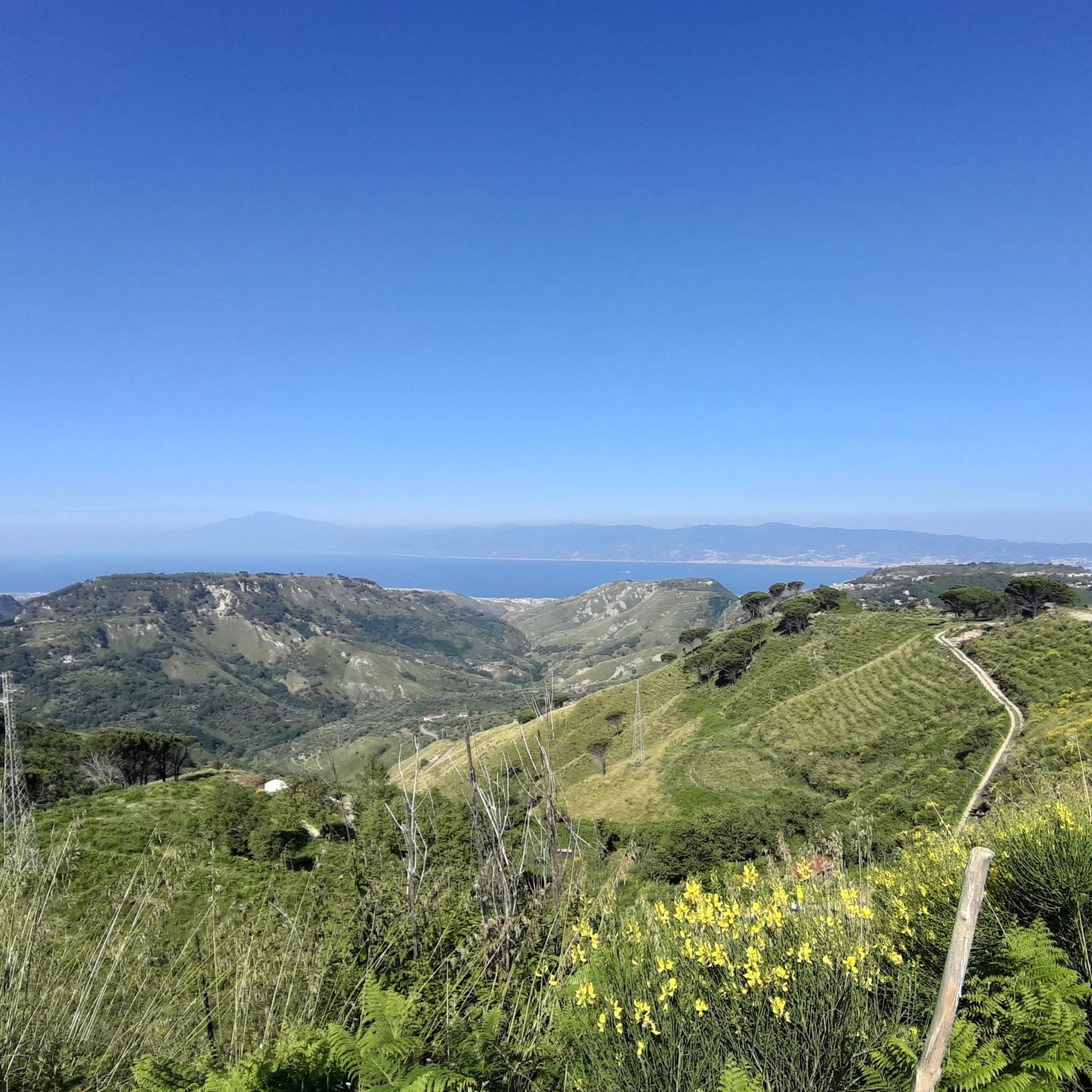
Embark on the Gambarie - ring tour - Aspromonte National Park, a moderate hike spanning 5.4 miles (8.7 km) with an elevation gain of 1581 feet (482 metres). This route typically takes around 3 hours and 35 minutes to complete. You will traverse varied terrain, including unpaved paths through extensive forests of beech, silver fir, chestnut, and oak, alongside some paved street sections. A highlight is the Vallescura Waterfall, part of the enchanting "Path of the Fairies," and on clear days, you can enjoy panoramic views across the Mediterranean Sea to Mount Etna. The trail requires good fitness and sure-footedness, aligning with a moderate difficulty rating.
Gambarie itself is a charming mountain resort, serving as a key hub for outdoor activities within the park, providing amenities and easy access to the trail. While the research does not specify trailhead access or parking details, its location within a well-established resort suggests convenient starting points. This popular route is known for its blend of natural beauty and accessible paths, making it a favorite among local hikers seeking both adventure and relaxation.
The Aspromonte National Park, recognized as part of the UNESCO Global Geoparks Network since 2021, offers unique geological features like the "fiumare," ephemeral riverbeds that cut through gorges. The trail's popularity stems from its scenic beauty, the presence of tranquil waterfalls, and its location within this protected area. This combination of a resort town and diverse natural landscapes makes the Gambarie ring tour a notable experience for visitors.
4.3
(16)
37
hikers
14.9km
04:46
630m
630m
Embark on the Monte Basilicò loop from Gambarie, a moderate hike spanning 9.2 miles (14.9 km) with an elevation gain of 2083 feet (635 metres), typically taking 4 hours and 45 minutes to complete. You will traverse enchanting beech and fir forests, encountering a mix of unpaved paths and some steeper sections. Along the way, clearings offer panoramic views of the Strait of Messina, Mount Etna, and the Aeolian Islands, with the picturesque Vallescura Waterfall also a highlight.
This loop begins conveniently from Gambarie, a mountain resort at 1,310 meters above sea level, serving as a key access point for the Aspromonte National Park. While some parts of the trail are easily accessible, others demand good fitness, sure-footedness, and sturdy shoes, especially on the steep path climbing a ridge of Monte Scirocco and the ascent to Monte Basilicò's summit. Plan your visit to allow ample time for the varied terrain.
The trail offers a deep immersion into the lush forests, showcasing diverse ecosystems including beech, fir, and oak. It passes near Monte Basilicò, a significant peak whose name, derived from the Greek "Basilikòs," suggests a "royal" or "imperial" mountain. Beyond the exceptional vistas, the route also reveals remnants of ancient snowfields and charcoal burners' clearings, adding layers of natural and historical interest to your journey.

Sign up for free
4.8
(8)
38
hikers
5.08km
01:28
130m
130m
Embark on the Anello del Sentiero di Basilicò, an easy hiking route that takes you through a tranquil, forested environment within the Aspromonte National Park. This loop covers 3.2 miles (5.1 km) with a gentle elevation gain of 421 feet (128 metres), making it perfect for a relaxed outing. You can expect to complete the hike in about 1 hour and 28 minutes, enjoying the peaceful atmosphere and the highlight of the charming Vallescura Waterfall nestled among the trees.
To begin your adventure, head to the trailhead located near the Gambarie Fountain. This is a convenient reference point, and you'll typically find parking available nearby, making access straightforward. The easy difficulty means you won't need any special equipment or advanced hiking skills, and the route is suitable for most fitness levels. Plan your visit for a time when you can fully immerse yourself in the natural surroundings.
The Aspromonte National Park provides a rich natural backdrop for this trail, known for its ancient forests and diverse plant life. It's a peaceful haven for nature lovers, offering a chance to connect with the environment away from the hustle and bustle. The Anello del Sentiero di Basilicò stands out as an accessible way to experience the park's serene beauty and discover its unique ecological character.
5.0
(2)
7
hikers
19.7km
06:08
740m
740m
Embark on the "From Gambarie to Materazzelli – loop tour in the Aspromonte National Park" for a challenging hike through diverse landscapes. This difficult 12.2-mile (19.7 km) loop takes you through unpaved paths, paved sections, and asphalted roads winding through lush fir and beech forests, including a magical beech wood. You will gain 2437 feet (743 metres) in elevation, with panoramic views of the Ionian and Tyrrhenian Seas, Mount Etna, and the distant Aeolian Islands, making for a rewarding 6-hour and 8-minute journey. The Materazzelli area features a clearing with the ruins of a former forest house, offering a glimpse into the past amidst stunning nature.
Starting from the charming mountain resort of Gambarie, this route demands a very good level of fitness. While the paths are noted as easily accessible, you should be sure-footed and wear sturdy shoes to comfortably navigate the varied terrain. The trail offers shade in summer, making it a refreshing option during warmer months. Plan your visit to allow ample time to complete the full loop and enjoy the extensive views.
This loop tour is celebrated for showcasing some of the finest fir and beech forests within the Aspromonte National Park. Beyond the natural beauty, the trail also holds historical interest, passing by the ruins of a forest house in Materazzelli and an old NATO base. Materazzelli itself serves as an ideal starting point for reaching the summit of Montalto, the highest peak in Aspromonte, further highlighting the area's significance for hikers.
4.2
(13)
33
hikers
10.9km
03:36
510m
510m
Moderate hike. Good fitness required. Easily-accessible paths. Suitable for all skill levels.
Get access to more routes and recommendations from other explorers.
Sign up for free
Already have an account?
Our route recommendations are based on thousands of hikes, rides, and runs completed by other people on komoot.
Start today with a free account
Your next adventure awaits.
Login or Signup
Popular around Santo Stefano In Aspromonte

Along the backbone of Calabria – Sentiero Italia
Explore art and culture in Italy – cycling Tours in Calabria's National Parks
MTB Trails around Santo Stefano In Aspromonte
Cycling around Santo Stefano In Aspromonte
Road Cycling Routes around Santo Stefano In Aspromonte

Running Trails around Santo Stefano In Aspromonte
Other adventures around Santo Stefano In Aspromonte


Tips from the Community


The region is known for its spicy, bold cuisine – 'nduja, caciocavallo cheese, wild herbs, local wines (like Greco di Bianco) and olive oil from mountain farms. It is also an area with a strong identity, with the Greek-Calabrian language spoken in some villages.
1
0
The perfect place for detox and contact with nature. The area is one of the most inaccessible and untouched mountain ranges in Italy. Aspromonte National Park is beech forests, rare plants and animals (e.g. wolves, golden eagles), waterfalls and spectacular panoramas - from the Tyrrhenian Sea to Sicily and Etna. And above all, no crowds.
1
0
Gambarie is a small mountain village located at an altitude of approximately 1,350 m above sea level in the Calabria region in the Aspromonte National Park.
1
0

The Materazzelli area is an ideal starting point to reach the summit of Montalto in Aspromonte. From here, among the ruins of a forestry toll booth, you can begin a route that crosses woods and clearings, allowing you to admire breathtaking views, from the Ionian Sea to the Tyrrhenian Sea and the Pollino mountains.
2
0
This stretch of asphalt road, isolated and quiet, winds through the woods of the Aspromonte Park, where every now and then it is possible to spot ancient oak trees and fresh springs. It extends from the Materazzelli area to the former NATO base.
1
0
Gambarie, in the heart of the Aspromonte National Park at 1,310 m above sea level, is a charming mountain resort in Santo Stefano in Aspromonte, Reggio Calabria. Founded in the 1920s, it offers both summer and winter attractions. Hiking trails, ski slopes and breathtaking views from Etna to the Aeolian Islands.
3
0
This stretch of trail passes near Monte Basilicò, offering a taste of the lush forests of the Aspromonte Park.
3
0
Frequently Asked Questions
How many hiking trails are available around Santo Stefano In Aspromonte?
There are over 25 hiking trails around Santo Stefano In Aspromonte, offering a diverse range of experiences within the Aspromonte National Park. These routes cater to various skill levels, from easy walks to more challenging climbs.
Are there easy or family-friendly hiking options in the area?
Yes, Santo Stefano In Aspromonte offers several easy and family-friendly trails. For instance, the Anello del Sentiero di Basilicò is an easy 5.1 km loop through forested areas, typically completed in under 1.5 hours, making it suitable for families. There are 4 easy routes in total.
What are the best trails for panoramic views?
For breathtaking panoramic views, consider trails that ascend to higher elevations. The summit of Montalto (1,956 m), the highest peak in the Aspromonte massif, offers 360-degree vistas across the Ionian and Tyrrhenian Seas, and even Mount Etna on clear days. Monte Scirocco, accessible from Gambarie, also provides impressive views, including the Strait of Messina and Mount Etna.
Are there any circular hiking routes?
Yes, many trails in the region are designed as loops. A popular option is the Gambarie - ring tour - Aspromonte National Park, a moderate 8.7 km route. Another excellent circular trail is the Monte Basilicò from Gambarie – loop in the Aspromonte National Park, which is a 14.9 km moderate path leading through beautiful fir and beech forests.
Can I hike with my dog in Santo Stefano In Aspromonte?
Generally, dogs are welcome on trails within the Aspromonte National Park, but it's always advisable to keep them on a leash, especially in areas with wildlife or near livestock. Ensure you carry enough water for both yourself and your dog, and always clean up after your pet.
What natural features or attractions can I expect to see along the trails?
The region is rich in natural beauty. You can explore diverse forests of beech, silver fir, chestnut, and oak, particularly along routes like the Monte Basilicò loop. The Aspromonte National Park is also home to spectacular waterfalls such as the Maesano Waterfalls (also known as Amendolea Falls) and the Vallescura waterfall, which can be found along the "Path of the Fairies." Unique "fiumare" (ephemeral riverbeds) like the Fiumara Amendolea carve through gorges, showcasing distinct geological formations.
What is the best time of year to go hiking in Santo Stefano In Aspromonte?
The best time for hiking generally spans from spring to autumn (April to October) when the weather is mild and trails are most accessible. Summer offers opportunities for exploring fiumare and canyoning in their higher reaches. Winter provides a unique experience, with Gambarie being a ski resort, allowing for snowshoeing or winter hiking on suitable trails.
How long do hikes typically take in this area?
Hiking durations vary significantly based on the trail's length and difficulty. Easy routes like the Anello del Sentiero di Basilicò can be completed in about 1 hour 30 minutes. Moderate trails, such as the Gambarie - ring tour, typically take around 3 hours 30 minutes. More challenging and longer routes, like the From Gambarie to Materazzelli loop (19.7 km), can take over 6 hours.
Is public transport available to reach hiking trailheads?
Santo Stefano in Aspromonte, particularly its hamlet of Gambarie, serves as a central hub for many trails. While specific public transport details for individual trailheads might vary, Gambarie is generally accessible and acts as a starting point for numerous routes into the Aspromonte National Park.
What do other hikers say about the trails in Santo Stefano In Aspromonte?
The hiking trails in Santo Stefano In Aspromonte are highly rated by the komoot community, with an average score of 4.4 stars from over 100 reviews. Hikers often praise the diverse landscapes, the beauty of the ancient forests, and the unique geological features like the fiumare and waterfalls. Many appreciate the variety of options available for different fitness levels.
Are there any specific geological points of interest to explore?
Yes, the Aspromonte massif is a UNESCO Geopark due to its complex geological history. You can discover unique crystalline metamorphic rocks and impressive formations. While not directly on a specific route in this guide, nearby features like Pietra Cappa, Europe's largest monolith, and the Valley of the Great Stones highlight this geological richness.
Most popular routes around Santo Stefano In Aspromonte
Most popular attractions around Santo Stefano In Aspromonte

Get inspired with the komoot mobile app


Explore more
Browse the best Hikes in other regions.
