The best running trails around Olgiate Molgora
3.8
(5)
437
runners
18
runs
Jogging around Olgiate Molgora offers diverse terrain, transitioning from flatter plains to elevated hills within the Brianza area of Lombardy. The region features a mix of landscapes, including natural elevations and proximity to the Parco Regionale di Montevecchia e della Valle del Curone. This varied topography provides options for different fitness levels and running preferences.
Best jogging routes around Olgiate Molgora
- The most popular jogging route is Abandoned Village of Consonno loop from Olgiate-Calco-Brivio, a 12.8 miles (20.6 km)…
Last updated: July 1, 2026
5.0
(1)
204
runners
Hard run. Very good fitness required. Sure-footedness, sturdy shoes and alpine experience required.
27
runners
7.74km
00:50
120m
120m
Moderate run. Good fitness required. Mostly paved surfaces. Suitable for all skill levels.

Sign up for free
21
runners
9.71km
01:01
110m
100m
Moderate run. Good fitness required. Mostly paved surfaces. Suitable for all skill levels.
18
runners
11.7km
01:15
180m
180m
Moderate run. Good fitness required. Mostly paved surfaces. Suitable for all skill levels.
3.0
(1)
20
runners
Hard run. Very good fitness required. Sure-footedness, sturdy shoes and alpine experience required.
Get access to more routes and recommendations from other explorers.
Sign up for free
Already have an account?
Our route recommendations are based on thousands of hikes, rides, and runs completed by other people on komoot.
Start today with a free account
Your next adventure awaits.
Login or Signup
Tips from the Community

The small sacred monument we encounter here is a universal symbol of the death of Jesus Christ, the Son of God, who was crucified and became human – but at the same time, it is also a symbol of the overcoming of death in the resurrection. Thus, all crosses point us to the Easter perspective of hope – inherent in Christianity – which, through faith in God, firmly trusts in the ability to overcome death and suffering. "We Christians connect our hopes in particular with the graces of heaven. This gives our hope a concrete basis and it arises from faith in God's goodness and love. And we know whom we can thank when our hopes are fulfilled, and whom we can entrust ourselves to when our hopes are not. I believe this certainty is a grace in itself that we are privileged to experience." (Christiane Völkel)
0
0

Immersed in the greenery of the Curone Regional Park, Cascina Bagaggera is a family-run agriturismo that combines hospitality, genuine cuisine, and organic farming. Born from the renovation of farmhouses dating back to the 17th and 19th centuries, the structure today hosts an agriristorante, inn rooms, and an agricultural shop – offering an authentic experience, immersed in nature and tradition. For those who love to experience nature up close – families, groups of friends, travelers seeking tranquility – Cascina Bagaggera also offers the possibility to stay: the inn rooms, surrounded by greenery, are an invitation to slow down, breathe, and reconnect with a simpler rhythm. Cascina Bagaggera is also the ideal place to recharge your e-Bike and earn DINAclub points. Find out how at: https://dinaclub.repower.com./ To discover the territory, a ready-to-ride itinerary: https://www.komoot.com/it-it/tour/2706104183?share_token=ax9bDzV5i1bJ6zINj8e33KDgjtWXk2z7e84yPQkbxBZTgPaWfL&ref=wtd
0
0

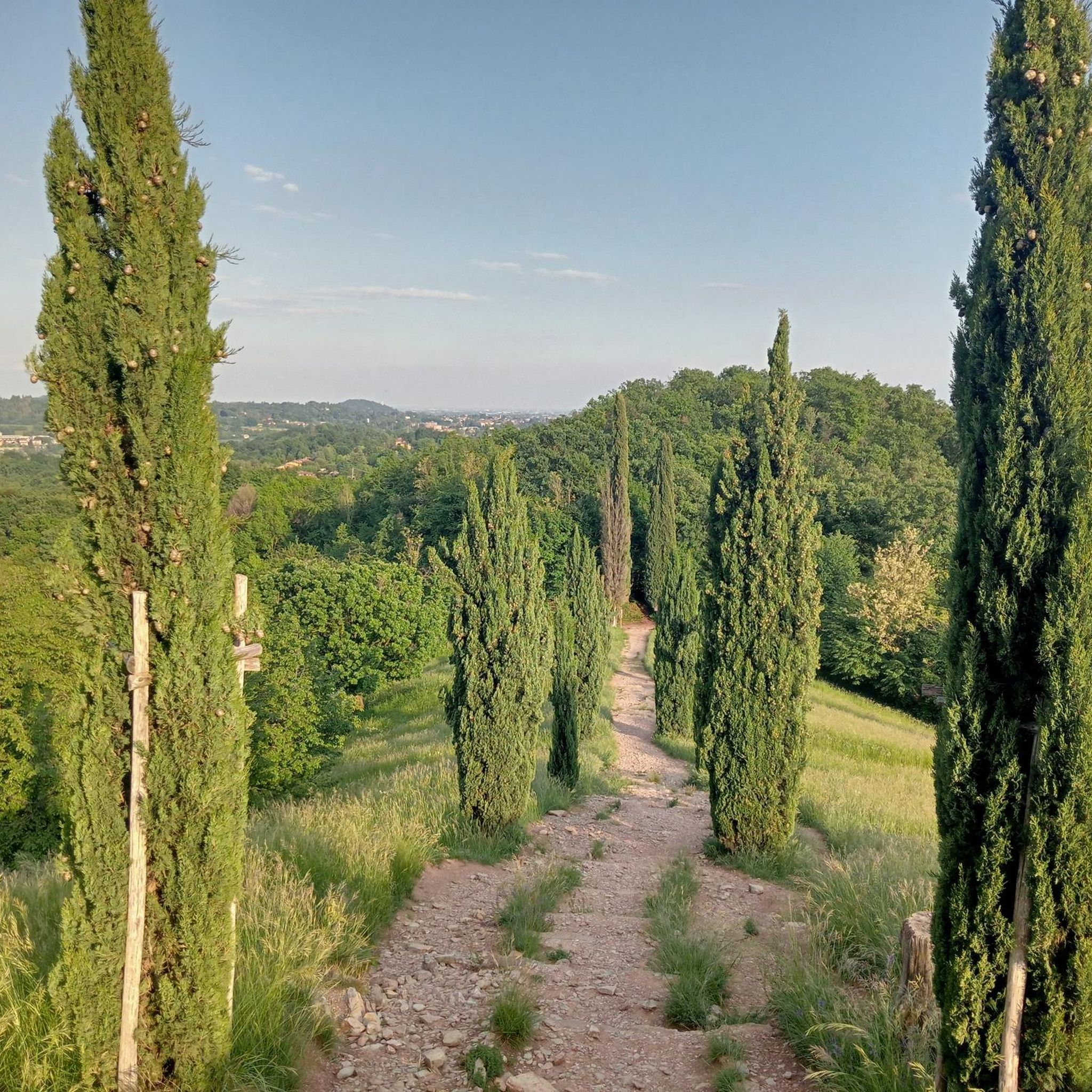
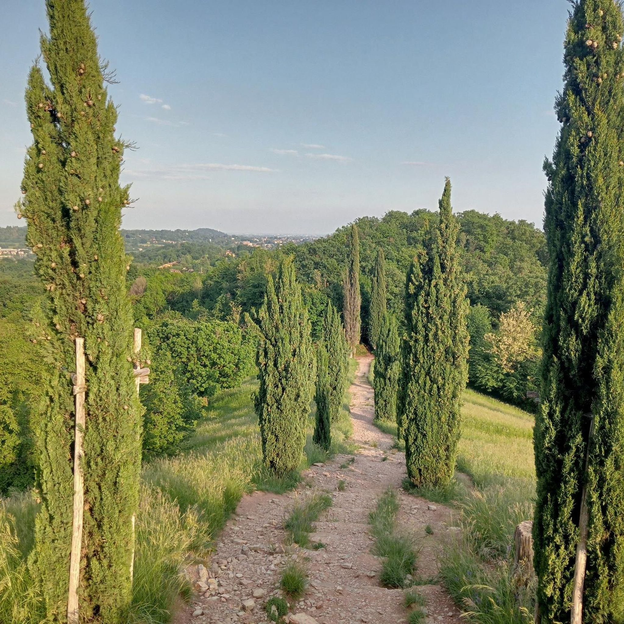
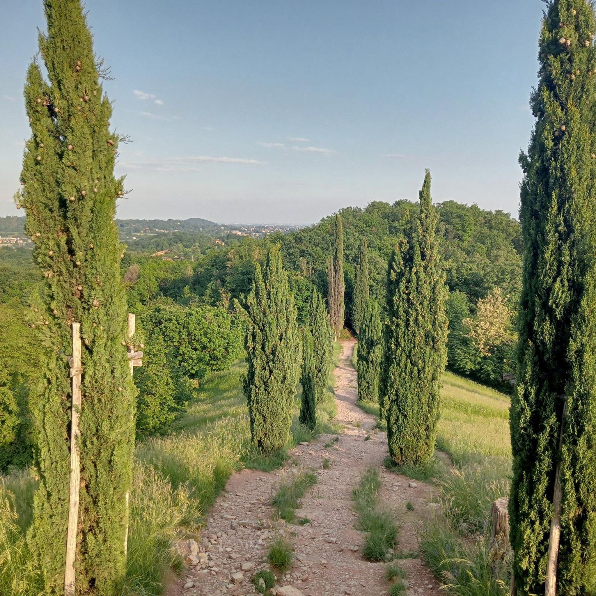
Stairway Leading to Cypress Hill
1
0

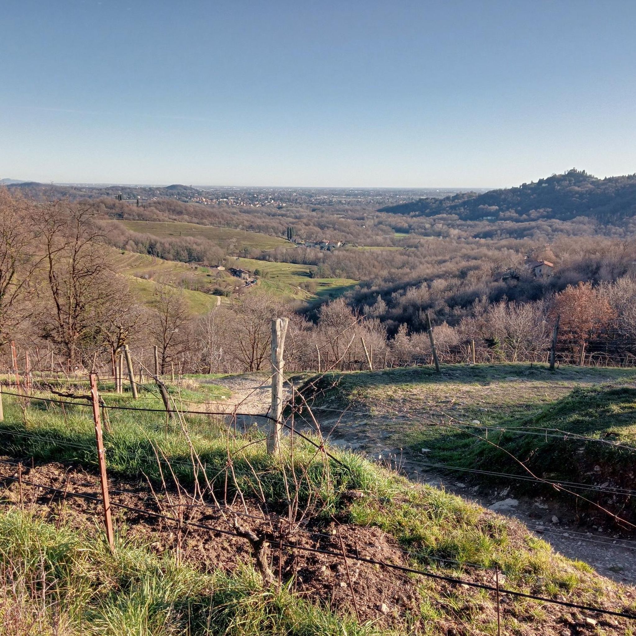
At the end of the Cypress Path (not cycle-friendly) or the climb from the Curone Valley (dirt road, with a fairly steep climb at the end) there is a place to catch your breath, with a view over the entire Curone Valley, which is worth the effort.
0
0

I agree @Corrado they were more in tune with nature, with less expense they could be repaired and not ruin the path
5
1

I preferred them before even if they were broken they were more fun and still manageable
1
0
The first one still has decent ground, but from the second one it's a disaster
6
1

In the Montevecchia regional park, this little bridge seems frail and unreliable, but it allows an easy crossing of the Curone torrent. Here everything is calm and immersed in greenery: the name from which the Curone was born (Cürón in the Brianza dialect) is singular: Deserto.
1
0
Frequently Asked Questions
How many running routes are available around Olgiate Molgora?
There are over 15 dedicated running routes in and around Olgiate Molgora, offering a variety of experiences for different fitness levels. The komoot community has explored these trails over 200 times.
What kind of terrain can I expect on jogging routes in Olgiate Molgora?
The region around Olgiate Molgora features diverse terrain, transitioning from flatter plains to elevated hills within the Brianza area of Lombardy. You'll find a mix of landscapes, including natural elevations and proximity to the Parco Regionale di Montevecchia e della Valle del Curone, providing options from gentle runs to more challenging uphill routes.
Are there easy running routes suitable for beginners in Olgiate Molgora?
Yes, there is at least one easy running route available, suitable for beginners or those looking for a less strenuous run. The varied topography also allows for shorter, flatter sections within longer routes that can be adapted for easier jogs.
Can I find routes with significant elevation gain for a more challenging run?
Absolutely. Olgiate Molgora offers several challenging routes with significant elevation gain. For example, the Abandoned Village of Consonno loop from Olgiate-Calco-Brivio features over 900 meters of ascent, providing a demanding workout for experienced runners.
Are there any circular running routes in the Olgiate Molgora area?
Yes, many of the running routes around Olgiate Molgora are circular, allowing you to start and finish at the same point. Examples include the Monte Church loop from Olgiate Molgora and the Monte Crosaccia loop from La Valletta Brianza.
What natural features or landmarks can I see while running in Olgiate Molgora?
The routes often pass through beautiful natural settings and near interesting landmarks. You might encounter features like the Cypress Peak, or the Brivio riverfront and Adda Bridge. The region is also known for its glacial lakes and proximity to the Parco Regionale di Montevecchia e della Valle del Curone.
Are the running trails in Olgiate Molgora suitable for families?
While specific family-friendly routes are not explicitly detailed, the presence of easy and moderate trails suggests options for families. Look for routes with minimal elevation and shorter distances if running with children. The diverse terrain means some paths will be more accessible than others.
Are dogs allowed on the jogging routes around Olgiate Molgora?
Generally, dogs are welcome on many outdoor trails in Italy, especially in natural park areas like those near Olgiate Molgora. However, it's always advisable to keep them on a leash and check local regulations for specific trails or protected areas to ensure a pleasant experience for everyone.
Where can I park my car when accessing running trails in Olgiate Molgora?
Many routes around Olgiate Molgora, especially those starting from towns like Olgiate-Calco-Brivio or La Valletta Brianza, typically have parking available nearby. It's recommended to check the starting point of your chosen route on komoot for specific parking information.
Is it possible to reach the running trails in Olgiate Molgora by public transport?
Olgiate Molgora has a train station, making it accessible by public transport. Many running routes start directly from the town or are within a short distance, allowing you to reach them without a car. Check local train schedules for connections.
What is the best season for jogging in Olgiate Molgora?
The varied terrain of Olgiate Molgora makes it suitable for jogging across multiple seasons. Spring and autumn offer pleasant temperatures and vibrant scenery. Summer can be warm, so early morning or late afternoon runs are ideal. Winter runs are possible, but some higher elevation paths might require checking for snow or ice conditions.
What do other runners say about the routes in Olgiate Molgora?
The running routes in Olgiate Molgora are highly rated by the komoot community, with an average score of 4.0 stars. Runners often praise the varied topography, the beautiful natural settings, and the options available for different ability levels.
Are there any specific viewpoints along the running routes in Olgiate Molgora?
Yes, several routes offer rewarding viewpoints. For instance, the Monte Church loop from Olgiate Molgora provides a steady climb to Monte Church with views of the surrounding area. Other routes might pass by highlights such as Monte Barro Summit View or Cypress Peak, offering panoramic vistas.
Most popular routes around Olgiate Molgora
Most popular attractions around Olgiate Molgora

Get inspired with the komoot mobile app


Explore more
Browse the best Running Trails & Routes in other regions.
