The 20 Most Amazing Peaks around Sant'Omobono Terme
Best mountain peaks around Sant'Omobono Terme are found within the picturesque Orobie Bergamasche mountain range, part of a pre-alpine chain. This region, nestled in the Valle Imagna, offers access to various peaks and scenic hiking opportunities. The area is known for its tranquility and direct engagement with nature, providing a blend of natural landscapes and cultural experiences. Visitors can explore diverse terrain, from challenging mountaineering routes to more accessible paths.
Best mountain peaks around Sant'Omobono Terme
- The most popular mountain…
Last updated: July 7, 2026
Luigi Azzoni Hut (Monte Resegone)
Highlight • Mountain Hut
Translated by Google •
Tip by

Monte Barro Summit View
Highlight • Summit
Translated by Google •
Tip by

Sign up now to discover places like this
Get recommendations on the best single tracks, peaks, & plenty of other exciting outdoor places.
Sign up for free
Summit of Resegone
Highlight • Summit
Translated by Google •
Tip by

View from Mount Resegone
Highlight • Summit
Translated by Google •
Tip by

First Horn (Monte Barro)
Highlight • Summit
Translated by Google •
Tip by

Sign up for free to discover even more peaks around Sant'Omobono Terme.
Sign up for free
Already have an account?
Start today with a free account
Your next adventure awaits.
Login or Signup
Popular around Sant'Omobono Terme
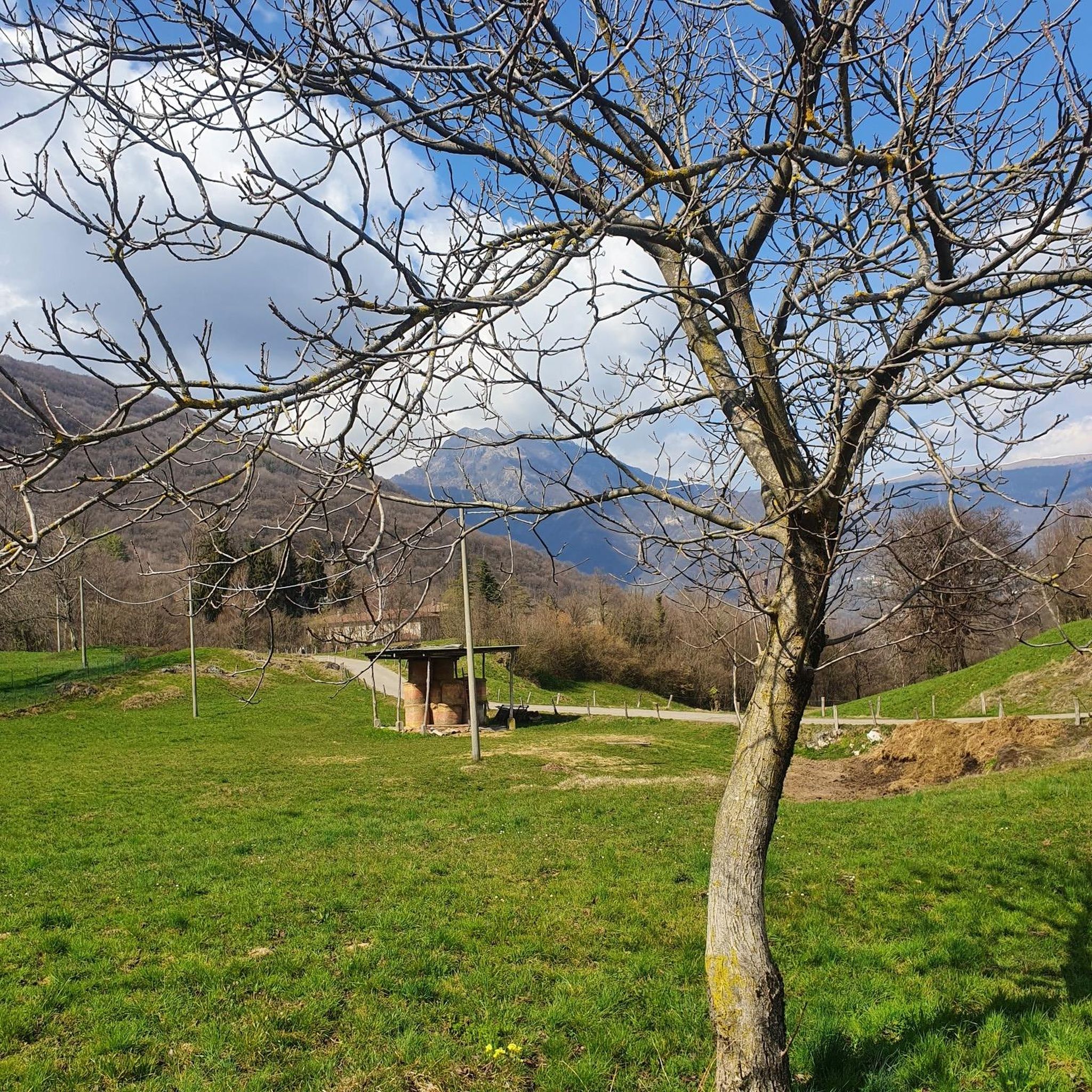
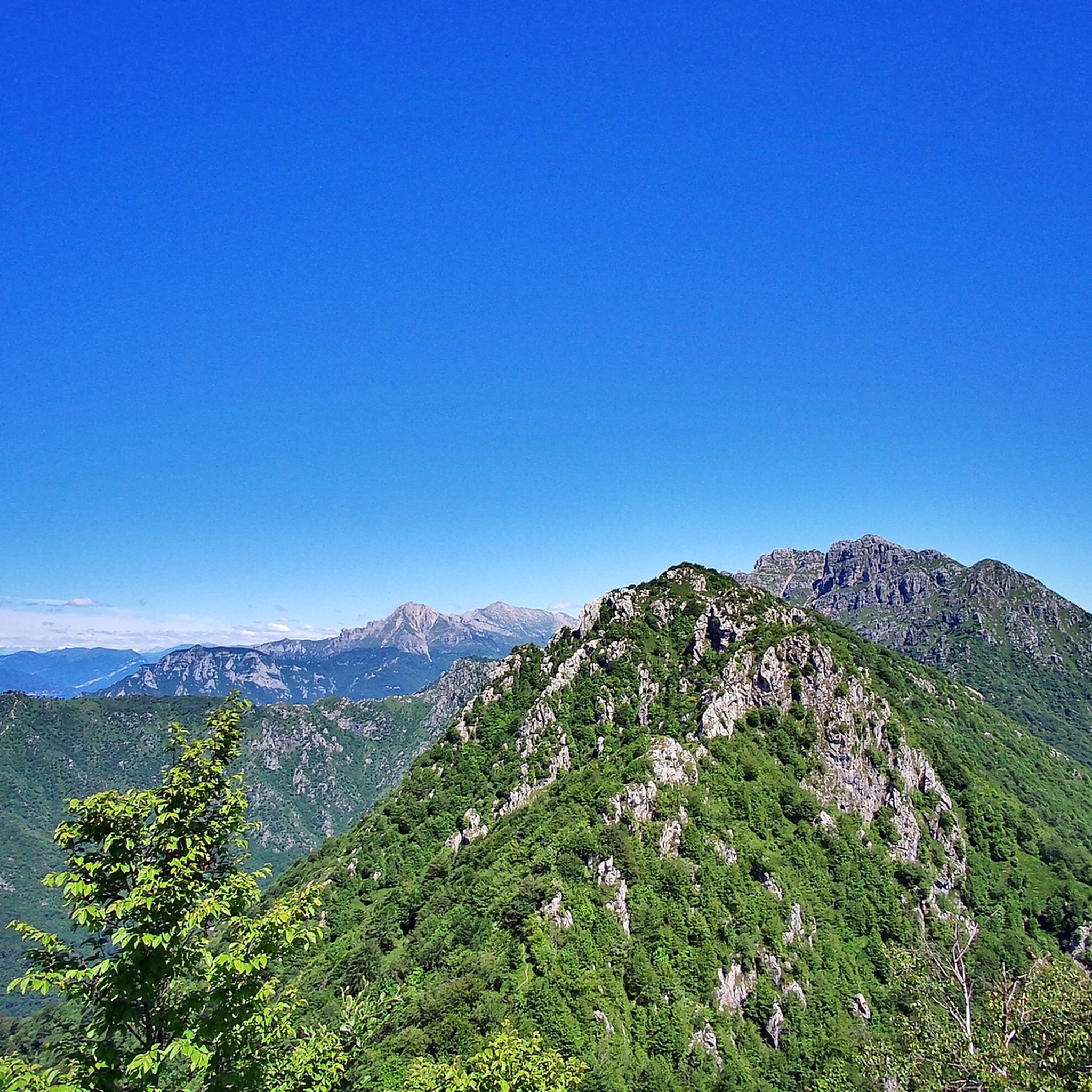
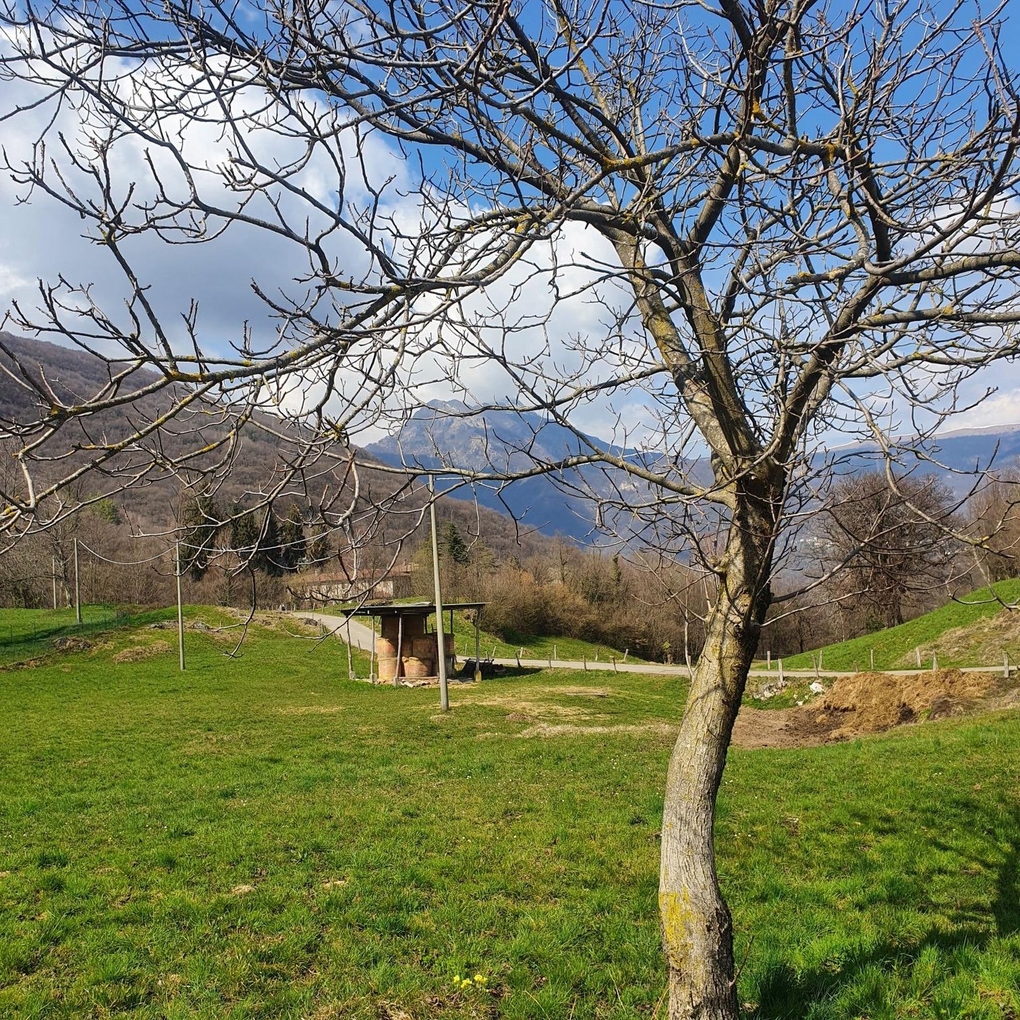


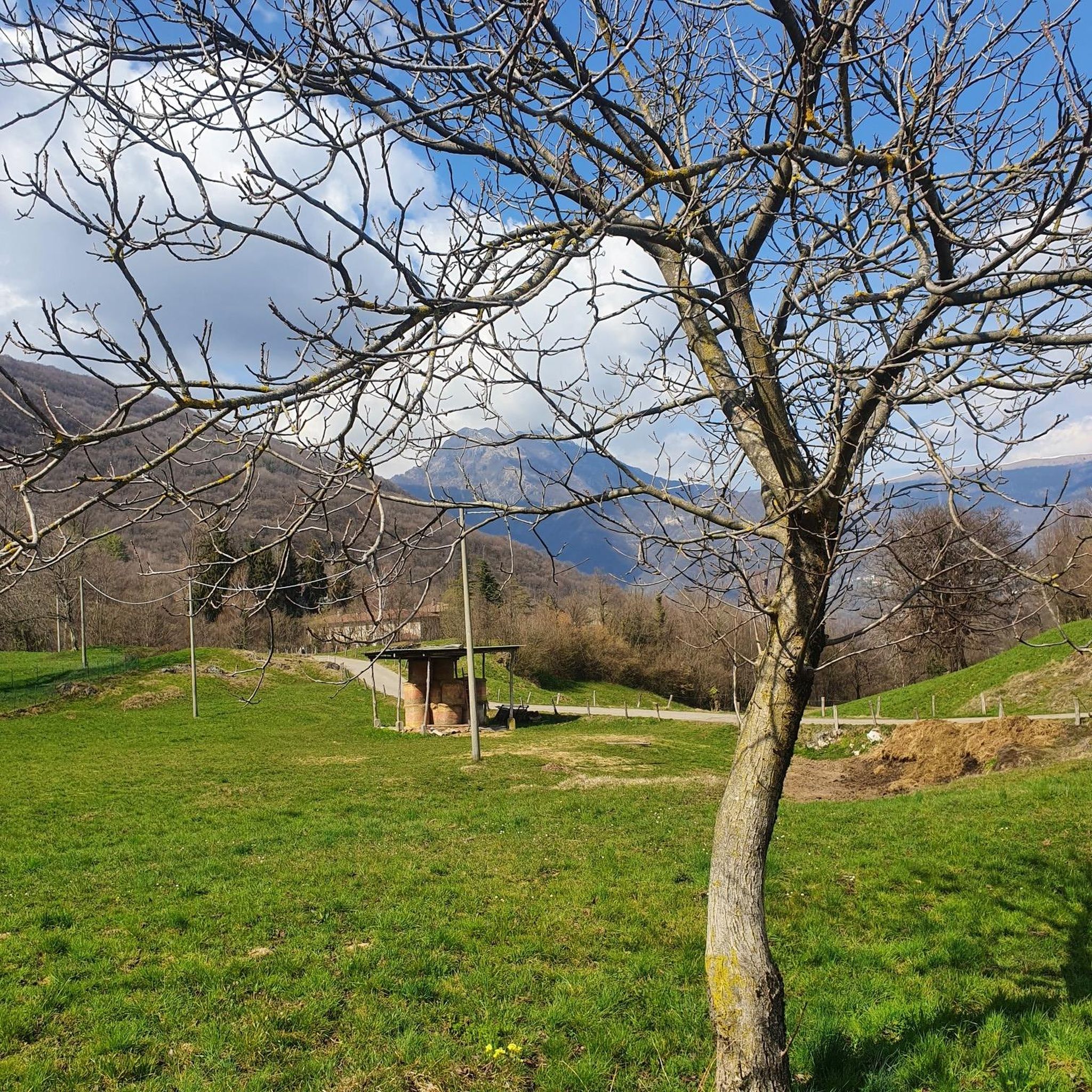
Tips from the Community

Always a show as always
0
0

Mount Resegone offers one of the most spectacular views in Lombardy! From its summit, at 1,875 meters, you can admire a breathtaking view that embraces the Alpine arch, the Apennines, Brianza and even Milan. What you can see from the top: Southern side: The city of Lecco, Lake Como, the Lombardy plain and, on clear days, even the Apennines. Northern side: Valsassina and the Bergamo valleys, such as Valle Imagna and Val Brembana. Western side: The lakes of Annone, Pusiano and Montorfano. Eastern side: The peaks of the Orobie, with glimpses of Monte Rosa in the distance. The Sentiero delle Creste is one of the most panoramic routes to reach the summit, offering spectacular views along the entire route. If you love photography or simply want to enjoy an unforgettable sunset, Resegone is a perfect destination!
0
0
Mount Resegone, also known as Mount Serrada, is a mountain in the Orobie Prealps, 1,875 meters high. It is located on the border between the provinces of Bergamo and Lecco, and is famous for its serrated profile, which resembles the blade of a saw—hence the name "Resegone". Main characteristics: Main peaks: Punta Cermenati, Punta Stoppani, Punta Manzoni, il Dente, Cima Pozzi, Pizzo Daina and Torre di Valnegra. Geology: Composed mainly of dolomite, a sedimentary rock dating back to the Upper Triassic. Hiking trails: Path no. 1 is the most popular route to reach the summit, starting from Lecco and arriving at the Rifugio Azzoni, located just below the summit. Shelters: The Rifugio Luigi Azzoni, near the summit, is a reference point for hikers. Curiosity: The Resegone is mentioned by Alessandro Manzoni in The Betrothed, where it is described for its characteristic shape
0
0

The Sentiero delle Creste is a nice post-work training ride when you have little time available.
0
0

The Rifugio Luigi Azzoni, located on the summit of Resegone, is a point of reference for hikers in the area. The panoramic view from its position is unparalleled, ranging from the Orobie Prealps to the plain. Open all year on weekends and every day in summer, it offers food and overnight accommodation.
1
1

Primo Corno is the highest peak of the three horns that make up Monte Barro, located in the Lombardy Prealps, in the province of Lecco. With an altitude of 814 meters, Primo Corno offers a spectacular view of the San Martino Valley, Lake Lecco, Lake Como and the surrounding mountains, such as Monte Resegone and the Grigne. Primo Corno can be reached via the Sentiero delle Creste (Path 305), a hiking trail that crosses the three horns of Monte Barro. This trail offers a panoramic trekking experience, with steep sections and rocky passages that make the route suitable for hikers with good physical preparation. From Primo Corno, you can continue towards Secondo Corno and Terzo Corno, or descend towards Monte Barro. The trail that leads to Primo Corno is well marked and offers beautiful panoramic views along the entire route. The Primo Corno del Monte Barro is particularly popular in spring and autumn, when the climate is ideal for hiking and the surrounding vegetation is particularly lush.
1
0
The 𝗣𝘂𝗻𝘁𝗮 𝗖𝗲𝗿𝗺𝗲𝗻𝗮𝘁𝗶 is the highest peak of the 𝗥𝗲𝘀𝗲𝗴𝗼𝗻𝗲, one of the most characteristic mountains of Lombardy, located in the 𝗣𝗿𝗲𝗮𝗹𝗽𝗶 𝗢𝗿𝗼𝗯𝗶𝗲, between Lecco and Bergamo. The 𝗥𝗲𝘀𝗲𝗴𝗼𝗻𝗲 is known for its unique appearance that resembles a saw with multiple tips. The 𝗣𝘂𝗻𝘁𝗮 𝗖𝗲𝗿𝗺𝗲𝗻𝗮𝘁𝗶 rises to 1875 meters and is one of the most popular destinations for hikers. Features of the 𝗣𝘂𝗻𝘁𝗮 𝗖𝗲𝗿𝗺𝗲𝗻𝗮𝘁𝗶: 𝗔𝗹𝘁𝗶𝘁𝘂𝗱𝗶𝗻𝗲: 1875 m 𝗣𝗼𝘀𝗶𝘇𝗶𝗼𝗻𝗲: part of the 𝗥𝗲𝘀𝗲𝗴𝗼𝗻𝗲 chain 𝗣𝗮𝗻𝗼𝗿𝗮𝗺𝗮: From the summit you can enjoy a spectacular view of Lecco, Lake Como and the Lombard Alps. On clear days you can see the Po Valley and even Milan in the distance. Itineraries to reach the 𝗣𝘂𝗻𝘁𝗮 𝗖𝗲𝗿𝗺𝗲𝗻𝗮𝘁𝗶: Several paths lead to the summit, with varying degrees of difficulty. Some of the most popular include: 𝗦𝗲𝗻𝘁𝗶𝗲𝗿𝗼 𝗱𝗮𝗹 𝗥𝗶𝗳𝘂𝗴𝗶𝗼 𝗔𝘇𝘇𝗼𝗻𝗶: The most popular route to reach the summit. The refuge is at about 1860 meters, almost at the top. From here you can take the last stretch to get to the 𝗣𝘂𝗻𝘁𝗮 𝗖𝗲𝗿𝗺𝗲𝗻𝗮𝘁𝗶 in a few minutes. 𝗦𝗲𝗻𝘁𝗶𝗲𝗿𝗼 𝗱𝗮𝗹𝗹𝗮 𝗖𝗮𝗽𝗮𝗻𝗻𝗮 𝗔𝗹𝗽𝗶𝗻𝗶𝘀𝘁𝗶 𝗠𝗼𝗻𝘇𝗲𝘀𝗶: A more challenging route that starts from Erve and crosses steep sections. It is appreciated by expert hikers. 𝗩𝗶𝗮 𝗱𝗮𝗹𝗹𝗲 𝗽𝗲𝗻𝗱𝗶𝗰𝗶 𝗱𝗶 𝗕𝗿𝘂𝗺𝗮𝗻𝗼: Another route, longer and more panoramic, starts from the Bergamo side of the 𝗥𝗲𝘀𝗲𝗴𝗼𝗻𝗲, ideal for those seeking tranquility. 𝗥𝗶𝗳𝘂𝗴𝗶𝗼 𝗔𝘇𝘇𝗼𝗻𝗶: 𝗥𝗶𝗳𝘂𝗴𝗶𝗼 𝗔𝘇𝘇𝗼𝗻𝗶, at 1860 meters, is a reference point for hikers. It is open all year round and offers an excellent base for rest. The summit can be reached in about 10-15 minutes. Activities in the area: 𝗘𝘀𝗰𝘂𝗿𝘀𝗶𝗼𝗻𝗶𝘀𝗺𝗼: The climb to the 𝗣𝘂𝗻𝘁𝗮 𝗖𝗲𝗿𝗺𝗲𝗻𝗮𝘁𝗶 is popular in both summer and winter. In winter, snowshoes are available. 𝗔𝗿𝗿𝗮𝗺𝗽𝗶𝗰𝗮𝘁𝗮: The 𝗥𝗲𝘀𝗲𝗴𝗼𝗻𝗲 offers interesting climbing routes. 𝗙𝗼𝘁𝗼𝗴𝗿𝗮𝗳𝗶𝗮: The landscape from the summit is one of the most photogenic in Lombardy, with spectacular views of the lake and the mountains. 𝗣𝘂𝗻𝘁𝗮 𝗖𝗲𝗿𝗺𝗲𝗻𝗮𝘁𝗶𝗶𝗻𝗴 is an ideal destination for those who love the mountains and want to experience an excursion in an environment rich in history and breathtaking views.
0
0

Stunning panorama that repays every effort made to reach the summit
0
1
Frequently Asked Questions
What are some popular mountain peaks offering great views near Sant'Omobono Terme?
For expansive views, consider Monte Barro Summit View, which offers wonderful vistas of the surrounding lakes. Another excellent choice is Monte Linzone Summit, known for its spectacular panorama and a terrace overlooking the Po Valley, ideal for sunrises and sunsets.
Are there any challenging mountain peaks for experienced hikers in the area?
Yes, the region offers several challenging options. The distinctive Resegone mountain, part of the Orobie Bergamasche, features strenuous mountaineering routes. The Luigi Azzoni Hut (Monte Resegone) serves as a key reference point for hikers on this peak, offering unparalleled panoramic views. Monte Misma, located towards Val Cavallina, also provides more challenging itineraries for experienced hikers, with views stretching from Lake Iseo to the highest peaks of the Orobie.
What kind of outdoor activities can I do near the mountain peaks around Sant'Omobono Terme?
Beyond hiking, the area around Sant'Omobono Terme is excellent for various outdoor activities. You can explore numerous cycling routes, including challenging ones like the Palio Pass loop, or enjoy mountain biking trails such as the Vitae Trail. For more details on these activities, you can check the Cycling around Sant'Omobono Terme and MTB Trails around Sant'Omobono Terme guides.
Are there family-friendly mountain peaks or walks suitable for beginners?
Yes, Canto Alto (1,146 m) is a favored spot for families due to its meadows, which are ideal for picnics and leisurely walks. It offers exceptional panoramic views and can be accessed from villages like Sorisole or Bruntino. The region generally offers a variety of trails, from easy paths suitable for beginners to more demanding routes.
What historical or cultural sites can be found on or near these mountain peaks?
The Hermitage of San Genesio is a notable historical and religious site located on a challenging climb. From its vantage point, you can enjoy beautiful views of the lake, Resegone, and Valcava, making it a rewarding destination for those interested in both nature and history.
What makes the views from the Orobie Bergamasche mountains so special?
The Orobie Bergamasche mountains offer diverse and expansive views. From peaks like Resegone, you can see the Orobie Prealps stretching to the plain. Monte Barro provides wonderful views of the surrounding lakes, while Monte Linzone offers a unique perspective over the Po Valley. The varied terrain ensures a wide range of scenic panoramas.
What are some of the best hiking routes available near Sant'Omobono Terme?
The area boasts a variety of hiking routes, catering to different skill levels. For challenging mountaineering, consider routes leading to the summit of Resegone. There are also specific mountain hikes like the 'Ferrata Gamma 2 Summit – View From Resegone loop' or the 'Via Ferrata of Mount Medale'. You can find more detailed information and routes in the Mountain Hikes around Sant'Omobono Terme guide.
What is Corno Medale known for?
Corno Medale (or Mount Medale), standing at 1,029 meters, is particularly known for its challenging via ferrata. This route is described as vertical and exposed but offers incredibly rewarding views from the summit. The stunning rock face and the magnificent panorama of Lecco and its surroundings are key attractions for climbers.
What do visitors enjoy most about the mountain peaks around Sant'Omobono Terme?
Visitors frequently highlight the unparalleled panoramic views from various summits, such as those from the Luigi Azzoni Hut (Monte Resegone) or Monte Linzone Summit. The sense of accomplishment after a challenging climb and the tranquility of nature are also highly appreciated. Many enjoy the diverse trails and the opportunity to capture stunning photos of the landscapes.
Is it possible to find accommodation or refreshments on the mountain peaks?
Yes, for instance, the Luigi Azzoni Hut (Monte Resegone) is located on the summit of Resegone and serves as a reference point for hikers. It offers food and overnight accommodation, typically open on weekends year-round and daily in summer, providing a convenient resting point or destination for those undertaking the ascent.
What is the best time of year to hike the mountain peaks near Sant'Omobono Terme?
The Orobie Bergamasche mountain range is generally accessible for hiking from spring through autumn. Summer offers the warmest weather and longest daylight hours, while spring and early autumn provide pleasant temperatures and vibrant scenery. Some huts, like the Luigi Azzoni Hut, are open year-round on weekends, suggesting that even in colder months, specific routes might be viable for well-prepared hikers.
Most popular routes around Sant'Omobono Terme
Most popular attractions around Sant'Omobono Terme

Get inspired with the komoot mobile app


Explore more
See even more amazing summits around Sant'Omobono Terme with these guides:
