The best mountain hikes around Ponte In Valtellina
5.0
(5)
56
hikers
5
hikes
Mountaineering routes around Ponte In Valtellina are situated within the Rhaetian Alps of Lombardy, offering diverse and dramatic landscapes. The region is characterized by high peaks, rugged terrain, and deep valleys such as Val Fontana and Val d'Arigna. Towering granite cliffs and numerous alpine lakes, including Lake Rogneda, are prominent natural features.
Best mountaineering routes around Ponte In Valtellina
- The most popular mountaineering route is Rifugio Mario Merelli al Coca – Lake Coca loop from Valbondione, a 6.3 miles (10.2 km) trail that takes about 5 hours 25 minutes to complete. This difficult route offers challenging ascents towards high-altitude refuges and alpine lakes.
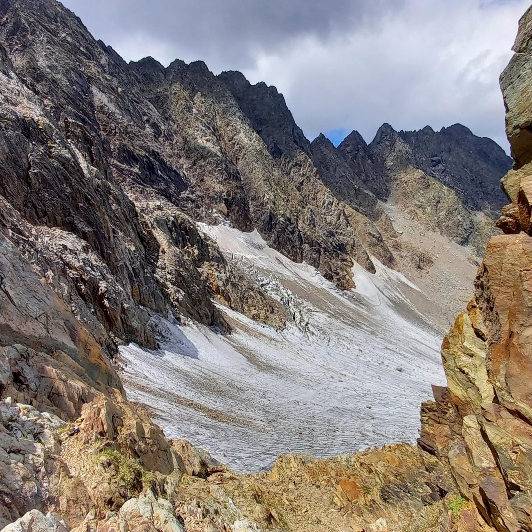
- Another top favourite among local mountaineers is View of Fellaria Glacier – Alpe Gembrè, 2217m loop from Campo Moro, a difficult 10.7 miles (17.3 km) path. This route provides expansive views of the Fellaria Glacier and surrounding peaks, typically completed in about 7 hours.
- Local mountaineers also love the Pizzo Meriggio loop from Albosaggia, a 7.8 miles (12.6 km) trail leading through the Orobic Alps, often completed in about 6 hours 5 minutes.
- Mountaineering around Ponte In Valtellina is defined by high peaks, rugged alpine terrain, and picturesque valleys. The extensive network offers options for various ability levels, from moderate paths to challenging mountaineering routes.
- The routes in Ponte In Valtellina are highly rated by the komoot community with an average score of 5.0 stars from more than 3 reviews. More than 100 mountaineers have used komoot to explore Ponte In Valtellina's varied terrain.
Last updated: July 4, 2026
10
hikers
12.4km
06:05
1,060m
1,060m
Hard mountaineering route. Very good fitness required. Sure-footedness, sturdy shoes and alpine experience required.
5.0
(1)
6
hikers
16.7km
07:42
1,280m
1,280m
Hard mountaineering route. Very good fitness required. Sure-footedness, sturdy shoes and alpine experience required.

Sign up for free
5
hikers
13.9km
07:58
1,470m
1,460m
Hard mountaineering route. Very good fitness required. Sure-footedness, sturdy shoes and alpine experience required.
5.0
(3)
28
hikers
11.6km
04:57
590m
590m
Hard mountaineering route. Good fitness required. Sure-footedness, sturdy shoes and alpine experience required.
5.0
(1)
3
hikers
15.4km
06:48
880m
870m
Hard mountaineering route. Very good fitness required. Sure-footedness, sturdy shoes and alpine experience required.
Our route recommendations are based on thousands of hikes, rides, and runs completed by other people on komoot.
Start today with a free account
Your next adventure awaits.
Login or Signup

Tips from the Community

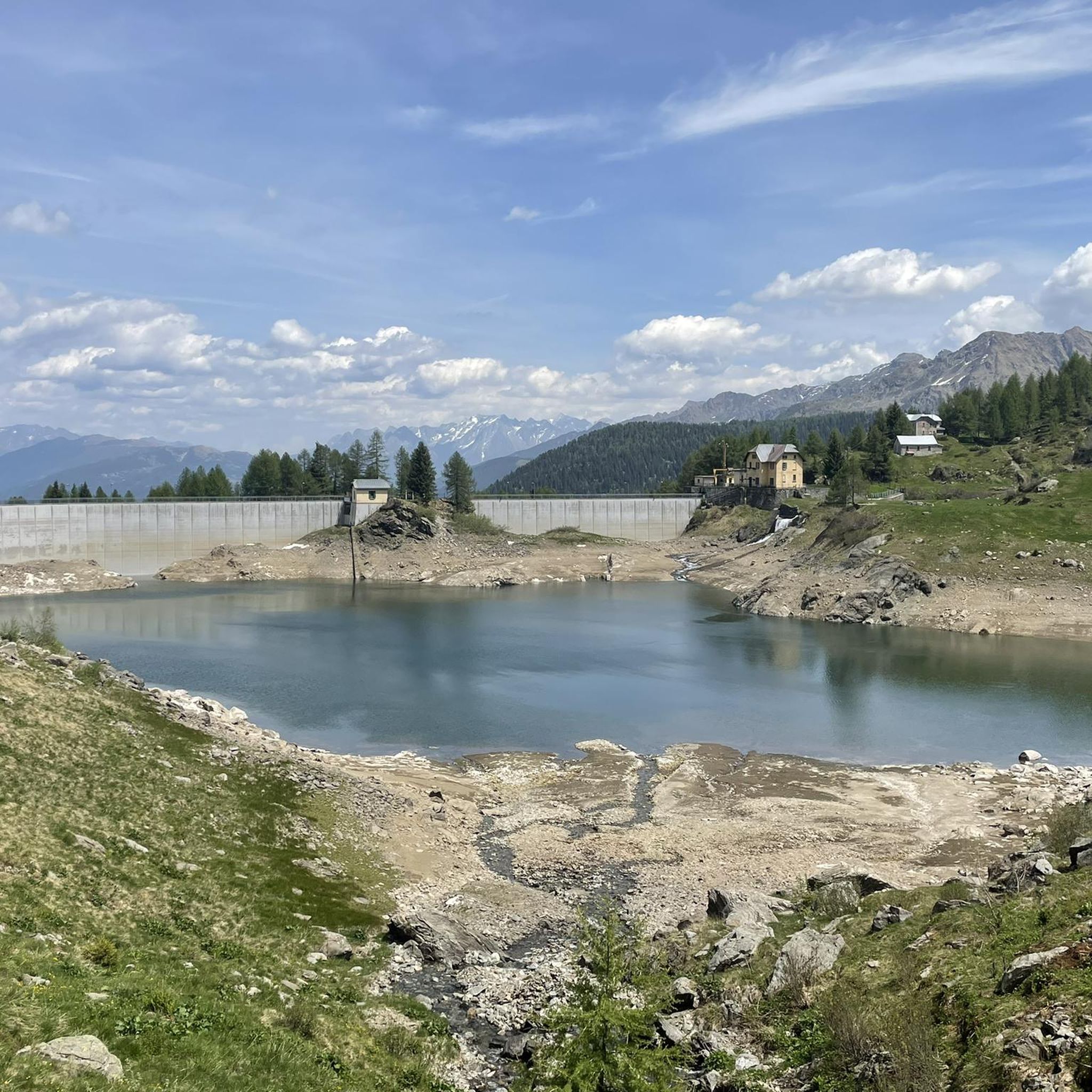
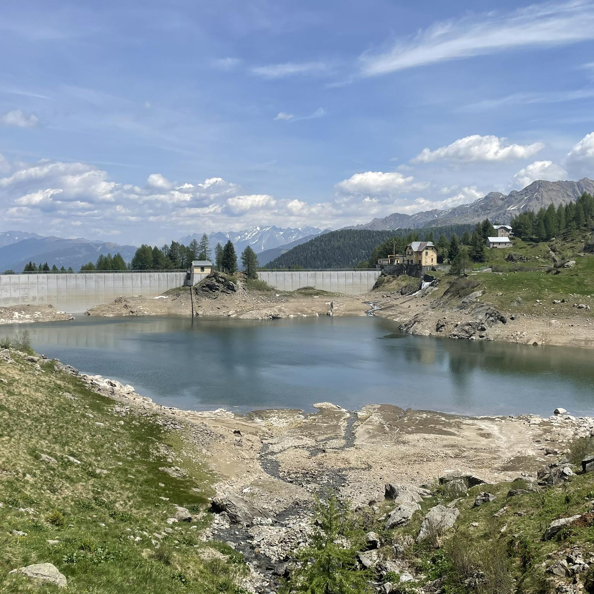
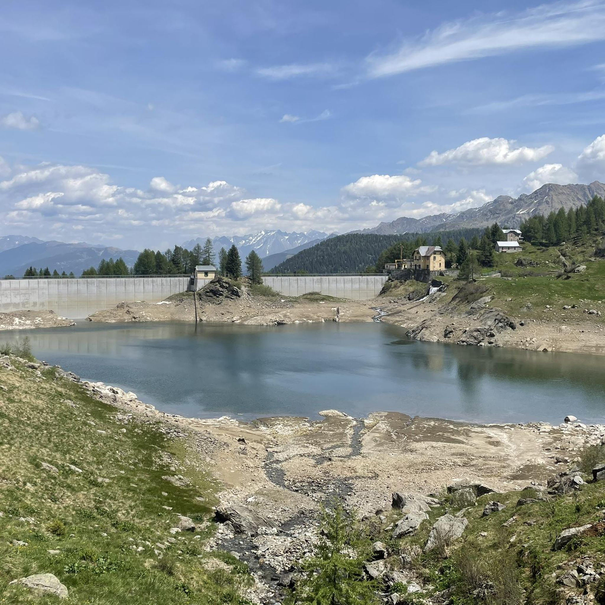
Imposing constructions that generate 2 artificial basins...
0
0
Very direct path to quickly ascend from the dam to the refuge, mostly accessible to everyone, you gain elevation steadily. Don't trust the signs, step counts and times are randomly given.
0
0
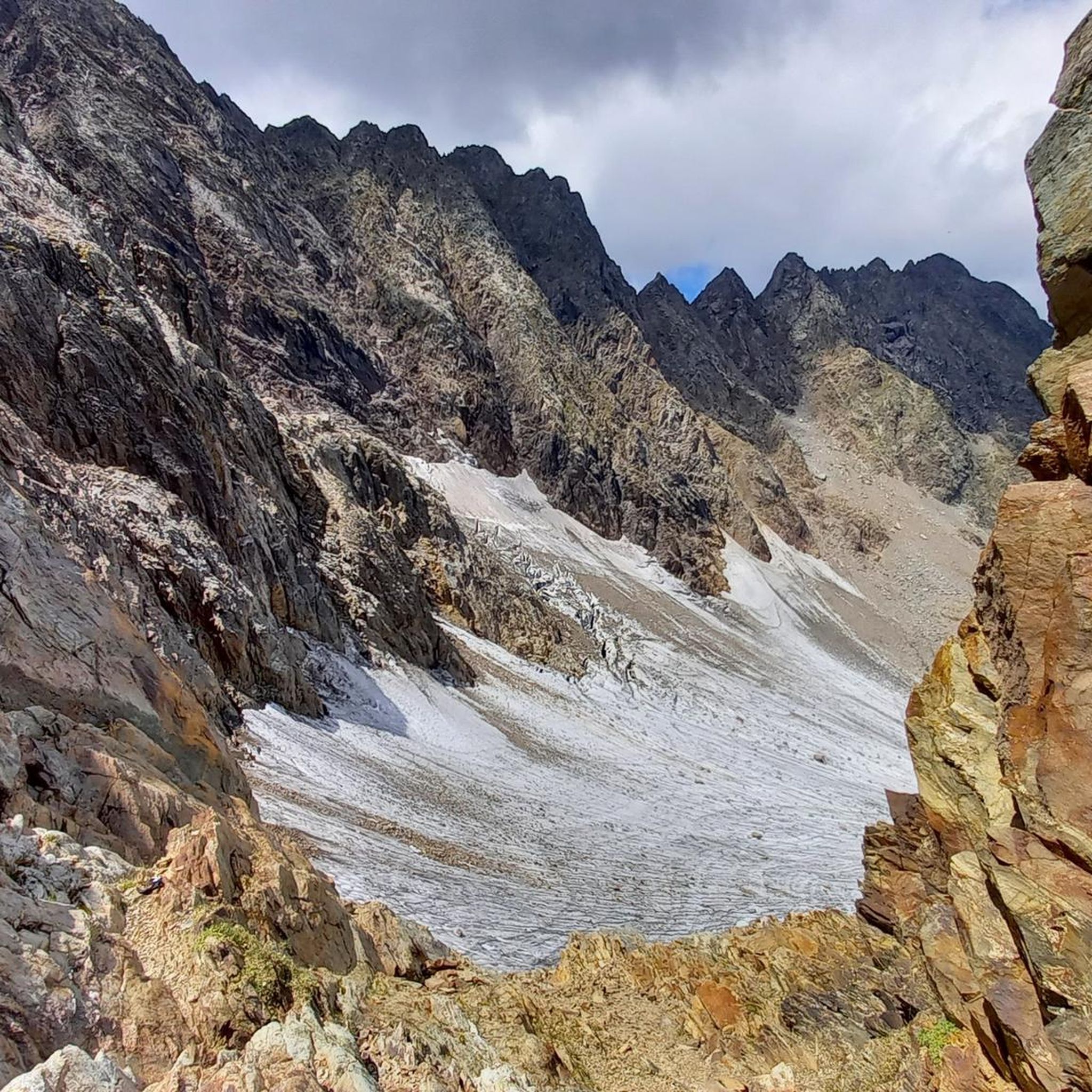
It is possible to do a loop and my advice is to do it counter-clockwise. However, if the goal is to reach the glacier in a day, it would be good to take the left trail uphill to reduce the overall kilometers and elevation gain.
0
0
It is a mountain pasture where cheese is produced. They have both goats and cows and a donkey. I also saw smoking near the rock face. The product is the same as what is later served in the mountain hut (a few hundred meters away).
0
0

A passage that may frighten the less experienced but is safe and without major difficulties
0
0
Merelli Refuge at Coca: a rugged and fascinating place in the Orobie Alps The Mario Merelli Refuge at Coca, at 1,891 meters, is one of the most iconic spots in the Coca Valley. Dedicated to the Bergamo mountaineer Mario Merelli, it retains his spirit: essential, authentic, deeply rooted in the mountains. Its location is what immediately strikes you: a natural balcony leading to the basin of the Orobie Giants, dominated by Pizzo Coca, Redorta, Scais, and Porola, a cluster of peaks that creates an imposing and almost solemn amphitheater. The ascent from Valbondione The classic access starts from Valbondione, near the village of Grumetti. The trail climbs steeply from the start, gaining altitude with regular switchbacks. It's a route that many describe as steep but safe, challenging enough to give you a sense of the mountain without ever becoming technical or exposed. Once out of the forest, the valley opens up and the dark walls of the Coca appear; The final, more challenging stretch leads to the refuge, which suddenly appears on a panoramic hill. The effort is always rewarded: those who arrive speak of its astonishing beauty and a setting that remains in their hearts. A refuge that tells a story The Merelli is a base for climbing Pizzo Coca and for crossings to the Brunone and Curò refuges, but it is also a place of memory. Inside, you can feel the legacy of Mario Merelli, and the atmosphere is that of the refuges of old: simple, welcoming, and sincere. It is a refuge that is not reached by chance: it is reached with commitment, and perhaps for this very reason, it leaves a profound impression.
0
0
The Chapel of San Carlo, located as you ascend from the Tezzi Alti of Gandellino toward the Sedornia Valley, is a small Alpine place of devotion dedicated to Saint Charles Borromeo, a saint widely venerated throughout Lombardy. Its origins are linked to popular tradition and the widespread presence of the Borromean cult in the Bergamo valleys, especially between the 17th and 18th centuries, when many rural communities erected chapels and votive stones to ask for protection from disease, famine, and natural disasters. The chapel is located along an ancient path connecting the Tezzi hamlets and the Sedornia pastures: a necessary passageway for shepherds, farmers, and travelers. For this reason, the local community chose to erect a small, simple, stone sacred building here as a sign of protection for those tackling the climb to the mountain pastures. Its location, slightly raised from the trail and overlooking the Sedornia stream, recalls the typical function of Alpine votive chapels: to bless the path and protect the valley. Over time, the chapel has become a symbol of identity for the residents of Gandellino and Tezzi. It is still carefully maintained today and is part of local cultural itineraries, as evidenced by tourist itineraries that include it among the area's historical points of interest.
0
0
The Spiazzi dell'Acqua Picnic Area is one of the most peaceful and pleasant spots in the Gandellino area, surrounded by greenery and perfect for a relaxing break before or after a hike. Located in an easily accessible clearing, it offers tables, natural shade, and a cool atmosphere thanks to the proximity to the water. It's a simple yet meticulously maintained spot, ideal for families, groups, or anyone looking to enjoy a quiet moment in nature. Its secluded location and wooded setting make it a small haven of peace, convenient to reach yet far from the noise.
0
0
Frequently Asked Questions
How many mountaineering routes are available around Ponte In Valtellina?
There are 9 mountaineering routes around Ponte In Valtellina, offering diverse experiences from moderate to difficult. The region is known for its challenging alpine terrain.
What makes mountaineering in Ponte In Valtellina unique?
Mountaineering in Ponte In Valtellina offers a unique blend of the majestic Rhaetian and Orobie Alps, featuring towering peaks, glaciers, and deep valleys like Val Fontana and Val d'Arigna. The area is also characterized by its terraced landscapes, which are a UNESCO World Heritage Site, showcasing a unique harmony between human activity and nature.
What do other mountaineers say about the routes in Ponte In Valtellina?
The routes in Ponte In Valtellina are highly rated by the komoot community, with an average score of 5.0 stars from more than 3 reviews. Users often praise the challenging ascents, expansive views, and the rugged beauty of the alpine terrain.
Are there any moderate mountaineering routes suitable for those with less experience?
Yes, there are 3 moderate mountaineering routes available. One popular option is the Rifugio Cristina loop from Fang, which covers 11.2 km and typically takes around 3 hours 40 minutes. This route offers a less strenuous but still rewarding alpine experience.
What are some challenging mountaineering routes for experienced climbers?
For experienced mountaineers, there are 6 difficult routes. The Rifugio Mario Merelli al Coca – Lake Coca loop from Valbondione is a challenging 10.2 km trail taking about 5 hours 25 minutes. Another demanding option is the Rifugio Mario Merelli al Coca – Antonio Curò Mountain Hut loop from Valbondione, a 14 km route with significant elevation gain.
When is the best time of year for mountaineering in Ponte In Valtellina?
The best time for mountaineering in Ponte In Valtellina is generally from late spring to early autumn (June to September) when the weather is more stable and trails are clear of snow. Some higher altitude routes may still have snow patches early in the season. Always check local weather and trail conditions before heading out.
Are there circular mountaineering routes available in the area?
Yes, many of the mountaineering routes around Ponte In Valtellina are circular. Examples include the Rifugio Mario Merelli al Coca – Lake Coca loop from Valbondione and the Pizzo Meriggio loop from Albosaggia, allowing you to start and end at the same point.
Can I find routes that pass by significant natural landmarks like waterfalls or glaciers?
Absolutely. The region is home to spectacular natural features. While specific routes may vary, the broader area boasts the impressive Serio Falls, one of Europe's highest waterfalls, and the stunning Fellaria Glacier, which can be admired on routes like the View of Fellaria Glacier – Alpe Gembrè, 2217m loop from Campo Moro. You can also explore highlights like Gleno Dam and Lake or the Barbellino Reservoir.
Are there mountaineering routes that include mountain huts for overnight stays or refreshments?
Yes, the presence of mountain huts is a key feature of mountaineering in this region. Routes often lead to or pass by huts like the Antonio Curò Mountain Hut or the Fratelli Calvi Hut, providing essential accommodation, food, and a chance to rest during longer expeditions. For example, the Rifugio Mario Merelli al Coca – Antonio Curò Mountain Hut loop is a great option.
Are there any notable peaks or summits accessible via mountaineering routes?
The Rhaetian and Orobie Alps surrounding Ponte In Valtellina offer access to numerous peaks. While specific routes vary, you can find highlights like Monte Sasna Summit and Mount Aga within the broader region, providing challenging ascents and panoramic views.
Is public transport available to reach trailheads around Ponte In Valtellina?
While Ponte in Valtellina itself is accessible, reaching specific high-altitude trailheads for mountaineering often requires private transport. Public transport options might be limited for direct access to remote starting points, so planning for car access or local taxi services is advisable for many routes.
Are permits required for mountaineering in the Valtellina region?
Generally, permits are not required for standard mountaineering routes in the Valtellina region. However, it's always recommended to check with local authorities or mountain guides for any specific regulations, especially if you plan to enter protected areas or attempt highly technical climbs.
Most popular routes around Ponte In Valtellina
Most popular attractions around Ponte In Valtellina

Get inspired with the komoot mobile app


Explore more
Browse the best Mountain Hikes & Routes in other regions.
