The best road cycling routes around Malagnino
4.5
(166)
2,342
riders
17
rides
Road cycling routes around Malagnino are characterized by generally flat terrain with minimal elevation gain, making them suitable for various fitness levels. The area's landscape is shaped by its proximity to significant waterways, including the Po and Oglio rivers, which often feature in route descriptions. This region of Lombardy offers extensive networks of roads that traverse agricultural lands and connect small towns. The consistent, gentle gradients provide opportunities for long-distance cycling without demanding climbs.
Best road cycling routes around Malagnino
…Last updated: October 14, 2026
5.0
(1)
27
riders
91.5km
03:57
160m
160m
Moderate road ride. Good fitness required. Some segments of this route may be unpaved and difficult to ride.
5.0
(1)
24
riders
Hard road ride. Very good fitness required. Mostly well-paved surfaces and easy to ride.

15
riders
Moderate road ride. Good fitness required. Mostly well-paved surfaces and easy to ride.
5.0
(1)
12
riders
Moderate road ride. Good fitness required. Some segments of this route may be unpaved and difficult to ride.
15
riders
Moderate road ride. Good fitness required. Mostly well-paved surfaces and easy to ride.
Get access to more routes and recommendations from other explorers.
Already have an account?
Our route recommendations are based on thousands of hikes, rides, and runs completed by other people on komoot.
Start today with a free account
Your next adventure awaits.

Tips from the Community

Pontevico is an Italian municipality of about 7,150 inhabitants located at the southern end of the province of Brescia, in Lombardy. The village stands in a historically strategic position along the Oglio river, which marks the natural border with the province of Cremona. The name derives from the Latin Pons Vici, which literally means "bridge of the village". The municipal territory is predominantly flat and includes the hamlets of Bettegno, Campazzo, Chiesuola and Toro. Local economy is historically divided between a strong agricultural vocation and an industrial textile development linked to the Bassa Bresciana district. The center is about 32 kilometers from the provincial capital Brescia and is easily reachable by car via the A21 motorway or by the Brescia-Cremona railway line.
0
0

The walls and towers of Pizzighettone (Cremona) constitute one of the best-preserved and most significant walled circuits in Northern Italy. This imposing military fortress, lapped by the Adda river, rises to a height of about 12 meters and has a thickness that reaches 4 meters in some places. Its uniqueness lies in the presence of "casemates", a continuous series of internal rooms that are entirely covered and communicate with each other.
0
0
The Pizzighettone railway bridge is an important metal arch infrastructure located on the Pavia-Mantova line (in the Codogno-Cremona section) which crosses the Adda river, connecting the Pizzighettone station with the Ponte d'Adda stop.
0
0

Nestled in the hills of Val d’Arda, which in prehistoric times were covered by the sea and of which traces remain in numerous fossils, Castell’Arquato stands within the Parco Regionale del Piacenziano, which takes its name from this historical period. An Orange Flag of the Touring Club Italiano, the medieval village, of rare beauty and great scenic impact, is capable of fascinating from afar, with its profile dominating the entire valley, as well as up close, with its narrow streets and its medieval stone houses, perfectly preserved and subject to constant restoration.
2
0

A wonderful stop. Both the church and the baptistery were open, and we were able to enter for a visit. It's worth a detour if you're in the area.
3
0

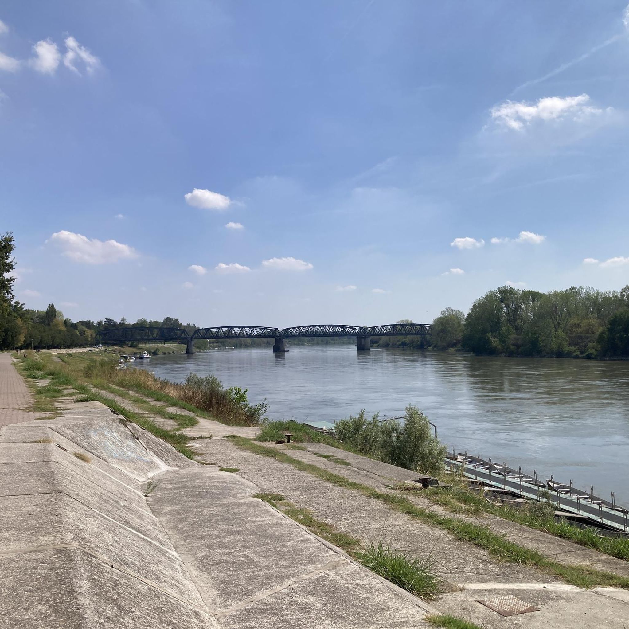
From the walk along the river there is a splendid view of the mighty railway bridge
2
0
Splendid church with a Romanesque and Gothic layout, but with later Renaissance and Baroque works inside.
2
0
Frequently Asked Questions
What is the general terrain like for road cycling around Malagnino?
Road cycling routes around Malagnino are predominantly flat, characterized by minimal elevation gain. The landscape is influenced by its proximity to the Po and Oglio rivers, offering extensive networks of roads through agricultural lands and connecting small towns. This makes the area suitable for long-distance cycling without demanding climbs.
How many road cycling routes are available in the Malagnino area?
There are over 15 road cycling routes available around Malagnino, catering to various skill levels from easy to difficult. The komoot community has rated these routes highly, with an average score of 4.4 stars.
Are there any easy road cycling routes suitable for beginners or casual riders?
Yes, there are easy routes available. For instance, the From the Po to the Oglio – Bridge over the Po loop from Villetta Malagnino is an easy 41.2 km route with minimal elevation gain, perfect for a relaxed ride.
What are some notable landmarks or attractions I can see while cycling around Malagnino?
While cycling in the broader Cremona province, you can explore several historical and architectural landmarks. Notable attractions include the Torrazzo of Cremona, the Iron Bridge over the Po River, the Cathedral of Saint Mary of the Assumption, and the Baptistery. Many routes traverse the countryside, offering views of agricultural fields and quiet villages.
Are there any challenging road cycling routes for experienced riders?
Yes, for experienced riders seeking a challenge, the Santuario di Lugagnano – View of Vigoleno loop from Villetta Malagnino is a difficult 139.8 km path. This route features the highest elevation gain in the area, providing a more demanding experience.
What do other road cyclists enjoy most about cycling in Malagnino?
The area is highly rated by the komoot community, with an average score of 4.4 stars from over 180 reviews. Reviewers often praise the flat riverine landscapes, agricultural fields, and quiet country roads that make for enjoyable and accessible cycling.
Are there any road cycling routes that follow the Po or Oglio rivers?
Yes, the region's landscape is shaped by its proximity to the Po and Oglio rivers, and many routes incorporate these waterways. For example, the From the Po to the Oglio – Bridge over the Po loop from Villetta Malagnino offers a direct connection to these river environments.
Can I find circular road cycling routes around Malagnino?
Many of the road cycling routes around Malagnino are designed as loops, allowing you to start and end at the same point. An example is the Roadbike loop from Villetta Malagnino, a 50 km trail through the local countryside.
What is the typical duration for road cycling routes in this area?
Route durations vary depending on distance and difficulty. Easy routes like the From the Po to the Oglio – Bridge over the Po loop from Villetta Malagnino can take around 1 hour 38 minutes, while more challenging routes such as the Santuario di Lugagnano – View of Vigoleno loop from Villetta Malagnino can take over 6 hours.
Are there any routes that pass by historical sites or castles?
Yes, some routes offer glimpses of historical sites. The Gazzo Castle - Scandalora Ripa d'Oglio (CR) – Memorial to the Fallen with F-104 loop from Villetta Malagnino is a moderate route that includes a castle and other points of interest.
Is Malagnino a good destination for long-distance road cycling?
Given the generally flat terrain and extensive network of quiet country roads, Malagnino and the surrounding Cremona province are well-suited for long-distance road cycling. The consistent, gentle gradients allow for sustained efforts without significant climbs.
Most popular attractions around Malagnino

Get inspired with the komoot mobile app


Explore more
Browse the best Road cycling routes in other regions.
