The best walks and hikes in the Swan Range
4.9
(17)
403
hikers
33
hikes
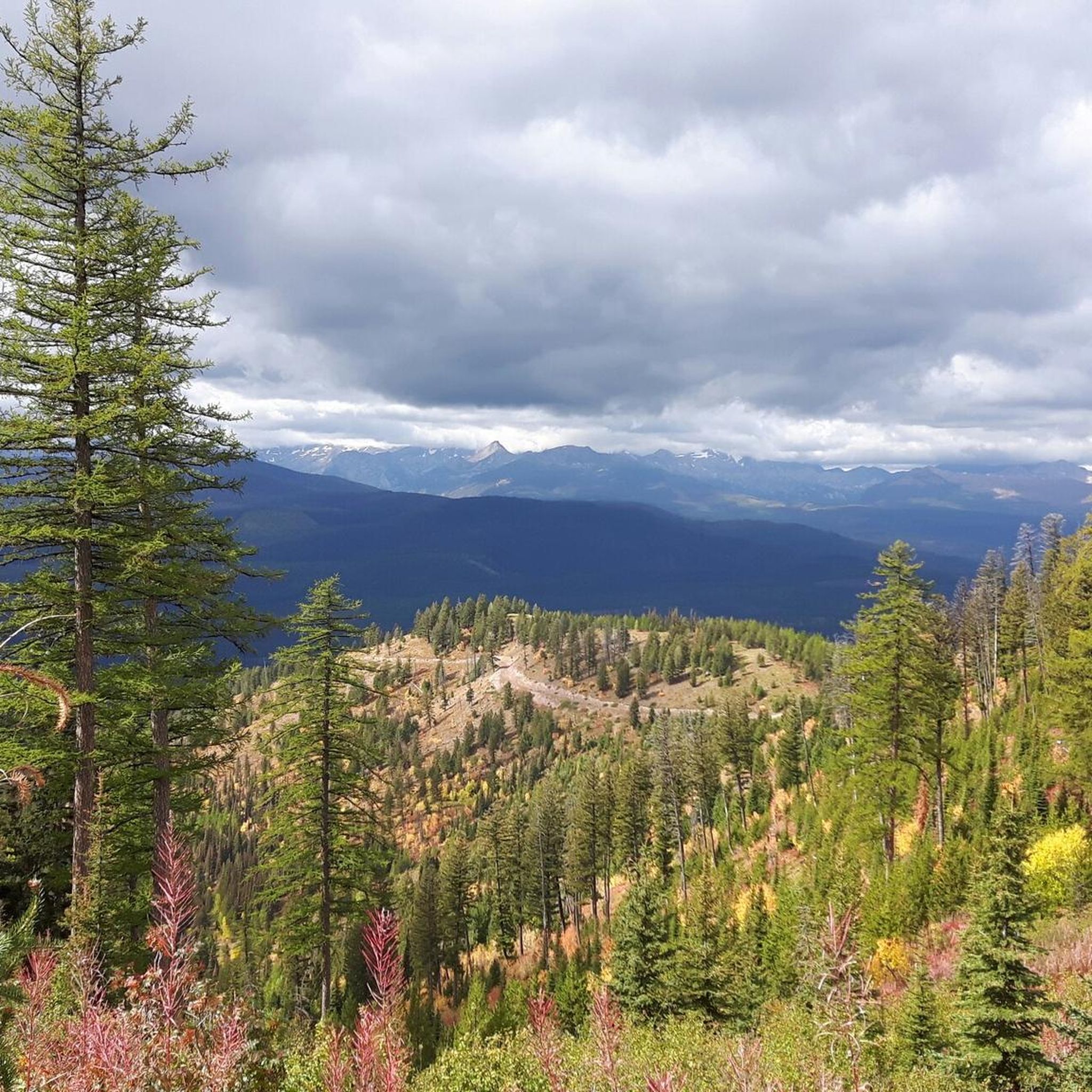
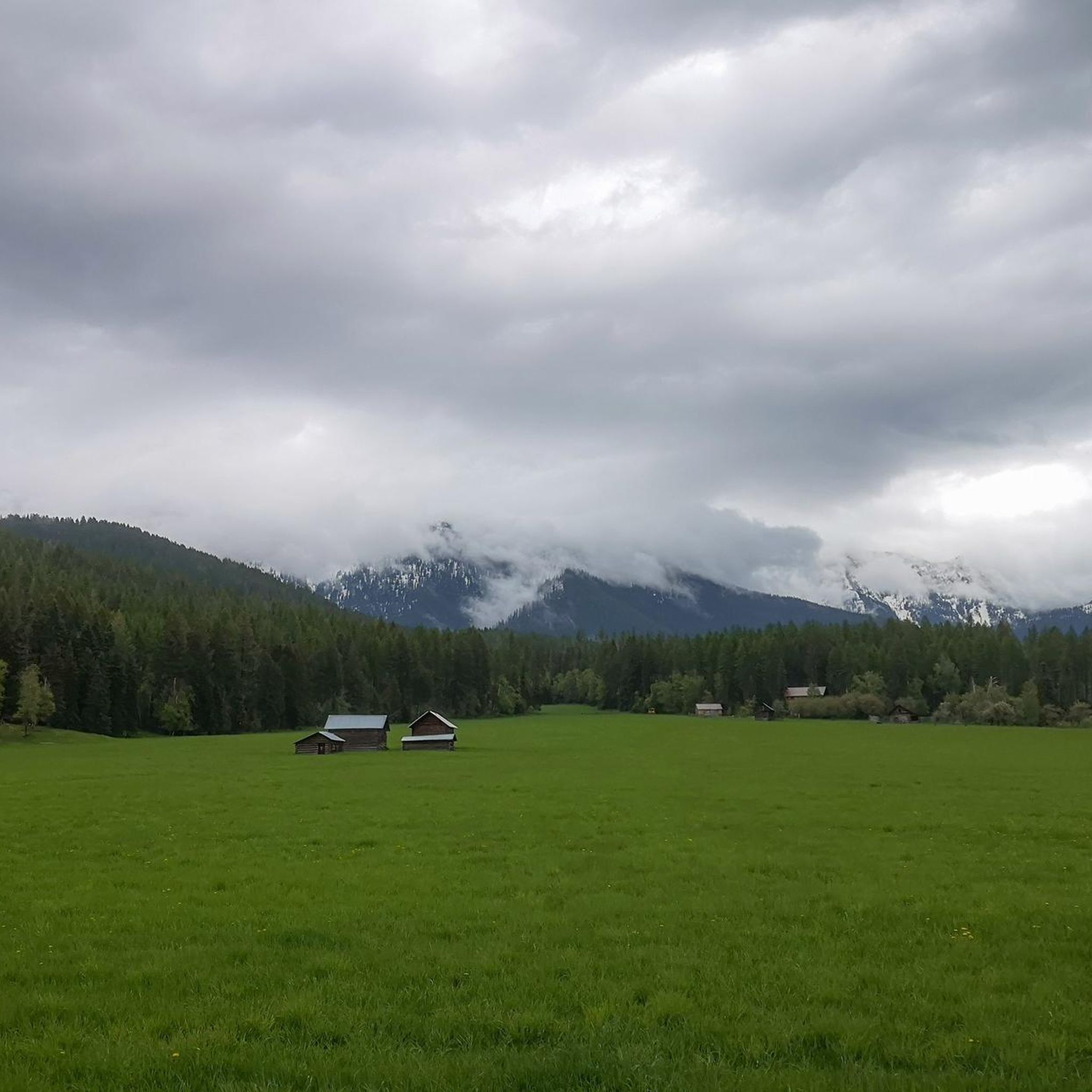
Hikes in the Swan Range explore a rugged mountain landscape in western Montana, located south of Glacier National Park. The region is characterized by a sheer western face, dense forests at lower elevations, and exposed limestone on its upper reaches. Many trails lead to alpine lakes and offer significant elevation gain, with a network of routes concentrated in the Jewel Basin Hiking Area.
Best hiking trails in the Swan Range
- The most popular hiking route is Holland Falls Trail — Flathead National Forest, a 3.0 mile (4.9 km) trail that takes around 1 hour 20 minutes to complete. This is an easy route with minimal elevation gain that leads to a waterfall.
- Another top favourite among local hiking enthusiasts is Mount Aeneas — Jewel Basin Hiking Area, a moderate 5.6 mile (9.0 km) path. The trail involves a steady climb to the summit inside the foot-traffic-only Jewel Basin.
- Local hiking enthusiasts also love the Birch Lake — Jewel Basin Hiking Area, a 6.5 mile (10.5 km) trail leading through alpine meadows, often completed in about 3 hours 10 minutes.
- Hiking in the Swan Range is defined by its pristine alpine lakes, dense forests, and high-elevation crests. The trail network provides options for different ability levels, from easy family hikes to challenging multi-day routes.
- The routes in Swan Range are highly rated by the komoot community with an average score of 4.9 stars from more than 10 reviews. More than 290 hikers have used komoot to explore Swan Range's varied terrain.
Last updated: June 24, 2026
4
hikers
11.5km
04:01
970m
80m
The Sapphire Lake trail in Flathead National Forest offers a profound sense of solitude amidst rugged alpine beauty. As you climb, you'll be treated to great views of the Mission Mountains, passing numerous waterfalls and enjoying jaw-dropping cliff-edge views of the valley and Upper Holland Lake before reaching the glassy, crystal-blue waters of the remote lake itself. This challenging route is a true wilderness experience, perfect for those seeking a demanding yet rewarding adventure.
This difficult 7.1-mile (11.5 km) hike involves a significant 3183 feet (970 metres) of elevation gain, typically taking around 4 hours and 1 minutes to complete. Access usually starts on the 415 trail, and while it can be done as a long day hike, many prefer to split it into a two-day backpacking trip. Be aware that snow can be present near the lake even in summer, so plan your visit accordingly and check conditions beforehand.
Situated at around 7,000 feet in elevation, this Sapphire Lake is a hidden gem in the Flathead National Forest, often uncrowded compared to more popular destinations. Its remote location and challenging access contribute to a significant sense of achievement for those who reach its shores. The trail provides an immersive wilderness experience, showcasing the pristine natural beauty of Montana's high country.
4
hikers
7.54km
02:13
300m
50m
Embark on a moderate hike along the Heart Lake via Mainline Trail (#481), a 4.7-mile (7.5 km) route that takes about 2 hours and 12 minutes to complete. You'll gain 989 feet (301 metres) in elevation as you wind through young pine and aspen forests. Early on, the trail offers lush sections with side-streams and a pretty cascade, providing a refreshing start. The path gradually ascends, with the final mile becoming steeper as you approach the stunning Heart Lake. This glacial lake is dramatically set against cliffs that often retain pockets of snow, creating a picturesque backdrop for your efforts.
Before you set out, know that this trail is shared by both hikers and horses, so be prepared to encounter equestrian users along the way. Heart Lake itself is a popular destination, especially for those interested in fishing or backpacking. If you are considering an overnight adventure, established campsites are available near the lake. Plan your visit to allow ample time to enjoy the serene environment and the views from the lake.
This route is nestled within Montana's Helena National Forest, offering a true immersion into the region's natural beauty. The presence of a glacial lake, carved into the landscape and framed by dramatic cliffs, highlights the unique geological features of this area. It's a notable trail for its accessibility to a pristine alpine environment, making it a favored spot for both day-trippers and those seeking a longer wilderness experience.

Sign up for free
3
hikers
5.06km
01:31
210m
70m
Embark on the easy Mount Aeneas Trail, a rewarding hike covering 3.1 miles (5.1 km) with an elevation gain of 679 feet (207 metres). You can expect to complete this route in about 1 hour and 30 minutes. As you ascend, the path winds through mixed conifer woodlands before opening up to ridgelines, offering a varied and engaging experience.
To begin your adventure, head to the Camp Misery trailhead. Be aware that the road leading to the trailhead can be rough, so plan your vehicle choice accordingly. The paths themselves are generally well-maintained and clearly marked, making navigation straightforward once you are on foot.
From the 7,500-foot summit, you are treated to expansive 360-degree vistas of the Flathead Valley, the Swan Range peaks, and the sprawling Jewel Basin. Keep an eye out for mountain goats, especially near the summit, and enjoy the vibrant seasonal wildflowers. You might even spot distant peaks of Glacier National Park and Flathead Lake.
1
hikers
5.11km
01:24
90m
50m
Embark on an easy 3.2-mile (5.1 km) hike along the Dearborn River Trail, where you'll gain 304 feet (93 metres) in elevation over approximately 1 hour and 23 minutes. The initial section passes by private cabins, but soon the landscape opens up to wild and impressive Rocky Mountain views. As you continue, you'll discover majestic reefs and cliffs forming the Dearborn River Canyon. The route's highlight is Devil's Glen, where the river has sculpted unique rock formations and created clear, glacial waters, complete with a small waterfall. Around 2.5 miles in, you can even find a natural swimming hole, offering a refreshing spot to cool off.
When planning your visit, be mindful that the first mile of the trail traverses near private cabins; please respect local property. This region is known for its wildlife, including grizzly bears and moose, so if you are considering camping, ensure you practice proper food storage techniques. The road leading to the trailhead is typically plowed, making the area accessible for winter activities. This allows for cross-country skiing or snowshoeing during colder months.
This trail offers a rewarding experience within Montana's Helena-Lewis and Clark National Forest. Beyond the initial stretch, the scenery transforms, showcasing the dramatic beauty of the Rocky Mountains. The impressive views of the Dearborn River Canyon's reefs and cliffs are a defining feature of this route. The unique geological formations at Devil's Glen, carved by the river, make this a notable destination for those exploring the region.
4.21km
01:40
490m
20m
Embark on the Strawberry Lake Trail No. 5, a moderate hike that leads you through dense pine forests, where towering western red cedar and lodgepole pines create a peaceful atmosphere. This route covers 2.6 miles (4.2 km) and involves a steady climb of 1597 feet (487 metres), typically taking about 1 hour and 40 minutes to complete. As you ascend, you might catch glimpses of Echo and Flathead Lakes peeking through the trees. The path eventually flattens, bringing you to the pristine Strawberry Lake, a beautiful alpine lake with clear, reflective waters and granite outcroppings, offering a tranquil reward for your effort.
When planning your visit, be aware that the trail can be rocky and steep in certain sections, so watch your footing for roots. You should also prepare for potentially muddy conditions and downed trees, particularly if you are hiking after spring storms. This is a shared-use trail, meaning you might encounter horseback riders, mountain bikers, or motorcyclists during your journey. Always be mindful of other users and share the path respectfully.
This trail is a rewarding option within Flathead National Forest, providing a solid workout with a picturesque destination. The consistent climb through varied terrain makes it a good choice for those seeking an active outdoor experience. The serene setting of Strawberry Lake, nestled among granite formations, highlights the natural beauty of the region and offers a perfect spot for quiet contemplation before your descent.
8.97km
02:50
550m
30m
Embark on a moderate hike to Pyramid Lake via Pyramid Pass Trail, covering 5.6 miles (9.0 km) with an elevation gain of 1804 feet (550 metres). You can expect to complete this route in about 2 hours and 49 minutes. The trail begins in dense forest, gradually opening up as you ascend towards Pyramid Pass. Here, you'll catch views of Pyramid Peak before a short descent to the serene 10-acre alpine Pyramid Lake. The path itself is a mix of dirt, rocks, and roots, with some sections following an old logging road. You might also spot vibrant wildflowers in season, adding color to your journey.
This trail is a popular access point, especially during summer. You might encounter outfitters and recreational horse parties on the route. It's important to be aware and cautious around stock animals, as they can be easily spooked by hikers. The trailhead offers general access, making it straightforward to begin your adventure into the Lolo National Forest.
The route serves as a key access route into the vast Bob Marshall Wilderness, offering a gateway to a more remote experience. Pyramid Lake itself is a notable feature, a peaceful 10-acre alpine lake nestled at 6,927 feet. This trail provides a rewarding day hike for those looking to explore a significant wild region and experience diverse forest and alpine landscapes.
4.78km
01:46
500m
10m
Embark on a moderate hike up the Mount Aeneas Trail, a 3.0-mile (4.8 km) route that challenges you with 1655 feet (505 metres) of elevation gain. You will spend about 1 hour and 45 minutes climbing through dense forests before emerging onto open ridgelines. As you ascend, the scenery transforms, leading you to expansive vistas. From the 7,500-foot summit, you can gaze across Flathead Lake, the Hungry Horse Reservoir, and the distant peaks of Glacier National Park. This journey offers a true sense of accomplishment.
Before you head out, be aware that the road leading to the Camp Misery trailhead can be quite rough, so a capable vehicle is highly recommended for access. The best time to experience the trail is from late spring through early fall, when you can avoid snow and enjoy the vibrant seasonal wildflowers. Always remember to carry bear spray, as wildlife encounters are possible in this area. Dogs are welcome to join you on the trail, but please keep them on a leash for their safety and that of other hikers and wildlife.
This trail is a highlight within the Flathead National Forest, known for its diverse ecosystem and abundant wildlife. Keep an eye out for mountain goats near the summit, often seen navigating the rocky terrain. The varied landscape, from shaded forest paths to exposed ridgelines, showcases the natural beauty of the region. It is a popular choice for those seeking a rewarding climb with panoramic views.
7.05km
03:59
1,500m
100m
The Holland Peak Trail offers a challenging hiking experience through diverse landscapes, culminating at the highest point of an almost 100-mile ridge in the Swan Range. This difficult 4.4-mile (7.1 km) route demands a significant effort, with an elevation gain of 4912 feet (1497 metres) over an estimated 3 hours and 58 minutes. As you ascend, you will encounter sections with scrambling and exposed slabs, leading to a notable viewpoint over Upper Rumble Creek Lake. The journey provides expansive views into the Bob Marshall Wilderness and distant vistas of the Mission Mountains and Glacier National Park. Keep an eye out for wildflowers and local wildlife, including mountain goats, adding to the natural beauty of your trek.
Given the difficult nature of the Holland Peak Trail, careful planning is essential before you set out. You should be prepared for tricky terrain, especially as you approach the summit. Early in the season, particularly in June, snow can still be present on the trail. If you plan to hike during this time, consider bringing specialized gear like crampons and ice axes for safe passage. Always check current trail conditions and weather forecasts before heading out to ensure a safe and enjoyable adventure.
This trail is a highlight within the Flathead National Forest, offering a unique opportunity to explore a remote and rugged part of the Swan Range. The route passes by picturesque bodies of water, including Lower and Upper Rumble Lake, providing scenic spots for a break. Reaching Holland Peak itself means standing atop a significant geological feature, offering a sense of accomplishment and unparalleled views. This trek is ideal if you are an experienced hiker looking for a demanding yet rewarding journey into a vast wilderness area.
1.10km
00:17
10m
10m
Embark on the Lion Lake Loop, an easy hike that guides you through a dense forest canopy in Flathead National Forest. This pleasant route spans 0.7 miles (1.1 km) and involves a gentle elevation gain of 42 feet (13 metres), making it a perfect choice for a quick outdoor escape. You can expect to complete this loop in about 17 minutes, enjoying the peaceful atmosphere among towering pines and seasonal wildflowers.
Planning your visit is straightforward, as the trail is generally accessible and does not require any special permits or fees. Parking is typically available near the trailhead, offering a convenient starting point for your adventure. This route is well-suited for beginner hikers and is considered family friendly, providing a welcoming experience for all.
As you explore the Lion Lake Loop, keep an eye out for local wildlife, as deer, various birds, and even moose are common sightings in this area. The trail offers a serene immersion into nature, highlighting the natural charm of the Flathead National Forest. It's a great way to experience the local ecosystem without committing to a longer, more strenuous journey.
4.50km
01:37
390m
90m
Embark on the Doris Ridge Trail for a moderate hiking experience that climbs through varied terrain. You will follow singletrack paths winding through a lush forest before reaching more open sections. The ascent rewards you with panoramic 360-degree views from Doris Mountain, where you can spot the impressive peaks of Glacier National Park. This route covers 2.8 miles (4.5 km) with a significant elevation gain of 1290 feet (393 metres), typically taking about 1 hour and 37 minutes to complete.
When planning your visit, be aware that the access road to the trailhead can be quite rough, so it is best to use a vehicle with higher clearance. Dogs are welcome on the trail, making it a great option if you want to bring your canine companion along. Always check local conditions before you head out to ensure a safe and enjoyable trip.
The Doris Ridge Trail is nestled within Flathead National Forest, offering a chance to immerse yourself in a diverse natural landscape. As you hike, keep an eye out for local wildlife and listen for various bird species, adding to the natural appeal of the area. This trail provides a rewarding balance of physical challenge and scenic beauty, making it a notable choice for exploring the region's outdoor offerings.
Get access to more routes and recommendations from other explorers.
Sign up for free
Already have an account?
Our route recommendations are based on thousands of hikes, rides, and runs completed by other people on komoot.
Start today with a free account
Your next adventure awaits.
Login or Signup


Tips from the Community

Upper Rumble Creek Lake is a beautiful alpine lake nestled in Montana's Swan Range, near Condon. Situated at an elevation of approximately 7,960 feet, it lies just beneath Holland Peak, the highest summit in the range at 9,356 feet. From this spot between Holland Peak and Norm's Big Peak, you get a truly stunning view down to the blue lake at the base of the steep bowl.
0
0
Sapphire Lake is small, pristine alpine lake located at approximately 7,006 feet in the Flathead National Forest. Most get here via Trail No. 415, which begins near Holland Lake. The hike to the lake is considered challenging, with a total round-trip distance of approximately 14.2 miles and an elevation gain of around 3,100 feet.
0
0
Upper Holland Lake is approximately 5.5 miles from the Holland Lake trailhead and and is often hiked as part of a loop with Upper Sapphire Lake. Situated at about 6,100 feet the lake is surrounded by towering peaks, making it scenic spot to eat some lunch at before continuing on your hike.
0
0

The summit of Mount Aeneas is very scenic: you have a spectacular view of Birch Lake, Black Lake and the other nearby basins of the Flathead National Forest.
0
0
From the summit of Doris Mountain, the view is majestic: ranging from the Hungry Horse Reservoir to the small lakes that you passed uphill.
0
0
Holland Peak is the highest peak in the Swan Range. The hike to its summit is very challenging and requires a sure-footedness on the ridge segment. From there, there is a breathtaking view of the Rumble Creek Lakes and the surrounding mountains.
0
0
Pyramid Lake is located below the homonymous peak. The path to reach it is easy to follow and it's not too steep. A hike that I highly recommend: it will leave you amazed.
0
0
The view along the trail is stunning and the lake is no less impressive. An excellent destination for a day hike.
0
0
Frequently Asked Questions
Are there any easy, family-friendly hikes in the Swan Range?
Yes, the Swan Range has options for families and younger hikers. The Holland Falls Trail is a great choice, offering a relatively flat 3-mile (4.9 km) roundtrip to a scenic waterfall. It's a rewarding walk that is manageable for most fitness levels.
What should I know about wildlife and bear safety when hiking here?
The Swan Range is home to a variety of wildlife, including both black and grizzly bears, moose, elk, and mountain lions. It is crucial to be bear-aware at all times.
Always carry bear spray and know how to use it, make noise while you hike to avoid surprising animals, and store food securely. Never feed wildlife. Hiking in groups is also recommended for safety.
When is the best time of year to hike in the Swan Range?
The primary hiking season is from July through September, when most trails are snow-free and the weather is generally favorable. Autumn, particularly late September and early October, is also a spectacular time to visit, as the larch trees turn a brilliant golden-orange color, creating a stunning contrast with the landscape.
Are there any good hikes to waterfalls?
Absolutely. Besides the popular Holland Falls, you can also explore the trail to Morrell Lake and Falls. This moderate 5.4-mile (8.7 km) hike in the Lolo National Forest leads to both a beautiful lake and a picturesque waterfall, offering two scenic rewards in one trip.
What is the Jewel Basin Hiking Area?
The Jewel Basin is a special 15,000-acre area within the Swan Range that is designated for foot traffic only, meaning no motorized vehicles or even pack animals are allowed. It's a hiker's paradise, featuring over 35 miles of trails, more than 20 alpine lakes, and prominent peaks like Mount Aeneas.
Are there options for multi-day backpacking trips?
Yes, the Swan Range is excellent for backpacking. For a classic multi-day experience, consider the Holland Lakes Loop. This challenging 12.5-mile (20.2 km) route takes you high along the Swan Crest and offers opportunities for backcountry camping near stunning alpine lakes.
What kind of terrain can I expect on the trails?
The terrain is quite varied. Lower elevation trails often wind through dense timber. As you climb, the forest gives way to open alpine meadows, often covered in wildflowers during the summer. Higher up, you'll find rugged, rocky paths, exposed limestone peaks, and classic glacial features like cirques and tarns.
Can I hike to a summit for panoramic views?
Definitely. A rewarding summit hike is the route up Mount Aeneas in the Jewel Basin. This moderate 5.6-mile (9.0 km) trail involves a steady climb but rewards you with expansive 360-degree views of the surrounding lakes and the Flathead Valley.
Are there any circular hikes or loops available?
Yes, there are several loop hikes. A great option for experienced hikers is the Lakes Loop in the Jewel Basin. This difficult 11.9-mile (19.2 km) trail connects several of the area's beautiful alpine lakes, providing a comprehensive tour of this unique landscape.
What do other hikers say about the trails in the Swan Range?
The trails in the Swan Range are highly regarded by the komoot community, with an average rating of 4.9 out of 5 stars. Hikers frequently praise the pristine alpine lakes, the solitude compared to nearby Glacier National Park, and the stunning, rugged mountain scenery.
Are there any moderate day hikes to an alpine lake?
Yes, a fantastic choice is the hike to Birch Lake. This 6.5-mile (10.5 km) roundtrip trail follows a path along steep, wildflower-covered slopes to a beautiful alpine lake, making for a classic Jewel Basin day hike.
Do I need to pay any fees to hike in the Swan Range?
The Swan Range spans multiple national forests, including the Flathead and Lolo National Forests. While general access is typically free, some developed trailheads, campgrounds, or day-use areas may require a recreation pass or fee. It's always best to check the specific requirements for your chosen trailhead before you go.
Most popular routes in the Swan Range
Most popular attractions in the Swan Range

Get inspired with the komoot mobile app


Explore more
Browse the best Hikes in other regions.
