The best walks and hikes around San Tomaso Agordino
4.5
(2519)
15,395
hikers
14
hikes
Hiking around San Tomaso Agordino offers access to the Dolomites, a UNESCO World Heritage site, characterized by dramatic peaks such as Marmolada, Civetta, and Pelmo. The region features a landscape of high mountains, alpine valleys like Cordevole and Biois, and extensive wild forests. Notable natural features include the isolated summit of Sasso Bianco and the glacial Lake Coldai. This varied terrain provides a range of hiking experiences for different skill levels.
Best hiking trails around San Tomaso Agordino
- The most popular hiking route is From Pian Molin-Costoia to Forcella S'ciota (via CAI 632), a 3.9 miles (6.3 km) trail that takes 3 hours 51 minutes to complete. This moderate route offers views of the surrounding Dolomite peaks.
- Another top favourite among local hikers is Piaia Parking – Rifugio Sasso Bianco loop from San Tomaso Agordino, a moderate 4.2 miles (6.8 km) path. This trail ascends through forests to the Rifugio Sasso Bianco, providing panoramic vistas.
- Local hikers also love the Rifugio Sasso Bianco – Sasso Bianco Summit loop from San Tomaso Agordino, a 9.6 miles (15.4 km) trail leading through alpine terrain to the Sasso Bianco summit, often completed in about 7 hours 15 minutes.
- Hiking around San Tomaso Agordino is defined by majestic Dolomite peaks, serene alpine lakes, and extensive forests, with routes ranging from moderate ascents to challenging summit trails. The network offers options for different ability levels.
- The routes in San Tomaso Agordino are highly rated by the komoot community with an average score of 4.5 stars from over 2000 reviews. More than 13000 hikers have used komoot to explore San Tomaso Agordino's varied terrain.
Last updated: October 12, 2026
2
hikers
6.28km
03:51
720m
720m
Alpine trail through UNESCO Dolomites with limestone peaks and meadows on CAI 632 route.
4.4
(38)
166
hikers
7.08km
03:17
720m
720m
Moderate hike. Good fitness required. Easily-accessible paths. Suitable for all skill levels.

4.8
(17)
119
hikers
14.8km
06:32
1,190m
1,190m
Hard hike. Very good fitness required. Mostly accessible paths. Sure-footedness required.
4.5
(19)
113
hikers
5.31km
02:01
360m
360m
Moderate hike. Good fitness required. Easily-accessible paths. Suitable for all skill levels.
16
hikers
11.0km
05:45
1,010m
1,010m
Hard hike. Very good fitness required. Mostly accessible paths. Sure-footedness required.
Get access to more routes and recommendations from other explorers.
Already have an account?
Our route recommendations are based on thousands of hikes, rides, and runs completed by other people on komoot.
Start today with a free account
Your next adventure awaits.


Tips from the Community

The image shows a shiny black beetle with grooved elytra belonging to the family Geotrupidae (commonly known as the dor beetle), likely a Geotrupes stercorarius or Anoplotrupes stercorosus, resting on clover leaves. Main characteristics Appearance: Oval and robust body, shiny black with dark metallic reflections and characteristic striations on the elytra. Ecology: They play a fundamental role in the recycling of organic matter by feeding on dung and plant debris, contributing to soil fertility. Behavior: They are often found in meadows or at the edges of woods walking in search of excrement or digging underground tunnels where they lay their eggs.
0
0
The image shows the characteristic bell-shaped flowers of an intense blue-violet color and the opposite leaves with marked veins of the Willow Gentian (Gentiana asclepiadea), also known as Esculapius's gentian. Family: Gentianaceae Flowering: from August to September Habitat: damp woods and cool grassy places in the mountains
0
0
The image shows an inflorescence of Monkshood (Aconitum, probably Aconitum degenii or a related species of the genus Aconitum), characterized by zygomorphic flowers in an intense blue-violet color with the typical "helmet" or hood structure of the upper sepal and blurred green leaves in the background. [1, 2] General characteristics: A perennial herbaceous plant of the Ranunculaceae family, with an erect stem and flowers arranged in racemes or panicles. Toxicity: The entire genus Aconitum is extremely toxic as it contains potent alkaloids, including aconitine, which is dangerous by contact and ingestion. Habitat: It commonly grows in damp woods, along forest edges, and in cool mountain pastures of Europe.
0
0

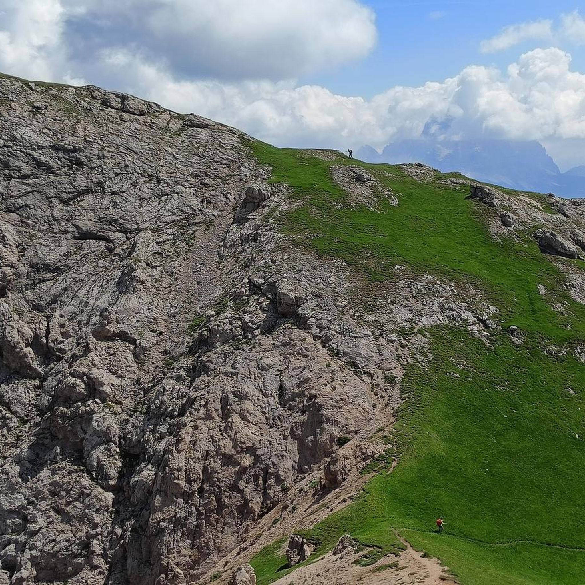
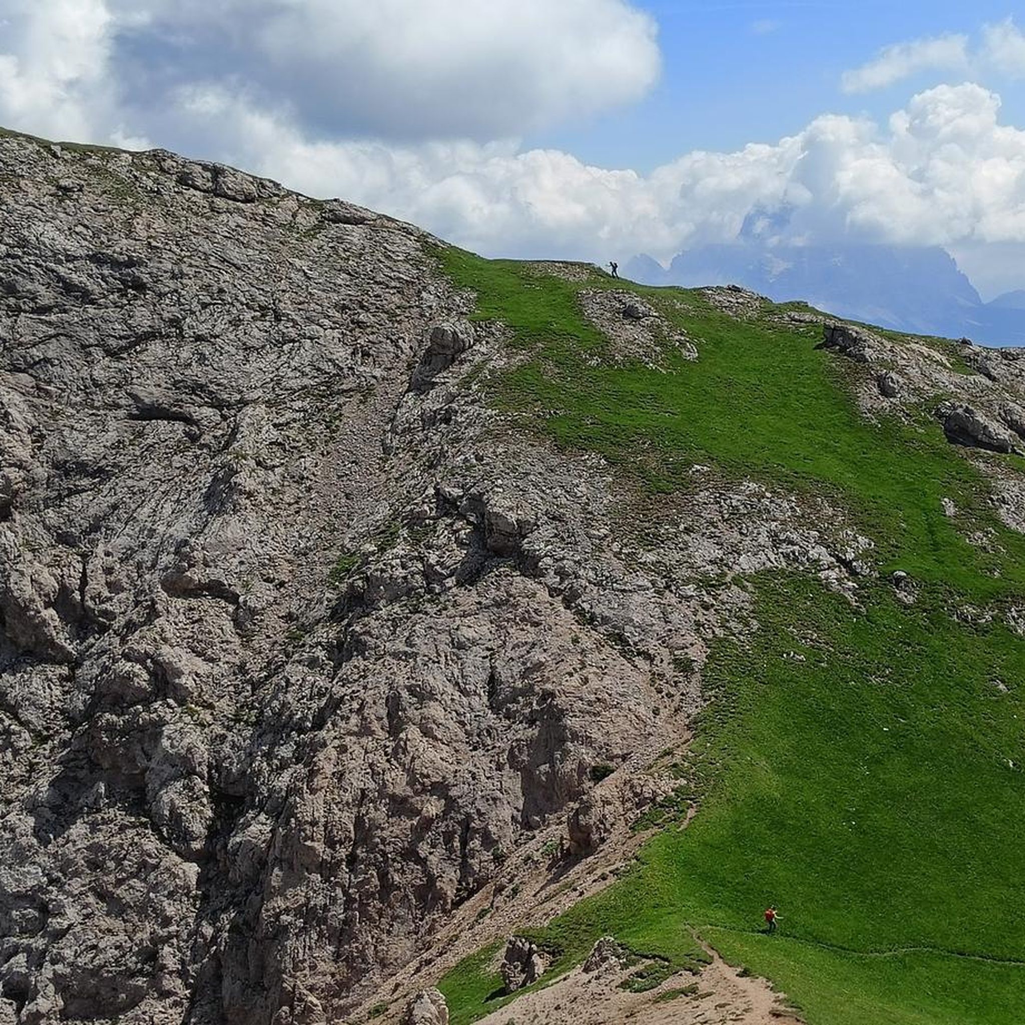
Follow the path on the right, indicated by some stone men to reach the summit. The path on the left is an alternative route, much steeper and more difficult as the trail disappears, as reported by some hikers I spoke to at the summit
2
0

Extremely steep CAI 632 path downhill towards San Tomaso Agordino.
1
0
Crossing path, CAI 682, further on joins the "Alta Via dei Pastori", for expert hikers.
1
0
Steep rocky step up, the steel cable helps a little.
1
0
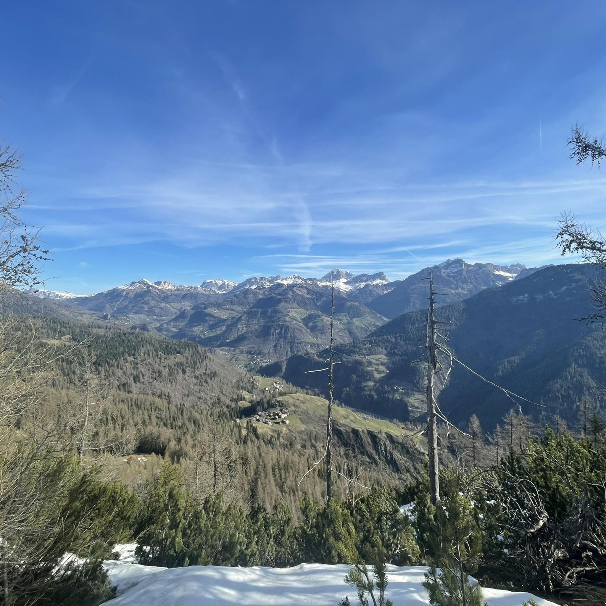
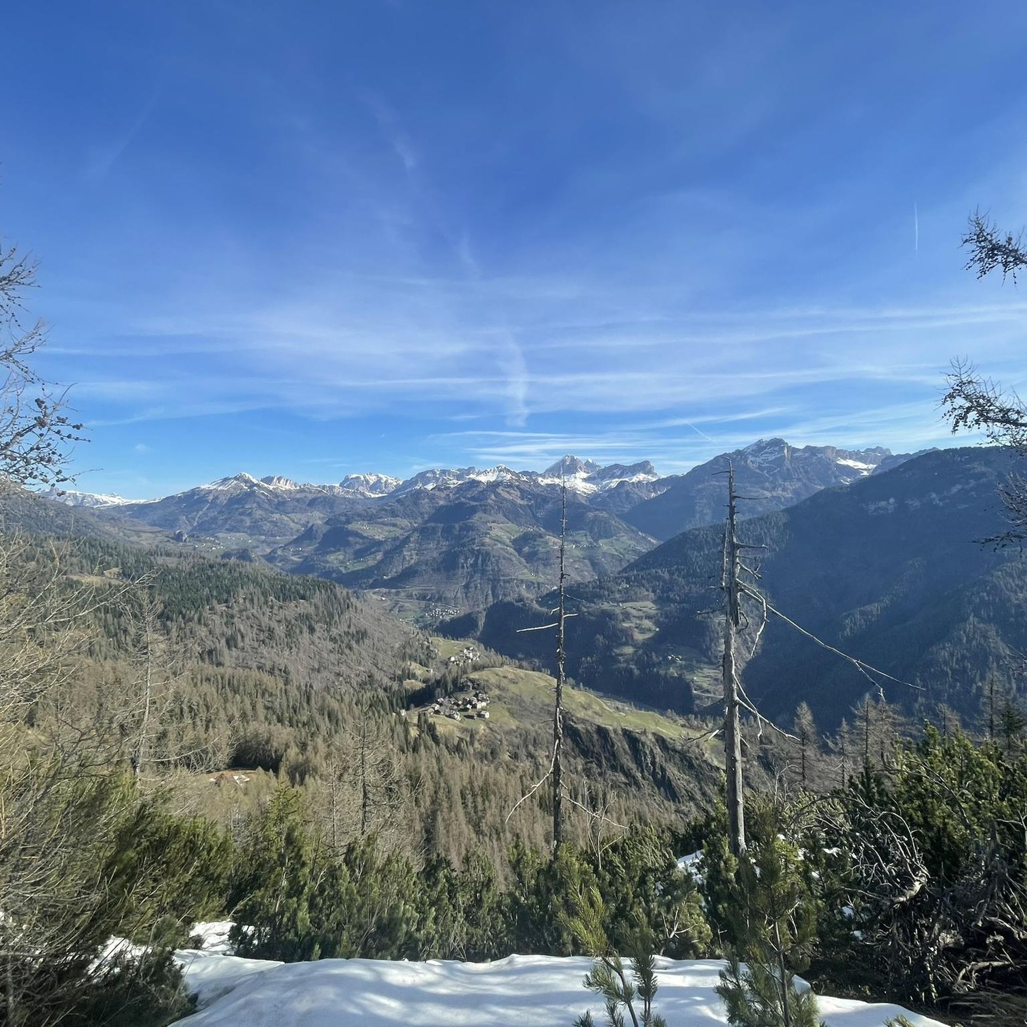
Panorama from the slopes of Sasso Bianco.
1
0
Frequently Asked Questions
How many hiking trails are available in San Tomaso Agordino?
San Tomaso Agordino offers a selection of 12 hiking trails. These routes cater to various skill levels, with 8 moderate and 4 difficult options, ensuring there's a suitable path for most hikers.
What makes hiking in San Tomaso Agordino unique?
Hiking in San Tomaso Agordino provides access to the stunning Dolomites, a UNESCO World Heritage site, with dramatic peaks like Marmolada, Civetta, and Pelmo. The region features diverse landscapes, from high mountains and alpine valleys to extensive wild forests. Unique features include the isolated summit of Sasso Bianco and the glacial Lake Coldai, offering breathtaking panoramic views and serene natural environments.
Are there challenging hikes for experienced trekkers?
Yes, San Tomaso Agordino offers 4 difficult hiking routes for experienced trekkers. One notable challenging option is the Rifugio Sasso Bianco – Sasso Bianco Summit loop from San Tomaso Agordino, which leads through alpine terrain to the Sasso Bianco summit. Additionally, the Alta Via dei Pastori, a high-altitude route, traverses the municipality and is suitable for expert hikers.
Are there any circular hiking routes in San Tomaso Agordino?
Yes, several circular routes are available. For a moderate experience, consider the Piaia Parking – Rifugio Sasso Bianco loop from San Tomaso Agordino, which ascends through forests to the Rifugio Sasso Bianco. Another option is the general Hiking loop from San Tomaso Agordino, offering a moderate 3.3-mile journey.
What kind of natural features or landmarks can I see while hiking?
The region is rich in natural beauty and interesting landmarks. You can explore the glacial Lake Coldai, situated at 2,143 meters, or visit the isolated summit of Sasso Bianco for exceptional panoramic views. Other notable attractions include the dramatic Serrai di Sottoguda gorge and the View of the San Lucano Valley. The area is also surrounded by iconic Dolomite peaks like Civetta and Marmolada.
Are there family-friendly hiking options in San Tomaso Agordino?
For families, the unique Miniature Dolomites Trail (Dolomiti in Miniatura) is a great option. This themed path features large sculptures of the main Dolomite massifs, carved in stone, winding for about 5 km through the woods, offering a pleasant and curious itinerary for all ages.
Can I hike with my dog in San Tomaso Agordino?
Generally, dogs are welcome on hiking trails in the Dolomites, but it's always advisable to keep them on a leash, especially in areas with livestock or wildlife. Be sure to carry water for your dog and check for any specific local regulations or protected areas where dogs might be restricted.
What do other hikers enjoy the most about hiking in San Tomaso Agordino?
The area is highly rated by the komoot community, with an average score of 4.5 stars from over 2,000 reviews. Hikers frequently praise the majestic Dolomite peaks, serene alpine lakes, and extensive forests. Many appreciate the varied terrain, which offers routes from moderate ascents to challenging summit trails, and the well-marked paths that make exploration enjoyable.
Are there any specific viewpoints or panoramic spots worth seeking out?
Absolutely. The summit of Sasso Bianco (2407 meters) is renowned for providing an exceptional panoramic terrace over the Dolomites. Additionally, the View of the San Lucano Valley offers another stunning perspective of the surrounding landscape.
What is the best time of year for hiking in San Tomaso Agordino?
The best time for hiking in San Tomaso Agordino is typically from late spring to early autumn (May to October). During these months, the weather is generally mild, trails are clear of snow, and the alpine meadows are vibrant. Summer offers the warmest temperatures, while early autumn provides stunning fall foliage.
Are there any long-distance trails that pass through San Tomaso Agordino?
Yes, San Tomaso Agordino is a stage along the significant regional trail known as the Genuine Dolomites Path. Specific sections of this path lead to the Rifugio Sasso Bianco and through Vallada and the San Tomaso Pass. The Alta Via dei Pastori is another high-altitude route suitable for expert hikers that traverses the municipality.
Are there places to explore beyond the main trails, such as characteristic villages?
Yes, the area is dotted with numerous small, characteristic hamlets. Villages like Bramezza, Caracoi Agoin, Caracoi Cimai, and Celat offer cultural and natural interest, unique views, and traditional 'tabià' (Dolomite barns), providing a glimpse into local life and history.
Most popular routes around San Tomaso Agordino
Most popular attractions around San Tomaso Agordino

Get inspired with the komoot mobile app


Explore more
Browse the best Hikes in other regions.
