The best road cycling routes around Cessalto
4.3
(190)
6,126
riders
401
rides
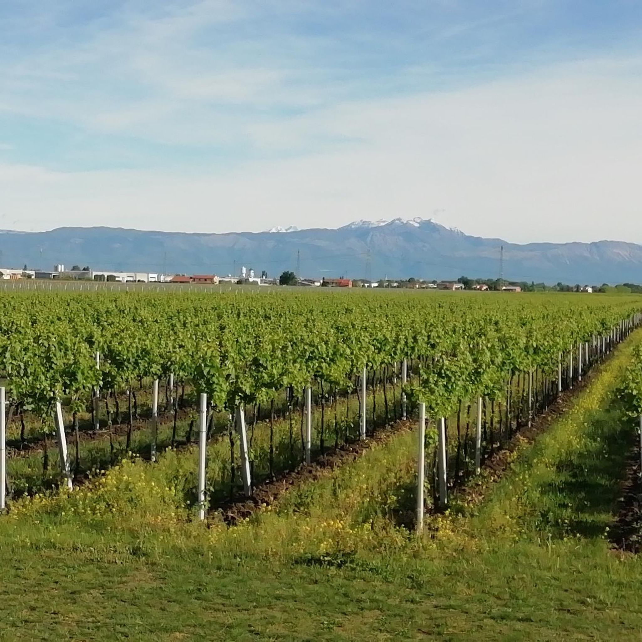
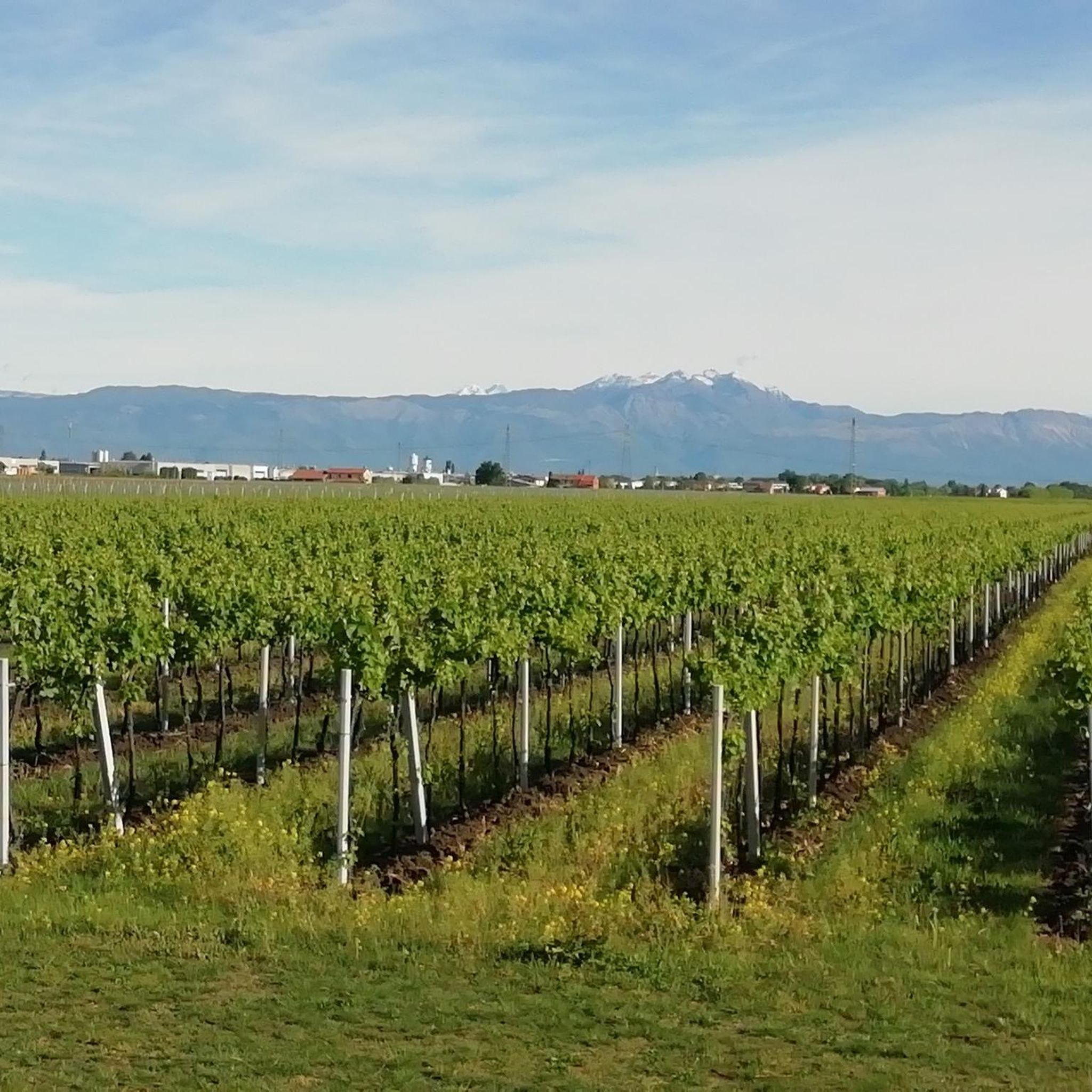
Road cycling routes around Cessalto traverse the flat to gently rolling plains characteristic of the Veneto region. The landscape is significantly shaped by the Piave and Livenza Rivers, offering a unique riverine environment. Cyclists will encounter picturesque meadows, shaded woodlands, and distinctive bamboo thickets along these routes. The terrain is generally level, making it suitable for accessible road cycling experiences.
Best road cycling routes around Cessalto
- The most popular road cycling route is Road Along the Livenza River – La Salute di Livenza loop from Ceggia, a 36.9 miles (59.4 km) trail that takes 2 hours 18 minutes to complete, following the Livenza River.
- Another top favourite among local road cyclists is Tezze Bridge over the Livenza River – Vittoria Canal in Cessalto loop from San Stino di Livenza, a moderate 40.6 miles (65.4 km) path that explores the waterways and canals of the region.
- Local road cyclists also love the Lungo Argine Road – Road Along the Livenza River loop from San Stino di Livenza, a 19.5 miles (31.4 km) trail leading through riverine landscapes, often completed in about 1 hour 11 minutes.
- Road cycling around Cessalto is defined by its flat plains, the Livenza River, and open meadows. The network offers options for different ability levels, from easy rides to more moderate distances.
- The routes in Cessalto are highly rated by the komoot community with an average score of 4.3 stars from over 170 reviews. More than 5800 road cyclists have used komoot to explore Cessalto's varied terrain.
Last updated: July 5, 2026
4.3
(21)
333
riders
Moderate road ride. Good fitness required. Mostly well-paved surfaces and easy to ride.
3.0
(1)
104
riders
68.1km
02:50
90m
90m
Moderate road ride. Good fitness required. Mostly well-paved surfaces and easy to ride.

Sign up for free
4.3
(3)
82
riders
Moderate road ride. Good fitness required. Mostly well-paved surfaces and easy to ride.
5.0
(1)
109
riders
81.5km
03:08
90m
90m
Moderate road ride. Good fitness required. Mostly well-paved surfaces and easy to ride.
22
riders
75.9km
02:53
100m
100m
Moderate road ride. Good fitness required. Mostly well-paved surfaces and easy to ride.
Get access to more routes and recommendations from other explorers.
Sign up for free
Already have an account?
Our route recommendations are based on thousands of hikes, rides, and runs completed by other people on komoot.
Start today with a free account
Your next adventure awaits.
Login or Signup

Tips from the Community

The course of the Cavetta Canal which flows into the Piave river.
2
0

The Cortellazzo Bridge, located in the homonymous fishing village in Jesolo, is a characteristic mobile structure that crosses the artificial Cavetta canal, a vital waterway connecting the Sile and Piave rivers. This bridge plays a crucial role for both road traffic in the area and inland navigation, allowing the passage of recreational and commercial vessels. The structure opens exclusively by telephone reservation during dedicated time slots, which differ between the summer and winter seasons, thus ensuring a balance between road and river traffic. Beyond its practical function, the bridge represents a historical symbol of Cortellazzo's identity, linked to the tradition of fishermen and the historical land reclamation works of the Veneto region.
0
0

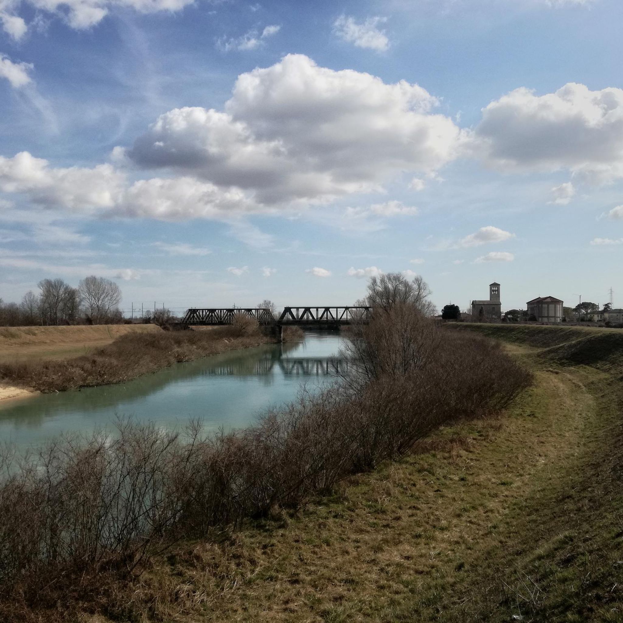
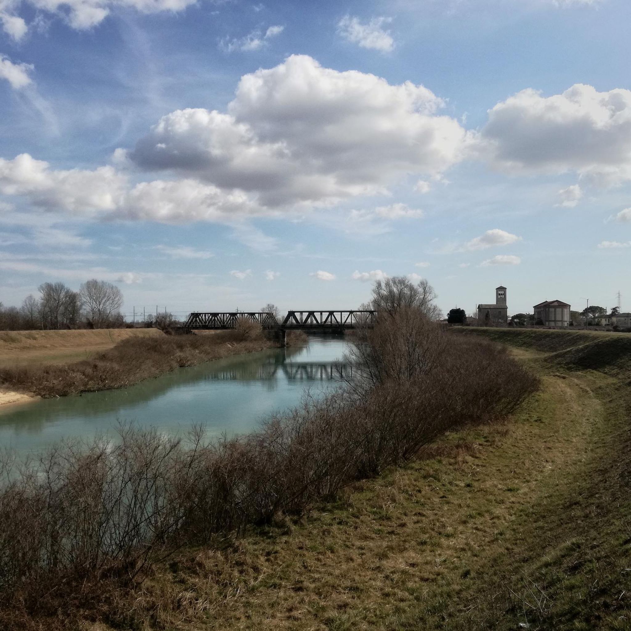
At La Salute and from the bridge over the Livenza, there are great views of the Livenza.
0
0
An asphalted side road with very little car traffic. The view of the Livenza is almost permanent and when the Livenza has a calm water flow, there are great opportunities for mirror image photos.
0
0

The Duomo di Santa Maria delle Grazie (also commonly called the cathedral) is the main church and the historical symbol of San Donà di Piave. It is located in the heart of the city center and belongs to the diocese of Treviso. Origins: The first religious structure was built in the second half of the 15th century. The building was later rebuilt in neoclassical style in the 19th century by the Venetian architect Gian Battista Meduna. Destruction: During World War I, being on the Piave front line, the church was completely razed to the ground by bombing. In 1917, the retreating Italian army also blew up the bell tower so as not to leave it as an observation point for the enemy. Rebirth: The current building was reconstructed between 1919 and 1923 based on a design by architect Giuseppe Torres. It was solemnly consecrated on September 19, 1925, by the Bishop of Treviso. Style: Torres decided to maintain the strong neoclassical imprint of the previous 19th-century structure, explicitly drawing inspiration from the famous Church of the Redeemer in Venice. It features a single, large central nave topped by a solemn barrel vault. Six communicating chapels open up on the sides. Behind the main altar, precious Carrara marble sculptures stand out. The bell tower: At its top stands a bronze statue of an angel with a sword. The current one replaces the original statue by Torres, which was destroyed by lightning in 1966.
1
0
The Ponte di Tezze, which connects the banks of the Livenza river between the provinces of Treviso and Pordenone, represents a fundamental infrastructure for local mobility and history. The current structure, characterized by spans that elegantly reflect on the river's waters, stands at a historically strategic point for trade and movement between the Veneto and Friuli regions. The surrounding area is of considerable landscape value: the banks of the Livenza here offer suggestive natural views, with lush vegetation that changes color with the seasons. The bridge is not just a functional link, but a privileged viewpoint for admiring the slow flow of the river, a symbol of a territory that has managed to integrate modern development with the protection of the river environment.
2
0
The historic center of San Stino di Livenza develops along the banks of the homonymous river, an element that has shaped its identity and economy over the centuries. The heart of the town is dominated by the bulk of the Castello di Passo di Torre, an ancient defensive structure that testifies to the strategic importance of the area as a crossing point between land and water. Strolling through the central streets, you will encounter the Parish Church of Santo Stefano Protomartire, which houses valuable works. The pedestrian area and the squares offer a typical glimpse of the Venetian mainland villages, where civil architecture blends with the riverine nature, creating a serene atmosphere that invites the discovery of local traditions and the history of the eastern Veneto territory.
2
0

“Flumen Liquentia ex montibus Opiterginis…” among the rivers mentioned by Pliny is the Livenza, in the feminine form. Almost always, however, in current language it is used as if it were masculine, due to the appellation “river” that precedes it. Regarding the origin of its name, there are two versions: some derive it from livens, from the verb livere (to be livid in color); others from liquens, from the verb liqui (to be liquid, to melt). By the ancients it was always called Liquentia and this is also because its waters teem, clear, cold and silent at the foot of the mountain above the pebbles, as if these and those were liquefying. Sacile's peculiar river is certainly one of the most beautiful waterways encountered in the plains of northern Italy. A means of communication, the ultimate defense of the nascent Veneto Domain, a source of life for its water flow and fish richness, the Livenza has always been cited by Greek and Latin authors.
1
0
Frequently Asked Questions
What kind of terrain can I expect on road cycling routes around Cessalto?
Road cycling routes around Cessalto primarily traverse flat to gently rolling plains, characteristic of the Veneto region. The landscape is significantly shaped by the Piave and Livenza Rivers, offering a unique riverine environment with picturesque meadows, shaded woodlands, and distinctive bamboo thickets. The terrain is generally level, making it suitable for accessible road cycling experiences.
Are there road cycling routes suitable for beginners in Cessalto?
Yes, Cessalto offers a good selection of routes for beginners. Out of nearly 400 road cycling routes, 164 are classified as easy. An example of an easy route is the Lungo Argine Road – Road Along the Livenza River loop from San Stino di Livenza, which is 19.5 miles (31.4 km) long and takes about 1 hour 11 minutes to complete.
How many road cycling routes are available in the Cessalto area?
There are over 380 road cycling routes available in and around Cessalto, catering to various preferences and skill levels, including easy, moderate, and some more difficult options.
What do other cyclists say about the road cycling experience in Cessalto?
The road cycling routes in Cessalto are highly rated by the komoot community, with an average score of 4.3 stars from over 170 reviews. More than 5,800 road cyclists have used komoot to explore the varied terrain, often praising the scenic riverine landscapes and accessible routes.
What natural features or landmarks can I see while road cycling near Cessalto?
While cycling near Cessalto, you can explore several natural features and landmarks. The Piave Vecchia Cycle Path follows the ancient riverbed, offering views of meadows, woodlands, and bamboo thickets. You might also encounter the Confluence of the Monticano and Livenza Rivers or the tranquil Bosco Olmè forest.
Are there any unique bridges or historical sites to visit along the routes?
Yes, the region offers unique points of interest. The Fossalta di Piave Floating Bridge is a notable private pontoon bridge that allows cyclists to cross the Piave River. Additionally, the Old River Port of Noventa di Piave, dating back to the 10th century, provides a glimpse into the region's historical trade and maritime past.
Can I find circular road cycling routes in Cessalto?
Yes, many of the road cycling routes around Cessalto are designed as loops, allowing you to start and finish in the same location. For example, the Road Along the Livenza River – La Salute di Livenza loop from Ceggia is a popular circular route.
What is the best time of year for road cycling in Cessalto?
The flat to gently rolling terrain of Cessalto makes it suitable for road cycling for much of the year. Spring and autumn generally offer the most pleasant temperatures for longer rides, while summer can be enjoyable, especially in the mornings or late afternoons. Conditions along the Piave Vecchia Cycle Path might be slippery after rain, so checking local weather is always advisable.
Are there any moderate-difficulty road cycling routes for more experienced riders?
Absolutely. Cessalto features 211 routes classified as moderate. A popular choice is the Tezze Bridge over the Livenza River – Vittoria Canal in Cessalto loop from San Stino di Livenza, a 40.6 miles (65.4 km) path that explores the region's waterways and canals.
Are there any road cycling routes that follow the Livenza River?
Yes, the Livenza River is a prominent feature in many Cessalto road cycling routes. The Road Along the Livenza River – Livenzetta Harbor loop from San Stino di Livenza is a great option, offering scenic views along the river for 51.5 km.
Are there any road cycling routes that pass through the town of Ceggia?
Yes, several routes originate from or pass through Ceggia. The Piazza Luigi Luzzatti – Livenzetta Harbor loop from Ceggia is a 43.3 km route that starts in Ceggia and offers an easy cycling experience.
Most popular attractions around Cessalto

Get inspired with the komoot mobile app


Explore more
Browse the best Road cycling routes in other regions.
