The best walks and hikes around Civitella Del Tronto
4.3
(230)
990
hikers
27
hikes
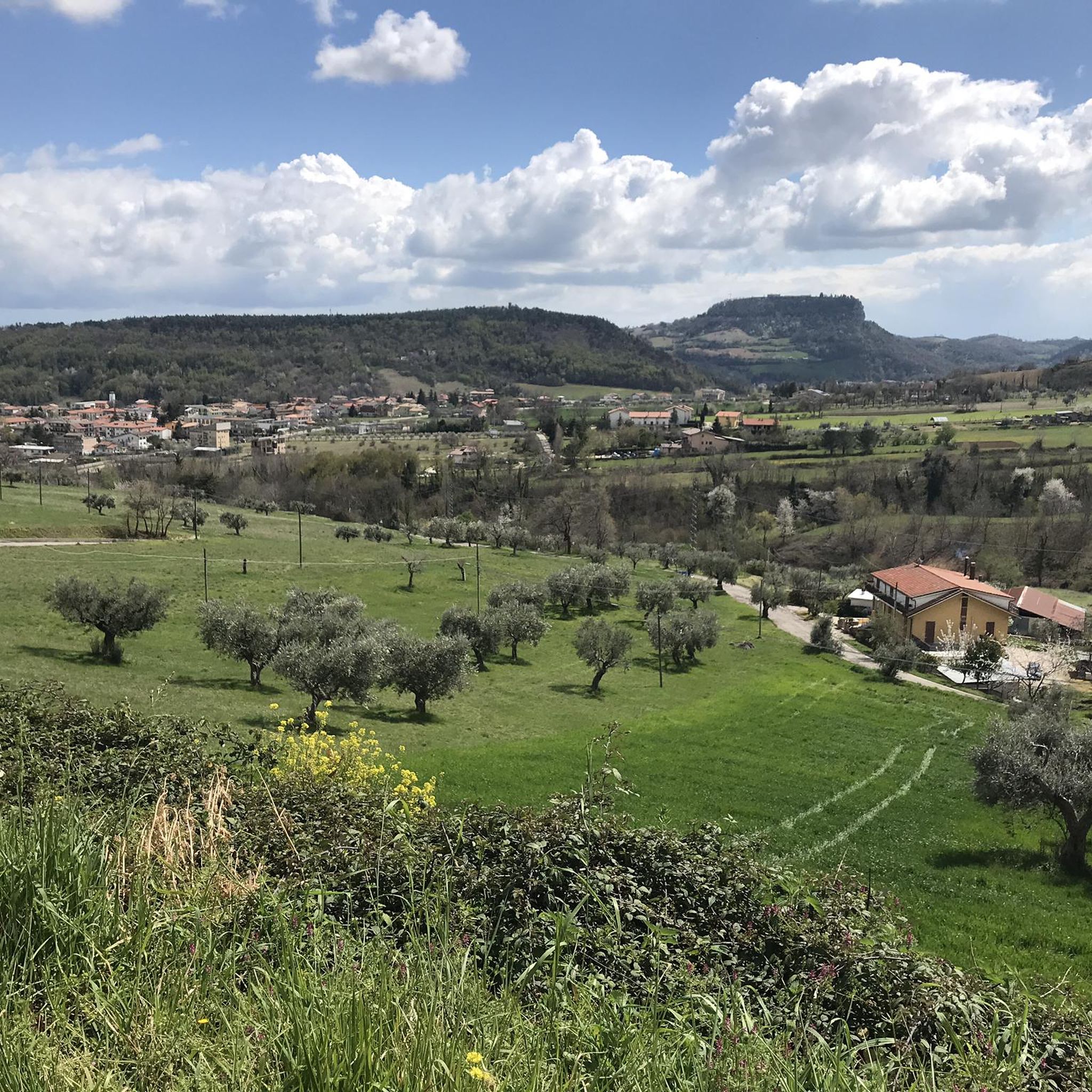
Hiking around Civitella Del Tronto offers access to diverse landscapes within the Gran Sasso e Monti della Laga National Park in the central Italian Apennines. The region features dramatic mountain scenery, including the Monti della Laga massif and hills like Monte Girella, alongside the deep Salinello Gorges. Civitella del Tronto itself is situated on a travertine cliff, providing views of the Tronto Valley. This area provides a variety of natural features for outdoor activities.
Best hiking trails around Civitella Del…
Last updated: July 8, 2026
4.8
(30)
94
hikers
Moderate hike. Good fitness required. Mostly accessible paths. Sure-footedness required.
4.6
(5)
20
hikers
7.73km
02:46
390m
390m
Moderate hike. Good fitness required. Mostly accessible paths. Sure-footedness required.

Sign up for free
4.7
(46)
164
hikers
9.40km
03:19
410m
410m
Hard hike. Good fitness required. Sure-footedness, sturdy shoes and alpine experience required.
4.0
(3)
15
hikers
Moderate hike. Good fitness required. Mostly accessible paths. Sure-footedness required.
4.5
(15)
69
hikers
3.09km
01:15
110m
110m
Hard hike. Great for any fitness level. Sure-footedness, sturdy shoes and alpine experience required.
Get access to more routes and recommendations from other explorers.
Sign up for free
Already have an account?
Our route recommendations are based on thousands of hikes, rides, and runs completed by other people on komoot.
Start today with a free account
Your next adventure awaits.
Login or Signup
Popular around Civitella Del Tronto

Other adventures around Civitella Del Tronto

Tips from the Community

Trekking that starts from the equipped area of Ripa Alta, with parking, water fountain, kiosk-bar, and picnic tables. The path in the first part is very steep and without shelter from the sun. You then enter the woods: the path follows the course of the river which, in the summer period, is completely dry (August 2025). In several places you can leave the path and enter the riverbed, thus skirting the rocky walls of the two twin mountains. The path is marked as risky: in reality, in the summer period, it is easily manageable even for children aged ten and up; during the period when the river is present, it may be riskier to venture onto it.
0
0
Trekking that starts from the equipped area of Ripa Alta, with parking, water fountain, kiosk-bar and picnic tables. The path in the first part is very steep and without shade from the sun. You then enter the woods: the path follows the course of the river which, in the summer period, is completely dry (August 2025). In several places you can leave the path and enter the riverbed, thus skirting the rocky walls of the twin mountains. The path is marked as risky: in truth, in the summer period it is easily manageable even by children aged ten and over; in the period when the river is present, it may be riskier to venture there.
0
0

beautiful beech forest, old charcoal burners' path
0
0


Monte Girella is the top of the Montagna dei fiori. You can climb to the top via an easy path starting from the Monte Piselli ski lifts in the San Giacomo area. From the top, on clear days you can see the Adriatic coast up to Conero, the Gran Sasso and Sibillini mountains. It is beautiful to observe the nearby Montagna di Campli.
2
0


Beautiful and quiet rest area and playground. From here you can start the Salinello Gorge
0
0

On the border between Marche and Abruzzo, in the province of Teramo, located in the Gran Sasso and Monti della Laga National Park, stands the evocative Castel Manfrino, so called from the historical and popular tradition that connects the territory to the exploits of King Manfredi (1232-1266 ), last Swabian sovereign, natural son and successor of Frederick II and Bianca of the Lancia counts of Monferrato. A fortress commissioned by the Swabian King Manfredi to guard the borders between the Papal State and the Kingdom of Naples, it was therefore in a strategic position for sighting and control of traffic and therefore determined its centrality as a defensive position in the territory.
3
0
Frequently Asked Questions
How many hiking trails are available around Civitella del Tronto?
There are over 20 hiking routes around Civitella del Tronto, ranging from easy strolls to more challenging mountain paths. The komoot community has explored these trails over 900 times, offering a variety of options for different skill levels.
What kind of terrain can I expect on hikes near Civitella del Tronto?
The terrain around Civitella del Tronto is diverse, featuring the rugged Monti della Laga massif, the deep Salinello Gorges, and hills like Monte Girella. You'll find paths through forests, along riverbeds, and up to panoramic viewpoints, often with significant elevation changes.
Are there any family-friendly hiking options in the area?
While many trails offer moderate challenges, there are easier routes suitable for families. The region's diverse landscapes, including the Monti della Laga massif and views of the Tronto Valley, provide engaging scenery for all ages. Look for routes with less elevation gain and shorter distances for a more relaxed family outing.
Can I bring my dog on the hiking trails around Civitella del Tronto?
Many trails within the Gran Sasso e Monti della Laga National Park are dog-friendly, but it's always advisable to keep your dog on a leash, especially in protected areas or near livestock. Ensure you carry enough water for both yourself and your pet, and respect local regulations regarding wildlife and nature conservation.
What are some notable natural features or landmarks to see while hiking?
The region is rich in natural beauty. You can explore the impressive Salinello Gorges, ascend to Monte Girella for panoramic views, or discover the 'Valley of the Hundred Waterfalls' within the Gran Sasso National Park. The area also features the vast Campo Imperatore plateau, known as 'Little Tibet'.
Are there any historical sites or attractions accessible from the trails?
Yes, several hikes can lead you to historical points of interest. The route from Ripe di Civitella, for example, explores the Gran Sasso e Monti della Laga National Park and leads to the historic Castel Manfrino. You can also visit the unique San Marco Hermitage, carved into a rock face, or the impressive Civitella del Tronto Historic Town and Fortress, offering breathtaking views.
Are there circular hiking routes available?
Yes, there are several circular routes. For instance, the Salinello Gorges – Salinello Gorge loop from Ripe offers a challenging circular experience through the gorges. Another option is the Mount Girella – Summit Cross of Monte Girella loop from Centro Servizi Tre Caciare, providing a scenic round trip.
What do other hikers enjoy most about hiking in Civitella del Tronto?
The area is highly rated by the komoot community, with an average score of 4.2 stars from over 200 reviews. Hikers often praise the dramatic mountain scenery, the diverse ecosystems, and the blend of natural beauty with historical charm, particularly the panoramic views from elevated points like Monte Girella.
Is parking available at the trailheads?
Parking is generally available near popular starting points for hikes. For example, routes like the Walloon pond – Mount Piselli loop often start from areas like Centro Servizi Tre Caciare, where parking facilities are typically present. It's advisable to check specific route details for precise parking information.
Are there any huts or shelters along the trails?
Yes, the area features several huts and shelters that can be useful during longer hikes. Notable examples include the renovated Tre Caciare (Stone Shepherd Huts), which serve as a starting point for various excursions, and the Stone Hut on Monte Piselli.
What is the best time of year to go hiking in Civitella del Tronto?
The best time for hiking in Civitella del Tronto is typically from spring to autumn. Spring offers lush greenery and blooming wildflowers, while autumn provides pleasant temperatures and vibrant foliage. Summer can be warm, especially at lower elevations, but higher mountain trails offer cooler conditions. Winter hiking is possible but requires appropriate gear and experience due to snow and ice, particularly in the Gran Sasso massif.
Do I need a permit to hike in the Gran Sasso e Monti della Laga National Park?
Generally, individual hikers do not need a specific permit for day hikes within the Gran Sasso e Monti della Laga National Park. However, it's always recommended to respect park regulations, stay on marked trails, and be aware of any specific rules for certain areas or activities. For more detailed information, you can consult the official park resources.
Most popular routes around Civitella Del Tronto
Most popular attractions around Civitella Del Tronto

Get inspired with the komoot mobile app


Explore more
Browse the best Hikes in other regions.
