The best walks and hikes around Tìana/Tiana
4.6
(337)
1,656
hikers
26
hikes
Hiking around Tìana/Tiana offers access to the mountainous interior of Sardinia, characterized by high peaks and rugged terrain. The region features prominent summits like Punta La Marmora and Bruncu Spina, providing challenging ascents and expansive views. Trails often navigate through elevated landscapes, connecting various mountain features.
Best hiking trails around Tìana/Tiana
- The most popular hiking route is Punta La Marmora from Bruncu Spina Trail, a difficult 11.1 miles (17.9 km) trail that takes 6 hours to complete. This route…
Last updated: July 8, 2026
4.7
(22)
95
hikers
17.9km
06:00
690m
690m
Hike Sardinia's highest peak on this difficult 11.1-mile loop from Bruncu Spina, offering panoramic views and diverse terrain.
5.0
(7)
40
hikers
13.9km
04:35
530m
530m
Hike the difficult 8.6-mile Bruncu Spina - Sentiero Italia Loop in Sardinia, offering panoramic views and a challenging mountain experience.

Sign up for free
4.8
(155)
785
hikers
14.3km
04:44
550m
550m
Hard hike. Good fitness required. Sure-footedness, sturdy shoes and alpine experience required.
4.4
(12)
48
hikers
12.3km
03:51
460m
460m
Hard hike. Good fitness required. Sure-footedness, sturdy shoes and alpine experience required.
5.0
(1)
6
hikers
10.1km
02:41
100m
100m
Moderate hike. Good fitness required. Easily-accessible paths. Suitable for all skill levels.
Get access to more routes and recommendations from other explorers.
Sign up for free
Already have an account?
Our route recommendations are based on thousands of hikes, rides, and runs completed by other people on komoot.
Start today with a free account
Your next adventure awaits.
Login or Signup
Tips from the Community

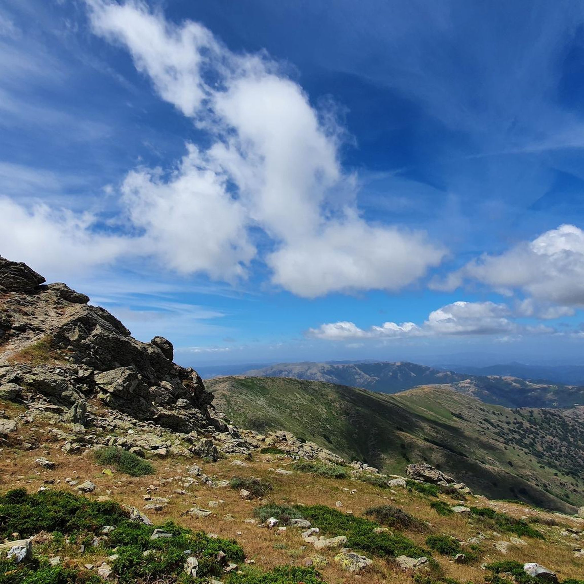
The Monti del Gennargentu form the highest mountain range in Sardinia and the "roof of the island". It is located in the heart of Barbagia. The rugged, rocky mountain world is home to Punta La Marmora (1,834 m), the highest peak in Sardinia, as well as historical Nuragic villages, and offers fantastic hiking opportunities.
1
0
The Monti del Gennargentu form Sardinia's highest mountain range and the "Roof of the Island". It is located in the heart of Barbagia. The rugged, rocky mountain world is home to Punta La Marmora (1,834 m), Sardinia's highest peak, as well as historical Nuragic villages, and offers fantastic hiking opportunities.
1
0
The Bruncu Spina belongs to the Massiccio del Gennargentu, the silver-grey roof of Sardinia, part of the National Park „Parco Nazionale del Golfo di Orosei e del Gennargentu“. Probably the reason why the landscape is still so untouched and authentic, even almost barren, despite ski operations. The slopes are simple and only roughly marked, everything seems very free and has almost a bit of a freestyle atmosphere.
1
0

Great view. Beautiful area.
2
0

At 1,834 meters, Punta La Marmora is the highest peak in the whole of Sardinia. It is located in the Gennargentu massif, between the municipalities of Arzana and Desulo, and is named after the general and scientist Alberto Ferrero della Marmora, who described the Sardinian island in two scientific-literary works.
2
0

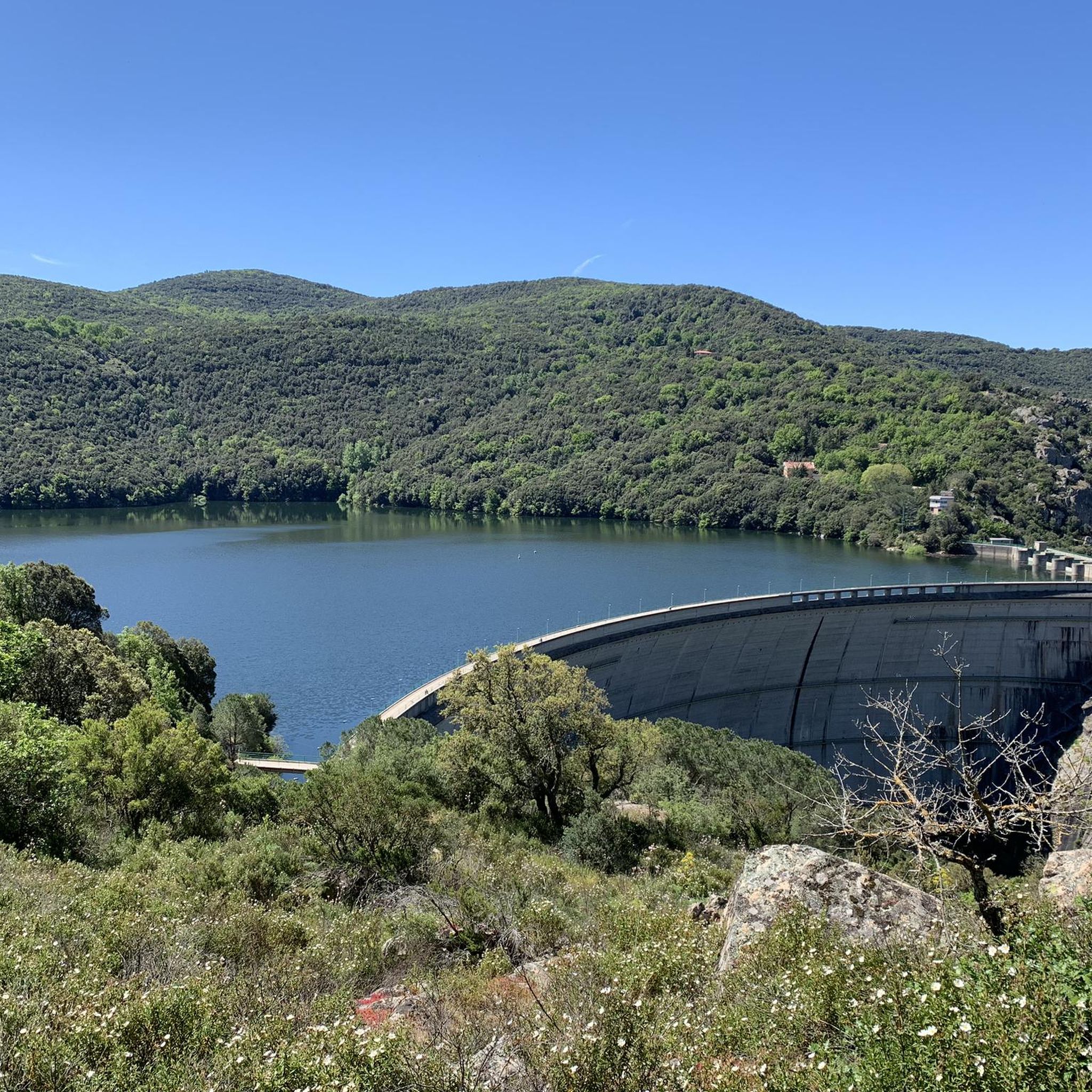
Depending on the season there is more or less water.
1
0

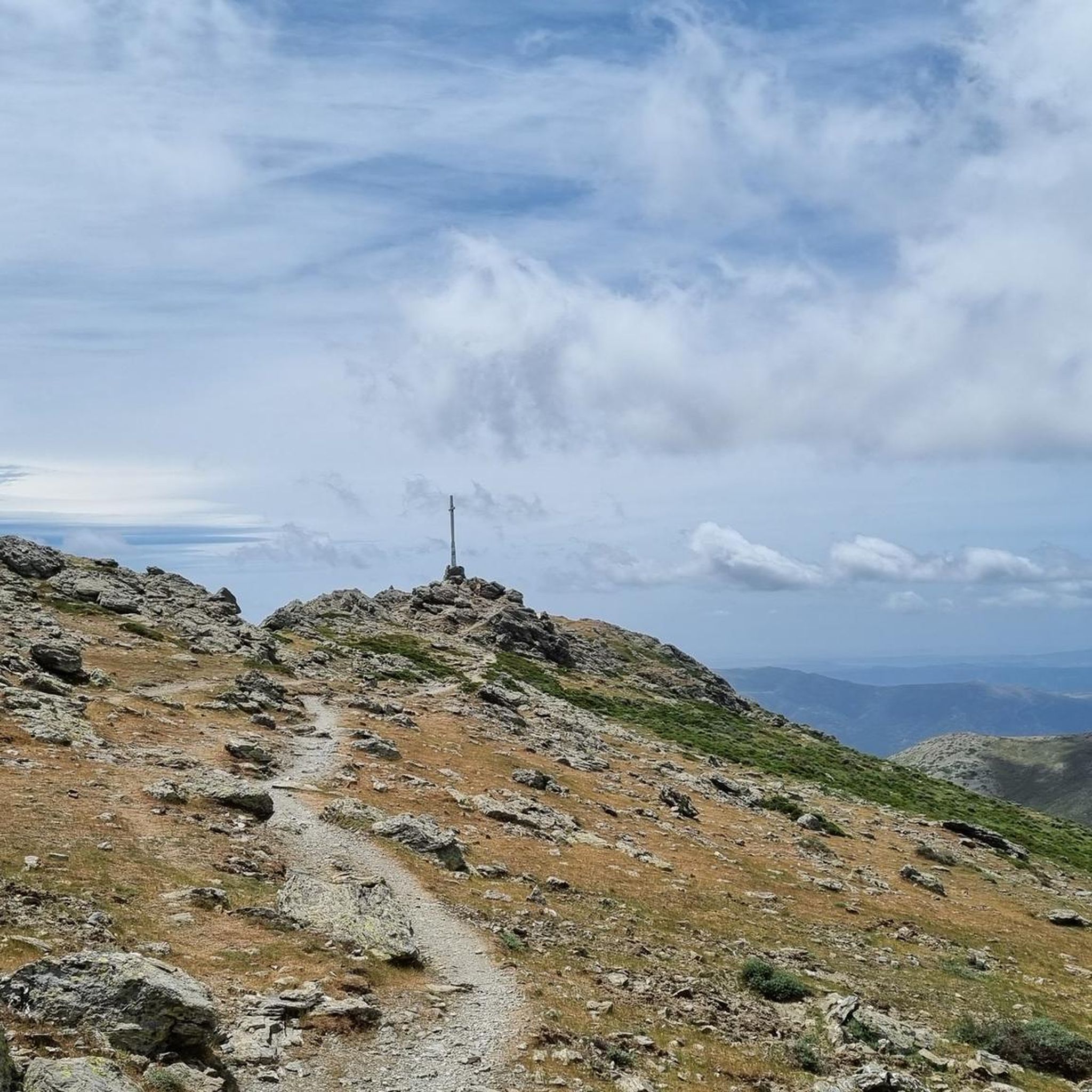
It may not be obvious that Sardinia's highest mountain is crowned by an imposing summit cross, but it seems completely natural to the mountain hiker. A base made of natural stone from the surrounding area forms the lower level of this small sacred monument. A round column bears the Latin inscription "Ave Crux spes unica" (loosely translated "Hail [Holy] Cross, [our] only hope") and continues further up - almost seamlessly - into the longitudinal beam of the cross. Like many other summit crosses, it is comparatively simple in its design and has no corpus, but is certainly dignified.
3
0
Frequently Asked Questions
How many hiking trails are available around Tìana/Tiana?
There are over 20 hiking trails documented around Tìana/Tiana on komoot, offering a variety of experiences in the mountainous interior of Sardinia.
Are there easy hiking trails suitable for beginners or families?
While Tìana/Tiana is known for its challenging mountain terrain, there are 6 routes classified as easy. These paths offer a gentler introduction to the region's natural beauty, though specific family-friendly features like playgrounds are not explicitly noted.
What are the typical lengths of hikes in this area?
Hikes around Tìana/Tiana vary significantly in length. Many of the more prominent routes, such as the Punta La Marmora from Bruncu Spina Trail, are long, often exceeding 10 miles (16 km) and taking several hours to complete. There are also shorter options available for those seeking less strenuous walks.
Are there circular hiking routes around Tìana/Tiana?
Yes, several popular routes are designed as loops, allowing you to start and end at the same point. Examples include the Bruncu Spina - Sentiero Italia Loop and the High Trail to Bruncu Spina – Punta Paulinu loop from S'Arena, which are great for exploring varied mountain terrain.
Is Tìana/Tiana a dog-friendly hiking destination?
Generally, dogs are welcome on hiking trails in Sardinia, especially in natural, less populated areas like those around Tìana/Tiana. However, it's always advisable to keep your dog on a leash, especially in areas with livestock or protected wildlife, and to carry enough water for both of you. Check local regulations for specific trails if you have concerns.
What is the best time of year to hike in Tìana/Tiana?
The best time to hike in Tìana/Tiana is typically during spring (April-June) and autumn (September-October). During these seasons, the weather is milder, and the landscapes are vibrant. Summer can be very hot, especially at lower altitudes, while winter brings colder temperatures and potential snow at higher elevations.
What are the winter hiking conditions like in Tìana/Tiana?
Winter hiking in Tìana/Tiana, particularly in the Gennargentu mountain range, can be challenging. Higher peaks like Punta La Marmora and Mount Bruncu Spina often experience snow and ice, requiring appropriate gear and experience. Lower elevation trails might be accessible, but always check weather forecasts and trail conditions before heading out.
Are there notable viewpoints or attractions along the hiking trails?
Yes, the mountainous region offers numerous scenic spots. You can find stunning vistas from Mount Bruncu Spina and other high points, including a dedicated View of the Mountains of Sardinia. Other interesting features include the unique Sa Crabarissa Rock Formation and the ancient Nuraghe Lo.
What kind of wildlife can I expect to see while hiking?
The Gennargentu region is home to diverse wildlife. Hikers might spot mouflon, wild boars, and various bird species, including golden eagles and griffon vultures. Keep an eye out for smaller mammals and reptiles as well. Maintaining a respectful distance and observing quietly will enhance your chances of a sighting.
What essential gear should I bring for hiking in Tìana/Tiana?
Given the rugged and mountainous terrain, it's crucial to be well-prepared. Essential gear includes sturdy hiking boots, layers of clothing suitable for changing mountain weather, plenty of water, snacks, a map or GPS device, sun protection, and a first-aid kit. For winter hikes, add snowshoes or microspikes and warmer clothing.
Is parking available at the trailheads around Tìana/Tiana?
While specific parking information for every trailhead isn't always detailed, access points to popular routes in mountainous regions like Tìana/Tiana typically have designated or informal parking areas. It's advisable to research your specific starting point beforehand, especially for less-trafficked trails, and arrive early during peak seasons.
What do other hikers enjoy most about the trails in Tìana/Tiana?
The hiking routes in Tìana/Tiana are highly rated by the komoot community, with an average score of 4.7 stars from over 300 reviews. Hikers frequently praise the challenging ascents, the expansive panoramic mountain vistas, and the sense of adventure offered by the rugged, high-altitude trails, especially those leading to Sardinia's highest points.
How challenging are the hikes in Tìana/Tiana generally?
The hikes around Tìana/Tiana are predominantly challenging, with 9 out of 21 routes classified as difficult. The region is characterized by high peaks and rugged terrain, involving significant elevation gains. While there are easier options, many trails are designed for experienced hikers seeking strenuous ascents and demanding loops.
Most popular routes around Tìana/Tiana
Most popular attractions around Tìana/Tiana

Get inspired with the komoot mobile app


Explore more
Browse the best Hikes in other regions.
