The best mountain hikes around Orgòsolo/Orgosolo
4.7
(6)
59
hikers
5
hikes
Mountaineering routes around Orgòsolo/Orgosolo traverse a rugged landscape characterized by deep limestone gorges, such as the Gorropu Gorge, and prominent mountain passes like Genna Silana. The region features significant elevation changes, with routes often ascending to viewpoints like Monte Corrasi and Point Sos Nidos. This area of Sardinia offers challenging terrain suitable for experienced mountaineers. The geological formations provide a diverse environment for exploration.
Best mountaineering routes around Orgòsolo/Orgosolo
- The most popular mountaineering route is Genna Silana Pass – Gorropu…
Last updated: October 11, 2026
15
hikers
10.5km
04:16
700m
710m
Moderate mountaineering route. Good fitness required. Mostly accessible paths. Sure-footedness required.
12
hikers
9.42km
04:03
700m
700m
Moderate mountaineering route. Good fitness required. Mostly accessible paths. Sure-footedness required.

5.0
(3)
11
hikers
6.70km
02:27
310m
310m
Hard mountaineering route. Good fitness required. Sure-footedness, sturdy shoes and alpine experience required.
11
hikers
Hard mountaineering route. Good fitness required. Sure-footedness, sturdy shoes and alpine experience required.
5.0
(2)
10
hikers
Moderate mountaineering route. Good fitness required. Mostly accessible paths. Sure-footedness required.
Our route recommendations are based on thousands of hikes, rides, and runs completed by other people on komoot.
Start today with a free account
Your next adventure awaits.
Popular around Orgòsolo/Orgosolo


Tips from the Community

The Monti del Gennargentu form the highest mountain range in Sardinia and the "roof of the island". It is located in the heart of Barbagia. The rugged, rocky mountain world is home to Punta La Marmora (1,834 m), the highest peak in Sardinia, as well as historical Nuragic villages, and offers fantastic hiking opportunities.
1
0
The Bruncu Spina belongs to the Massiccio del Gennargentu, the silver-grey roof of Sardinia, part of the National Park „Parco Nazionale del Golfo di Orosei e del Gennargentu“. Probably the reason why the landscape is still so untouched and authentic, even almost barren, despite ski operations. The slopes are simple and only roughly marked, everything seems very free and has almost a bit of a freestyle atmosphere.
1
0

The atmosphere is constantly changing. It's always worth taking a look behind you. There are always climbing opportunities for children.
0
0
After the moderately challenging climb, the landscape opens up to the plateau. Simply beautiful. We had a picnic here and watched the sheep grazing, their bells ringing.
0
0

Great view. Beautiful area.
2
0

Park here if you want to take the hiking trail toward the gorge. Tickets are available at the kiosk, which also has some drinks and snacks.
1
0
Not a highlight, but the start of the hiking trail and an opportunity to briefly walk along or into the river for a refreshing dip.
0
1
The sinkhole with the remains of a settlement is a real highlight, but it's not located at this spot, but 15 minutes further up. This is where the rock crevice is located, another highlight of the Tiscali hiking trail.
0
0
Frequently Asked Questions
Are there any beginner-friendly mountaineering routes around Orgòsolo/Orgosolo?
The mountaineering routes around Orgòsolo/Orgosolo are generally quite challenging, with most being rated as difficult. However, there are a couple of moderate options available. You might consider the Gorropu Gorge – Sa Barva Parking Area loop from Parcheggio per Tiscali, which offers a less strenuous exploration of the Gorropu Gorge area. Another moderate choice is the Monte Corrasi loop from Ulìana/Oliena.
What are some of the more challenging mountaineering routes in the Orgòsolo/Orgosolo area?
For experienced mountaineers seeking a challenge, the region offers several difficult routes. The Genna Silana Pass – Gorropu Gorge loop from Passo di Genna Silana is a demanding trail with significant elevation gain through a dramatic gorge landscape. Another difficult option is the Point Sos Nidos – Monte Corrasi loop from Ulìana/Oliena, which leads through mountainous terrain with panoramic views. The Monte Corrasi – Point Sos Nidos loop from Ulìana/Oliena also presents a substantial challenge.
What kind of geological features can I expect to see on these routes?
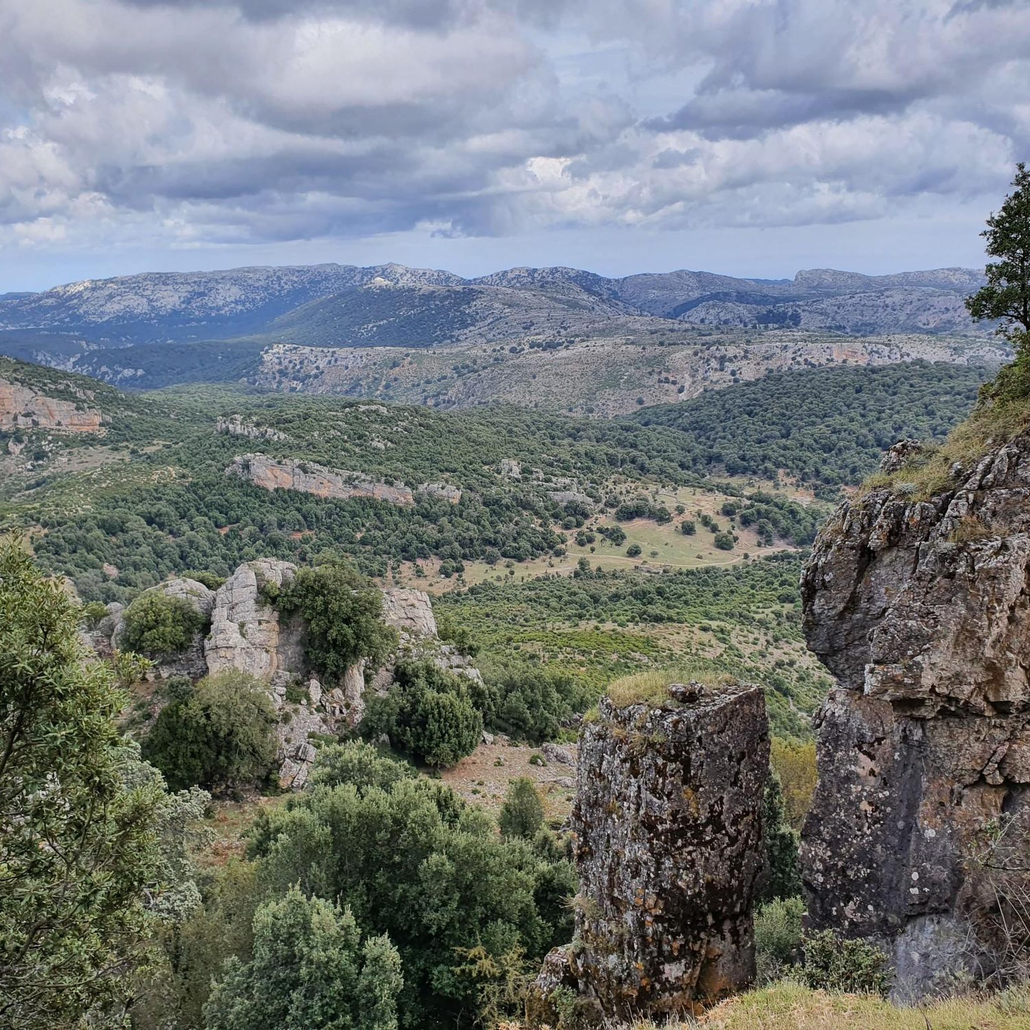
The Orgòsolo/Orgosolo region is characterized by its rugged limestone landscape. You'll encounter deep limestone gorges, most notably the Gorropu Gorge, which is a prominent feature on several routes. The area also features impressive rock formations like the Rock Spire at Gorropu Gorge, and various mountain passes.
Are there any circular mountaineering routes available?
Yes, several routes in the area are circular, allowing you to start and end at the same point. Examples include the Genna Silana Pass – Gorropu Gorge loop from Passo di Genna Silana, the Gorropu Gorge – Sa Barva Parking Area loop from Parcheggio per Tiscali, and the Point Sos Nidos – Monte Corrasi loop from Ulìana/Oliena.
What are some notable natural attractions or landmarks along the mountaineering routes?
The routes offer access to several significant natural landmarks. The most famous is the Gorropu Gorge, one of Europe's deepest canyons. You can also reach summits like Monte Corrasi Summit and the Summit of Punta La Marmora. Additionally, you might encounter features like the Font Spring (Fonte di Gorroppu) and various mountain passes such as Passo Genna Silana.
What is the best time of year for mountaineering in Orgòsolo/Orgosolo?
The best time for mountaineering in this region is typically during the spring (April to June) and autumn (September to October) months. During these periods, temperatures are milder, and the weather is generally more stable, making for more pleasant and safer conditions. Summers can be very hot, and winters may bring snow to higher elevations, making some routes more challenging or inaccessible.
Are there any specific permits required for mountaineering in the Orgòsolo/Orgosolo area?
While general permits for hiking are not typically required for most routes, access to certain protected areas or specific sections of the Gorropu Gorge might have entry fees or require guided access, especially during peak season. It's always advisable to check with local tourism offices or park authorities for the most up-to-date information before your trip.
What is the typical elevation gain on these mountaineering routes?
The elevation gain varies significantly depending on the route's difficulty. For instance, the difficult Genna Silana Pass – Gorropu Gorge loop involves an ascent of over 940 meters. Even moderate routes like the Monte Corrasi loop from Ulìana/Oliena can have over 720 meters of elevation gain, so be prepared for substantial climbs.
What do other mountaineers enjoy most about the routes in Orgòsolo/Orgosolo?
The mountaineering routes in Orgòsolo/Orgosolo are highly rated by the komoot community, with an average score of 4.75 stars from over 26 reviews. Reviewers often praise the dramatic gorge landscapes, the challenging ascents, and the panoramic views from summits like Monte Corrasi. The rugged and unspoiled nature of the terrain is also frequently highlighted.
Is it possible to find wild swimming spots near the mountaineering routes?
While the region is known for its rugged mountains and gorges, opportunities for wild swimming directly along the mountaineering routes are limited. The Gorropu Gorge itself features a river, but swimming access might be restricted or require specific conditions. For dedicated swimming, you might need to explore coastal areas or specific river spots further afield in Sardinia.
What kind of gear should I bring for mountaineering in this region?
Given the challenging and rugged terrain, essential gear includes sturdy mountaineering boots with good ankle support, appropriate layered clothing for varying weather conditions, a backpack with sufficient water and snacks, a first-aid kit, and navigation tools (map, compass, or GPS device). Trekking poles are highly recommended for stability on steep and uneven paths. For some routes, a helmet might be advisable, especially in areas with potential rockfall.
Most popular attractions around Orgòsolo/Orgosolo

Get inspired with the komoot mobile app


Explore more
Browse the best Mountain Hikes & Routes in other regions.
