The best road cycling routes around Gavorrano
4.5
(682)
16,966
riders
46
rides
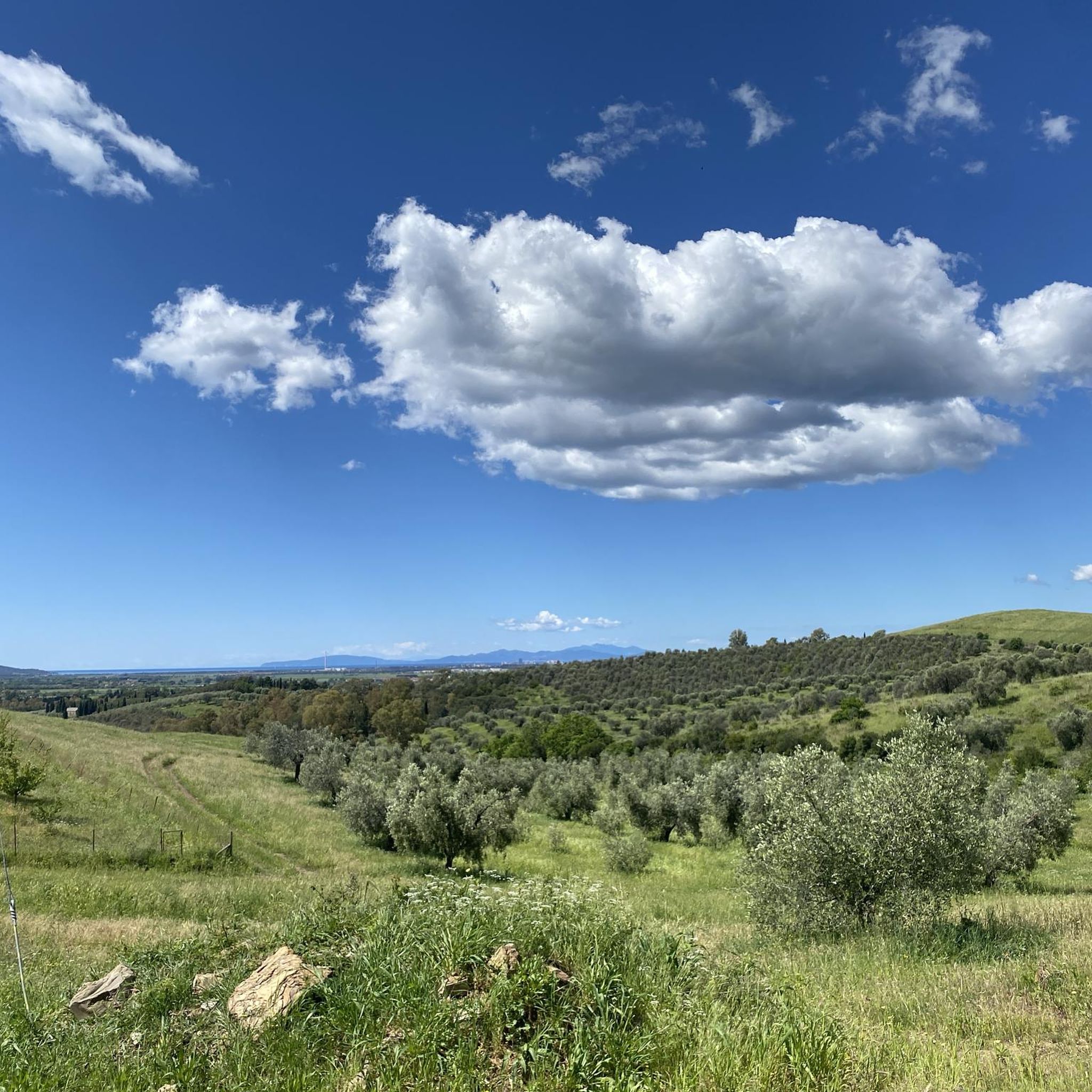
Road cycling routes around Gavorrano traverse a landscape characterized by rolling green hills, vast plains, and lush forests of chestnuts and olive groves. The region is situated within the Metalliferous Hills, offering varied terrain from gentle stretches to challenging ascents. Cyclists will encounter limestone outcrops and historic medieval villages nestled amidst vineyards and agricultural land. This diverse environment provides a range of road cycling experiences.
Best road cycling routes around Gavorrano
- The most popular road cycling route is Lago dell'Accesa…
Last updated: October 11, 2026
4.6
(10)
292
riders
63.0km
02:54
700m
700m
Moderate road ride. Good fitness required. Mostly well-paved surfaces and easy to ride.
4.5
(4)
222
riders
85.9km
04:00
1,000m
1,000m
Hard road ride. Very good fitness required. Mostly well-paved surfaces and easy to ride.

5.0
(3)
122
riders
109km
05:11
1,500m
1,500m
Hard road ride. Very good fitness required. Mostly well-paved surfaces and easy to ride.
5.0
(4)
132
riders
47.7km
02:14
450m
450m
Moderate road ride. Good fitness required. Some segments of this route may be unpaved and difficult to ride.
4.5
(2)
88
riders
120km
05:07
850m
850m
Hard road ride. Very good fitness required. Some segments of this route may be unpaved and difficult to ride.
Get access to more routes and recommendations from other explorers.
Already have an account?
Our route recommendations are based on thousands of hikes, rides, and runs completed by other people on komoot.
Start today with a free account
Your next adventure awaits.
Tips from the Community

Giuncarico is an ancient medieval village of early medieval origins located on a hill in Maremma Toscana, a hamlet of the municipality of Gavorrano in the province of Grosseto. The village arose around the 8th century on a height overlooking the Bruna river valley. It was controlled by the Aldobrandeschi, the Pannocchieschi and subsequently by the Republic of Siena. From the mid-16th century it became part of the Grand Duchy of Tuscany.
0
0
The ancient village of Vetulonia stands at about 335 meters above sea level on the hills of Castiglione della Pescaia, offering an extraordinary panoramic viewpoint that dominates the entire Tuscan Maremma plain, all the way to the sea. Formerly known as Vatluna, it was one of the most important centers of the Etruscan Dodecapolis, rediscovered at the end of the 19th century by the doctor and archaeologist Isidoro Falchi. Today it presents itself as a charming and silent hilltop village, a perfect blend of breathtaking landscapes and ancient history.
0
0
The beach and promenade of Follonica represent the beating heart of the summer life of this well-known seaside resort in the Tuscan Maremma. The town's coastline is characterized by very fine, light-colored sand, lapped by a calm sea with very gently sloping seabeds. This feature makes it perfect and safe for families with small children and for those seeking a day of absolute relaxation.
0
0
Il Barrino di Tatti is a renowned panoramic restaurant-pizzeria located about 410 meters above sea level, just outside the historic medieval village of Tatti (a hamlet of the municipality of Massa Marittima, in the province of Grosseto). Founded around 1970 as a village club, it is managed in synergy with the nearby Fattoria di Tatti - Sequerciani and is famous for its terrace with a breathtaking view that stretches across the entire Maremma region to the sea and the Island of Elba.
0
0

Sassetta is a small and authentic medieval village perched in the hinterland of the Etruscan Coast, in the province of Livorno, in the heart of the Val di Cornia. Inhabited by about 400 people, this village is distinguished by its stone houses, the tradition of old charcoal burners, and the presence of the characteristic red marble.
1
0
The climb from Castagneto Carducci towards Sassetta is a road section of about 8.2 kilometers with an elevation gain of 295 meters and an average gradient of 3.6%, ideal for road cycling and hiking.
0
0
The climb to Vetulonia offers ideal routes for cycling or hiking, with an elevation gain of about 300 meters. The most popular side starts from Grilli, approximately 4.3 km long with an average gradient of 7.2%. Alternatively, the climb from Vaticino extends for 5.2 km with an average gradient of 5.9%. The climb is characterized by challenging but consistent gradients, offering a splendid view of the Maremma Grossetana countryside.
1
0
Sassetta is a village in the Val di Cornia; a town of houses clinging to a hill in the hinterland of the Etruscan Coast, made of narrow streets, small squares, and beautiful infinities. The locality is famous for its marble, unique in the world, a red marble that stonemasons and creative sculptors have always magically shaped.
1
0
Frequently Asked Questions
How many road cycling routes are available around Gavorrano?
Gavorrano offers a wide selection of road cycling routes, with over 40 distinct tours available. These routes cater to various preferences, from moderate rides to more challenging ascents through the region's diverse landscapes.
What kind of terrain can I expect on road cycling routes in Gavorrano?
Road cycling in Gavorrano features a captivating mix of terrain. You'll encounter rolling green hills and vast plains, providing both gentle stretches and significant climbs. The routes often wind through lush forests, extensive olive groves, and vineyards, set within the unique geological formations of the Metalliferous Hills.
Are there routes suitable for beginners or those seeking an easier ride?
Yes, Gavorrano offers several routes suitable for those looking for an easier or more moderate ride. For example, the Lago dell'Accesa – Strada della Marsiliana loop from Gavorrano is a moderate 28-mile (45.1 km) route that provides beautiful views of Lake Accesa and the Maremma countryside without excessive difficulty.
What are some challenging road cycling routes in the Gavorrano area?
For experienced cyclists seeking a challenge, Gavorrano has routes with significant elevation gains. The View of Prata – View of Roccastrada loop from Gavorrano is a difficult 75.9-mile (122.2 km) route with nearly 1,900 meters of ascent, offering extensive views. Another demanding option is the Giuncarico Historic Village – View of Roccastrada loop from Gavorrano, a 53.2-mile (85.6 km) path with almost 1,000 meters of climbing.
What historical or cultural sights can I visit while road cycling in Gavorrano?
Many routes in Gavorrano pass through or near charming medieval villages like Gavorrano itself, Caldana, Ravi, and Giuncarico. You can also explore the region's mining heritage at the Parco Minerario Naturalistico di Gavorrano, which includes the Museo in Galleria and the evocative Teatro delle Rocce. The Giuncarico Historic Village is a notable stop on some routes.
Are there any natural attractions or scenic viewpoints along the routes?
Absolutely. The routes often feature stunning natural beauty, including views of the Metalliferous Hills and glimpses of the Tyrrhenian coast. You can cycle past extensive olive groves and vineyards. The Lago dell'Accesa is a prominent natural attraction, and the Archaeological Park of Lake Accesa offers both natural beauty and historical interest.
Can I find circular road cycling routes in Gavorrano?
Yes, the majority of road cycling routes in Gavorrano are designed as loops, allowing you to start and end your ride in the same location. Examples include the Lago dell'Accesa – Strada della Marsiliana loop from Gavorrano and the Follonica Beach – Donkey Farm loop from Gavorrano.
What is the best time of year for road cycling in Gavorrano?
Gavorrano's Mediterranean climate makes spring and autumn ideal for road cycling. During these seasons, temperatures are mild, and the landscapes are particularly vibrant, with blooming wildflowers in spring and rich colors in autumn. Summers can be hot, especially in July and August, while winters are generally mild but can have more unpredictable weather.
What do other cyclists say about road cycling in Gavorrano?
The road cycling routes in Gavorrano are highly regarded by the komoot community, boasting an average rating of 4.7 stars from over 40 reviews. Cyclists frequently praise the diverse terrain, the beautiful hilly landscapes, and the opportunity to explore charming medieval villages and historical sites.
Are there opportunities to combine road cycling with a visit to the coast?
While Gavorrano is inland, its proximity to the Tyrrhenian coast means you can find routes that offer a blend of inland scenery and coastal views. The Follonica Beach – Donkey Farm loop from Gavorrano is one such route that takes you towards the coast, allowing for a varied cycling experience.
Can I find routes that pass through charming medieval villages?
Yes, many road cycling routes in Gavorrano are designed to connect and pass through the region's well-preserved medieval villages. You can expect to cycle through places like Gavorrano, Caldana, Ravi, and Tatti Village, offering picturesque stops and a glimpse into local history.
Are there any routes that feature lakes or water bodies?
Yes, several routes incorporate the beautiful lakes in the area. The Il Barrino di Tatti – Lake Accesa loop from Gavorrano is a popular option that leads past Lago dell'Accesa, a significant natural feature in the region.
Most popular attractions around Gavorrano

Get inspired with the komoot mobile app


Explore more
Browse the best Road cycling routes in other regions.
