The best road cycling routes around Soazza
4.6
(161)
4,432
riders
31
rides
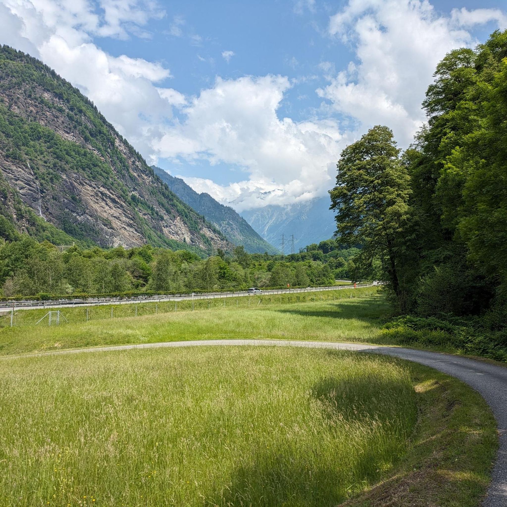
Road cycling routes around Soazza are situated in the Italian-speaking Valle Mesolcina, within the canton of Graubünden, Switzerland. The region is characterized by steep, densely forested mountain slopes and a dramatic alpine environment. Soazza itself is built on a sloped terrace, providing expansive views of the surrounding valley and mountains. The area offers varied terrain for road cyclists, with roads winding through ascents and descents.
Best road cycling routes around Soazza
- The most popular road cycling route is Climb to…
Last updated: July 7, 2026
4.9
(11)
194
riders
37.9km
02:24
1,110m
1,110m
Hard road ride. Very good fitness required. Mostly well-paved surfaces and easy to ride.
5.0
(3)
136
riders
48.5km
03:20
1,590m
1,590m
Hard road ride. Very good fitness required. Mostly well-paved surfaces and easy to ride.

Sign up for free
5.0
(7)
73
riders
38.3km
02:45
670m
670m
Moderate road ride. Good fitness required. Mostly well-paved surfaces and easy to ride.
5.0
(1)
63
riders
23.5km
01:32
740m
740m
Moderate road ride. Good fitness required. Mostly well-paved surfaces and easy to ride.
5.0
(1)
109
riders
56.4km
03:20
1,340m
1,340m
Hard road ride. Very good fitness required. Mostly well-paved surfaces and easy to ride.
Get access to more routes and recommendations from other explorers.
Sign up for free
Already have an account?
Our route recommendations are based on thousands of hikes, rides, and runs completed by other people on komoot.
Start today with a free account
Your next adventure awaits.
Login or Signup


Tips from the Community

The lake can be bypassed with a mountain bike. Two gates can only be bypassed by stopping and pushing. :-(
1
0

It's a great way to enjoy the descent! But be careful, the tunnels aren't lit. It's better to drive with your lights on!
2
0
A small café with a cozy space, a bit outside the center. There's a small fountain in front of the café, perfect for cooling off on hot days.
1
0

Typical Italian coffee with good refreshments like piadines or pinsas. And, of course, the finest espresso... The service is also excellent. We even got our water bottles filled for free.
0
0

Short flat stretch that allows you to regain some strength.
0
0

Splügen Pass / Passo dello Spluga The Splügen Pass has been proven to have been used since prehistoric times. There are also references to this in Roman times, e.g. the Itinerarium Antonini, a Roman road map from around 300 AD. The very close connections between the bishoprics of Chur and Como ran over the Splügen Pass. As early as 1396, there was evidence of significant customs revenues at Splügen. The expansion of the Viamala Gorge promoted its boom. The movement of goods was carried almost exclusively by packhorses, which meant frequent reloading. Transit traffic formed an important part of the flourishing economy. As late as 1798, the Austrian Field Marshal von Bellegarde wrote: "The largest train of goods from Milan to Germany goes over this pass, but mostly on horses and mules." Between 1818 and 1823, the first road that was passable for freight wagons and stagecoaches was built at the same time as the San Bernardino, and to a large extent it still follows the same route as it was then. After that, freight volumes and international passenger traffic over the Splügen increased several times over and reached their peak in the mid-1850s. The opening of the Alpine railways (1867 Brenner, 1872 Mont Cenis) had already reduced transit traffic over the Splügen. The opening of the Gotthard Railway in 1882 brought Graubünden transit traffic to a virtual standstill. A large wave of emigration was a direct result. The decades-long efforts to build a Splügen railway ultimately failed. The construction of the national road with a car tunnel at the San Bernardino opened up new perspectives. The Splügen Pass has been closed in winter since World War II. Text / Source: Interest Group for Alpine Passes IAP, PO Box 11, 6491 Realp https://www.alpen-paesse.ch/de/alpenpaesse/spluegenpass/
11
0
Splügen Pass (Alpine crossing (2113 m) Alpine crossing (2113 m) on the border between the Rheinwald in the Hinterrhein valley and the Italian Val San Giacomo (St. Jakobstal). The village of Splügen at the northern starting point, mentioned around 840 as cella in speluca, gave the pass its name. Italian Passo dello Spluga, Romanesque Pass dal Spleia. In the Middle Ages, the Splügen Pass was also known as Colmen d'Orso and Urschler. At the same time as the San Bernardino, the first road that was open to freight wagons and carriages was built between 1818 and 1823. After the Simplon and before the Gotthard, the Lower Road was thus the second Swiss "artificial road" across the Alps. For the route from Chur over the San Bernardino to Bellinzona, the Kingdom of Sardinia-Piedmont was responsible for a large part of the costs, in addition to the canton of Graubünden. The The Lombardo-Venetian Kingdom saw this as a threat to the volume of traffic over the Splügen Pass and in return had a road built at its own expense across the national border to the village of Splügen. This road essentially corresponded to the route still used at the beginning of the 21st century. On the north side, according to the plans of engineer Carlo Donegani, the road no longer led through the avalanche slope of the Altberg. On the south side, an almost completely new route was chosen below Monte Spluga to Campodolcino, bypassing the Cardinell Gorge. Many galleries and refuge houses were built at regular intervals, especially on the south side. After the devastating flood damage of 1834, the road was rebuilt in some places. In 1841, the first mountain house with the customs station was built on the north side (2022 m). Text / Source: Historical Dictionary of Switzerland (HLS) https://hls-dhs-dss.ch/de/articles/008823/2013-01-10/
13
0
Frequently Asked Questions
What kind of terrain can I expect on road cycling routes around Soazza?
Road cycling routes around Soazza are characterized by the dramatic alpine environment of the Valle Mesolcina. You can expect roads winding through steep, densely forested mountain slopes, offering both challenging ascents and rewarding descents. The region provides varied terrain, from moderate to difficult, with expansive views of the valley and surrounding mountains.
Are there road cycling routes suitable for beginners in Soazza?
While many routes in Soazza feature significant elevation changes, there are 3 routes classified as easy, making them more suitable for beginners or those looking for a less strenuous ride. The overall network offers options for various ability levels.
What scenic viewpoints or landmarks can I see while road cycling in Soazza?
The region offers numerous scenic points. You can enjoy panoramic views of the valley and mountains, especially from routes like the San Martino Church, Soazza – Pian San Giacomo loop from Soazza, which passes by the historic Parish Church of San Martino. Other notable attractions in the vicinity include the Lake Dosso, the Catino Waterfall, and the Marmitte dei Giganti Nature Reserve.
Are there any circular road cycling routes around Soazza?
Yes, there are several circular road cycling routes available. For instance, the San Martino Church, Soazza – Pian San Giacomo loop from Soazza is a popular difficult route offering panoramic views. Another option is the Waterfall at Buffalora – Lostallo Village and Waterfall loop from Lostallo, which takes you through the Valle Mesolcina.
What is the best season for road cycling in Soazza?
Given Soazza's alpine location, the best season for road cycling is typically from late spring through early autumn (May to October). During these months, the weather is generally milder, and mountain passes are more likely to be clear of snow, offering optimal conditions for exploring the routes.
How many road cycling routes are available around Soazza?
There are over 20 road cycling routes around Soazza, offering a diverse range of experiences for cyclists. These routes vary in difficulty, from moderate to difficult, ensuring options for different skill levels.
What do other road cyclists say about the routes in Soazza?
The road cycling routes in Soazza are highly rated by the komoot community, with an average score of 4.8 stars from over 120 reviews. Cyclists often praise the stunning alpine landscapes, the challenging ascents, and the quiet, immersive natural experience the region provides.
Are there any routes that pass by waterfalls?
Yes, you can find routes that feature waterfalls. The Waterfall at Buffalora – Lostallo Village and Waterfall loop from Lostallo is a moderate route that leads through the Valle Mesolcina and includes a waterfall. Additionally, the Catino Waterfall is a notable natural monument in the area.
Can I find routes that pass by lakes in the Soazza area?
Yes, the region around Soazza features several beautiful lakes that can be incorporated into or viewed from cycling routes. Notable lakes include Lake Dosso, Lake Cama, and Lake Truzzo, offering picturesque stops or views along your ride.
Is there parking available for cyclists in Soazza?
While specific parking facilities for cyclists are not detailed, Soazza is a small village. It's generally advisable to look for public parking areas within the village or at the start points of specific routes. Always check local signage for parking regulations.
How can I reach Soazza using public transport with my bike?
Soazza is located in the Valle Mesolcina. Public transport options, such as PostBus services, connect the village to larger towns like Bellinzona. It's recommended to check the specific public transport provider's website for their bike transport policies and schedules, as these can vary by route and season. For general information about Soazza, you can visit MySwitzerland.com.
Are there family-friendly road cycling routes in Soazza?
While many road cycling routes in Soazza are challenging due to the mountainous terrain, there are 3 routes classified as easy, which might be more suitable for families with older children or those seeking a gentler ride. Additionally, the region has a disused railway line between Mesocco and Boffalora, which, while primarily a hiking trail, often provides relatively flat and scenic paths that can be enjoyed by cyclists looking for a less strenuous experience.
Most popular attractions around Soazza

Get inspired with the komoot mobile app


Explore more
Browse the best Road cycling routes in other regions.
