The best walks and hikes around Oulx
4.5
(1084)
6,653
hikers
184
hikes
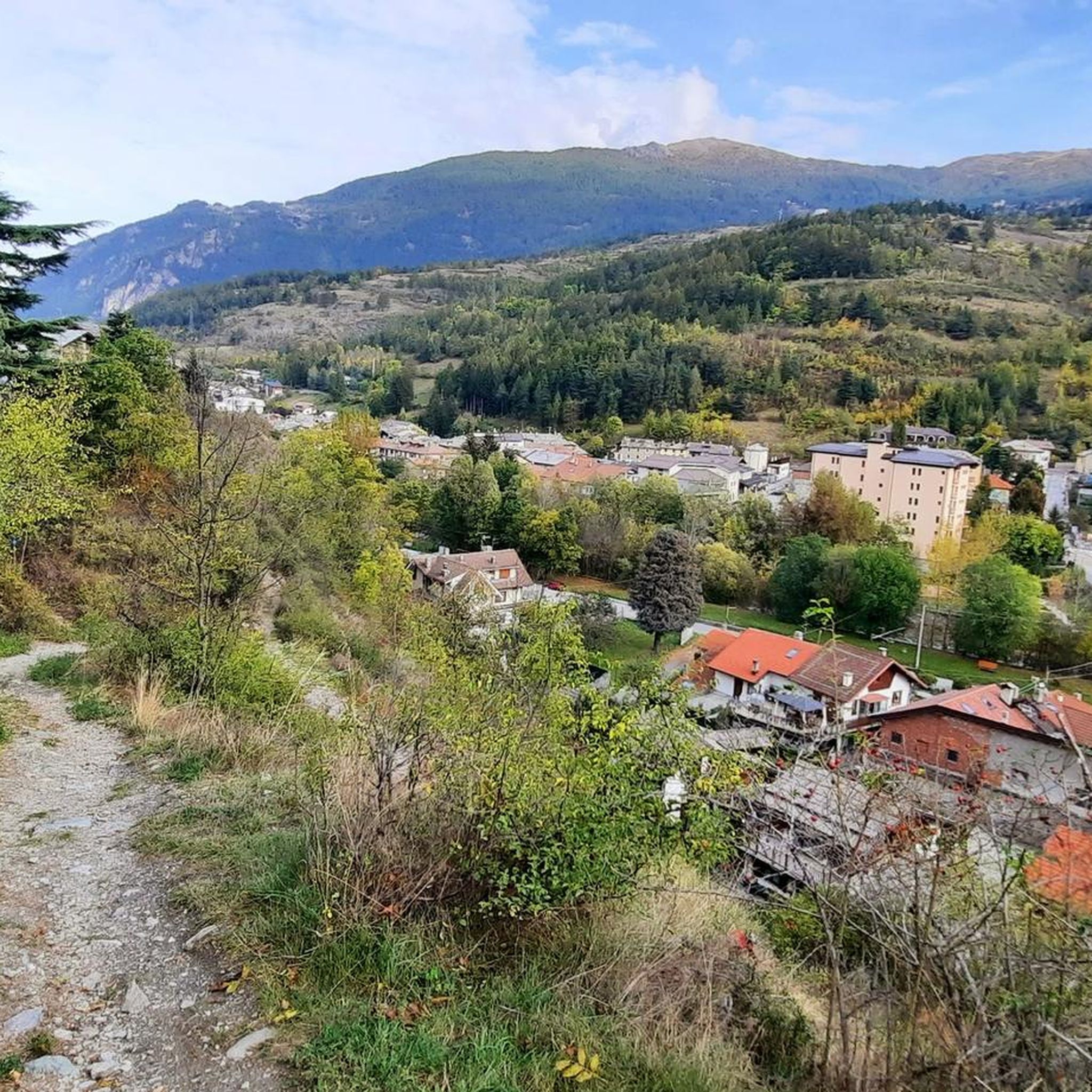
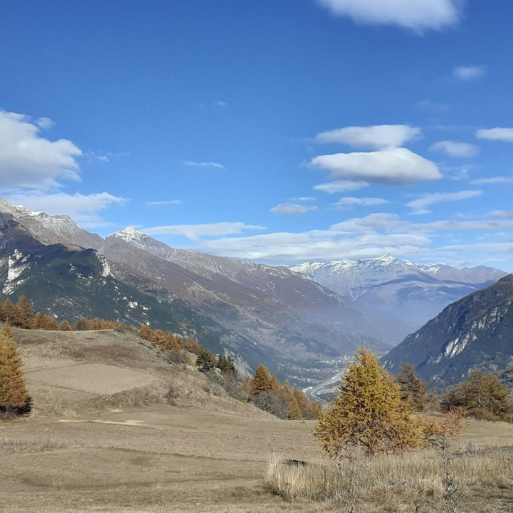
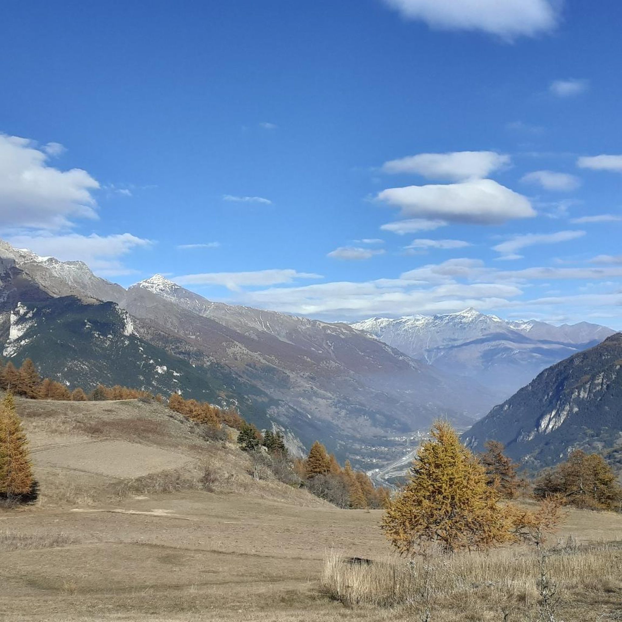
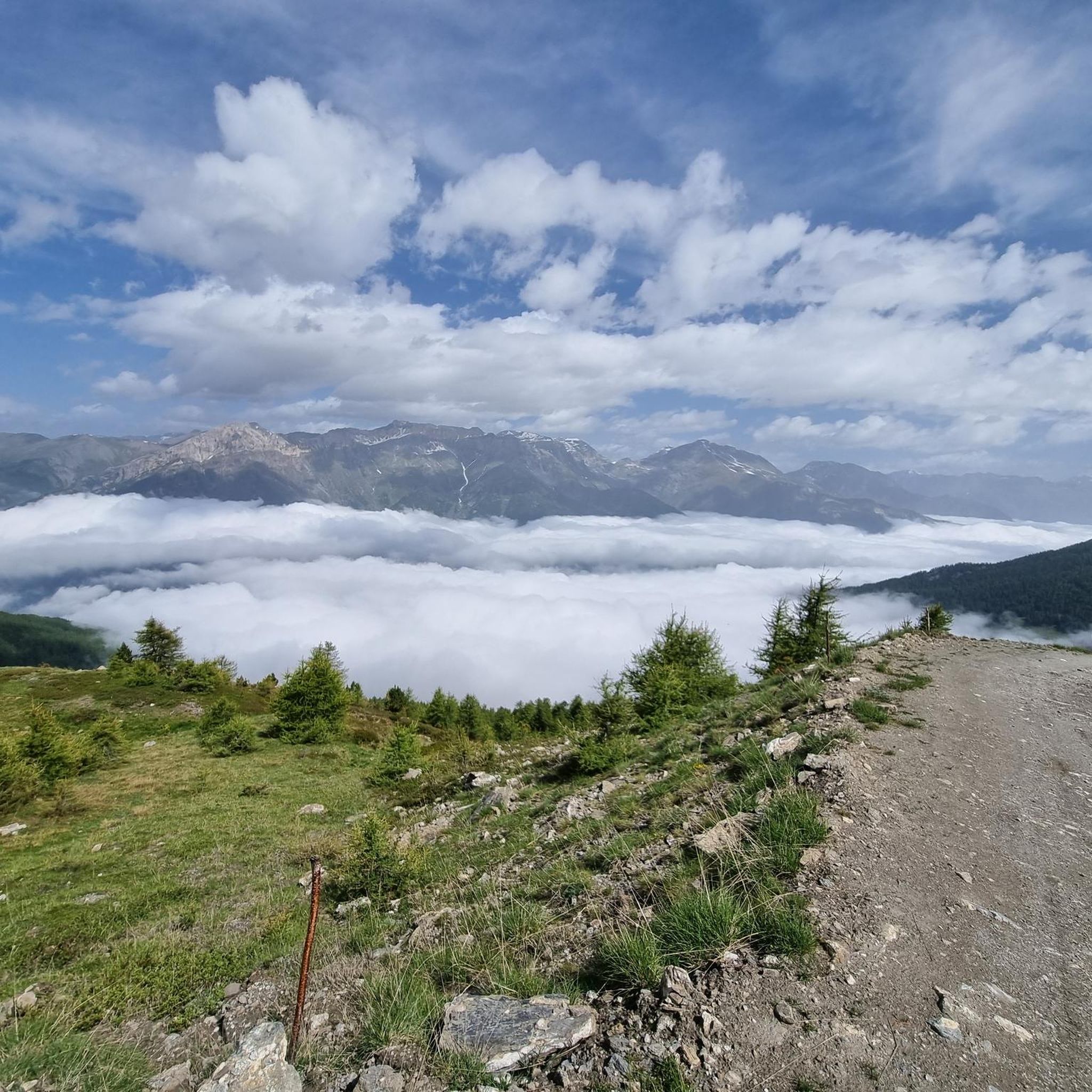
Hiking around Oulx offers diverse terrain within Italy's Valle di Susa, characterized by the rugged peaks of the Cottian Alps. The region features dense forests, picturesque alpine lakes, and varied landscapes suitable for different hiking experiences. Trails often traverse mixed woodlands and open spaces, providing views of the surrounding mountains and valleys.
Best hiking trails around Oulx
- The most popular hiking route is Amazas to Vazon Trail via Soubras, a 4.5 miles (7.2 km) trail that takes 2 hours 43 minutes to complete. This moderate route offers varied terrain and views of the Susa Valley.
- Another top favourite among local hikers is Punta della Mulattiera and Col des Acles Loop, a difficult 7.2 miles (11.6 km) path. This challenging loop ascends through alpine terrain, providing panoramic views of the Cottian Alps.
- Local hikers also love the Monte Cotolivier Trail from Oulx, a 7.5 miles (12.0 km) trail leading through forested slopes and open areas, often completed in about 5 hours 16 minutes.
- Hiking around Oulx is defined by rugged alpine peaks, dense forests, and high-altitude lakes. The network offers options for different ability levels, from easy walks to demanding mountaineering routes.
- The routes in Oulx are highly rated by the komoot community with an average score of 4.6 stars from more than 800 reviews. More than 5,900 hikers have used komoot to explore Oulx's varied terrain.
Last updated: October 10, 2026
4.0
(3)
17
hikers
28.9km
09:27
950m
1,530m
Hard hike. Very good fitness required. Mostly accessible paths. Sure-footedness required.
4.7
(18)
111
hikers
7.17km
02:44
450m
450m
Embark on the Amazas to Vazon Trail via Soubras, a moderate hike covering 4.5 miles (7.2 km) with an elevation gain of 1481 feet (451 metres). This route takes approximately 2 hours and 43 minutes to complete, leading you through quiet mountain villages above Oulx. You will discover historic stone houses and traditional architecture, eventually reaching the notable Soubras Chapel, built on the site of a Roman necropolis. Beyond the villages, the trail opens up to meadows that bloom with vibrant orchids, offering a varied and scenic experience.
When planning your visit, be aware that the trail is predominantly gravel, with significant natural and alpine sections. Sure-footedness is required on some uneven or rocky parts, so wear appropriate footwear. While there are no specific warnings about snow conditions or road closures, it is always wise to check local conditions before you head out. Parking near Amazas is generally good, making access straightforward for most visitors.
This trail is a fantastic way to explore the Oasi Xerotermica di Oulx-Amazas, offering a glimpse into the region's past and natural beauty. The path connects you with the unique character of mountain villages and their traditional architecture. The historical significance of the Soubras Chapel, combined with the diverse terrain and blooming meadows, makes this route a distinctive choice for a moderate day hike.

4.7
(10)
60
hikers
11.6km
05:09
890m
890m
Embark on the Punta della Mulattiera and Col des Acles Loop, a difficult hiking route that challenges you with 2904 feet (885 metres) of elevation gain over 7.2 miles (11.6 km). This demanding trail, estimated to take 5 hours and 8 minutes, leads you through the rugged Western Alps. You will experience high-altitude valleys and panoramic views of peaks like Monte Seguret and Monte Thabor, offering a truly wild mountain atmosphere.
To begin this high-alpine adventure, you can often start your hike from Bardonecchia or Pian del Colle. Be prepared for varied terrain, including gravel sections and single trails, which can be steep and technically demanding, especially above the tree line where surfaces may be slippery. Planning your visit for good weather is essential to fully enjoy the challenging conditions.
This route is notable for its unique blend of natural beauty and history, taking you past historical military fortifications, such as the ruins of Caserma XVI near Passo della Mulattiera. The trail also offers the distinct experience of crossing the Franco-Italian border at Col des Acles, adding a significant geographical and cultural element to your journey.
3.0
(1)
10
hikers
13.6km
05:32
900m
890m
Embark on the challenging Rifugio Guido Rey and Sentiero Balcone Loop, a difficult hike spanning 8.4 miles (13.6 km) with a significant 2964 feet (903 metres) of elevation gain. This route typically takes around 5 hours and 32 minutes to complete. As you hike, you will traverse diverse terrain, from natural paths winding through picturesque conifer woods to more demanding alpine sections. Keep an eye out for charming wooden bridges crossing mountain streams and the serene Rifugio Rey Lake. The historic Guido Rey Mountain Hut serves as a notable landmark, offering a place to rest and enjoy the surroundings.
Planning your visit requires good preparation, as this difficult loop demands very good fitness and sure-footedness. Some sections may even require alpine experience, so assess your skills carefully before you go. While the trails are generally well-marked and regularly maintained, always check local conditions for potential snow or road closures before you head out. Starting early in the day is advisable to allow ample time to complete the route comfortably.
This trail offers a rewarding adventure through the Cozie Alps, showcasing the natural beauty of the Oasi Xerotermica di Puys-Beaulard. Beyond the physical challenge, you will discover stunning views, including a notable vista of Château-Beaulard, and pass through areas dotted with fields of wildflowers. The historic Guido Rey Mountain Hut, situated at 1761 metres, is a significant landmark where you can enjoy local food, adding a cultural touch to your outdoor experience.
4.7
(7)
38
hikers
11.6km
03:40
410m
410m
Start your hike from Las Pellousieres to Chateau Beaulard on CAI Trail 739, a moderate route covering 7.2 miles (11.6 km). You will gain 1348 feet (411 metres) in elevation, with an estimated duration of 3 hours and 40 minutes. The trail leads you through dense woods of larch, spruce, and mountain pine, characteristic of the Susa Valley. As you progress, the path frequently opens up to offer panoramic views of the surrounding Alps, including prominent peaks like Rocciamelone. Look for the classic vista of Chateau Beaulard as you near the end of your journey. The varied terrain, shifting from wider mule tracks to narrower trails, ensures an engaging experience.
When planning your visit, be aware that conditions on the trail can vary significantly depending on the season. During winter, you might need snowshoes or microspikes, so it is wise to check the current conditions for CAI Trail 739 beforehand. Good trekking boots are essential for the diverse surfaces, and poles are highly recommended for added stability. Consider starting your hike early to enjoy the views and avoid the warmest parts of the day, especially in summer.
This trail is situated within the Riserva Naturale dello Stagno di Oulx, offering a chance to explore the natural environment of the Susa Valley. The route provides a balanced challenge for hikers, combining physical exertion with rewarding scenery. It is a great way to experience the typical flora and expansive mountain vistas of this Italian Alpine region. The trail's connection to Chateau Beaulard also offers a glimpse into the charming local architecture and history.
Get access to more routes and recommendations from other explorers.
Already have an account?
Our route recommendations are based on thousands of hikes, rides, and runs completed by other people on komoot.
Start today with a free account
Your next adventure awaits.


Other adventures around Oulx

Tips from the Community

Path created and used by local people for their work in the mountains
0
0

The Chapel of San Barnaba is located in the lower part of the small village of Soubras, in a panoramic spot, with benches outside useful for taking a break if you have been walking for a long time.
0
0

very nice point where you cross the river
0
0
From the Rey refuge, with a short but very steep climb on a wide dirt road, we reach the banks of this lake. There is a small house called "Naturalistic Observatory" which we can use as a shelter in case of rain
0
0

Splendid mountain lake that is surrounded by the wildest nature
0
0

It is located at approximately 1800 m above sea level, on the route coming from Bardonecchia
0
0

View from the return from the Guido Rey refuge
0
0
Frequently Asked Questions
What kind of hiking trails can I expect around Oulx?
Oulx, nestled in the Valle di Susa, offers a wide variety of hiking trails, from easy strolls through dense forests to challenging ascents in the rugged Cottian Alps. You'll find paths traversing mixed woodlands, open meadows, and leading to picturesque alpine lakes, providing diverse landscapes and panoramic views.
Are there easy hiking trails suitable for families with children in Oulx?
Yes, Oulx has several easy trails perfect for families. The Amazas to Vazon Trail via Soubras is a moderate 4.5-mile route with varied terrain. Additionally, the Gran Bosco Natural Park offers wide forest roads, like the OULX Montagne Seu route, which are ideal for easy walks with children.
Where can I find challenging hikes with significant elevation gain?
For more demanding hikes, the higher alpine regions of the Cottian Alps provide challenging routes. The Punta della Mulattiera and Col des Acles Loop is a difficult 7.2-mile path with substantial elevation gain, offering panoramic views. Another option is the Monte Cotolivier Trail from Oulx, a 7.5-mile difficult route through forested slopes.
Are there any circular hiking routes in the Oulx area?
Yes, circular routes are available for hikers who prefer to start and end in the same location. The Punta della Mulattiera and Col des Acles Loop is a notable difficult circular path. Another option is the Rifugio Guido Rey and Sentiero Balcone Loop, a difficult 8.4-mile trail offering varied scenery.
What natural attractions or landmarks can I see along the hiking trails?
Hiking trails around Oulx often lead to stunning natural attractions. You can discover beautiful alpine lakes such as Lake Laux, Rochemolles Lake, and Lago di Laune. Many routes also offer views of prominent peaks like Monte Thabor and Monte Genevris, and you can explore parts of the Gran Bosco Natural Park.
What is the best time of year for hiking in Oulx?
The best time for hiking in Oulx is generally from late spring to early autumn (May to October). During these months, the weather is milder, and most trails are free of snow, allowing access to higher alpine areas and offering vibrant flora and fauna. Winter hiking is possible but requires specialized gear and experience due to snow and ice.
Can I bring my dog on the hiking trails in Oulx?
Many trails in the Oulx region are dog-friendly, especially those in natural parks like the Gran Bosco Natural Park, which features wide forest roads. However, it's always advisable to keep your dog on a leash, especially in areas with wildlife or near livestock, and to check specific trail regulations before you go.
What kind of wildlife might I encounter while hiking?
The Gran Bosco Natural Park, a significant natural feature in the area, is home to diverse wildlife. Hikers might spot marmots, badgers, foxes, roe deer, deer, and various bird species like woodpeckers. There's also a chance to see wolves, which inhabit the park's 700 hectares of mixed forest.
Are there any trails that offer exceptional panoramic views?
Absolutely. Many trails in Oulx provide spectacular panoramic views of the Valle di Susa and the surrounding Cottian Alps. Routes leading to Monte Genevris are known for their extensive vistas. The From Borgata Vazon to Colletto Pourachet Junction (via Route 716), a moderate 5-mile trail, also offers great viewpoints along its path.
How many hiking routes are available in the Oulx area?
There are over 180 hiking routes available around Oulx, catering to various skill levels. This includes approximately 20 easy trails, over 120 moderate routes, and more than 40 difficult paths, ensuring options for every hiker.
What do other hikers say about the trails in Oulx?
The hiking routes in Oulx are highly rated by the komoot community, with an average score of 4.6 stars from over 800 reviews. Hikers often praise the diverse terrain, the stunning alpine scenery, and the well-maintained paths that lead through forests and to breathtaking viewpoints.
Most popular attractions around Oulx

Get inspired with the komoot mobile app


Explore more
Browse the best Hikes in other regions.
