The best road cycling routes around Cartosio
4.4
(119)
3,185
riders
161
rides
Road cycling routes around Cartosio traverse diverse landscapes, including cultivated areas, dense woodlands, and unique eroded clay formations known as "calanchi." The terrain is situated between the Apennines and Monferrato hills, offering varied gradients and panoramic views of the lower Bormida Valley. The region features a network of paved roads suitable for road bikes, providing opportunities for scenic rides.
Best road cycling routes around Cartosio
- The most popular road cycling route is Mioglia – Road through the tuff loop from…
Last updated: July 1, 2026
36
riders
Moderate road ride. Good fitness required. Mostly well-paved surfaces and easy to ride.
5.0
(1)
12
riders
36.5km
01:52
510m
510m
Moderate road ride. Good fitness required. Mostly well-paved surfaces and easy to ride.

Sign up for free
13
riders
28.1km
01:41
570m
570m
Moderate road ride. Good fitness required. Mostly well-paved surfaces and easy to ride.
6
riders
41.9km
02:19
830m
820m
Moderate road ride. Good fitness required. Some segments of this route may be unpaved and difficult to ride.
5.0
(1)
9
riders
38.2km
02:12
840m
840m
Moderate road ride. Good fitness required. Mostly well-paved surfaces and easy to ride.
Get access to more routes and recommendations from other explorers.
Sign up for free
Already have an account?
Our route recommendations are based on thousands of hikes, rides, and runs completed by other people on komoot.
Start today with a free account
Your next adventure awaits.
Login or Signup

Tips from the Community

Bar well stocked and with excellent ice cream 🤩
0
0

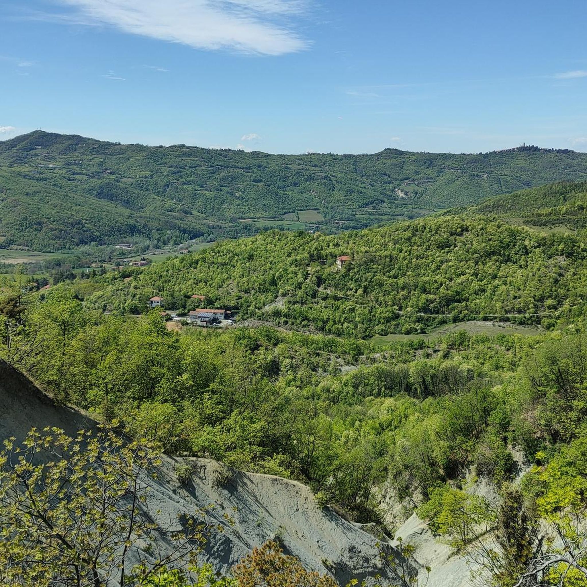
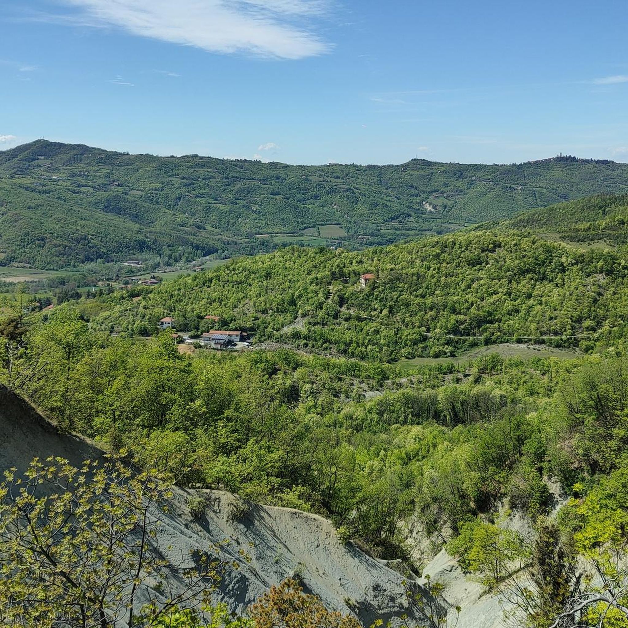
Castelletto d’Erro is a small hilltop village in the Alto Monferrato, in the province of Alessandria, at an altitude of about 544 m. From here you can enjoy a very wide panoramic view of the hills, vineyards and the Valle dell’Erro.
8
0

Castelletto d'Erro is a tiny village in Alto Monferrato, just over a hundred inhabitants, perched on the hills between the Erro and Bormida valleys. It was born as a fortification to control the underlying via Emilia Scauri, the ancient Roman road to Liguria. Of the ancient castle, the square tower from around 1330 remains, with a crowning of blind arches and a raised entrance door. From the meadow around the tower, the panorama stretches over the entire Acqui area and, on clear days, as far as the Alps.
0
0
Always carry 5-10 cent coins with you to use these machines.
12
0
Ski out of traffic on good asphalt.
17
0
Scenic road perfect for cycling without traffic.
18
0
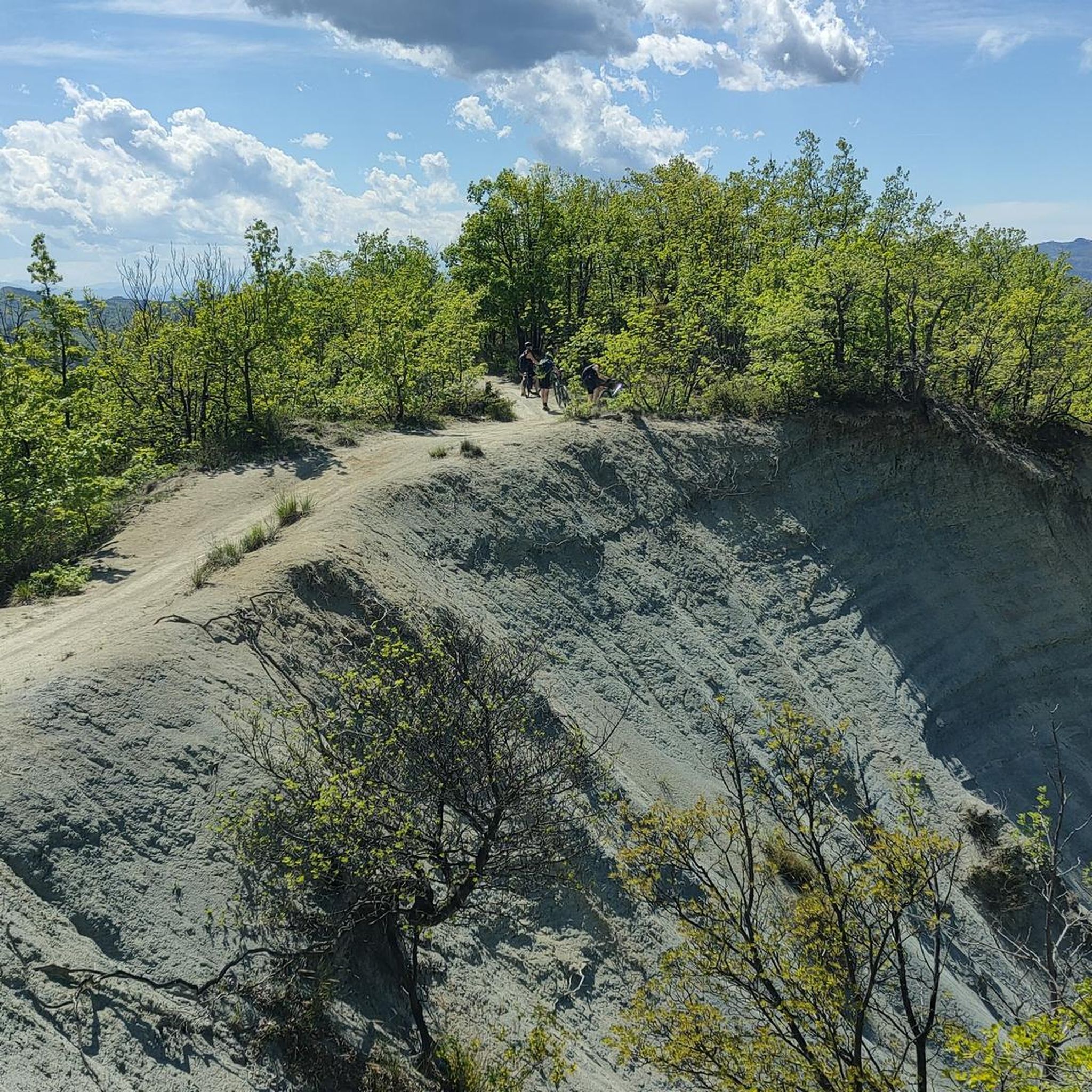
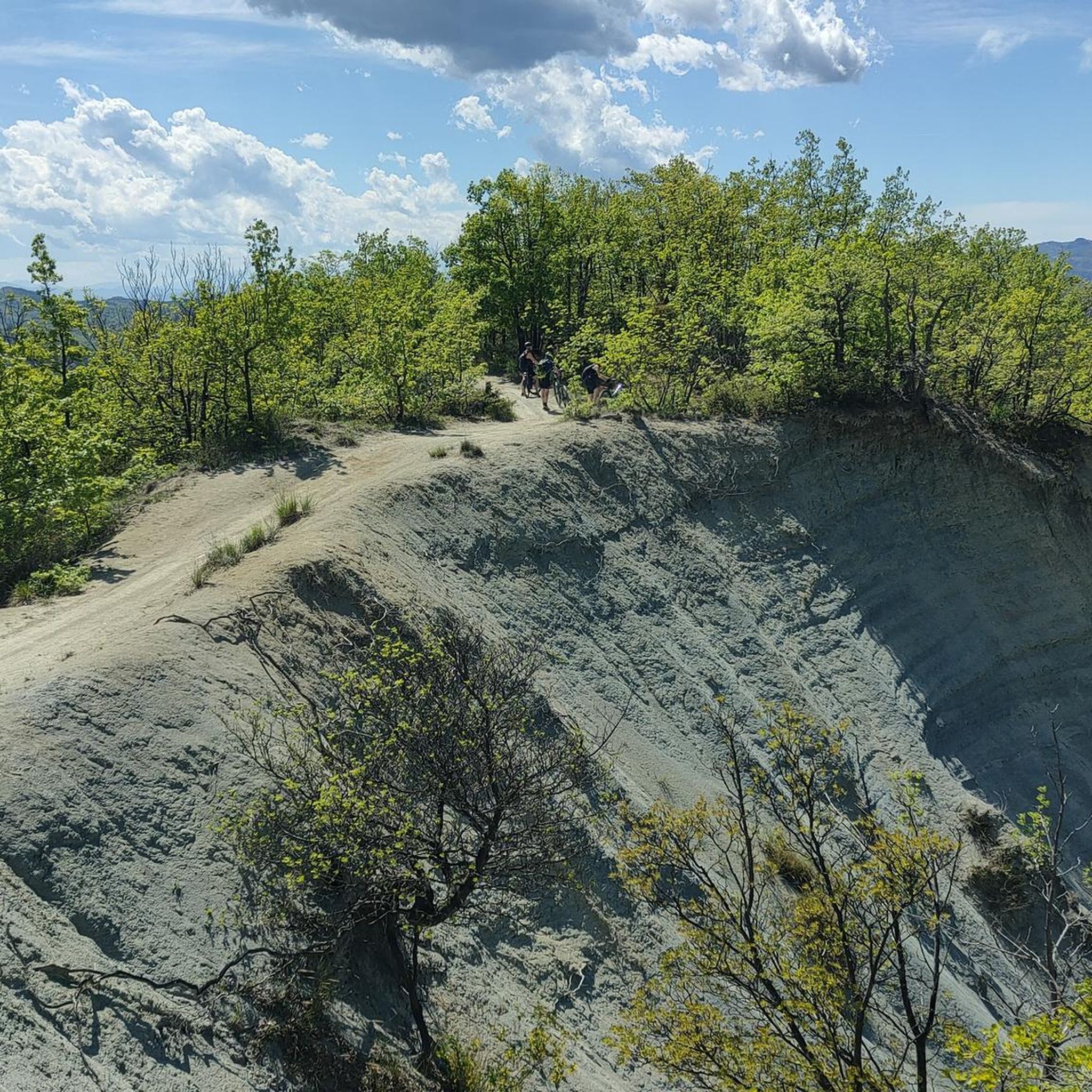
In this area the Calanchi offer wonderful views.
17
0
A spectacular view of the magnificent Alps.
17
0
Frequently Asked Questions
How many road cycling routes are available around Cartosio?
There are over 170 road cycling routes around Cartosio, offering a wide range of options for different skill levels and preferences. The komoot community has explored these routes over 3000 times.
What kind of terrain can I expect on road cycling routes in Cartosio?
Road cycling routes in Cartosio traverse diverse landscapes, including cultivated fields, dense woodlands, and unique eroded clay formations known as "calanchi." The terrain is situated between the Apennines and Monferrato hills, offering varied gradients and panoramic views of the lower Bormida Valley. You'll find a network of paved roads suitable for road bikes.
What is the best time of year for road cycling in Cartosio?
The region generally offers pleasant conditions for road cycling from spring through autumn. Summers can be warm, but the varied terrain with woodlands provides some shade. Spring and early autumn typically offer milder temperatures and beautiful scenery.
Are there road cycling routes suitable for beginners or those looking for easier rides?
Yes, Cartosio offers routes suitable for various abilities. While many routes feature moderate climbs, there are options with less steep ascents. For example, the area has 6 routes classified as easy, and 89 as moderate, providing plenty of choices for those seeking a less strenuous ride.
What are some of the more challenging road cycling routes in the Cartosio area?
For experienced cyclists seeking a challenge, there are 78 difficult routes around Cartosio. One such route is the Piazza Italia Acqui Terme – Roman Aqueduct of Acqui Terme loop from Cartosio, which covers over 60 kilometers with more than 1100 meters of elevation gain.
Are there any circular road cycling routes around Cartosio?
Yes, many of the road cycling routes in Cartosio are designed as loops, allowing you to start and end in the same location. An example is the Church of Melazzo – View of the Ligurian Apennines loop from Cartosio, a 41.9 km trail through hilly landscapes.
What natural features or landmarks can I see while road cycling around Cartosio?
You can encounter unique natural features like the striking "calanchi" formations, which are eroded clay landscapes. The Calanchi Badlands – From Malvicino to Pareto loop from Rivere offers views of these. Additionally, you might pass by the famous La Bollente Hot Spring Fountain in nearby Acqui Terme, a natural monument with sulphurous water gushing at 74.5°C.
Are there historical sites or cultural attractions accessible by road bike near Cartosio?
Absolutely. You can cycle past the remains of the ancient Roman Aqueduct of Acqui Terme, dating back to the first century AD. The fortified Monastero Bormida village, with its old arched bridge, is also a notable historical point of interest in the vicinity.
What do other cyclists say about road cycling in Cartosio?
The road cycling routes around Cartosio are highly rated by the komoot community, with an average score of 4.5 stars from over 90 reviews. Cyclists often praise the varied terrain, panoramic views, and the network of paved roads that make for enjoyable rides.
Can I find places to stop for refreshments or food along the routes?
While specific cafes on every route aren't detailed, the region's villages and towns, such as Cartosio itself and nearby Acqui Terme, offer opportunities for refreshments. Planning your route to pass through these settlements will allow for convenient stops.
Are there family-friendly road cycling options in Cartosio?
For families, it's advisable to look for routes with less traffic and gentler gradients. While specific 'family-friendly' designations for road cycling are less common than for leisure cycling, easier routes with moderate difficulty and shorter distances, like some of the 6 easy routes available, could be suitable for families with older children.
What are the typical distances and durations for road cycling routes in Cartosio?
Routes vary significantly. For example, the Castelletto d’Erro loop from Castelletto d'Erro is a moderate 27.9 km path, while the Mioglia – Road through the tuff loop from Cartosio covers 36.5 km and takes about 1 hour 52 minutes. You'll find options ranging from shorter rides under 20 km to longer excursions over 60 km.
Most popular attractions around Cartosio

Get inspired with the komoot mobile app


Explore more
Browse the best Road cycling routes in other regions.
