Attractions and Places To See around Tadasune/Tadasuni - Top 20
Attractions and places to see around Tadasune/Tadasuni is a municipality in the Province of Oristano, Sardinia, Italy. Situated on the western shore of Lake Omodeo, the area offers a blend of historical, cultural, and natural attractions. Visitors can explore ancient archaeological sites, historic buildings, and diverse landscapes. The region provides opportunities for exploration within its undulating geometric profile and varied terrain.
Best attractions and places to see around Tadasune/Tadasuni
- The most popular attractions is Santa Chiara Dam, a man-made monument that was the original dam built in 1924 to form Lake Omodeo. This historic barrier is now partially submerged since being replaced by the new Eleonora D'Arborea dam.
- Another must-see spot is Santa Chiara Dam on the Tirso, a man-made monument and historical site. This dam, completed in 1924, regulated the Tirso River and created what was once Europe's largest artificial lake.
- Visitors also love Nuraghe Losa, a historical site. This significant archaeological site near Abbasanta features impressive Nuragic architecture, including a trefoil nuraghe and remains of an extensive settlement.
- Tadasune/Tadasuni is known for its historical sites, man-made monuments, and natural features like Lake Omodeo. The area offers a variety of attractions to see and explore, from ancient structures to engineering marvels.
- The attractions around Tadasune/Tadasuni are appreciated by the komoot community, with 5 upvotes and 11 photos shared by visitors.
Last updated: June 24, 2026
Nuraghe Losa
Highlight • Historical Site
Translated by Google •
Tip by

Santa Chiara Dam on the Tirso
Highlight • Monument
King of the victorious and renewed homeland, he inaugurated on April 28, 1924 the works of Tirso which, divined by the first architects of the Italian economy drawn by Angelo Omodeo, powerfully subsidized by the state;
Giulio Dolcetta
it fulfilled in the first five years of glorious peace under the presidency of Giovanni Cini, by mandate and with the means of the Italian Commercial Bank, and of the Italian Society for Southern Railways.
----
Collaborate to the general organization, Angelo Bruni and Antonio Pierazzuoli.
The major work is the Santa Chiara di Ula dam designed by Luigi Kambo.
He built,
Felice Costamagna
assisted by his brother Andrea, by Ottavio and Alfonso Gervaso, by Carlo Avanzini, Silvio Silva, Giovanni Brotzu, Stefano Meloni, Tullio Serra Emilio Elia and Tommaso Fiorelli.
Leading the effort of 16,000 Italian workers.
---
Andrea Pertoldeo, Engineer, fell in the long and bitter struggle against the unhealthy place and the resistance of nature.
L.Costan [...], A. Carpanelli E. Gramsci, P. Prisco, G. Pace, E. Serra
And the workers: G. Fundoni, A. Cancedda, D. Simula, E. Secchi, [...]. Crucas, C. Manai,
G. Marras, A. Floris, G. Manca, B. Sotgiu, P. Oppo. [...]. Crispazio, I. Scoonamilla, P. Succu, A. Garau,
G. Lai, A. Cossu, A. Follesa, A. Frau, F. Aresti, R. Carrucciu, V. Sedilesu, R. Canali, A. Brau,
L. Moro, G. Cannas, G. Marcus, P. Tidu, R. Manca [...] G. Piras, A. Molli, E. Mantegano, R. Remano
GOD THE FATHER WATCH AND FECOND
Translated by Google •
Tip by

Sign up now to discover places like this
Get recommendations on the best single tracks, peaks, & plenty of other exciting outdoor places.
Sign up for free
Santa Chiara Dam and Lake Omodeo Road
Highlight (Segment) • Cycleway
Translated by Google •
Tip by
Chief Engineer's House of the Santa Chiara Dam
Highlight • Monument
The point of interest can be easily reached by bike with the service road behind sa cantinedda, but obviously to go down to visit the house you have to park the bike and go down the steps at the side of the road.
Translated by Google •
Tip by
Busachi Bridge over the Tirso River
Highlight • Bridge
Translated by Google •
Tip by

Sign up for free to discover even more attractions around Tadasune/Tadasuni.
Sign up for free
Already have an account?
Start today with a free account
Your next adventure awaits.
Login or Signup
Tips from the Community

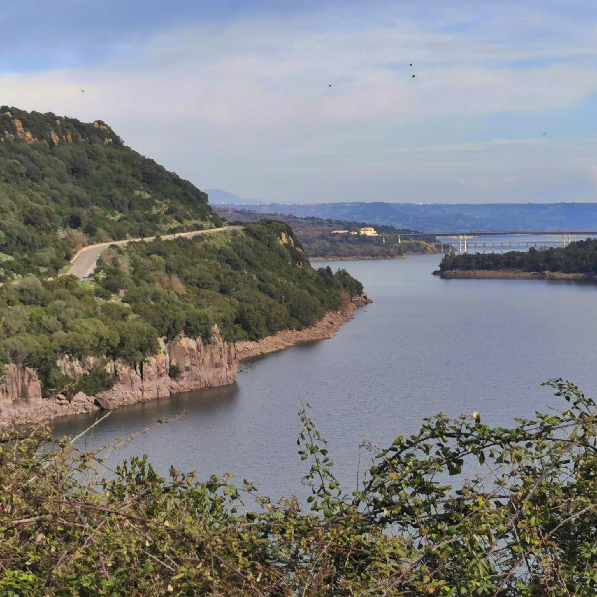
Very nice lakeside road, shame about the potholes in the asphalt
0
0

one of the most beautiful Nuraghe in Sardinia
0
0

The Nuraghe Losa cult site is located on the Italian island of Sardinia near the municipality of Abbasanta on the SS 131 (“Carlo Felice”). It can be reached via a separate exit at kilometer 123.
2
0

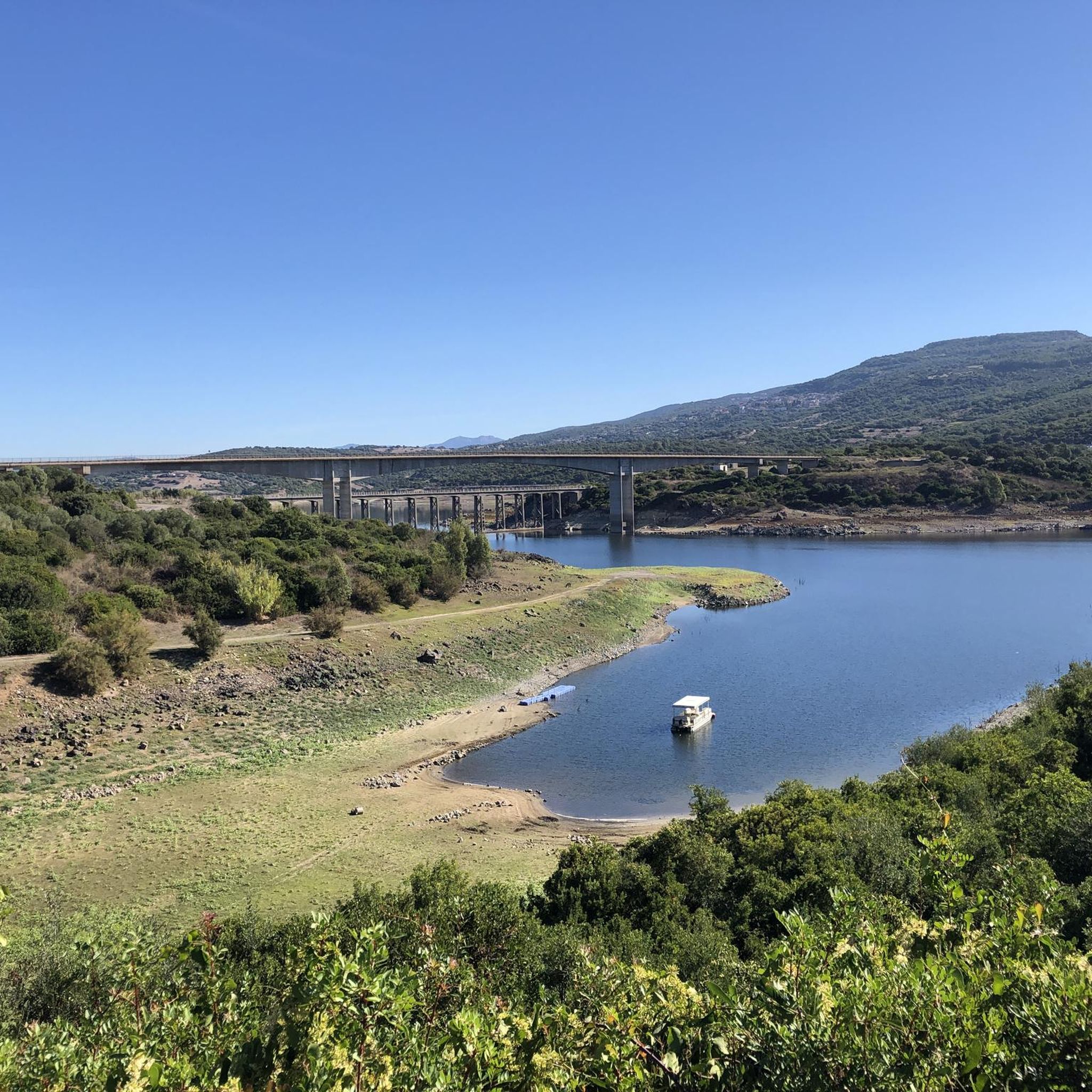
Bridge over the Tirso River, blocked by the Eleonora D'Arborea Dam to form the artificial basin of Lake Omodeo.
1
0

After crossing the high threshold, three corridors lead to as many chambers covered with tholos (mock domes). The mastio, still 13 meters high today but originally higher, has a "classic" structure: large main chamber with three niches arranged in the shape of a cross. A spiral staircase that once went to the top leads clockwise to the upper small chamber. All around are the three small towers with high, narrow chambers connected to each other by the masonry that surrounds the whole structure. It also includes three wells that were used to store food reserves or other materials. The main tower and the triangular bastion are surrounded by a long, massive oval wall with doors and two cantilevered small towers, the walls of which are interrupted by notches. The outer masonry extends north and west at the back and is also provided with a narrow passage. At the base of the small western tower is a cistern. In front of the entrance to the facade, on the other hand, an imposing round building can be viewed, which probably fulfilled important functions - perhaps it was the assembly hut - as two opposite entrances, two large niches, four lockers and five notches suggest. Only a small part of the extensive surrounding settlement, which covers 3.5 hectares, has been excavated. In various places there are still remains of Nuragic dwellings and especially houses from the late Punic period, the period of the Roman Republic and the Empire as well as the late Roman and Byzantine periods. Source: https://www.sardegnaturismo.it/en/discover/nuraghe-losa
0
0
The original name Nurache ‘e losas means “nuraghe of tombs” and refers to the Roman burial urns carved into the rock on the edge of this site. The unmistakable outlines of the Nuraghe Losa stand out on the basaltic plateau of Abbasanta, five kilometers from the small town in the Oristano area. Strolling around the massive, solid, flat structure, whose plan is in the form of an equilateral triangle, perspectives that seem like the front part of a ship's prow catch the eye. It is one of the most impressive and striking symbols of Nuragic architecture... It is distinguished by its articulated design, compact volume and fine masonry technique. The remains of an extensive settlement embedded in the green Mediterranean maquis have been preserved around the nuraghe. It bears testimony to the millenary history of this site, from the Nuragic period to the Roman era and, when it was used as a burial place, to the High Middle Ages (7th-8th centuries). The complex, built entirely of large blocks of basalt, consists of a trefoil nuraghe dating from the Middle Bronze Age (15th-14th centuries BC), a protective masonry and the remains of a village with round huts dating from the Late Bronze Age to the Iron Age were erected (13th-9th centuries BC). At the entrance one notices that this huge compact mass - the secret of good construction - also has large spaces. But not the uncovered courtyard, so characteristic of most complex nuraghi, but which has probably been replaced in function by outdoor spaces. The nuraghe is accessed via two elevated entrances compared to the surrounding land, and via a straight corridor to the original central tower (mastio) in the shape of a truncated cone, as well as to the two side towers. The rear tower, on the other hand, is accessible via a secondary entrance. You will walk through the chiaroscuro of the corridors, breathe in the smell of the moss-covered stones and immerse yourself in the mythical Nuragic age.
0
0

It can be visited only during the dry season, during the rainy season the house is partially submerged almost to the roof. In 1997, with the inauguration of the new dam (Eleonora d'Arborea dam) and the further raising of the water level, the house of the foreman ends up underwater to keep company with the remains of zuri, the petrified forests, some nuraghe and other structures of anthropogenic origin. The house housed the foreman, the deputy head and their respective families, now it houses only ruins and vegetation.
2
0
***go down on foot, highlight not cycleable*** The point of interest can be easily reached by bike with the service road behind sa cantinedda, but obviously to go down to visit the house you have to park the bike and go down the steps at the side of the road.
2
0
Frequently Asked Questions
What historical sites can I explore around Tadasune/Tadasuni?
The region is rich in history. You can visit significant archaeological sites like Nuraghe Losa near Abbasanta, which features impressive Nuragic architecture. Other notable historical landmarks include the Sacred Well of Santa Cristina, the Roman Baths of Fordongianus, and various other Nuraghi such as Su Pranu. The area also has ancient burial sites like Domus de Janas Sa Perdera and Tomba di Giganti Su Pranu.
What natural attractions are there to see in Tadasune/Tadasuni?
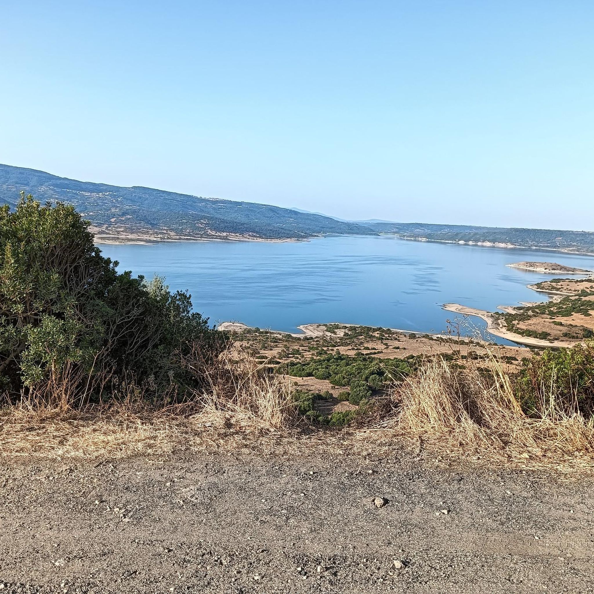
The most prominent natural feature is Lake Omodeo, one of Italy's largest artificial lakes, formed by the damming of the Tirso River. It offers breathtaking views and opportunities for relaxing walks. When water levels are low, you might even spot remains of ancient Nuraghes and a petrified forest. The surrounding countryside also provides diverse landscapes perfect for exploring nature trails.
Are there any cultural points of interest in Tadasune/Tadasuni?
Yes, Tadasune/Tadasuni offers several cultural sites. You can visit the Casa Museo di Antonio Gramsci, dedicated to the influential Italian philosopher. The Parish house hosts a Museum of Sardinian Musical Instruments, showcasing about 400 traditional instruments. Walking through the Tadasuni Historic Center also allows you to admire ancient architecture and discover the village's past.
What outdoor activities can I do near these attractions?
The area around Tadasune/Tadasuni is excellent for outdoor activities. You can find various MTB trails, running routes, and cycling paths. The undulating countryside and Lake Omodeo provide scenic backdrops for hiking and exploring nature trails. For example, you can cycle along the Santa Chiara Dam and Lake Omodeo Road.
Are there family-friendly attractions around Tadasune/Tadasuni?
While specific 'family-friendly' categories aren't listed for all attractions, exploring the natural beauty of Lake Omodeo and its surroundings can be enjoyable for families. The archaeological sites like Nuraghe Losa offer an educational experience. Gentle walks in Tadasuni's countryside are also suitable for families.
What is the significance of the Santa Chiara Dam?
The Santa Chiara Dam is a historic man-made monument. It was the original dam built in 1924 to form Lake Omodeo, regulating the Tirso River and creating what was once Europe's largest artificial lake. Although now partially submerged by the new Eleonora D'Arborea dam, it remains a significant historical site, with the Chief Engineer's House also visible during dry seasons.
Can I find hiking trails suitable for beginners in Tadasune/Tadasuni?
The Tadasuni countryside offers diverse landscapes, and while specific beginner trails aren't detailed, the general area is noted for its undulating profile and nature trails. You can find various running routes, some of which are rated as 'easy' or 'moderate' and could be suitable for beginner hikers.
What is the best time of year to visit Tadasune/Tadasuni attractions?
Given the outdoor nature of many attractions and the potential for low water levels revealing ancient sites in Lake Omodeo, spring and autumn generally offer pleasant weather for exploration. These seasons avoid the intense heat of summer and the potentially higher water levels of winter, making it ideal for hiking, cycling, and visiting archaeological sites.
Are there any churches or religious sites to visit?
Yes, Tadasuni has several historic churches. The Parish of San Nicola di Bari, constructed in the mid-19th century in Neoclassical style, houses a 16th-century Madonna of Boele. The 18th-century Church of Santa Croce is also a must-see in the town center, and the Church of San Michele is located in the countryside.
What do visitors enjoy most about Tadasune/Tadasuni?
Visitors appreciate the blend of historical, cultural, and natural attractions. The impressive archaeological sites like Nuraghe Losa, the scenic views of Lake Omodeo, and the historical significance of the Santa Chiara Dam on the Tirso are frequently highlighted. The opportunity to explore ancient structures and engineering marvels within a beautiful natural setting is a key draw.
Can I find places to eat or drink near the attractions?
While specific cafes near hiking trails are not detailed, Tadasuni offers gastronomic routes for those interested in local flavors. Exploring the historic center might reveal local eateries. For more specific information, it's recommended to check local listings or ask residents upon arrival.
Are there any unique or 'hidden gem' attractions in the area?
Beyond the well-known sites, the region holds several unique discoveries. The Museum of Sardinian Musical Instruments, located at the Parish house, is a specialized collection. Additionally, when water levels are low in Lake Omodeo, the partially submerged remains of ancient Nuraghes and a petrified forest become visible, offering a truly unique glimpse into the past.
Most popular attractions around Tadasune/Tadasuni

Get inspired with the komoot mobile app


Explore more
Still not found the Highlight you’re looking for? See guides of the top attractions in other regions:
