The best mountain hikes around Val Rezzo
5.0
(1)
6
hikers
2
hikes
Mountaineering routes around Val Rezzo are situated within the Lepontine Alps, offering challenging terrain and diverse mountain scenery. The region features peaks exceeding 2,000 meters, with altitudes ranging significantly and providing varied gradients for mountaineering. Key attractions include Monte Grona and Pizzo di Gino, alongside numerous mountain passes and huts that support multi-day expeditions. This combination of high-altitude peaks and demanding trails makes Val Rezzo a compelling destination for strenuous outdoor pursuits.
Best mountaineering routes around Val Rezzo
- The most…
Last updated: June 28, 2026
5.0
(1)
4
hikers
6.07km
02:22
410m
410m
Moderate mountaineering route. Good fitness required. Mostly accessible paths. Sure-footedness required.
1
hikers
11.7km
05:57
1,100m
1,100m
Hard mountaineering route. Very good fitness required. Sure-footedness, sturdy shoes and alpine experience required.

Sign up for free
1
hikers
8.35km
05:05
900m
900m
Hard mountaineering route. Very good fitness required. Sure-footedness, sturdy shoes and alpine experience required.
Our route recommendations are based on thousands of hikes, rides, and runs completed by other people on komoot.
Start today with a free account
Your next adventure awaits.
Login or Signup

Tips from the Community

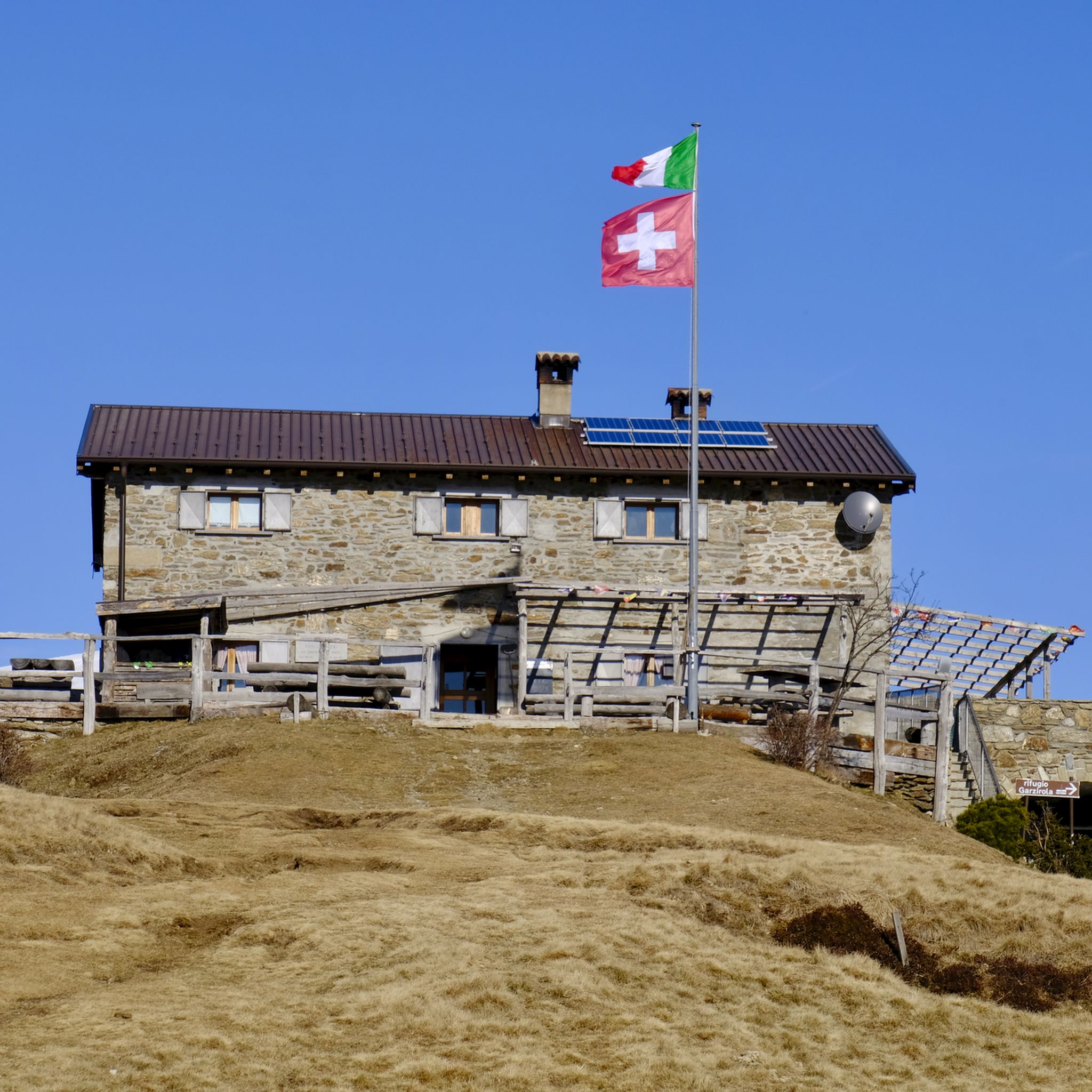
An unmanned hut that is a good destination and place to take a break
0
0

A small cabin with a fireplace and sleeping accommodations. Unfortunately, when we arrived, there was no water left at the well in front of the house, except for a few drops.
0
0

A small high alpine pasture with a hut offering accessible shelter from the elements. A small fountain in front of the hut provides a beautiful view over the Ceresio Pass and across to Osteno.
0
0

Rifugio Menaggio, located at 1383 m, offers unique views of Lake Como. It is the ideal base for climbing Monte Grona, with via ferratas or challenging trails. It is a panoramic and welcoming point for every hiker, it is managed by the CAI and offers refreshments and overnight stays in the summer season.
3
1

From here the path becomes increasingly steep and narrow, slippery in wet weather in winter and autumn. Difficult climb to the top. Then also very difficult descent over narrow rocky paths, then wide but steep descent to the city
0
0

Strölech Bridge over the Rezzo torrent
0
0

The via ferrata should only be attempted if you have a via ferrata set and the necessary experience for the ascent to Monte Grona.
2
0
From the summit of Monte Grona, the view extends not only to Lake Como, but also to Lake Lugano and the Lago di Piano in front of it. There are several ways to reach Monte Grona: a via ferrata, a steep path ("Sentiero Direttissima") and an easier panoramic path.
0
0
Frequently Asked Questions
What kind of mountaineering challenges can I expect in Val Rezzo?
Val Rezzo, situated in the Lepontine Alps, offers a range of mountaineering challenges. You'll find diverse mountain scenery with peaks exceeding 2,000 meters, providing varied gradients. Routes often demand sure-footedness, sturdy shoes, and alpine experience, especially on more strenuous paths like those encompassing Cima di Fiorino or Pizzo di Gino. The region is known for its high-altitude peaks and demanding trails.
Are there any mountaineering routes suitable for those with less experience in Val Rezzo?
While many routes in Val Rezzo are challenging, there are options for varying ability levels. For instance, the View of Lake Como loop from Porlezza is classified as moderate, offering a good introduction to the region's terrain without the extreme demands of more difficult ascents. It's always advisable to choose routes that match your fitness and experience level.
How long do mountaineering routes in Val Rezzo typically take to complete?
The duration of mountaineering routes in Val Rezzo varies significantly based on distance, elevation gain, and difficulty. For example, the Panoramic Trail to Monte Grona – Monte Grona Summit View loop from Plesio, a difficult route covering 10.3 km, typically takes around 5 hours 12 minutes. Longer, more strenuous routes like the Rifugio Venini – Hike to Rifugio Venini loop from Alpe di Colonno (19.0 km) can take over 7 hours.
What are some of the more challenging mountaineering routes in the Val Rezzo area?
For experienced mountaineers seeking a challenge, the Val Rezzo area offers several demanding routes. The Monte Grona Summit View – Panoramic Trail to Monte Grona loop from Plesio is a difficult 11.8 km route with over 1000 meters of elevation gain. Another challenging option is the Sasso Rosso – Monte Boglia loop from Brè sopra Lugano, which traverses varied alpine terrain.
What natural landmarks or viewpoints can I expect to see on mountaineering routes in Val Rezzo?
Mountaineering in Val Rezzo offers stunning natural landmarks and panoramic viewpoints. You can expect magnificent views from peaks like Monte Grona (1,736 m) and Pizzo di Gino (2,245 m). The region also features serene lakes such as Lake Piano, and unique rock formations like Sasso Grande (Denti della Vecchia). The historic church of San Lucio (1,541 m) on the Swiss-Italian border is also a notable point of interest reachable via an uphill hike.
Are there any circular mountaineering routes in Val Rezzo?
Yes, Val Rezzo features several circular mountaineering routes. Examples include the Panoramic Trail to Monte Grona – Monte Grona Summit View loop from Plesio, which offers expansive summit views, and the Rifugio Venini – Hike to Rifugio Venini loop from Alpe di Colonno, leading through high-altitude terrain. These loops allow you to experience diverse landscapes without retracing your steps.
Can I find waterfalls near the mountaineering routes in Val Rezzo?
Yes, the Val Rezzo area is home to several beautiful waterfalls that can be explored. While not directly on every mountaineering route, highlights like Tobi Waterfall, Sanagra Stream Waterfalls and Sass Curbee, and Loggio Waterfall are nearby attractions that add to the region's natural beauty.
What is the best time of year for mountaineering in Val Rezzo?
The best time for mountaineering in Val Rezzo is typically during the warmer months, from late spring to early autumn (May to October), when trails are generally free of snow and weather conditions are more stable. During this period, you'll experience pleasant temperatures and clearer views of the Lepontine Alps. Always check local weather forecasts before heading out, as mountain conditions can change rapidly.
Is public transport available to access mountaineering trailheads in Val Rezzo?
Access to some mountaineering trailheads in Val Rezzo via public transport can be limited, as many routes start from more remote mountain villages or passes. While some larger towns in the region may have bus services, reaching specific, higher-altitude starting points often requires private transportation. It's recommended to research specific route access points and local transport options in advance.
Are permits required for mountaineering in Val Rezzo?
Generally, permits are not required for day mountaineering trips on established trails in Val Rezzo. However, if you plan to undertake multi-day expeditions involving overnight stays in mountain huts, it's advisable to check with the specific hut for booking requirements. There are no indications of special permits needed for general access to the trails themselves.
What do other mountaineers enjoy the most about mountaineering in Val Rezzo?
The Val Rezzo area is highly rated by the komoot community, with an average score of 5.0 stars from over 30 reviews. Reviewers often praise the region's stunning natural landscapes, the challenging yet rewarding terrain, and the expansive views from the high-altitude peaks. The presence of mountain huts and diverse trails for different skill levels also contributes to a highly appreciated mountaineering experience.
Can I bring my dog on mountaineering trails in Val Rezzo?
While many trails in Italy are dog-friendly, specific regulations can vary, especially in protected areas or near mountain huts. It's generally recommended to keep dogs on a leash for their safety and to protect local wildlife. Always check for any specific signage or local rules at the trailhead or with local tourism offices regarding dogs on mountaineering routes in Val Rezzo.
Most popular routes around Val Rezzo
Most popular attractions around Val Rezzo

Get inspired with the komoot mobile app


Explore more
Browse the best Mountain Hikes & Routes in other regions.
