The best walks and hikes around Rocca D'Evandro
4.4
(90)
573
hikers
30
hikes
Hiking around Rocca D'Evandro offers diverse landscapes within the Province of Caserta, characterized by mountainous views, ancient forest tracks, and volcanic terrain. The region features prominent hills like Monte Camino and Monte Cesima, providing extensive vistas over valleys, distant mountain ranges, and the Venafro plain. Trails often follow river valleys, such as the Garigliano, and lead to natural features like the Conca della Campania Waterfall. This varied topography provides a range of hiking experiences.
Best hiking trails around Rocca D'Evandro
- The most popular hiking route is From Roccamonfina to the Conca della Campania Waterfall – ring tour, a 9.6 miles (15.5 km) trail that takes 4 hours 39 minutes to complete. This moderate route leads to a notable natural waterfall, particularly impressive after rainfall.
- Another top favourite among local hikers is Roccamonfina Loop Trail, a difficult 10.6 miles (17.1 km) path. This route explores the unique volcanic terrain and historical sites around Roccamonfina.
- Local hikers also love the Suio and the Garigliano Dam – loop tour, a 9.6 miles (15.5 km) trail leading through the Garigliano river valley, often completed in about 4 hours 11 minutes.
- Hiking around Rocca D'Evandro is defined by mountainous views, volcanic terrain, and ancient forest tracks. The network offers options for different ability levels, from moderate to difficult.
- The routes in Rocca D'Evandro are highly rated by the komoot community with an average score of 4.3 stars from over 60 reviews. More than 400 hikers have used komoot to explore Rocca D'Evandro's varied terrain.
Last updated: October 12, 2026
3.9
(7)
16
hikers
15.5km
04:39
500m
500m
Embark on the "From Roccamonfina to the Conca della Campania Waterfall – ring tour," a moderate hike through the scenic Roccamonfina Regional Park. This 9.6-mile (15.5 km) loop takes you through lush chestnut forests, characteristic of the fertile volcanic soil, and features the picturesque Conca della Campania Waterfall. You will gain about 1651 feet (503 metres) in elevation over approximately 4 hours and 39 minutes, making it a rewarding experience for those with good fitness.
While many paths are easily accessible, some sections, especially near the waterfall, can be steep and slippery due to humidity, so good trekking shoes are essential. The flow of the Rivo di Conca stream, which feeds the waterfall, is more robust during rainy seasons, making early spring an ideal time to visit for a more impressive display. As a ring tour, you will enjoy diverse views without backtracking, offering a comprehensive exploration of the area.
This route stands out for its unique blend of natural beauty and historical elements, particularly along the "Sentieri dei Mulini" (Path of the Mills). Here, you will discover ancient water mills, providing a glimpse into the region's past. Hiking in the heart of an ancient, extinct volcano also offers a distinctive geological backdrop, contributing to the unique flora and overall landscape of the Roccamonfina Regional Park.
4.5
(2)
9
hikers
17.1km
05:02
480m
480m
The Roccamonfina Loop Trail offers a challenging hike through a landscape shaped by ancient volcanoes, now covered in thick sweet chestnut forests. You will navigate 10.6 miles (17.1 km) of varied terrain, gaining 1587 feet (484 metres) in elevation, which typically takes around 5 hours and 1 minute to complete. This difficult route follows old paths and streets, leading you past historical sites like the Orto della Regina Megalithic Walls. As you climb, expect sweeping views of the Costa Campana and the Roccamonfina volcano's caldera, particularly from spots like Mount Frascara.
Before you set out on this difficult hike, make sure you have a very good level of fitness and wear sturdy shoes for the varied terrain. The trail demands sure-footedness, and depending on the season, you might encounter snowfall, so always check local conditions before you go. Be prepared for a demanding trek that could require some alpine experience, especially during colder months. Plan to start early to allow ample time for completion.
This trail is located within the Roccamonfina and Foce Garigliano Volcanic Area Regional Park, highlighting its unique geological origins. The ancient volcanic activity has created a distinct environment, now home to dense, centuries-old sweet chestnut forests that you will walk through. Beyond the natural beauty, the route also offers a glimpse into history with its ancient streets and paths, making it a notable journey for those interested in both nature and heritage.

1
hikers
15.5km
04:12
220m
220m
Moderate hike. Good fitness required. Easily-accessible paths. Suitable for all skill levels.
5.0
(2)
3
hikers
23.2km
07:29
1,020m
1,020m
Hard hike. Very good fitness required. Easily-accessible paths. Suitable for all skill levels.
4.5
(4)
17
hikers
9.70km
02:49
250m
260m
Moderate hike. Good fitness required. Easily-accessible paths. Suitable for all skill levels.
Get access to more routes and recommendations from other explorers.
Already have an account?
Our route recommendations are based on thousands of hikes, rides, and runs completed by other people on komoot.
Start today with a free account
Your next adventure awaits.

Tips from the Community

Good morning guys, but how do we organize ourselves with other users to do it together?
0
0

Walls of the Queen's Garden
0
0

Dam that allows you to pass from one bank to the other
0
0


The Garden of the Queen is a short path, easily accessible with children and offers the thrill of discovering a place shrouded in mystery. The path starts immediately uphill but is very short (about 800 meters to the destination), for where the difficulty level is really low. You know you're on the right path because there are fences that accompany you and the climb is made easier by steps made from tree trunks. A few meters later, there it was, in the middle of the forest surrounded by trees and covered in green moss. A large wall, made of enormous trachyte boulders, which extends for a perimeter of approximately 250 metres. How many millennia have passed since man laid the first stone here? It is not known, it is thought that the walls were built around the 5th century BC, evidence of the presence of man in very ancient times in this area. It is not even clear what the function was: some speak of a temple dedicated to a divinity from the pre-Roman epic, while others assume it was a military post which had the function of controlling the border areas. Even the name "garden" suggests one of these two hypotheses: "hortus" means enclosure (used in a military sense), or it can also be understood as a sacred place.
1
0

beautiful in this season for the flowering gorse
0
0

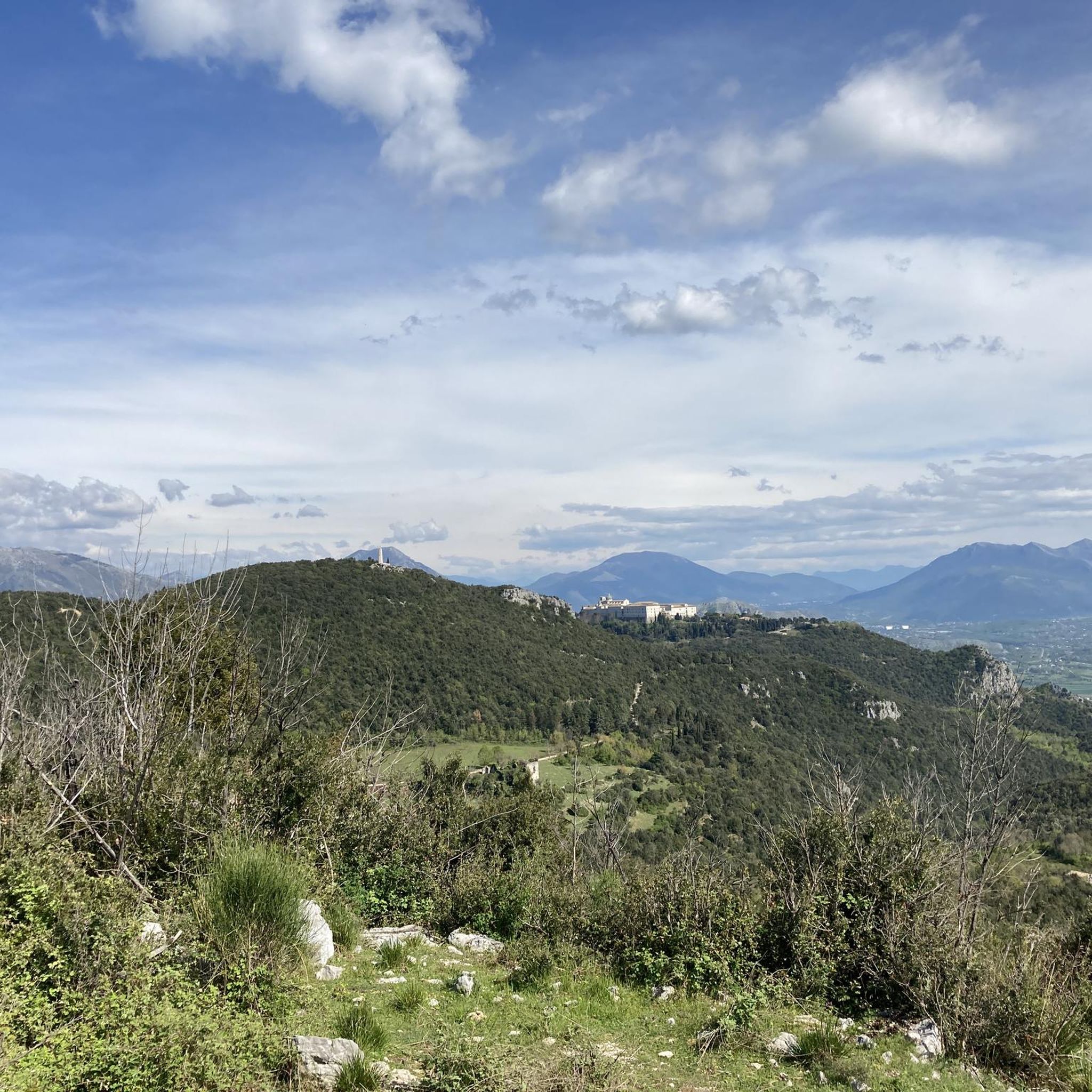
Dirt road with a beautiful panoramic view of the Venafro valley, Monte Sammucro and Monte Corno.
1
0
Frequently Asked Questions
How many hiking trails are available around Rocca D'Evandro?
There are over 25 hiking trails in the Rocca D'Evandro area. These routes cater to various fitness levels, with 7 easy, 16 moderate, and 3 difficult trails to choose from.
Are there any family-friendly hiking options in Rocca D'Evandro?
Yes, for families, the path to the Orto della Regina Megalithic Walls is a great option. It's short and easily accessible, even for children, leading to a mysterious ancient site. You can find more details about this historical site here: Orto della Regina Megalithic Walls.
Can I find trails with waterfalls in the Rocca D'Evandro region?
Absolutely. The Conca della Campania Waterfall is a notable natural attraction, especially impressive after rainfall. You can explore it on routes like the From Roccamonfina to the Conca della Campania Waterfall – ring tour or the shorter Conca Waterfall loop from Roccamonfina. The waterfall itself is a highlight you can learn more about here: Conca della Campania Waterfall.
What kind of views can I expect on hikes around Rocca D'Evandro?
The region offers diverse and panoramic views. From locations like Monte Camino and Monte Cesima (at 1180 meters), you can enjoy 360-degree vistas encompassing rolling valleys, hills with perched villages, and distant mountain ranges such as the ancient Roccamonfina volcano, the Aurunci mountains, and the Matese mountains. Trails often provide views of the Garigliano river carving through rich farmland.
Are there any circular hiking routes available?
Yes, many routes in the area are designed as loops. Examples include the From Roccamonfina to the Conca della Campania Waterfall – ring tour, the Roccamonfina Loop Trail, and the Suio and the Garigliano Dam – loop tour, which are all circular paths.
What historical sites or landmarks can I explore while hiking?
The area is rich in history. You can visit Rocca D'Evandro's 10th-century castle and its medieval old town at the foot of Monte Camino. The Orto della Regina Megalithic Walls are a fascinating ancient site. Additionally, the Roccamonfina area, explored by the Roccamonfina Loop Trail, features unique volcanic terrain and historical points of interest.
What do other hikers say about the trails in Rocca D'Evandro?
The trails around Rocca D'Evandro are highly rated by the komoot community, with an average score of 4.3 stars from over 60 reviews. Hikers often praise the diverse landscapes, from mountainous views to ancient forest tracks, and the variety of routes suitable for different ability levels.
Are there any challenging hikes for experienced trekkers?
Yes, for experienced hikers seeking a challenge, routes like the Monte Cesima from San Pietro Infine offer significant elevation gain and extensive views. The Roccamonfina Loop Trail is also classified as difficult, exploring volcanic terrain and historical sites.
What kind of natural features define the hiking experience in Rocca D'Evandro?
The region is characterized by its varied natural features, including mountainous terrain with 360-degree views, ancient forest tracks with dappled sunlight, and unique volcanic landscapes near Roccamonfina, which also hosts ancient chestnut forests. The Garigliano river valley and the Conca della Campania Waterfall further add to the natural diversity.
Is it possible to hike through volcanic landscapes in this area?
Yes, the proximity to the extinct Roccamonfina volcano means you can hike through unique volcanic terrain. The Roccamonfina Loop Trail specifically explores this characteristic landscape, including ancient chestnut forests.
Are there any specific points of interest related to World War II history?
Monte Camino is an integral location during World War II, offering not only historical significance but also beautiful views. You can find ancient stone ruins near the Chapel of Monte Camino, adding a historical layer to your hike.
Most popular attractions around Rocca D'Evandro

Get inspired with the komoot mobile app


Explore more
Browse the best Hikes in other regions.
