The best MTB trails around Spigno Saturnia
4.6
(222)
700
riders
91
rides
Mountain bike trails around Spigno Saturnia traverse a varied landscape, characterized by significant elevation changes, river valleys, and proximity to coastal areas. The region features prominent hills such as Monte Redentore, offering challenging ascents and panoramic viewpoints. Riders can expect routes that explore both inland terrain and paths leading towards the Garigliano River mouth and Baia Domizia Beach. This diverse geography provides a range of mountain biking experiences.
Best mountain bike trails around Spigno Saturnia
- The most popular mountain bike…
Last updated: June 24, 2026
4.7
(18)
83
riders
34.1km
03:34
1,310m
1,310m
Hard mountain bike ride. Very good fitness required. Advanced riding skills necessary. Some portions of the route may require you to push your bike.
5.0
(3)
29
riders
56.9km
05:33
1,910m
1,910m
Hard mountain bike ride. Very good fitness required. Advanced riding skills necessary. Some portions of the route may require you to push your bike.

Sign up for free
4.7
(20)
48
riders
49.3km
03:07
550m
550m
Moderate mountain bike ride. Good fitness required. Suitable for all skill levels.
5.0
(1)
22
riders
Moderate mountain bike ride. Good fitness required. Advanced riding skills necessary.
4.2
(5)
21
riders
54.3km
04:28
1,260m
1,260m
Hard mountain bike ride. Very good fitness required. Advanced riding skills necessary. Some portions of the route may require you to push your bike.
Get access to more routes and recommendations from other explorers.
Sign up for free
Already have an account?
Our route recommendations are based on thousands of hikes, rides, and runs completed by other people on komoot.
Start today with a free account
Your next adventure awaits.
Login or Signup
Other adventures around Spigno Saturnia

Tips from the Community

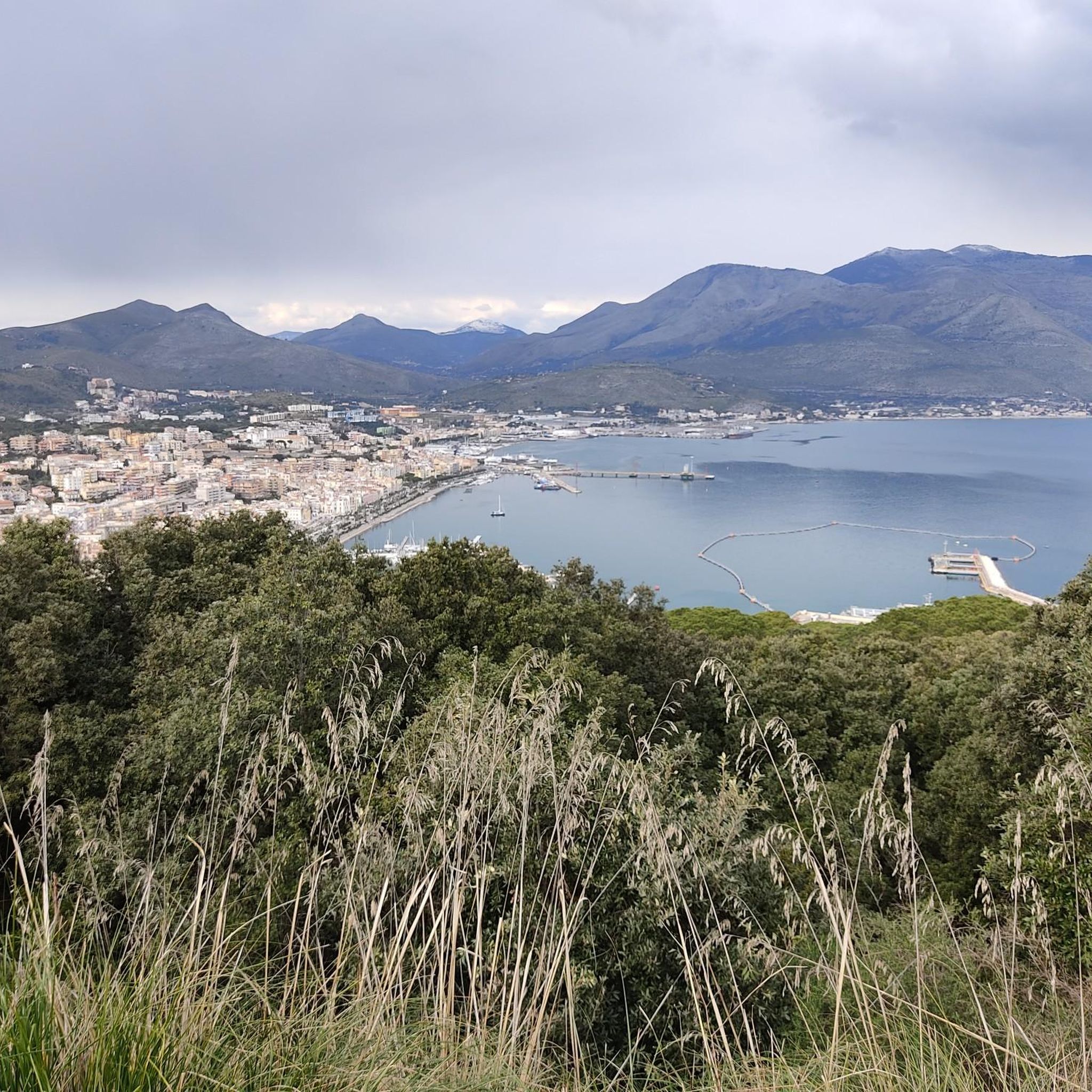
The Park of Monte Orlando covers an area of 89 hectares, of which 59 are land area and 30 are marine area. Located within the territory of Gaeta, the Park represents the terminal part of the Aurunci mountain system. This protected area is managed by the Riviera di Ulisse Regional Park Authority together with the areas of the Gianola and Monte di Scauri Suburban Regional Park and the Natural Monument of Sperlonga. With a typically rounded shape, Monte Orlando is connected to the mainland to the north by a thin strip of land and ends in the south with a high rocky coast characterized by spectacular cliffs. The territory is affected by the corrosive action of water; in fact, rain penetrating the rocks dissolves the calcium carbonate contained within them, giving rise to numerous and typical erosive forms. The sea has also contributed to shaping the promontory and, over the centuries, through wave motion, has modeled and etched the rocks, leaving fossil traces, recognizable signs of the ancient sea level. Human intervention, in different historical eras, has left its mark on Monte Orlando. Particular attention should be paid to the military fortifications, built both outside and inside the current Park, which made Gaeta a fortress of strategic importance for the Kingdom of Naples. At the summit, we find the Mausoleum of Lucius Munatius Plancus.
0
0
The city of Gaeta owes its name to Caieta, Aeneas's nurse, who, according to tradition, is buried right here. According to another interpretation, it derives from the Greek term indicating the “cavity” of the famous gulf. Whatever the truth, what is certain is that the city has a very ancient history, a past that can still be felt in some areas such as the medieval quarter of Sant’Erasmo, attested as early as the era of the Duchy of Gaeta and the maritime republics. A decadent nostalgia can be felt in the streets of the quarter, visibly marked by the bombings of World War II. However, houses dating back to the 12th century are still visible along narrow alleys made of stairs, underpasses, and arches. The medieval quarter has two hearts. The first is the Church of San Giovanni a Mare, a 10th-century Romanesque building with evident Byzantine influence. The second is the Cathedral, consecrated in the 12th century. Inside, a splendid marble Easter candelabrum is kept, while outside stands the imposing Arab-Sicilian bell tower, with interwoven arches, inlays, and majolica tiles. Above all dominates the Aragonese-Angevin castle, which dates back to the 8th century and was later enlarged in the 13th and then in the 16th centuries. Finally, visit the Church of the Annunciation with the Golden Grotto, the Sanctuary of the Split Mountain with the mausoleum of Lucius Munatius Plancus, and the characteristic Via dell'Indipendenza.
0
0
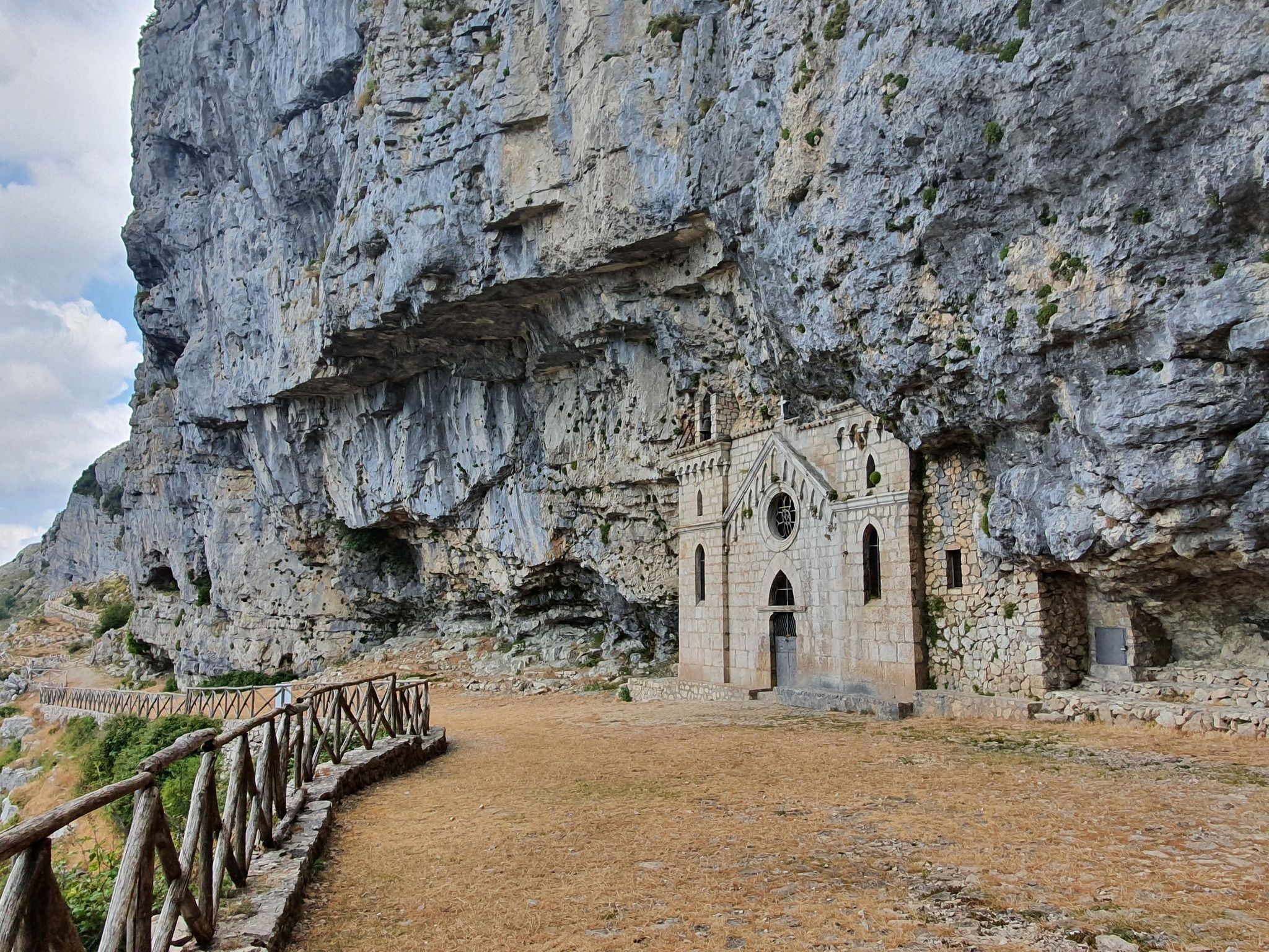
The hermitage of San Michele Arcangelo is a small church located on the slopes of Mount Altino, which belongs to the Aurunci Mountains chain, at 1220 m above sea level in the territory of Maranola (a hamlet of Formia). Set in the rock, it is located along the path that leads from Sella Sola to the summit of the Redentore, on a sheer spur. The rock sanctuary, dedicated to Saint Michael the Archangel, dates back to 830, as it is mentioned in the Codex diplomaticus cajetanus. However, the stone facade, which closes a natural cavity, was rebuilt in neo-Gothic style at the end of the 19th century, in 1893, when Archbishop Francesco Niola climbed Mount Altino on a pastoral visit. He indicated the interior of the grotto as an ideal location for the new construction, in order to avoid the damage suffered by the previous church, caused by runoff water, falling rocks, and ice. The new project was drawn up by the engineer Silvio Forte of Trivio. The rock was squared to form the environment of the Church, and a space twelve meters long, ten wide, and seven high was obtained. On the back wall, opposite the entrance, a niche also carved into the rock houses the statue of Saint Michael. The facade, facing west and with two projecting volumes on the sides, has in the center a pointed arch entrance door, surmounted by a rose window open to let light into the church's interior. On the arch of the door, next to the inscription “Angelorum Principi”, are the dates 830, the year of the foundation of the old monastery, and August 5, 1895, the day of the inauguration of the new Sanctuary. These dates are also reported on a plaque placed inside the church. Both the rose window and the other openings of the facade were closed by polychrome stained glass windows, now lost.
0
0
After the dirt road immersed in a beautiful beech forest, you reach a picnic area where you turn right towards Christ the Redeemer.
0
0
Once at the top of the climb, a wonderful panorama opens up over the valley with a view of Christ the Redeemer.
0
0

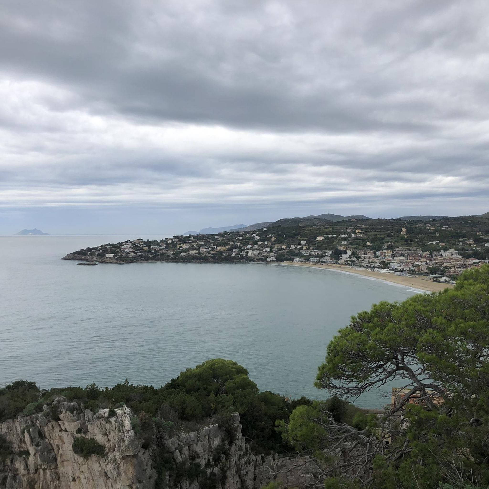
The climb to the Redentore rewards with a breathtaking panorama of the Gulf of Gaeta
0
0

excellent yes it goes well in the Gulf of Gaeta
0
0

Beautiful sanctuary to visit
0
0
Frequently Asked Questions
How many mountain bike trails are available in Spigno Saturnia?
There are over 80 mountain bike trails around Spigno Saturnia, offering a diverse range of experiences. The komoot community has explored these routes over 750 times, contributing to an average rating of 4.6 stars.
Are there easy mountain bike trails suitable for beginners in Spigno Saturnia?
Yes, Spigno Saturnia offers a few easier mountain bike trails. While the region is known for its challenging terrain, there are 5 routes classified as easy. For those looking for a moderate challenge, there are 60 moderate routes available.
Are there challenging mountain bike trails for advanced riders?
Absolutely. Spigno Saturnia is well-suited for advanced mountain bikers, with 21 routes classified as difficult. These trails often feature significant elevation changes and technical sections. For example, the Ascent to Monte Redentore – View of Maranola loop from Castellonorato is a demanding 56.9 km route with nearly 2000 meters of ascent.
What kind of terrain can I expect on mountain bike trails in Spigno Saturnia?
Mountain bike trails in Spigno Saturnia traverse a varied landscape, characterized by significant elevation changes, river valleys, and proximity to coastal areas. You'll find routes exploring both inland terrain, including prominent hills like Monte Redentore, and paths leading towards the Garigliano River mouth and Baia Domizia Beach.
Are there mountain bike trails with scenic viewpoints in Spigno Saturnia?
Yes, many trails offer panoramic views, especially those ascending Monte Redentore. For instance, the Ascent to Monte Redentore – View of Monte Redentore loop from Castellonorato provides challenging climbs rewarded with expansive vistas. The region's hilly terrain naturally lends itself to numerous scenic overlooks.
Can I find loop mountain bike trails in Spigno Saturnia?
Yes, many of the mountain bike trails in Spigno Saturnia are designed as loops, allowing you to start and finish at the same point. Examples include the difficult Itri Castle – View of Maranola loop from Castellonorato and the moderate Mouth of the Garigliano River – Baia Domizia Beach loop from Castellonorato.
What attractions can I see along the mountain bike trails in Spigno Saturnia?
The trails often pass by or offer views of interesting historical and natural sites. You might encounter landmarks such as the Hermitage of St. Michael the Archangel, the Tomb of Cicero, or the Snow Well of the Aurunci Mountains. Many routes also provide views of significant peaks like Cima del Redentore (Monte Altino).
What do other mountain bikers enjoy most about the trails in Spigno Saturnia?
The komoot community rates the mountain bike trails in Spigno Saturnia highly, with an average score of 4.6 stars from over 200 reviews. Riders frequently praise the challenging climbs, the diverse landscapes ranging from mountains to coastal views, and the rewarding panoramic vistas from high points like Monte Redentore.
Is Spigno Saturnia suitable for winter mountain biking?
While the region generally experiences mild winters compared to more northern areas, the significant elevation changes mean that higher routes, especially those around Monte Redentore, may be subject to colder temperatures and occasional snow. Lower elevation and coastal routes are generally more accessible during winter months. Always check local weather conditions before heading out.
Are there any mountain bike trails that lead to coastal areas?
Yes, some routes in Spigno Saturnia extend towards the coast. For example, the moderate Mouth of the Garigliano River – Baia Domizia Beach loop from Castellonorato offers a ride that takes you to the Garigliano River mouth and Baia Domizia Beach, providing a different riding experience compared to the inland mountain trails.
What is the best time of year for mountain biking in Spigno Saturnia?
Spring and autumn are generally the most pleasant seasons for mountain biking in Spigno Saturnia, offering mild temperatures and vibrant scenery. Summer can be hot, especially at lower elevations, so early morning or late afternoon rides are recommended. Winter can be suitable for lower-altitude trails, but higher mountain routes may be colder.
Most popular attractions around Spigno Saturnia

Get inspired with the komoot mobile app


Explore more
Browse the best MTB trails in other regions.
