The best road cycling routes around Bidda Matzràxia/Villamassargia
4.8
(46)
984
riders
48
rides
Road cycling routes around Bidda Matzràxia/Villamassargia traverse the diverse landscapes of the Sulcis-Iglesiente region in Sardinia. The area features a varied topography, including mountainous sections, undulating terrains, and coastal stretches. Cyclists encounter ancient olive groves, broadleaf forests, and karst complexes, with routes often weaving through areas rich in mining heritage.
Best road cycling routes around Bidda Matzràxia/Villamassargia
- The most popular road cycling route is Sulcis-Iglesiente and Acquafredda Castle Loop, a 46.8 miles (75.3 km) trail that takes 3 hours…
Last updated: July 7, 2026
24
riders
75.3km
03:25
850m
850m
Embark on the Sulcis-Iglesiente and Acquafredda Castle Loop, a racebike route that immerses you in Sardinia's historical landscapes. You will cycle through Mediterranean vegetation and wild nature, encountering remnants of…
5.0
(1)
11
riders
Hard road ride. Very good fitness required. Mostly well-paved surfaces and easy to ride.

Sign up for free
10
riders
102km
05:13
1,660m
1,660m
Hard road ride. Very good fitness required. Mostly well-paved surfaces and easy to ride.
7
riders
Easy road ride. Great for any fitness level. Mostly well-paved surfaces and easy to ride.
11
riders
Moderate road ride. Good fitness required. Mostly well-paved surfaces and easy to ride.
Get access to more routes and recommendations from other explorers.
Sign up for free
Already have an account?
Our route recommendations are based on thousands of hikes, rides, and runs completed by other people on komoot.
Start today with a free account
Your next adventure awaits.
Login or Signup

Tips from the Community

A pleasant, scenic walk along the harbor and the calm waters of the lagoon. From here, you can admire the sunset over the gulf, watch the fishing boats return, or simply enjoy the relaxed atmosphere of the seaside village.
1
0

According to legend, the Acquafredda Castle was built by the Gherardesca family, Counts of Donoratico, when they acquired southeastern Sardinia. In fact, in 1257, the fortress came into the possession of Ugolino of Donoratico, lord of the Cagliarani territory, immortalized by Dante in Canto 23 of the Inferno. However, the castle is older, as it is already mentioned in a papal bull of 1215. After Ugolino's death (1288), it passed into the possession of Pisa, then to the Aragonese (1324), and subsequently to several feudal lords until it was redeemed by Victor Amadeus III (1785). From the top of a mountain, the castle dominates the territory of Siliqua, four kilometers away. Climbing its slopes, the view sweeps from the green valley of the Cixerri to Cagliari, from the Marmilla to the Iglesias area. At dawn and dusk, their shadows extend across the valley.
4
0
Iglesiente, the region at the center of the Sardinian mining epic and of which it is the capital, derives its name. It has a population of 27,000 and is the episcopal see and heir to the ancient diocese of Sulcis. Iglesias means "churches" in Spanish. It is no coincidence that in a city with a glorious past, especially under Catalan-Aragonese rule (when it was a royal city), the celebrations surrounding the Good Friday customs stand out, recalling Spanish customs in form and color. The mystery processions on Holy Tuesday and Holy Friday are particularly impressive. Among the churches, the Cathedral of Santa Chiara (dating back to the 13th century), the churches of Madonna delle Grazie, Del Collegio, a Jesuit temple, and San Francesco, one of Sardinia's best-preserved and most important buildings in the Gothic-Catalan style, which houses an altarpiece dating back to 1560, are particularly worth seeing.
0
0

I recommend the Sant Antioco-Calasetta trek, walking all along the coast and passing through Cussorgia, 24 km round trip, an experience not to be missed!!
0
0

In the distance, beyond the first bend, after abandoning the few remaining houses, you can see a church, the church of Sant'Angelo, on which you can see two dates (1734 and 1914), the dates of construction and renovation of the church.
1
0
The mountain village of Sant'Angelo was founded with the founding of Fluminimaggiore (of which it is a hamlet) in the early 1700s. It consists of a few houses, scattered throughout a lush surrounding woodland, and charming but abandoned villas. In the second half of the 19th century, the village was part of an area (representing the largest agricultural and pastoral estate in Sardinia) known as "Sa Tanca de Modigliani." The associated mining activity brought Emanuele and Flaminio Modigliani (grandfather and father, respectively, of the artist Amedeo Modigliani) to the area, making it plausible that Amedeo frequented it.
1
0
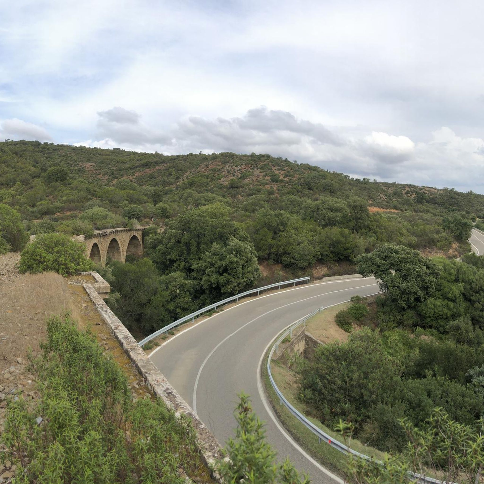
At 549 meters above sea level, the Genna Bogai Pass is one of the most scenic passes in the area. Reaching the summit is easier and shorter from Iglesias (about 10 km and 380 m of elevation gain) than from Fluminimaggiore (about 12 km and 500 m of elevation gain), but it's a beautiful climb regardless of your starting point. The road has little traffic, but caution is required due to the numerous sharp bends behind which vehicles, as well as herds of sheep and cows roaming freely, can hide!
1
0
Newly built (06/2025), the facade that looks directly onto the street looks more like a Pokemon (Moltres) than a hawk or any other bird it should represent!
1
0
Frequently Asked Questions
What kind of terrain can I expect on road cycling routes around Bidda Matzràxia/Villamassargia?
The region offers a diverse topography, ranging from challenging mountainous sections to undulating terrains and scenic coastal stretches. You'll encounter ancient olive groves, broadleaf forests, and karst complexes, with many routes weaving through areas rich in mining heritage. This variety ensures options for different fitness levels and preferences.
How many road cycling routes are available in Bidda Matzràxia/Villamassargia?
There are over 10 dedicated road cycling routes around Bidda Matzràxia/Villamassargia, offering a range of experiences from moderate to difficult. These routes are highly rated by the komoot community, with an average score of 4.9 stars.
Are there any routes suitable for beginners or those looking for an easier ride?
While the area is known for its more challenging terrain, with 7 moderate and 4 difficult routes, there are no routes specifically classified as 'easy' in this guide. However, routes like the Sulcis-Iglesiente and Acquafredda Castle Loop are moderate and offer a good introduction to the region's cycling.
What historical or natural landmarks can I see while cycling in the area?
The region is rich in both natural and historical sites. You can cycle past the impressive San Giovanni Cave, known as the longest drivable cave in the world, or explore the ancient Montessu Necropolis. Other notable sights include the monumental Sa Reina olive tree, the Cathedral of Iglesias, and the historical Sa Macchina Beccia (Santa Barbara Mine Shaft), reflecting the area's mining heritage.
Are there any long-distance road cycling routes in Bidda Matzràxia/Villamassargia?
Yes, for those seeking longer rides, routes like the challenging Bidderdi Pass (492 m) – Pan di Zucchero Sea Stack loop from Villamassargia-Domusnovas covers over 87 miles (140 km) with significant elevation gain. Another option is the Via Nuova, Iglesias – Ponte Romano loop from Villamassargia-Domusnovas, which is 70 miles (112.6 km) long.
What is the best time of year for road cycling in Bidda Matzràxia/Villamassargia?
The mild Mediterranean climate makes Bidda Matzràxia/Villamassargia suitable for cycling through much of the year. Spring and autumn are particularly ideal, offering pleasant temperatures and less crowded roads. Summers can be hot, while winters are generally mild but may see more rainfall.
Can I find routes that offer coastal views?
Absolutely. Many routes in the Sulcis-Iglesiente region offer breathtaking coastal views, with 'rollercoaster roads over high cliff tops and past secluded bays.' For example, the Pan di Zucchero Sea Stack – Buggerru Beach loop from Villamassargia-Domusnovas provides stunning vistas towards the iconic Pan di Zucchero sea stack and along the coast.
What do other road cyclists enjoy most about cycling in this region?
The area is highly rated by the komoot community, with an average score of 4.9 stars from over 30 reviews. Cyclists often praise the diverse terrain, the blend of natural beauty with historical sites, and the generally low traffic on many secondary roads, which contributes to a peaceful and immersive experience.
Are there any circular road cycling routes available?
Yes, many of the routes in the area are designed as loops, allowing you to start and finish in the same location. Examples include the popular Sulcis-Iglesiente and Acquafredda Castle Loop and the more challenging Bidderdi Pass (492 m) – Pan di Zucchero Sea Stack loop from Villamassargia-Domusnovas.
What kind of natural features can I expect to see along the routes?
Beyond the coastal views, you'll cycle through diverse Mediterranean landscapes, including evergreen forests of holm oak and cork oak, fragrant Mediterranean scrub, and ancient olive groves. The region is part of the Historical and Environmental Geological and Mining Park of Sardinia, offering a rich tapestry of environments.
Are there any routes that pass through significant historical mining areas?
Yes, the region is deeply connected to its mining heritage. Many routes traverse parts of the Santa Barbara Mining Route, allowing you to explore ancient mining paths and witness historical mining plants and ghost villages. The Sa Macchina Beccia (Santa Barbara Mine Shaft) is one such point of interest you might encounter.
Most popular routes around Bidda Matzràxia/Villamassargia
Most popular attractions around Bidda Matzràxia/Villamassargia

Get inspired with the komoot mobile app


Explore more
Browse the best Road cycling routes in other regions.
