The best road cycling routes around Sankt Marienkirchen bei Schärding
4.6
(293)
3,646
riders
410
rides
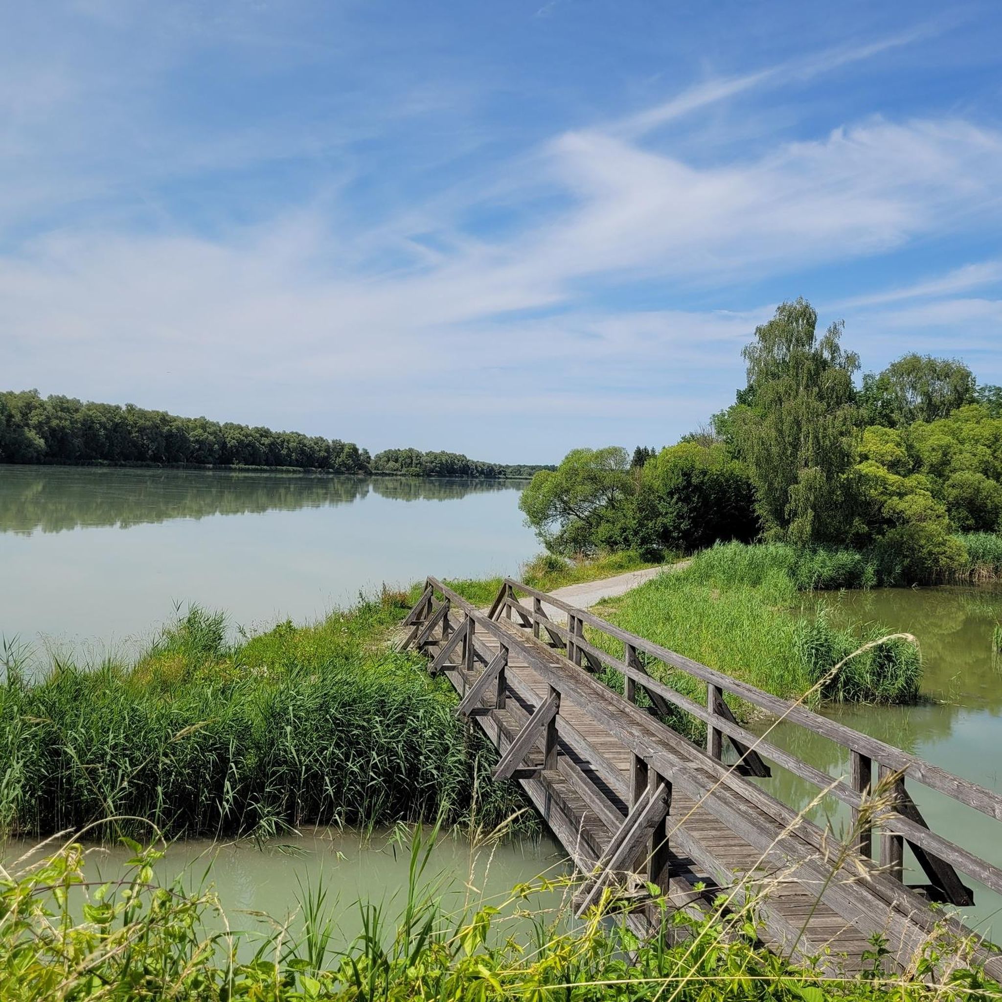
Road cycling around Sankt Marienkirchen bei Schärding is characterized by its location within the Innviertel region, featuring a landscape of rolling hills, forests, and river valleys. The area is bordered by the Antiesen stream, the Inn River, and the Lindetwald forest, with the edge of the Sauwald forest also present. This topography provides varied terrain for road cyclists, ranging from flatter river sections to gently hilly routes with occasional climbs. The region offers direct access to major cycle paths like…
Last updated: July 15, 2026
4.3
(3)
76
riders
57.0km
02:39
260m
260m
Moderate road ride. Good fitness required. Mostly well-paved surfaces and easy to ride.
21
riders
64.1km
03:02
450m
450m
Moderate road ride. Good fitness required. Some segments of this route may be unpaved and difficult to ride.

Sign up for free
7
riders
41.1km
01:47
250m
250m
Easy road ride. Great for any fitness level. Mostly well-paved surfaces and easy to ride.
5.0
(1)
8
riders
50.3km
02:21
470m
470m
Moderate road ride. Good fitness required. Mostly well-paved surfaces and easy to ride.
8
riders
45.5km
02:00
360m
360m
Moderate road ride. Good fitness required. Some segments of this route may be unpaved and difficult to ride.
Get access to more routes and recommendations from other explorers.
Sign up for free
Already have an account?
Our route recommendations are based on thousands of hikes, rides, and runs completed by other people on komoot.
Start today with a free account
Your next adventure awaits.
Login or Signup
Popular around Sankt Marienkirchen bei Schärding
Tips from the Community

Beautiful house on the market square
2
0
Ried im Innkreis is a town in western Upper Austria with 12,766 inhabitants, located approximately 80 kilometers west of Linz and 60 kilometers northeast of Salzburg. It is the district capital of the Ried district and a regional center within the Innviertel region. It is also the center of the Ried im Innkreis judicial district.
2
0
Ried is situated in the heart of the Innviertel hill country, in a depression of the Alpine foothills north of the Hausruck Forest. The town's name derives from the Middle High German word "Riet" (also: "Rieth," "Reet," "Rohr," and similar terms), meaning reeds growing on riverbanks and marshy ground. A spot where the gradient of the two rivers, Oberach and Breitsach, slowed and saturated the soil gave the town its name. The two rivers converge north of the old town to form the Rieder Bach, a stream that flows for 2.6 kilometers before emptying into the Antiesen River outside the town limits. Ried im Innkreis lies at an altitude of 433 meters. It extends 3.2 kilometers from north to south and 3.6 kilometers from west to east, covering a total area of 6.7 square kilometers.
3
0
Originally a 15th-century Gothic church, the nave was demolished in 1720 and replaced with a new Baroque structure. At the same time, the chancel was also redesigned in the Baroque style. The tower was heightened in 1731/32, its upper section was altered in 1868, and a new spire was added in 1930.
2
0
Ried im Innkreis is a town in western Upper Austria with 12,766 inhabitants, located approximately 80 kilometers west of Linz and 60 kilometers northeast of Salzburg. It is the district capital of the Ried district and a regional center within the Innviertel region. It is also the center of the Ried im Innkreis judicial district.
2
0

The Roman Catholic parish church of Raab is located in the village of Raab, part of the market town of Raab in the Schärding district of Upper Austria. Dedicated to the Archangel Michael, the church belongs to the Andorf deanery in the Diocese of Linz. The church is a listed building.
0
0
Raab Castle offers a fine example of how most of the small moated castles of the Innviertel region were built.
0
0
The moated castle with its defensive moat has existed since the 9th century. From 1850 to 2002, it housed the district court.
0
0
Frequently Asked Questions
How many road cycling routes are available in Sankt Marienkirchen bei Schärding?
There are over 440 road cycling routes around Sankt Marienkirchen bei Schärding, offering a wide range of options for different skill levels and preferences. This includes routes along riverbanks and those with more elevation gain through the rolling hills.
What kind of terrain can I expect on road cycling routes around Sankt Marienkirchen bei Schärding?
The region offers varied terrain, from flatter sections along the Inn River and Antiesen stream to gently rolling hills and occasional climbs, especially towards the edge of the Sauwald forest. This diversity provides engaging rides and panoramic vistas.
Are there easy road cycling routes suitable for beginners or families?
Yes, Sankt Marienkirchen bei Schärding offers over 70 easy road cycling routes. These often follow the river valleys, providing flatter, more accessible rides. The "Haager Lies" cycle path, a barrier-free route along a former railway line, is also connected to the area via the Antiesen cycle path, linking to the Inn Cycle Path.
What are some scenic highlights or landmarks I can see while road cycling in the region?
You can enjoy breathtaking views of the Inn River and the surrounding countryside, especially from routes traversing the rolling hills and the edge of the Sauwald forest. Notable attractions include the Baroque town of Schärding with its vibrant "Silberzeile" and castle park, the historic Reichersberg Abbey, and the charming market square of Obernberg am Inn. The Neuhaus Castle on the Inn is another impressive sight.
Are there any long-distance cycle paths accessible from Sankt Marienkirchen bei Schärding?
Absolutely. Sankt Marienkirchen bei Schärding provides direct access to the Inn Cycle Path (Innradweg R3), a major route tracing the Inn River. From Schärding, you can also easily reach the popular Danube Cycle Path (Donauradweg R1). The Roman Cycle Path (Römerradweg R6) also passes through the vicinity.
Can I find circular road cycling routes in the area?
Yes, the region features numerous circular tours. For example, the Obernberg am Inn – Schärding Old Town loop from Dietrichshofen is a popular moderate route connecting historic towns. The Pramtalradweg R21 also offers a 49 km circular tour through the hilly Innviertel landscape.
What do other road cyclists enjoy the most about road cycling in Sankt Marienkirchen bei Schärding?
The area is highly rated by the komoot community, with an average score of 4.6 stars from over 250 reviews. Cyclists often praise the varied terrain, from scenic river sections to challenging climbs, and the opportunity to explore historic towns and natural beauty along the way. The well-maintained paths and diverse route options are frequently highlighted.
Are there routes that pass by castles or historic sites?
Yes, many routes incorporate historical landmarks. For instance, the Aurolzmünster Castle – Main Square, Ried im Innkreis loop from Suben traverses the Innviertel landscape, passing through areas with historical significance. You can also find routes that lead past the Neuhaus Castle on the Inn and the impressive Reichersberg Abbey.
What is the best time of year for road cycling in Sankt Marienkirchen bei Schärding?
The region is beautiful throughout the warmer months. Spring and autumn offer pleasant temperatures and vibrant scenery, with fewer crowds. Summer is also excellent, especially for rides along the rivers where you can enjoy the lush greenery. Always check local weather forecasts before heading out.
Are there any routes that offer views of lakes or natural reserves?
While primarily focused on river landscapes, some routes may offer glimpses of smaller bodies of water or lead near natural reserves. The Lower Inn Nature Reserve (Naturschutzgebiet Unterer Inn), particularly the Vornbacher Enge, is a significant natural spectacle with diverse bird and plant species accessible by bike, offering impressive flora and fauna along the Inn River banks.
Where can I find parking for road cycling routes in Sankt Marienkirchen bei Schärding?
Many towns and villages along the major cycle paths, such as Schärding and Obernberg am Inn, offer designated parking areas suitable for cyclists. It's advisable to check specific starting points for routes for the most convenient parking options.
Can I access road cycling routes using public transport?
Yes, the region is reasonably well-connected by public transport, particularly to larger towns like Schärding, which can serve as a starting point for many routes. Some local train lines and bus services may accommodate bicycles, but it's recommended to check the specific operator's policies and schedules in advance.
Most popular routes around Sankt Marienkirchen bei Schärding
Most popular attractions around Sankt Marienkirchen bei Schärding

Get inspired with the komoot mobile app


Explore more
Browse the best Road cycling routes in other regions.
