The best mountain hikes around Veleso
5.0
(2)
6
hikers
1
hike
Mountaineering routes around Veleso are situated in the Lombardy region of Italy, offering access to the Triangolo Lariano and panoramic views of Lake Como and the surrounding Alps. The terrain features prominent peaks such as Monte San Primo, the highest point in the Larian Triangle at 1685 meters, and Monte Colmenacco. The area is characterized by diverse trails that traverse mountain ridges, forests, and open alpine landscapes.
Best mountaineering routes around Veleso
- The most popular mountaineering route is Cima del…
Last updated: July 4, 2026
5.0
(2)
4
hikers
9.15km
03:40
570m
570m
Moderate mountaineering route. Good fitness required. Mostly accessible paths. Sure-footedness required.
1
hikers
11.3km
03:27
340m
340m
Hard mountaineering route. Good fitness required. Sure-footedness, sturdy shoes and alpine experience required.

Sign up for free
1
hikers
10.4km
06:02
970m
980m
Hard mountaineering route. Very good fitness required. Sure-footedness, sturdy shoes and alpine experience required.
Our route recommendations are based on thousands of hikes, rides, and runs completed by other people on komoot.
Start today with a free account
Your next adventure awaits.
Login or Signup

Tips from the Community


Very nice place, since I passed by there very early the refuge was closed but 50m away there is an ultra-panoramic clearing
1
0

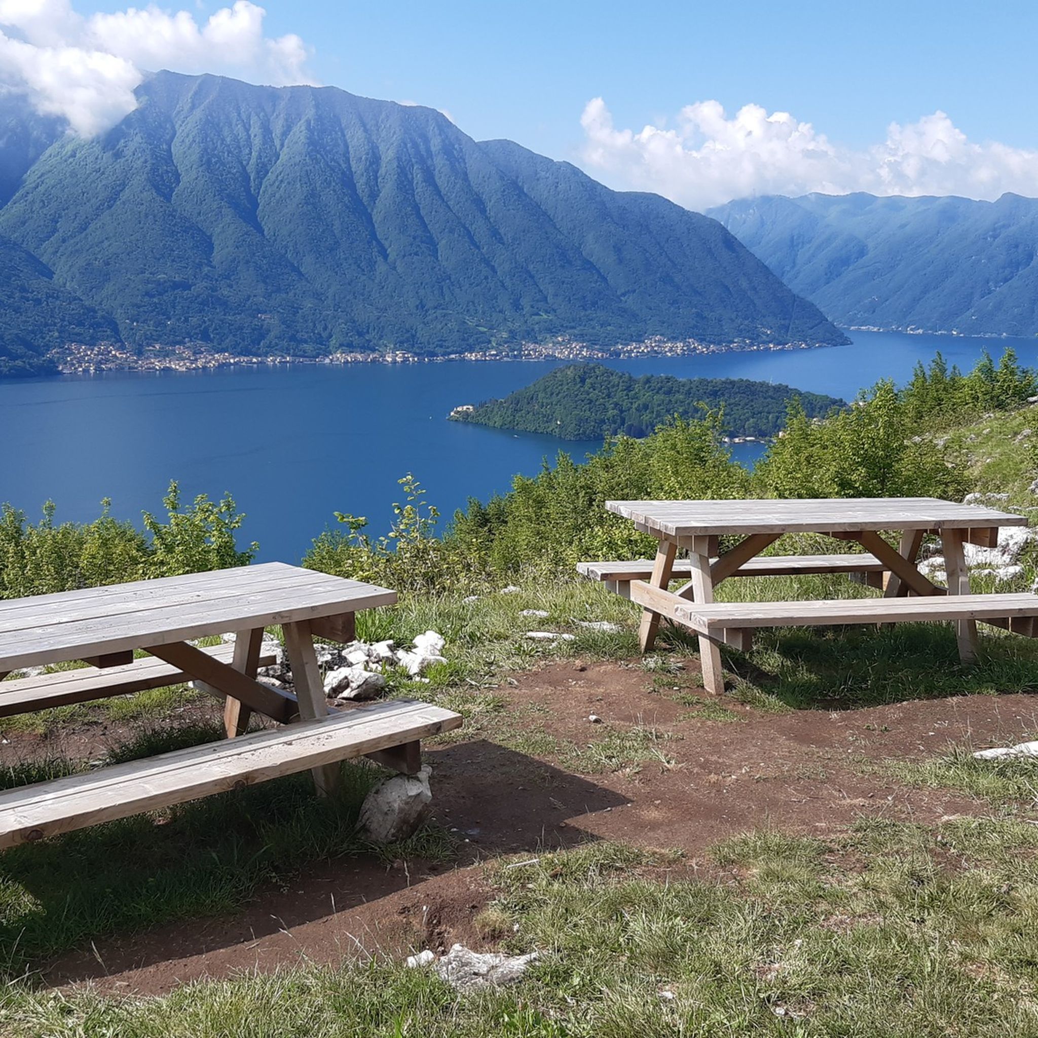
One of the three peaks (together with Sertore and Pasquella) that separates the valley that descends to the lake towards Colonno from the valley that descends towards Ponna and towards Val d'Intelvi. Reachable via an easy path from the Colonno alp (where there is a large parking lot and a refuge), and that in less than an hour leads to a magnificent view of Lake Como and Galbiga. A few meters down from the peak there is a practical table with two wooden benches.
1
0

Capanna Mara is a refuge located on the slopes of Mount Bollettone, one of the most famous peaks of the Larian Triangle, in the province of Como. It is located at about 1,300 meters above sea level and is an ideal destination for hikers who want to explore the area, enjoying breathtaking views of Lake Como and the surrounding mountains. Capanna Mara can be reached via various paths that start from Pian del Tivano, Asso and Caglio, and is a perfect place to stop during excursions to the summit of Bollettone. The path to the refuge is of medium difficulty and winds through woods, clearings and panoramic stretches that offer beautiful views of the valley and the lake. Once you arrive, the refuge offers a warm and hospitable welcome, with typical local dishes, such as polenta and cheeses, ideal for restoring after a day of trekking. Furthermore, the position of Capanna Mara makes it an excellent starting point for longer hikes, leading to Monte Bollettone or Monte Palanzone, both panoramic peaks that offer spectacular views. Capanna Mara is open mainly during the summer season, but it is also a reference point for hikers who want to enjoy the natural beauty of the Larian Triangle.
1
0

great ridge views
0
0

Frequently Asked Questions
How many mountaineering routes are available around Veleso?
Veleso offers a selection of 4 dedicated mountaineering routes. These routes vary in difficulty, providing options for different experience levels.
What are the typical difficulty levels for mountaineering routes in Veleso?
The mountaineering routes around Veleso are generally challenging. You'll find 1 moderate route and 3 difficult routes, often requiring good fitness and sure-footedness due to the diverse and sometimes steep terrain.
What kind of views can I expect on the mountaineering routes around Veleso?
Mountaineering in Veleso consistently offers spectacular panoramic views. Many routes provide extensive vistas of Lake Como, including its distinctive 'upside-down Y' shape, and the majestic Alps. On clear days, you might even see the Po Valley and the Milanese area from higher elevations like Monte San Primo.
Are there any circular mountaineering routes in the Veleso area?
Yes, several routes are designed as loops. For example, the Cima del Costone – Monte San Primo loop from Parco Monte San Primo is a popular difficult route, and the Rifugio Venini – Hike to Rifugio Venini loop from Alpe di Colonno is another challenging circular option.
What notable landmarks or natural features can I see along the mountaineering routes?
The routes often lead to prominent peaks and offer views of significant natural features. You can reach the Monte San Primo Summit, the highest point in the Larian Triangle. Other notable points include the Colma di Sormano Summit and Observatory, and the Mount Bolettone.
Are there mountain huts available along the trails for rest or overnight stays?
Yes, there are mountain huts in the vicinity that can serve as resting points or destinations. The Rifugio Venini – Hike to Rifugio Venini loop from Alpe di Colonno, for instance, leads directly to the Venini Hut. Other huts in the area include Capanna Mara, Rifugio Martina, and Rifugio Prabello.
What do other mountaineers say about the routes in Veleso?
The mountaineering routes in Veleso are highly regarded by the komoot community, with an average rating of 4.1 stars from over 11 reviews. Mountaineers often praise the stunning views of Lake Como and the diverse mountain terrain.
Is Veleso a good starting point for exploring the Triangolo Lariano?
Veleso is an excellent gateway to the Triangolo Lariano, the mountainous region situated between the two southern arms of Lake Como. Its location provides direct access to trails that traverse this area, offering varied landscapes from dense forests to open alpine environments.
Are there any less crowded mountaineering routes around Veleso?
While popular peaks like Monte San Primo attract many, exploring routes that venture slightly off the main paths can offer a quieter experience. An excursion from Veleso to the Colmenacco Alpine Pasture and the unique Sasso Calvarone boulder, for example, allows discovery of less-visited places on the southwest side of Mount San Primo.
What is the best time of year for mountaineering in Veleso?
The best time for mountaineering in Veleso is typically from late spring through early autumn (May to October) when the weather is most stable and the trails are clear of snow. During these months, you'll experience pleasant temperatures and optimal visibility for enjoying the panoramic views.
Are there any moderate mountaineering options for those seeking a less strenuous challenge?
Yes, while many routes are difficult, there is at least one moderate option. The Mountaineering loop from Canzo is a moderate 10.6 km route that still offers a rewarding experience without the extreme demands of the most difficult trails.
Most popular attractions around Veleso

Get inspired with the komoot mobile app


Explore more
Browse the best Mountain Hikes & Routes in other regions.
